


May 7, 2025 Wednesday Weather Update
Warmer pattern ahead for Eastern U.S. once we ditch a trough
Good morning!
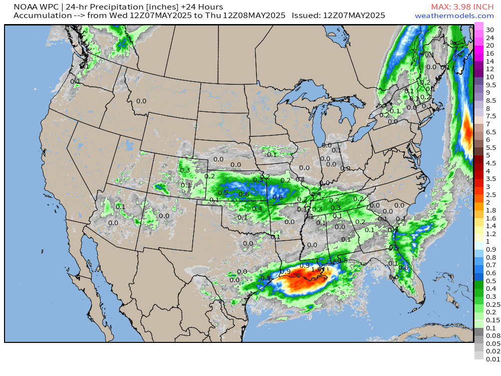
The Great Omega Block of early May 2025 has weakened with the troughs or cut-off lows eroded beneath two ridges — one in central Canada and the other off the NE Atlantic coast. We’re still dealing with the weakness associated with the Southwest trough that has expanded eastward into Texas and Oklahoma.

Just ahead of the leading mid-level low, the cyclonic circulation is pulling a deep layer of moisture out of the western Gulf of Mexico. The Integrated Vapor Transport (IVT) analysis from 00z (last evening 8 pm ET) showed the setup well explaining the heavy rain in eastern Texas and across all of Louisiana.

Preliminary rainfall totals through 8 AM from previous 24-hours (!)

Sea Level Pressure Anomaly nicely shows the high pressure over Ontario and Manitoba extending into the Midwest and Great Lakes providing beautiful and warm weather.

Over the next several days, the trough in the SW —> Texas will move into the Southeast and get stuck. That’s not a bad thing at all for Florida, which needs the rain desperately, and they will get plenty. The entire Southeast is looking at rainfall through middle of next week perhaps every day!
24-Hourly WPC Rainfall Next 7-Days
May see some rainfall return to the upper-Midwest and northern Rockies by Day 7 or the middle of next week.
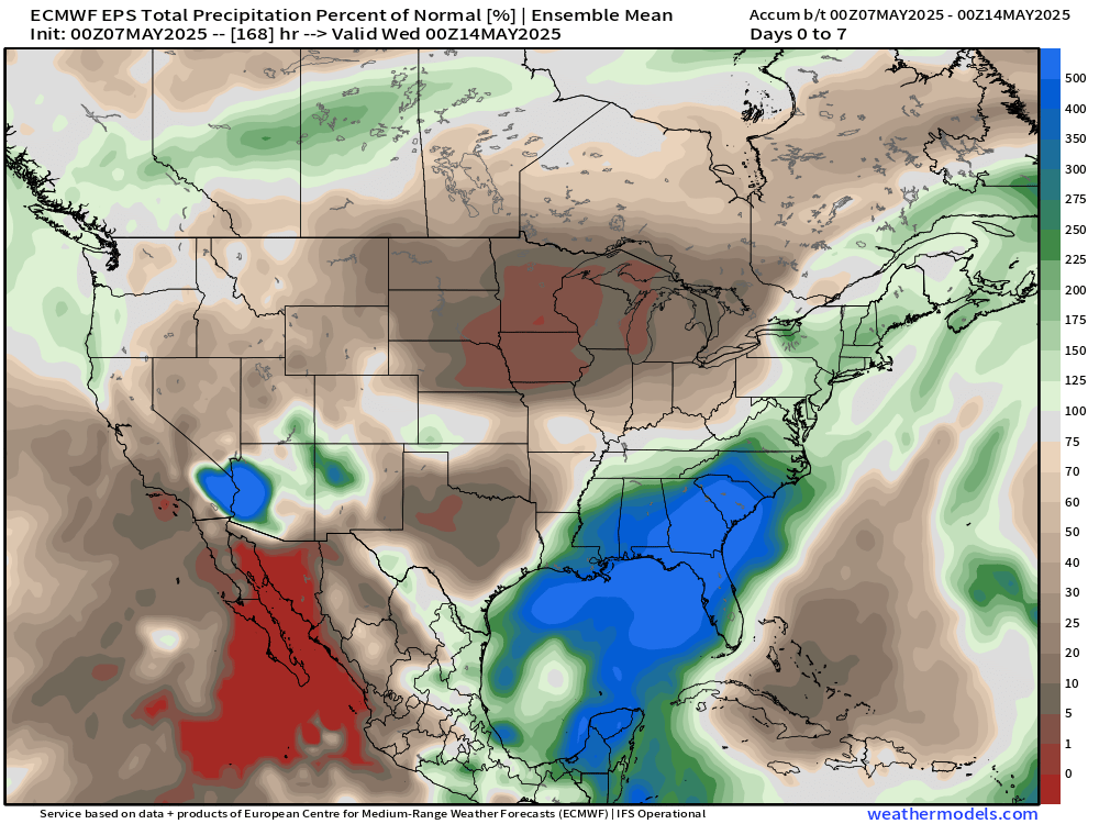
ECMWF 00z 7-day Precipitation Anomaly | Week 1 | % of Normal
Looking at perhaps zero rainfall for the Midwest into the Great Lakes through May 13-14. Way above normal for the Gulf of Mexico into the Southeast.
Week 2 | % of Normal
However, we dry out for the 3rd week of May from the 14th-21st especially across California into the Southwest and back into the Gulf.
Meanwhile, above normal rainfall in the ensemble mean where it was dry — flipping the script.

High Temperatures Today | Wednesday May 7, 2025

70.6°F is the Lower 48 average high temperature with 259 million at least 70°F. 90s in Florida but less than 9 million across the country.
Mainly 70s from Detroit to NYC and Boston.

Lower 70s in Minneapolis to Chicago and Columbus. Perfect!

Observed Radar 9:34 AM ET
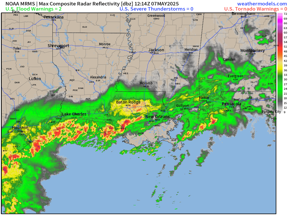
Most of the heaviest rain has moved off the Texas coastline into the Gulf, but still a deluge south of Interstate 10 into Baton Rouge and New Orleans.
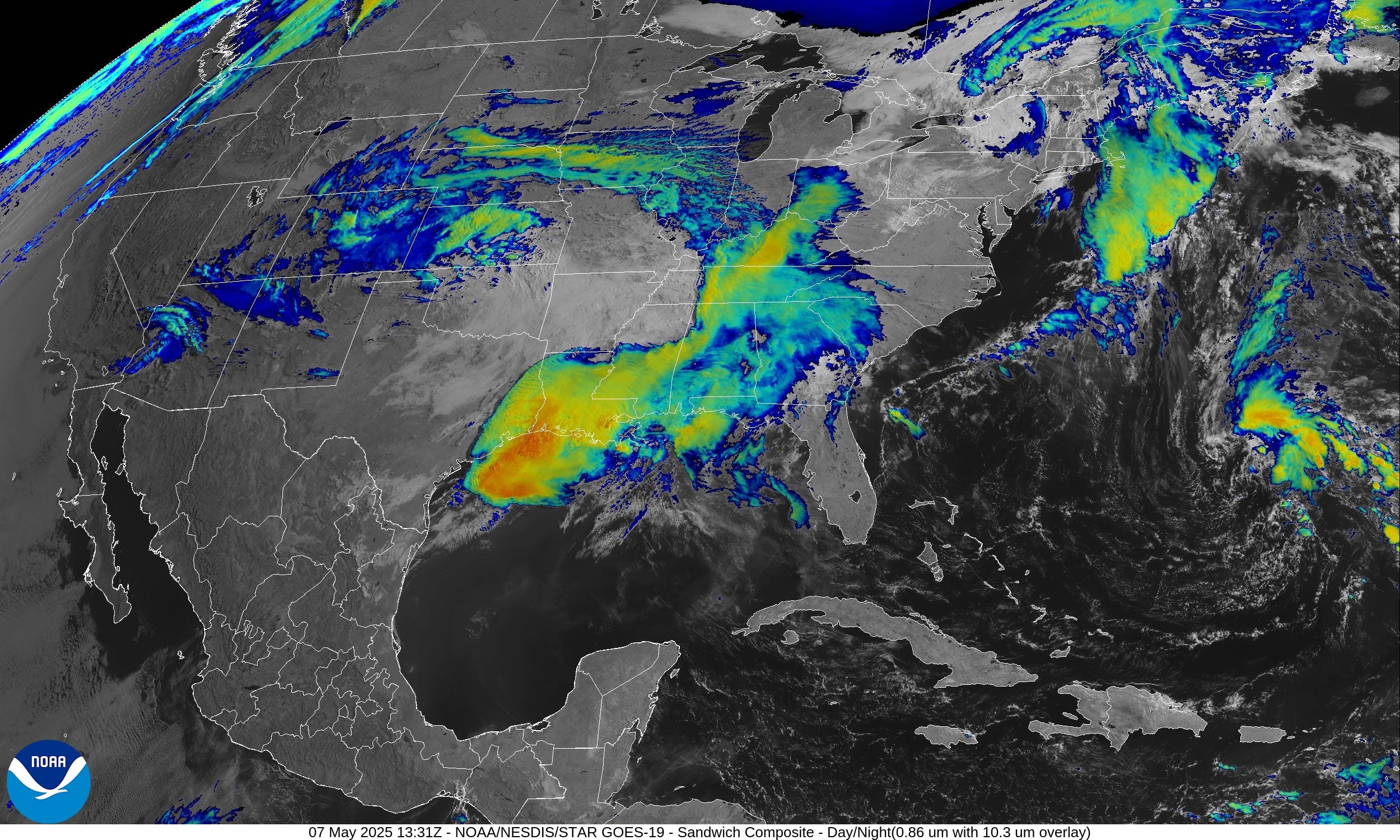
Satellite Imagery This Morning
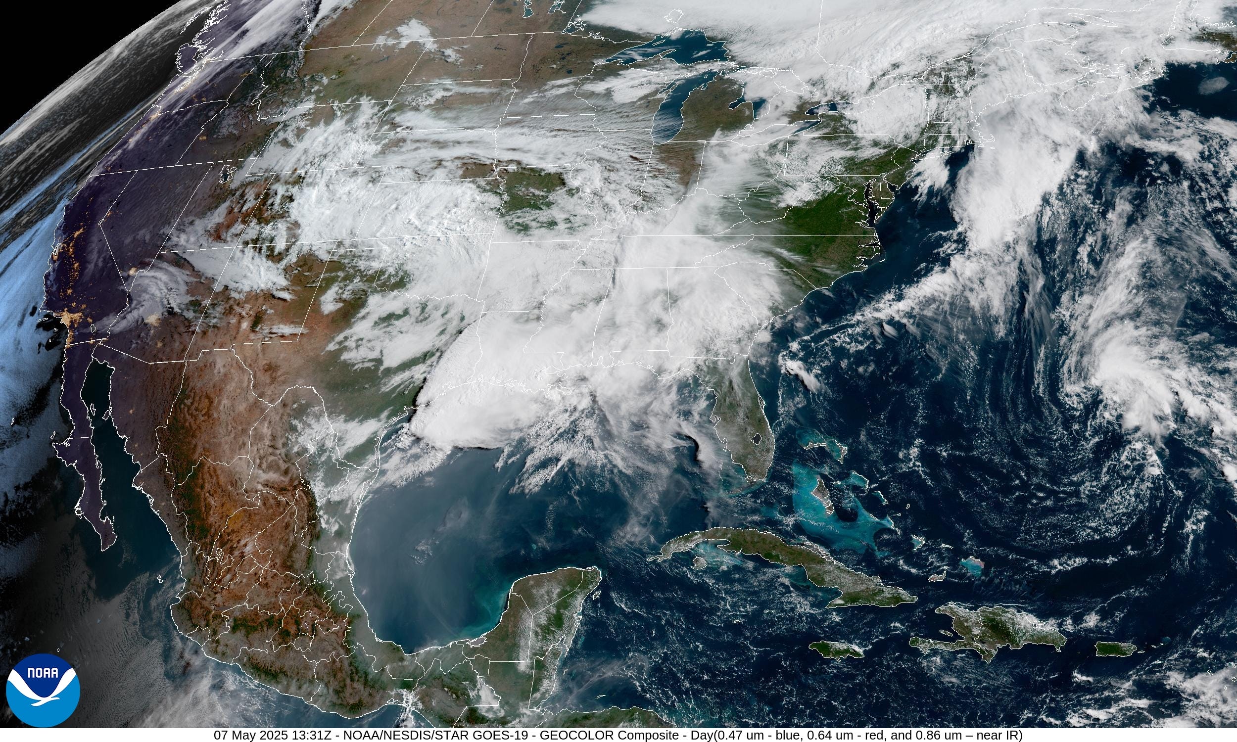
Huge mess of cloud cover with the persistent cut-off low stuck over the Southeast into Texas. Convection + heavy rain shows up on the IR sandwich enhanced satellite.
Weather Today | Fronts 8 AM

Only marginal risk of severe thunderstorms, so that’s good news. The overall weather pattern across the Lower 48 has dialed down its intensity with just general pop-up showers and storms for your grass and garden.
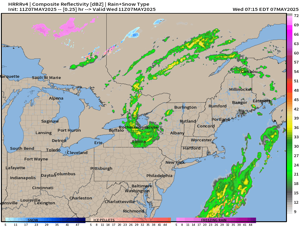
Radar Simulation next 18-hours through Thursday morning 1 AM ET

The coverage and intensity of the rain decreases during the day but still some pop-ups. However, the squall line along the Gulf coast looks to fizzle by time is reaches the Florida panhandle.
Area of low pressure across New England quickly diffuses offshore.
NWS WPC Precipitation | Next 7-days

HUGE rainfall totals for Florida and south Georgia over the next 7-days!

Temperature Analysis | 9:00 AM ET

Temperature Anomaly | 9:00 AM ET

Overall the Lower 48 is 0.0°F and near normal [1991-2020].
Keep reading with a 7-day free trial
Subscribe to Weather Trader to keep reading this post and get 7 days of free access to the full post archives.