


May 5, 2025 Monday Weather Update
Eventually the Omega Block will break down
Plenty of rain and showers today as the Omega block has not moved. We still have the two cut-off troughs beneath a ridge and then a trio of troughs across the Arctic latitudes. This pattern is thoroughly clogged up!

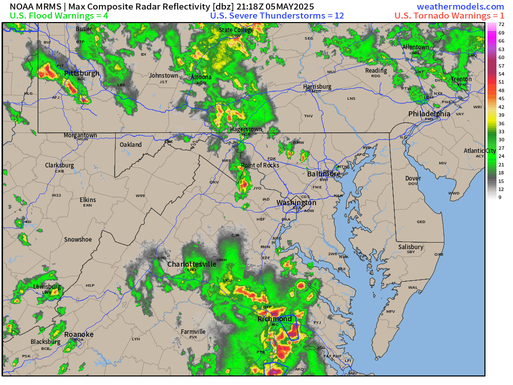
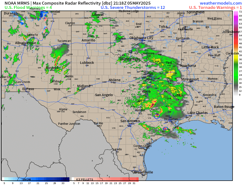
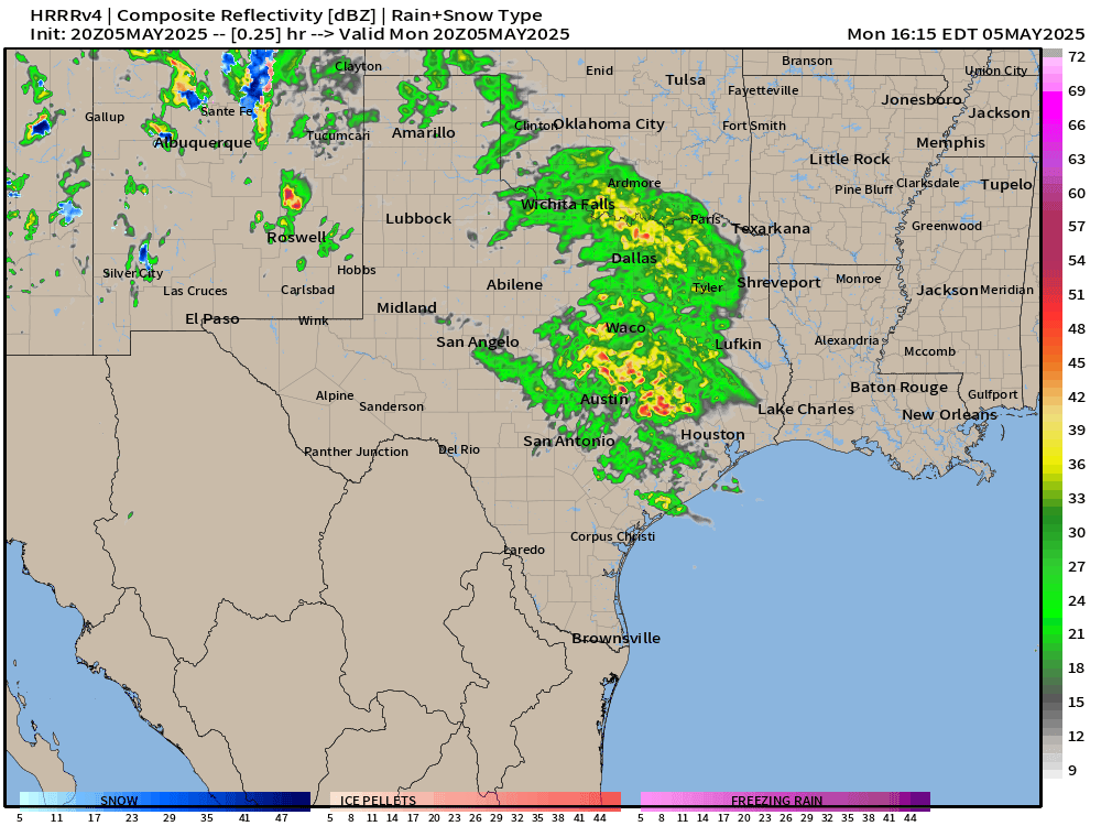
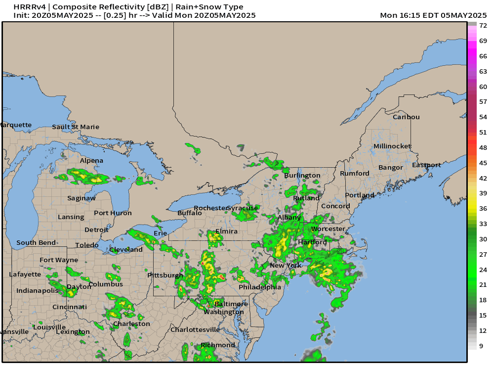
Current Radar 6:38 PM ET
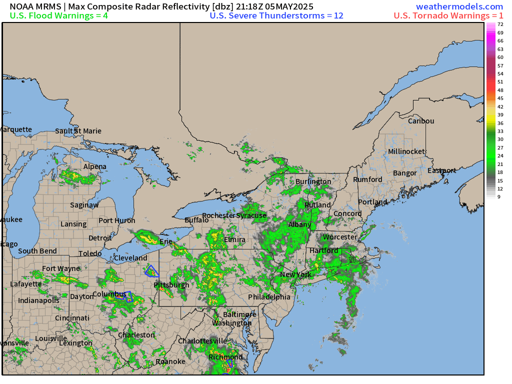
Severe storms approaching D.C. from the south mean business!
Eastern Texas is drenched. New storms firing in New Mexico into West Texas will be big hailers and potential for tornadoes.
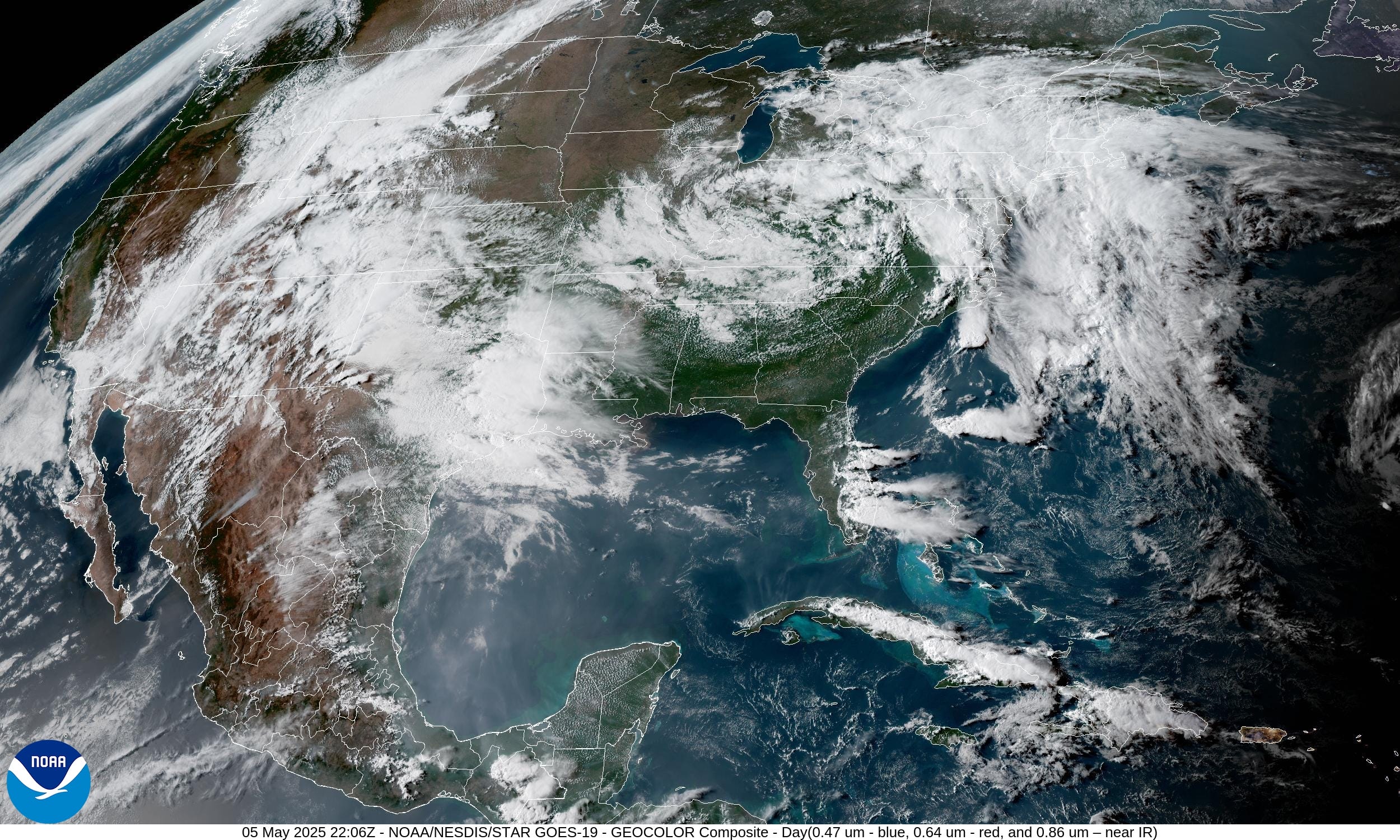
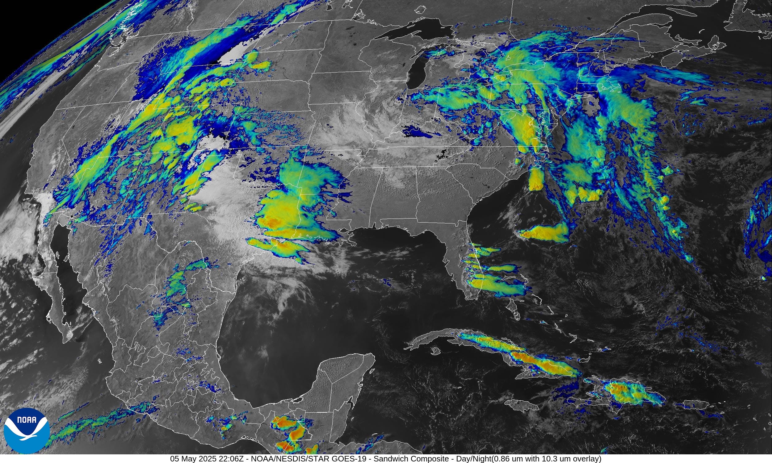
Satellite Imagery This Evening
The omega block continues to affect the Lower 48 with weird weather in the U.S. Southwest and Ohio River Valley with sunshine yet cool temperatures in between in the Southeast. Hot in the Dakotas!
Heaviest convection is in West Texas just billowing with newly fired supercells out of New Mexico. Heavy rain in eastern Texas is drenching Houston. Scattered rain and storm bands continue to streak into the Mid-Atlantic. Severe cells moving northward out of Virginia to Washington D.C in the next hours.

Radar Simulation next 18-hours through Tuesday morning 10 AM ET
Two upper-level lows spinning away …

Supercells will fire in west Texas over the next several hours and could hold together well east to San Antonio, Austin by mid-morning.
Waves of rain and storms continue to stream WNW around the low in Ohio with some bands being heavy including NYC into early morning.
Convective Outlook into early Tuesday Morning
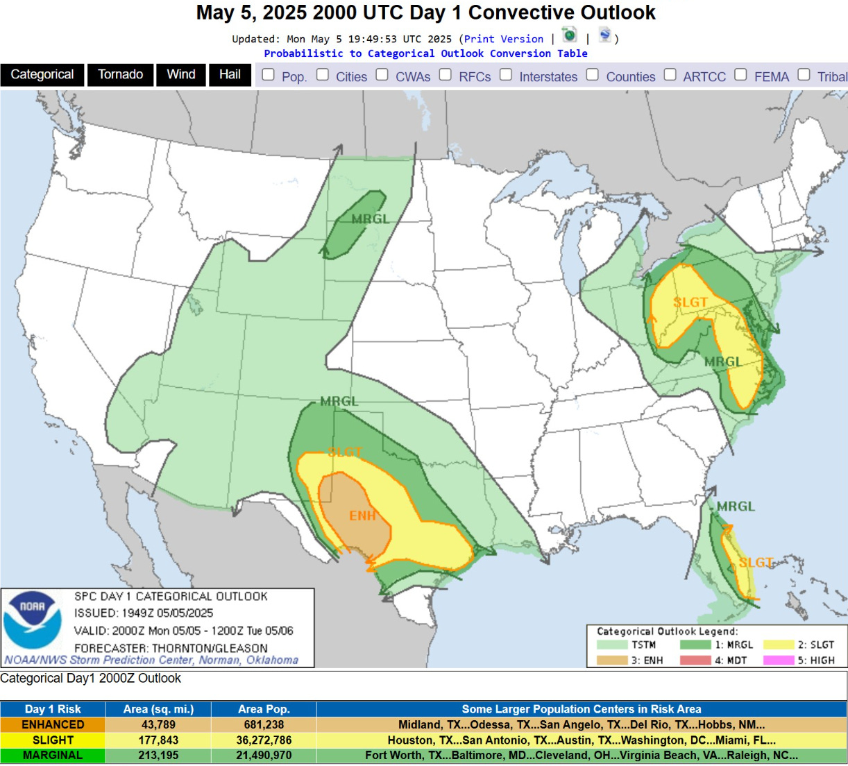
ENHANCED RISK for severe weather = very large hail, winds, and potential for tornado in New Mexico —> Texas later this evening
NWS WPC Precipitation | Next 7-days
HUGE rainfall totals along the Gulf Coast from Houston to New Orleans and even 2-3” in Florida. Great news for the parched sunshine state.
No rain for the Midwest including Minneapolis, all of Iowa and Chicago into Indianapolis.

WPC has maximum of 6-8” of rain centered on Interstate 10 through southern Louisiana.

Tuesday Weather | Fronts tomorrow at 8 PM ET

Tomorrow’s heavy rain will be focused along the front edge of the Southwest cut-off low ejecting eastward, finally, in Texas including Dallas and then along the Gulf coast. Still unsettled in the Northeast.
Temperature Analysis | 5:15 PM ET

There’s the clouds and rain showing up in the temperatures over Kentucky only in the 50s. A very comfortable 70°F in Atlanta. 80s in the Dakota seem to be the warm spots along with south Texas for the Lower 48. Only 64°F Lower 48 average at 5 PM.
Las Vegas has clouds and rain with 65°F and Phoenix is sunny with scattered showers in the lower 70s. Don’t worry, it will back toward 100°F by this weekend.

Temperature Anomaly | 5:15 PM ET
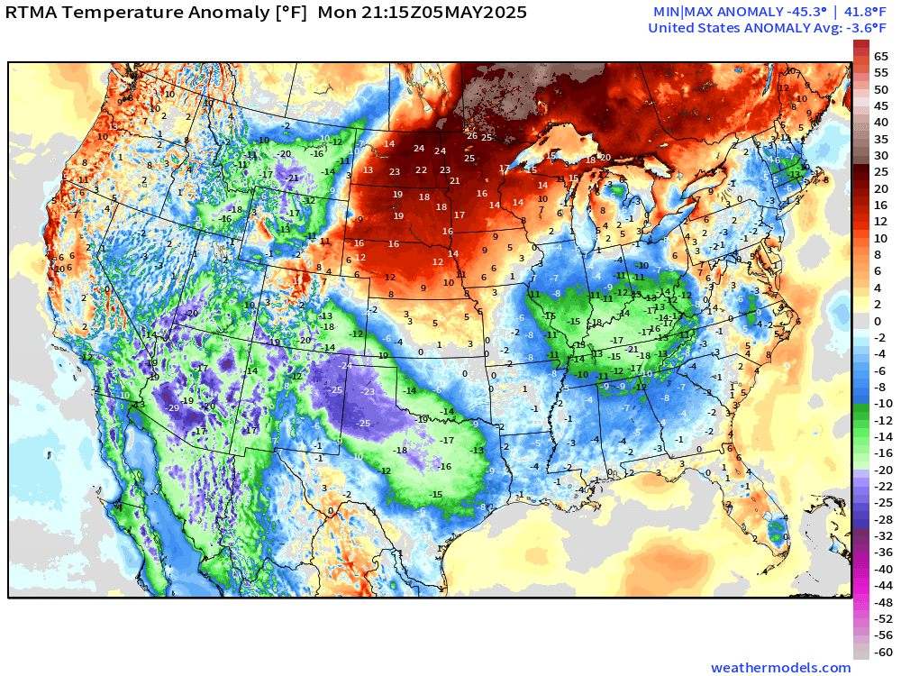
Overall the Lower 48 is -3.6°F below normal. Huge anomaly (negative) across the Southwest into Texas (clouds and rain) and then in Kentucky + Ohio River Valley.

Last Day: All new paid subscribers can use this coupon link to receive 20% off the Newsletter and receive all daily updates heading into hurricane season.
Keep reading with a 7-day free trial
Subscribe to Weather Trader to keep reading this post and get 7 days of free access to the full post archives.