


May 31, 2025 Saturday Tropical Update
Atlantic hurricane season officially begins tomorrow

Saturday’s Tropical Weather Headlines
Atlantic tropical update: Hurricane Season starts tomorrow June 1st, but no development expected in next 7-days. Any system thereafter would be unlikely (<20%) according to ensembles through Day 14.
Eastern Pacific tropical update: 40% chance of next system in 7-days — Barbara.
Saharan Dust / Air Layer remains in control of the tropical Atlantic with thick plume ready to affect Gulf, again.
Lack of a hurricane strength system in the Northern Hemisphere through June 4th — means a record for inactivity, at least since 1973.
Integrated Vapor Transport | Next 10-days
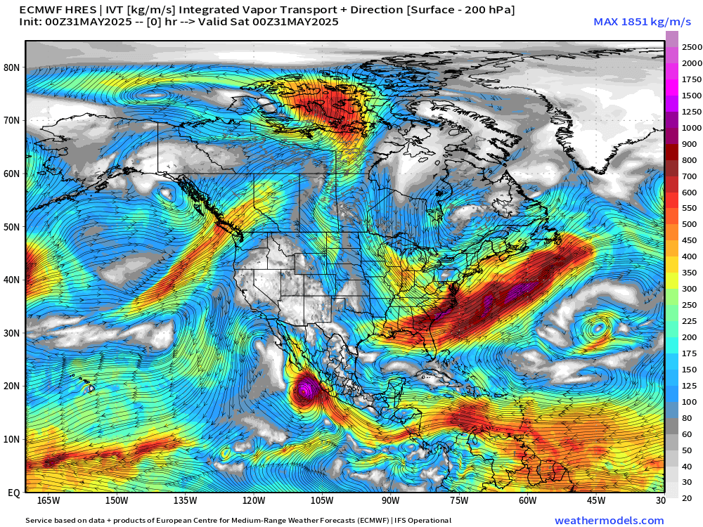
The ECMWF HRES (control) IVT model simulation for the next 10-days does not show anything spinning w/tropical designation across the Atlantic. We use the ECMWF for medium-range prediction because the GFS can’t be trusted.
Deep layer moisture does traverse the Caribbean at Day 7, but the intensity backs off as “Barbara” cranks up off the coast of Mexico.
A very strong high pressure cell is locked in across the Pacific NE of Hawaii into the Gulf of Alaska. Rossby wave thinning on the downstream side off the coast of California is spinning cut-off lows / troughs as higher (planetary) relative vorticity air is pushed south.
Precipitation and MSLP Next 10-days
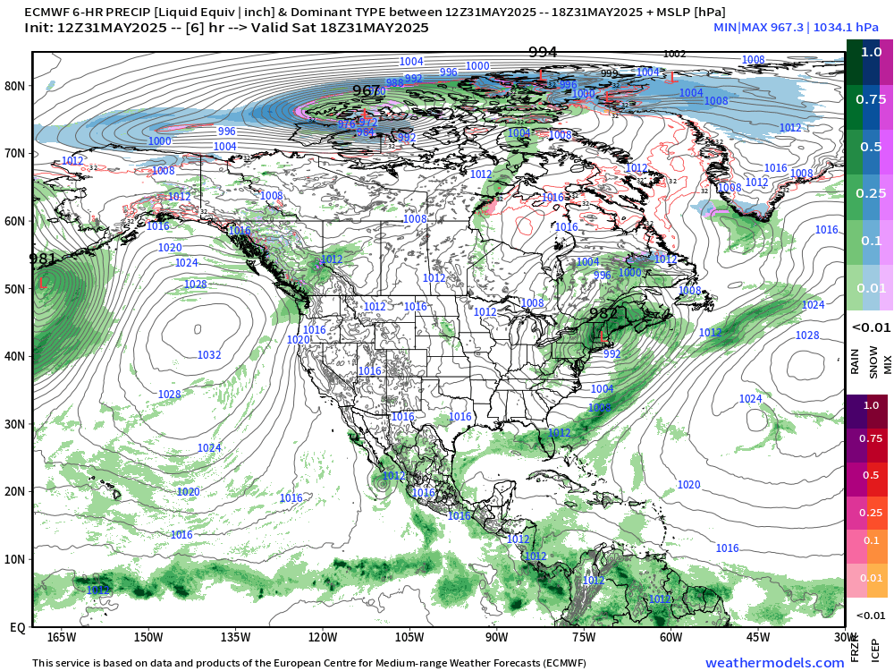
Only show in town in the tropics remains the potential EPAC system number 2.
Precipitable Water Next 7-days

My favorite parameter PWAT — next 7-days. You can see the surges of Saharan Air Layers (SAL) from the African continent as wave fronts blasting westward with lower PWAT (yellow) pushing the red (2-inches+) out of the way. A very sharp gradient exists along the periphery of the SAL to the ITCZ/monsoon trough.
High PWAT continues to collect over Central America waiting for some low-level vorticity to come along and take advantage, but only on the Pacific side are upper-level winds favorable.
Subscribe for 2025 Hurricane Season Updates — Know what’s coming down the pike 2-weeks ahead of time. Last day for 25% promo.
Atlantic Basin
Eastern Atlantic Satellite Image
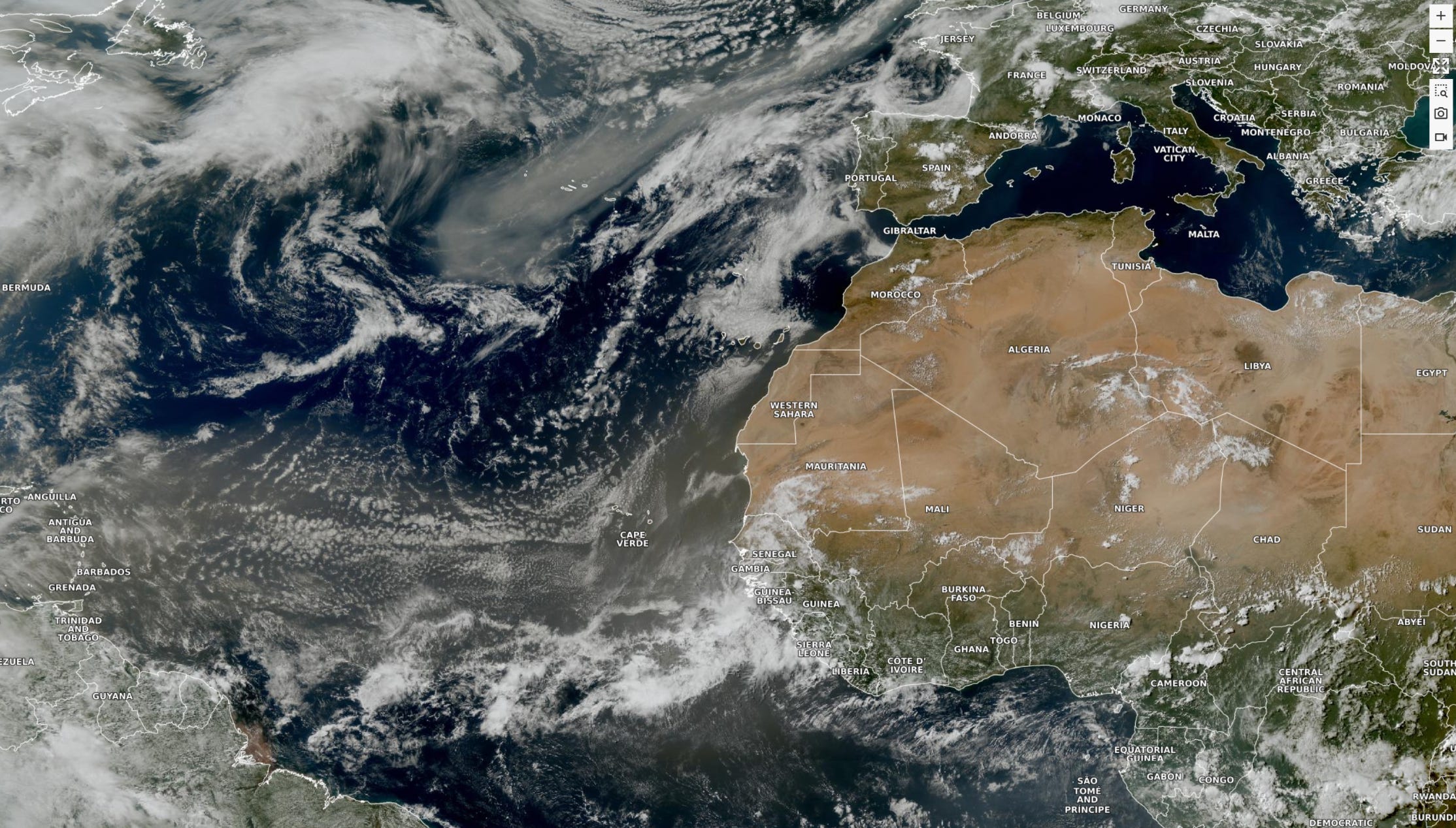
The tropical Atlantic is covered in a milky haze from the SAL (Saharan Air Layer) largely suppressing any convective activity.
A tropical wave that just left the African coast is showing some shower development, but a tropical storm is implausible.
ECMWF CAMS 00z DUST Aerosol Optical Depth (AOD) | 5-days Forecast
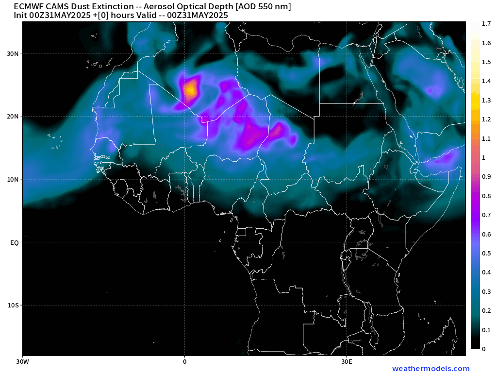
The dust is percolating across North Africa, as usual into early June.

Keep reading with a 7-day free trial
Subscribe to Weather Trader to keep reading this post and get 7 days of free access to the full post archives.