


May 30, 2024 Tropical Update
Central America rainfall very welcome

Please subscribe for $5/month for email inbox deliveries every morning — or more often as conditions warrant. The investment in my research and development will pay off as A.I. enabled weather forecasts become a normal part of our weather forecasting enterprise.
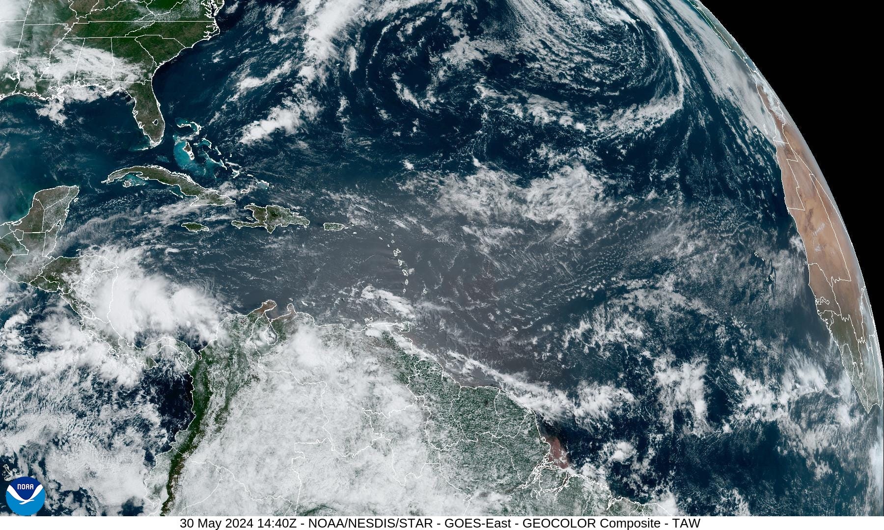
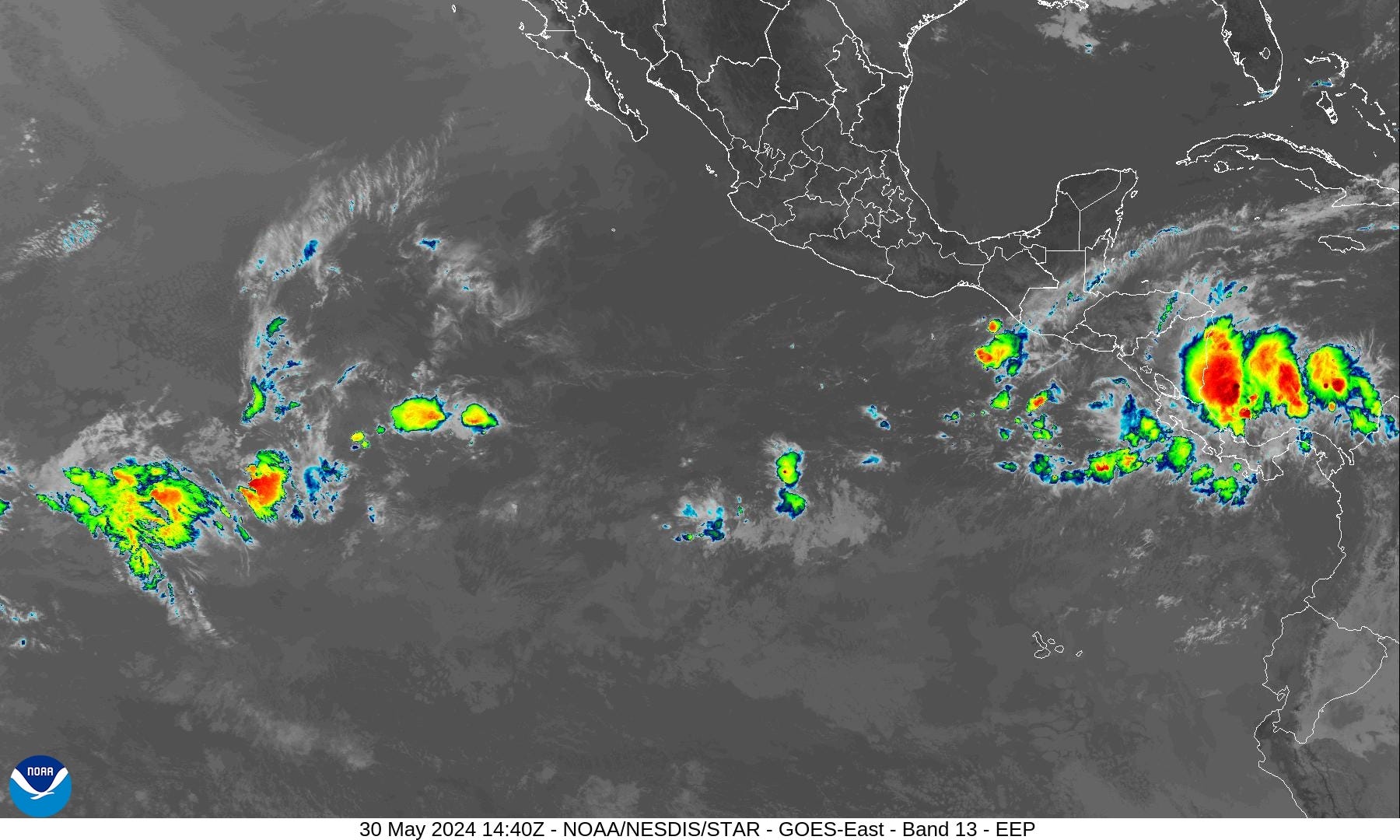
Area of storms/convection in the far southern Caribbean near Central America is quite welcome for drought / rain starved areas. Tropical cyclone development is not occurring.
Atlantic Basin Tropical Weather Outlook
No areas of interest in the NHC Tropical Weather Outlook across the Atlantic tropics as we reach the beginning of the 2024 Hurricane Season.

Precipitation quite welcome across Nicaragua, Costa Rica, and Panama over the next 48-hours.
African Dust | Saharan Air Layer (SAL)
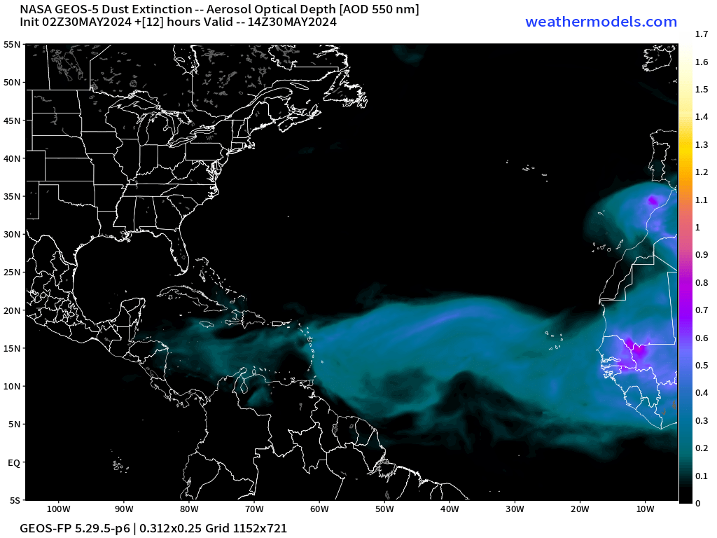
The current SAL is not particularly intense but will be noticeable today across the Lesser Antilles.
NASA’s global weather model (based upon GFS) contains a coupled-aerosol component that diagnoses and forecasts the evolution of African dust / Saharan Air Layers (SAL). SAL events can put a lid on tropical storm development but strong tropical waves have a large enough and isolated environment that simply expunges/wipes out the convective inhibition.
10-Day Precipitable Water Anomaly Forecast
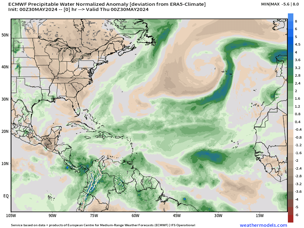
Cold fronts and troughs still impinge upon the tropics into June. As tropical waves move westward, they gain latitude and encounter hostile conditions including dry air and vertical wind shear. Not until July do the environmental conditions improve enough to expect tropical storm development in the far Atlantic even if ocean temperatures are warm enough.
[This is the “normalized anomaly” of precipitable water (my favorite variable) taking into account climatology (30-years) and calculating deviations from the historical mean. This allows easy tracking of extreme features like the tropical wave in the eastern Atlantic. The dry air with the late-season cold front is highlighted by this weekend.]
Powerful Late Season Cold Front

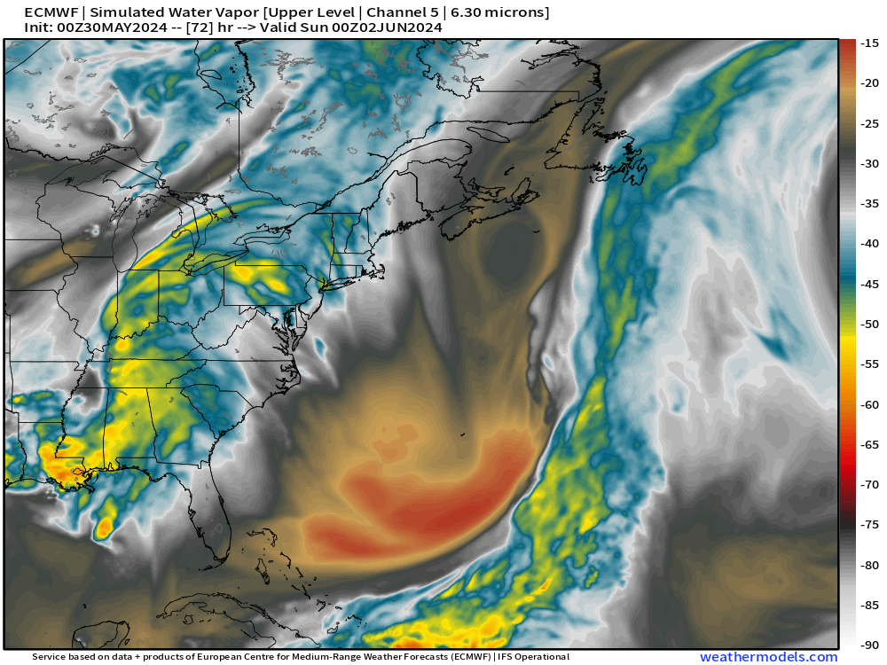
ECMWF HRES lost the subtropical storm development near Bermuda this weekend. However, a powerful cold front will extend into the Bahamas.
Atlantic Sea Surface Temperature Anomaly


Interesting to note that the late-season cold front off the U.S. East Coast will mix the ocean surface considerably and cool the Sea Surface Temperatures.
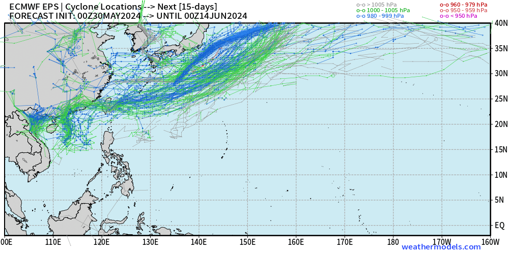
15-Day | Atlantic EPS Cyclone Tracks

No activity in the 15-day EPS Ensemble Forecast into mid-June.
Eastern Pacific Tropical Weather Outlook

NHC has popped up a 20% Chance of Cyclone Formation within 7-Days south of Mexico. There is some ensemble support for the development of the Eastern Pacific’s first Tropical Storm or Hurricane.

Western Pacific Tropical Weather Outlook
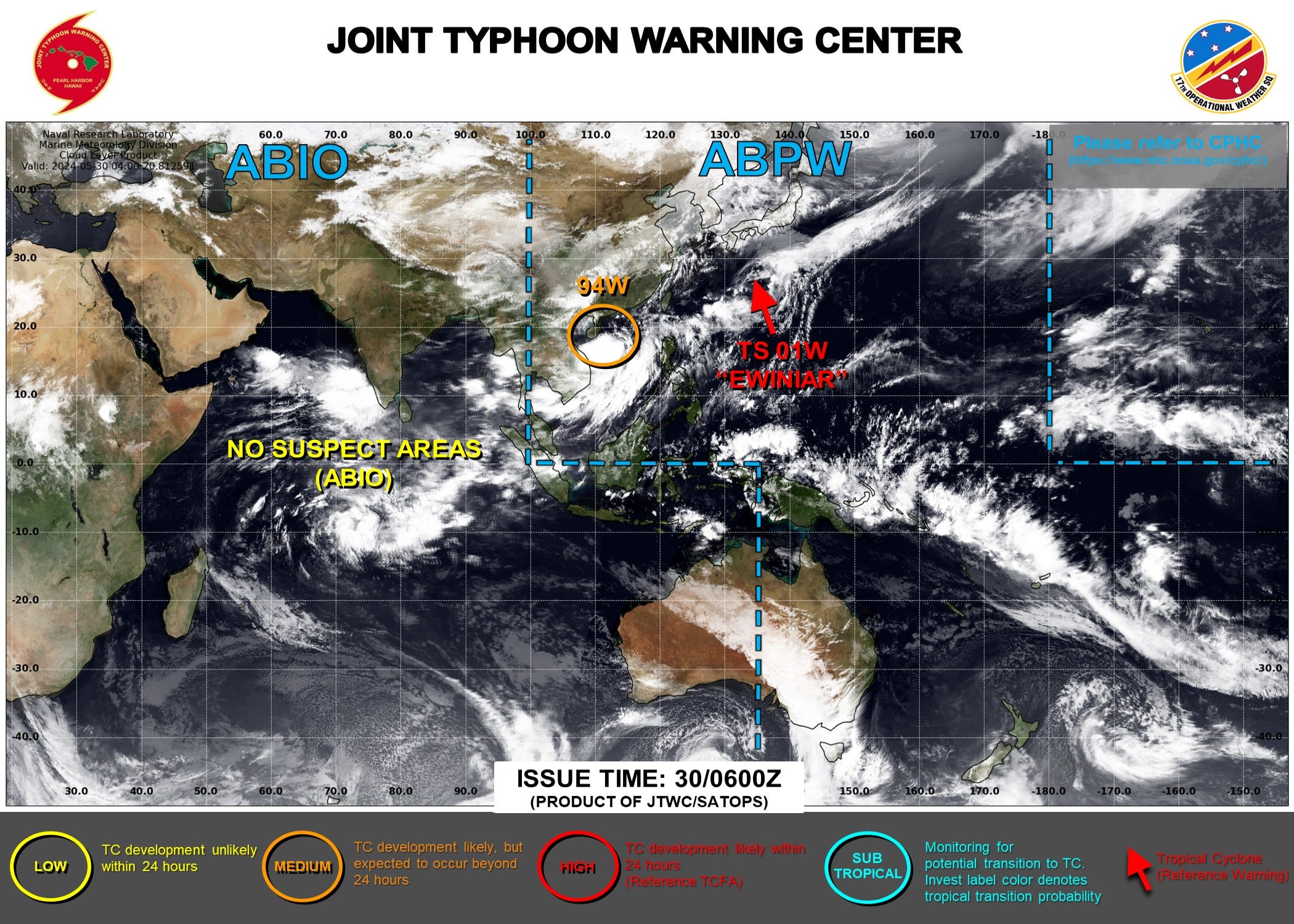
Tropical Storm Ewiniar [01W] will head into the North Pacific and continue to weaken. Invest 94W off the coast of China has a brief opportunity to become a tropical depression or weak storm before moving inland.
Amazing to see zip, zero, nada cyclone tracks south of 15°N across the entire Pacific from China to Hawaii. This is expected to be a quiet/weak Typhoon season, but this could be 1977 level dead.
ECMWF HRES 10-Day Storm Tracks

ECMWF AIFS 15-Day Storm Tracks

Thank you to Subscribers and Supporters! Welcome to May 2024 — countdown to hurricane season in 2-days.
Maps sourced from weathermodels.com designed and innovated by yours truly! I actually create all of my content from scratch.