


May 29, 2025 Thursday Weather
Still not seeing a heat wave as unsettled weather continues into June

Thursday’s Weather Headlines
Tropical Update issued earlier this morning for Thursday — Tropical Storm Alvin (01E) upgraded, and looks much better on satellite imagery.
Unsettled weather across eastern U.S. continues until we can rid ourselves of this stationary front.
Last 30-days rainfall anomaly: way too much from North Texas, Oklahoma, into the South and up into the Mid-Atlantic and Northeast. Some notable dry spots: Iowa, north Florida, Midwest and Great Lakes including Wisconsin and Michigan.

Thursday Evening Weather

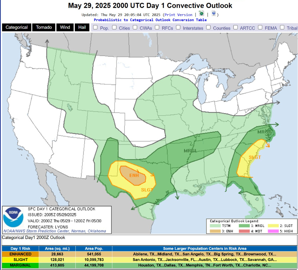
Enhanced Risk of Severe Storms in West Texas underway.
Current Satellite Imagery
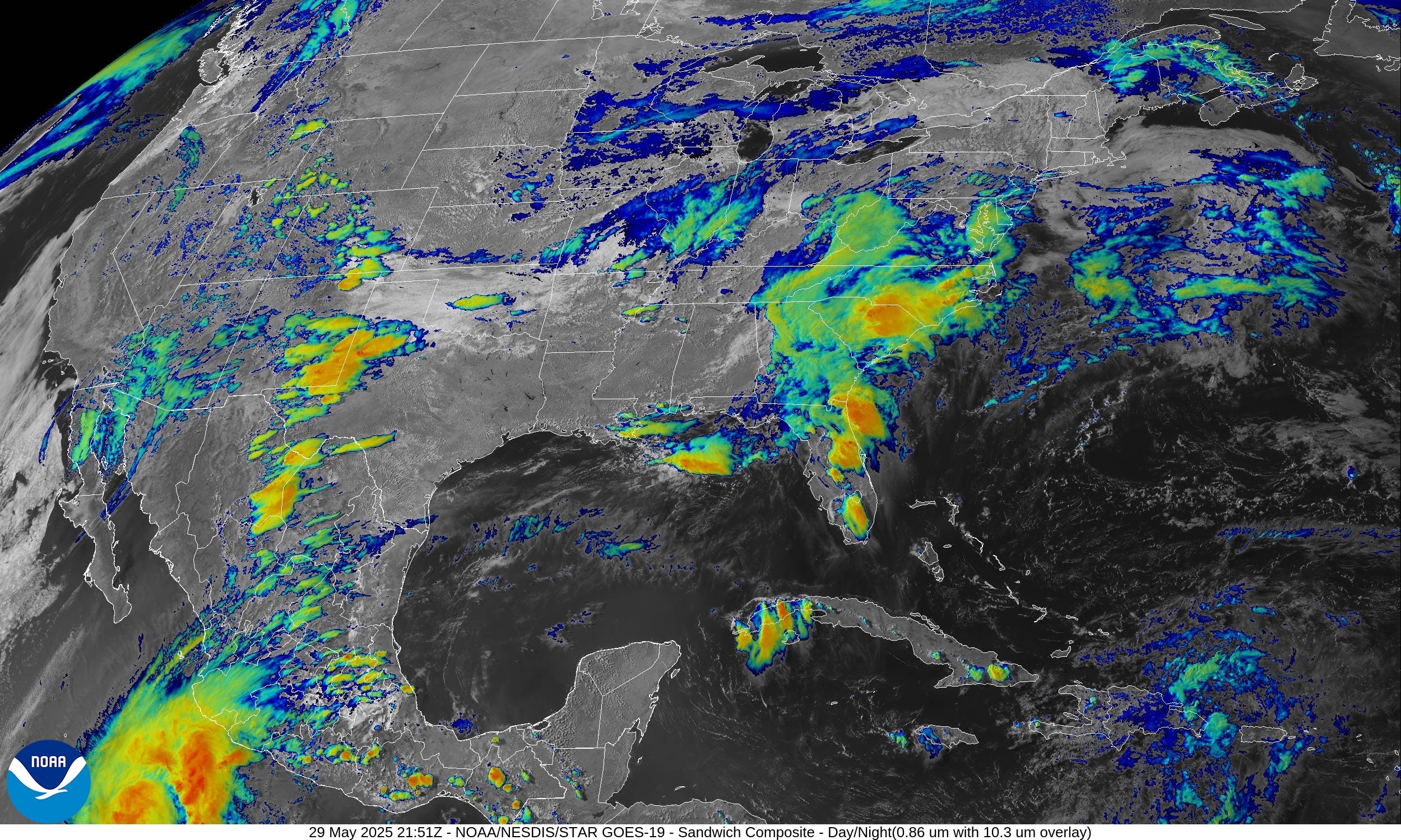
Still raining across the Southeast with another dreary day in Atlanta.
Radar Loops: 5:58 PM ET
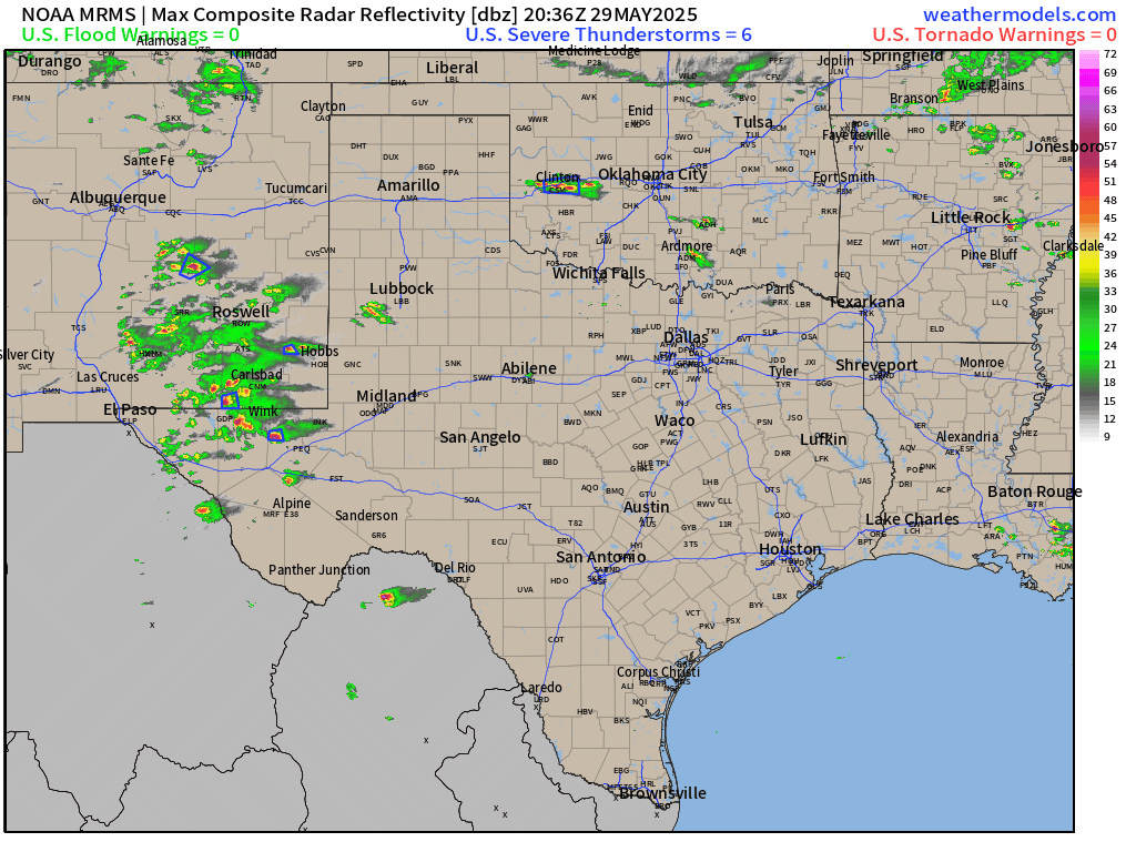
Multiple warnings in New Mexico and West Texas.
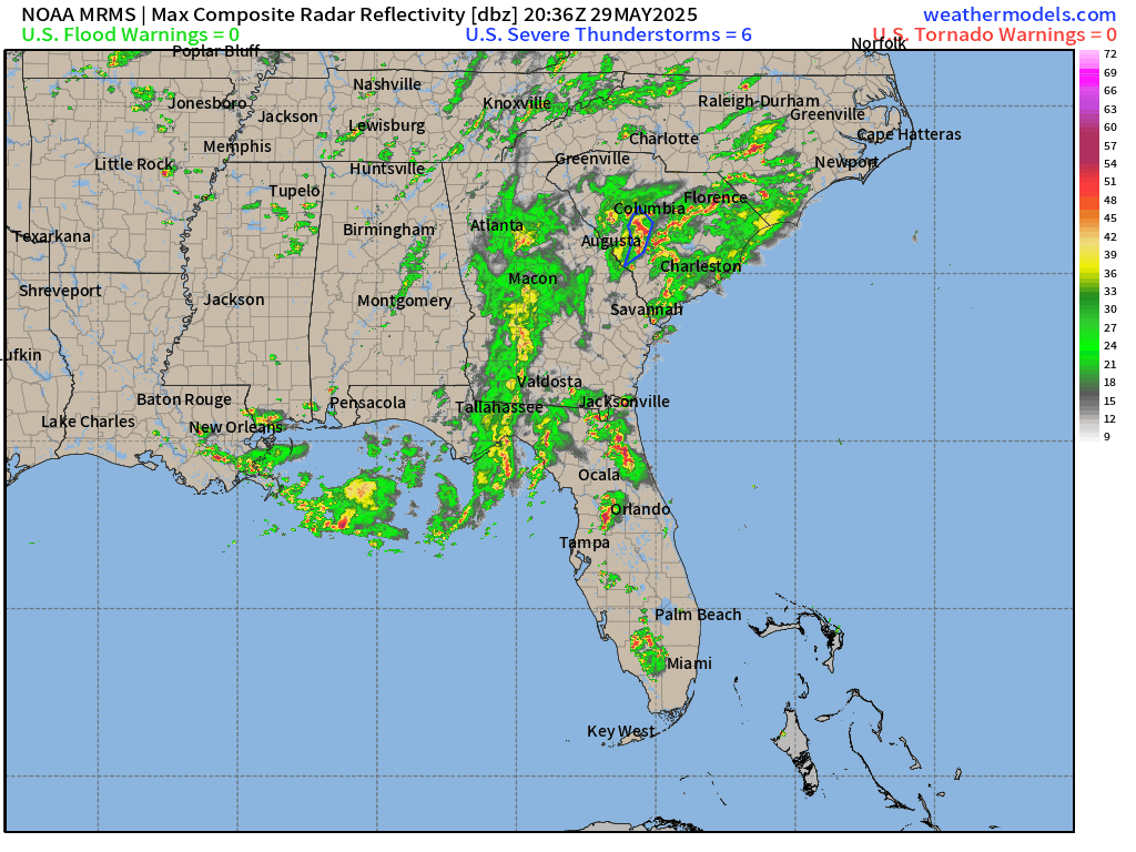
Rain has finally moved out of Atlanta. The Carolinas will see considerable coverage of moderate rain over the next 12-hours.
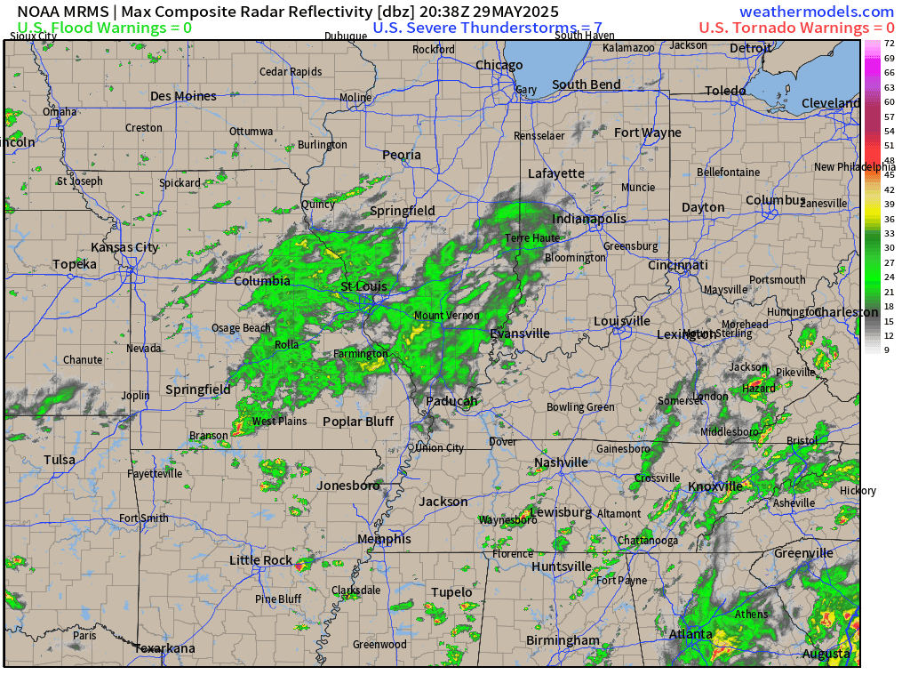
Light to moderate rain moving through St. Louis and then into the Ohio River Valley.
Convective Outlook Through Friday Morning | ENHANCED Risk
Precipitable Water | Next 7.5 Days

Heavy moisture from the Gulf of Mexico (yellow — red) is beaten back by Canadian troughs — and then resumes northward expansion on a 3-day cycle as frontal systems progress through the Lower 48.
Moisture with Tropical Storm Alvin is pulled into the U.S. Southwest on the periphery of an upper-level low that dips southward off western Baja California.
Then, another trough/upper-level low dips along the California coast into middle of next week with an atmospheric river aimed at Wash/Oregon.
Integrated Vapor Transport | Next 10-days
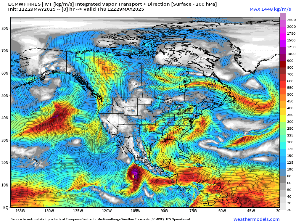
Low pressure in Canada has a plume of moisture up the East Coast Sun/Mon with a Nor’easter type system.
Alvin heads into Mexico and helps invigorate a Plains atmospheric river / surge of moisture out of the Gulf of Mexico.
Another tropical system is likely in the Eastern Pacific (Barbara) along the coast of Mexico by Day 10. A more summer-like pattern with southerly flow finally beats back a bunch of Canadian troughs —> warmer temperatures into early June.
Simulated Radar | HRRR 20z | Next 18-Hours

Strongest storms in Texas fizzle out later in the overnight hours. We get a brief break in the Southeast from the rain into early Friday. Rain in the Ohio River Valley continues through Friday morning.
Keep reading with a 7-day free trial
Subscribe to Weather Trader to keep reading this post and get 7 days of free access to the full post archives.