


May 29, 2024 Tropical Update
Tropical wave has sputtered out

Please subscribe for $5/month for email inbox deliveries every morning — or more often as conditions warrant. The investment in my research and development will pay off as A.I. enabled weather forecasts become a normal part of our weather forecasting enterprise.
Convection with a tropical wave in the central Main Development Region (MDR) has sputtered as dry/sinking/stable air combined with African Dust Layers.
Atlantic Basin Tropical Weather Outlook
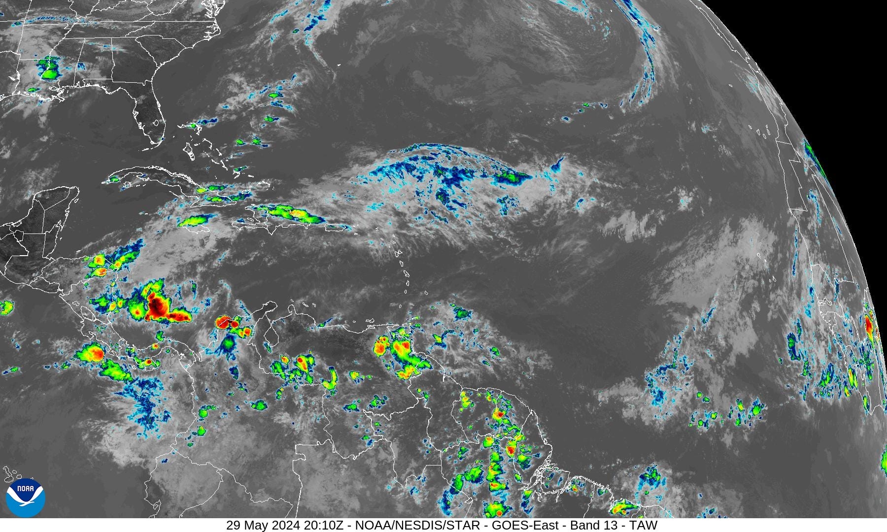
No other areas of interest across the Atlantic tropics as we reach the beginning of the 2024 Hurricane Season.
African Dust | Saharan Air Layer (SAL)

NASA’s global weather model (based upon GFS) contains a coupled-aerosol component that diagnoses and forecasts the evolution of African dust / Saharan Air Layers (SAL).
One such SAL layer is emerging off the African coast and heading westward. However, this is not a particularly intense event — which pick up in June and July.
SAL events can put a lid on tropical storm development but strong tropical waves have a large enough and isolated environment that simply expunges/wipes out the convective inhibition.
10-Day Precipitable Water Anomaly Forecast

This is the “normalized anomaly” of precipitable water (my favorite variable) taking into account climatology (30-years) and calculating deviations from the historical mean. This allows easy tracking of extreme features like the tropical wave in the eastern Atlantic. The dry air with the late-season cold front is highlighted by this weekend.
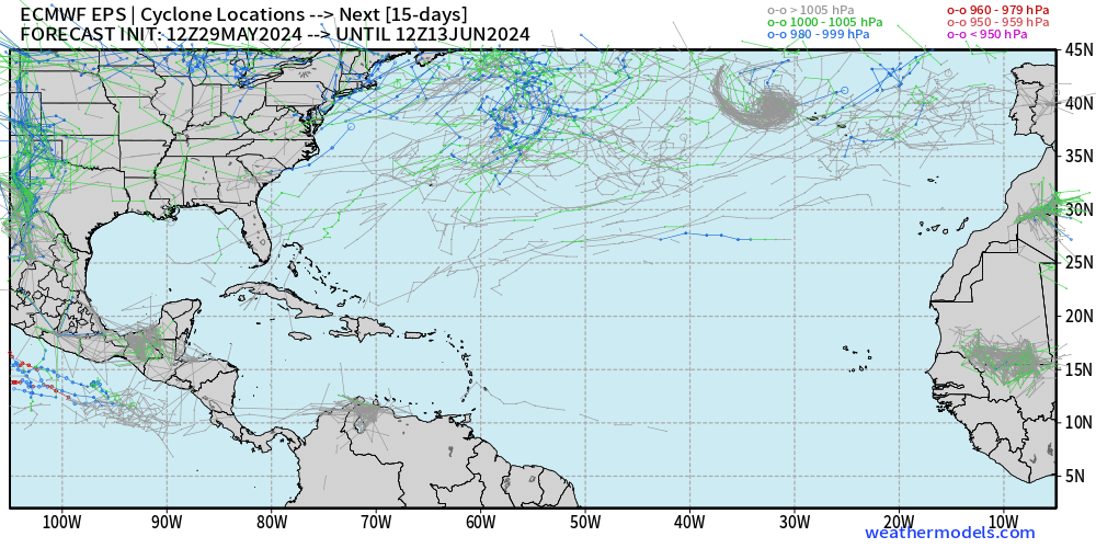
Potential Subtropical Development?


There will be an interesting subtropical cyclone development at 35°N latitude by Sat/Sun that could meet the criteria for a named subtropical system.
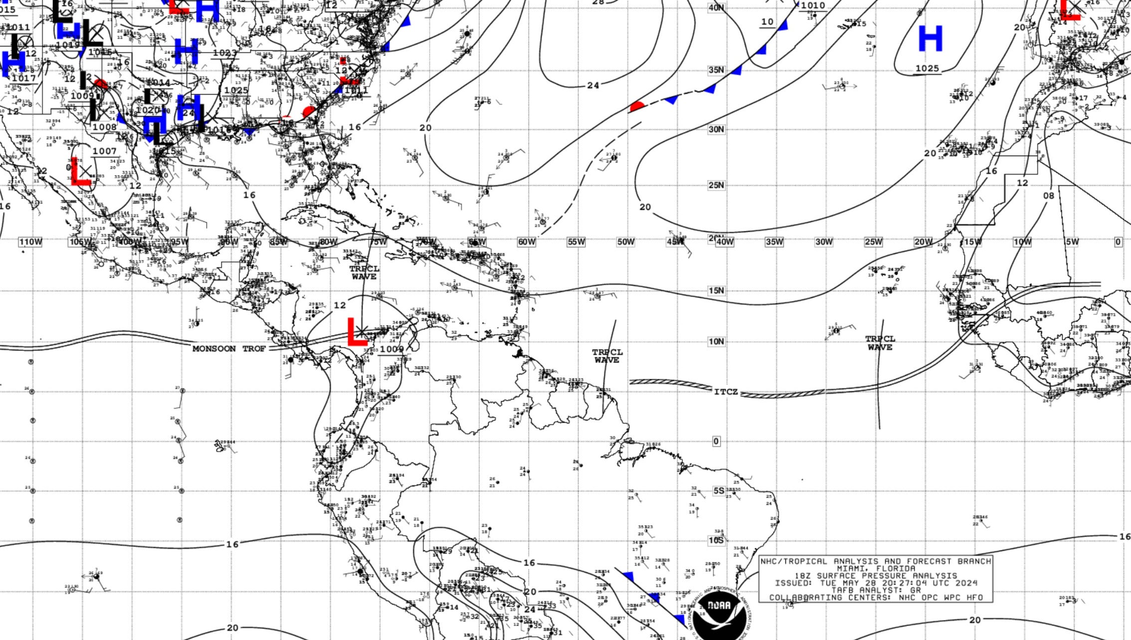
Check out the cold front dipping into the Bahamas with cooler, very dry air.
Atlantic Sea Surface Temperatures

Actual SSTs of 26°C are typically required for significant hurricane development in the Atlantic tropics unless there is an upper-level feature or trough to assist by cooling the tropopause.
Easy to see a large area or “warm pool” of 28°C SSTs extending from the coast of Africa through the MDR into the Caribbean. We are not even to June and this looks like a late July or early August ocean temperature profile.
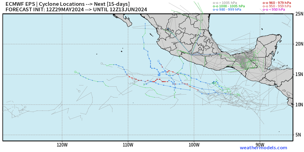
15-Day | Atlantic EPS Cyclone Tracks
Eastern Pacific Tropical Weather Outlook
No areas of development in the EPAC over the next 7-days from the NHC tropical weather outlook. However, the EPS cyclone tracks do register a few low pressure areas, but nothing imminent.
Western Pacific Tropical Weather Outlook
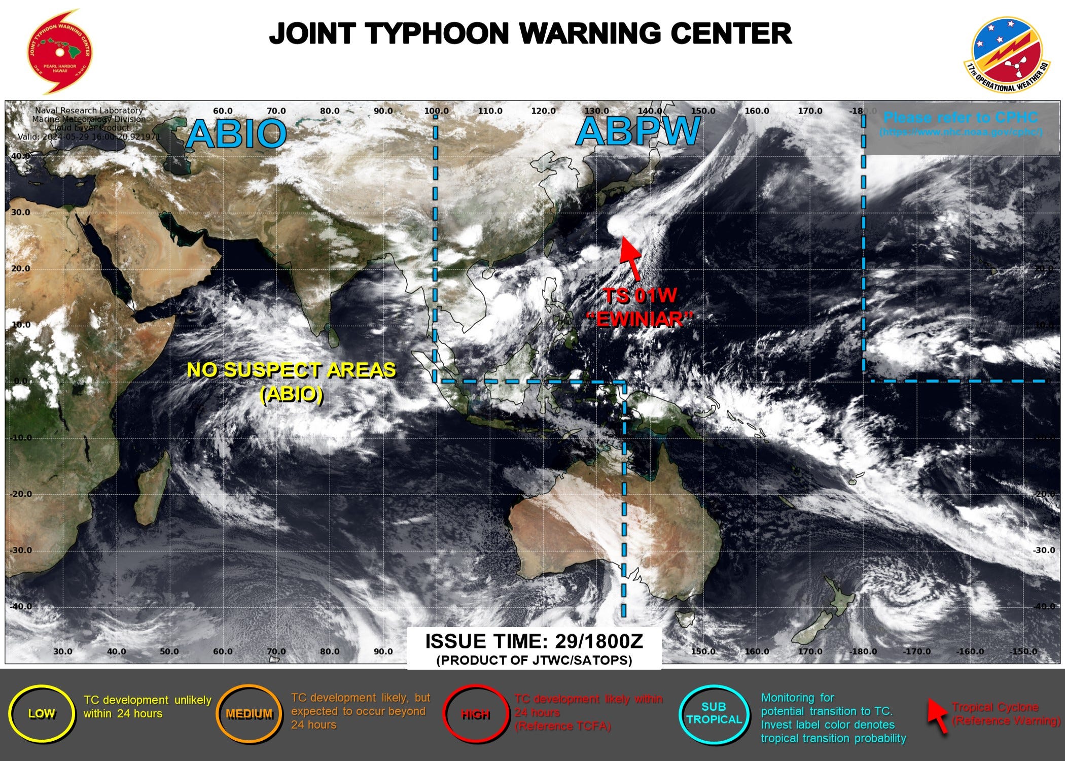
Tropical Storm Ewiniar [01W] is accelerating out to see off the coast of Japan. The system has maintained convection near the core but winds have decreased to 55-knots. No other areas of invest or development in the next several days.
ECMWF HRES 10-Day Storm Tracks

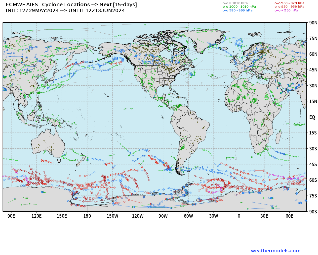
ECMWF AIFS 15-Day Storm Tracks
Thank you to Subscribers and Supporters! Welcome to May 2024 — countdown to hurricane season in 3-days.
Maps sourced from weathermodels.com designed and innovated by yours truly! I actually create all of my content from scratch.