


May 28, 2025 Wednesday Weather
Drying into next week with break from excessive rain

Wednesday’s Weather Headlines
Separate Tropical Update issued earlier this morning for Wednesday — since then, Tropical Depression 01E has developed, and will become Alvin in the next 12-hours, most likely.
Several areas of severe storms ongoing this evening
Active pattern continues with repeated trough influences from Canada
Warming into weekend and next week, but then another slight cool-down, keeping heat waves at bay
Evening Weather

Current Satellite Imagery
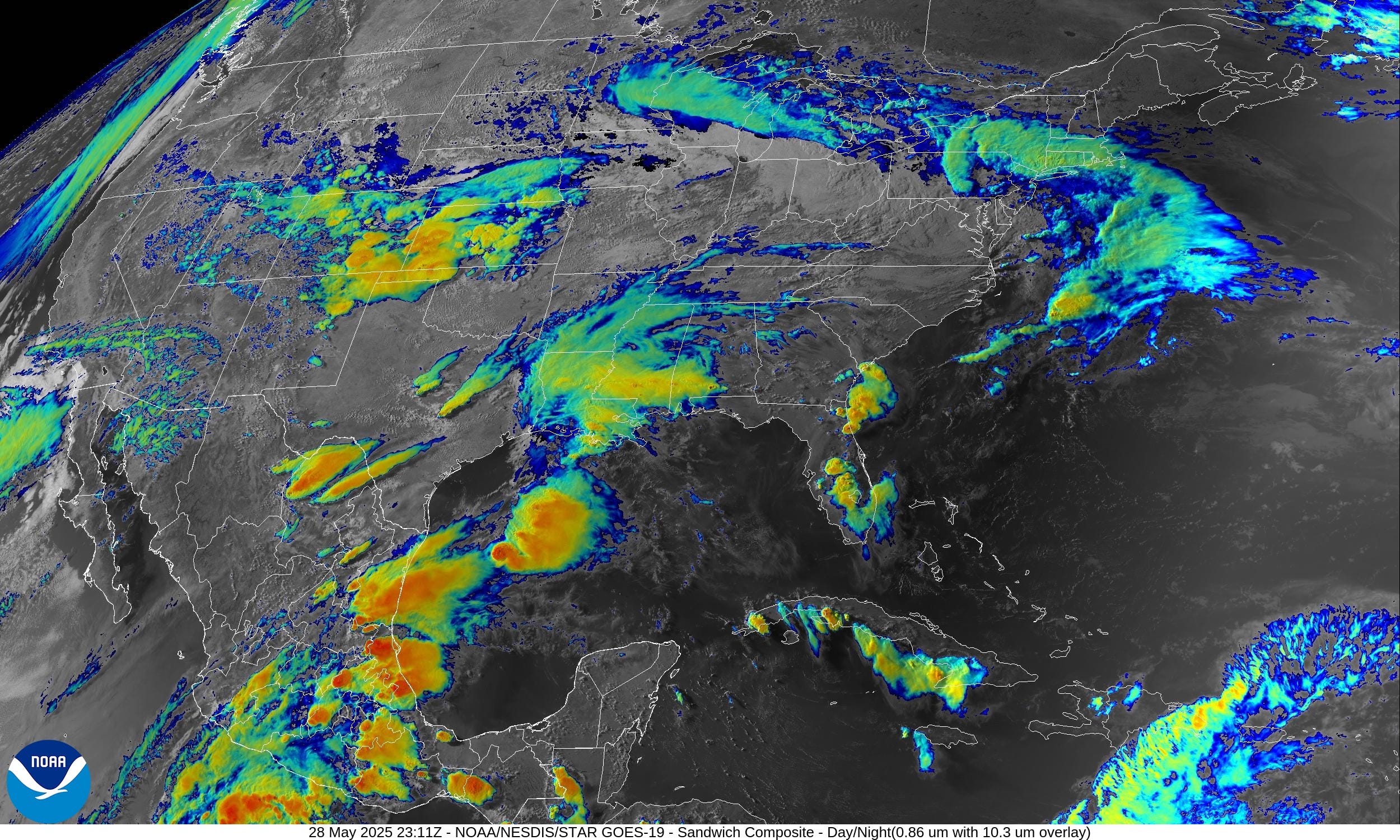
Several areas of convective (storms) including the Plains, Texas, Louisiana, and Florida.
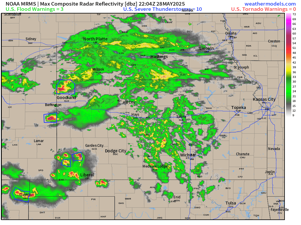
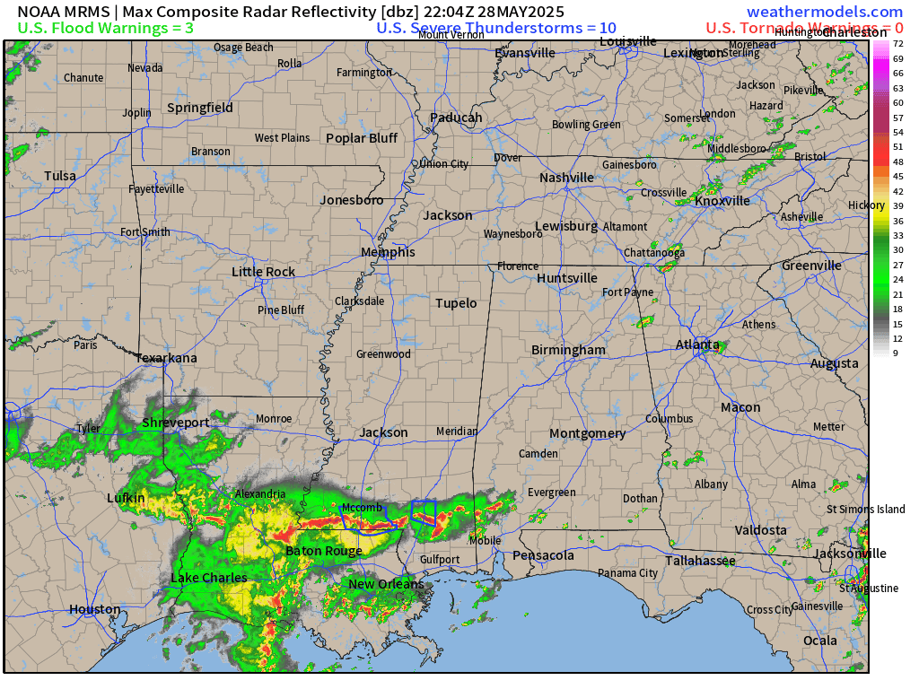
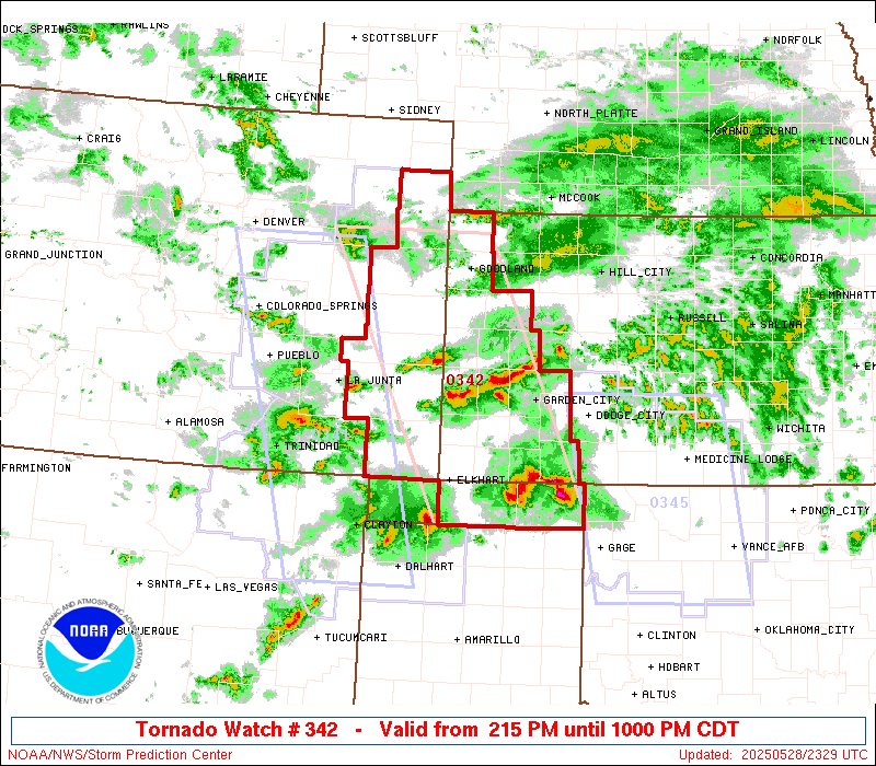
Radar Loops: 7:24 PM ET
A few severe storms in central Plains within a shield of cool rain. A strong cell moved through Liberal, Kansas.
More rain and storms moving out of the Gulf of Mexico into Louisiana and Mississippi.
Storms in Florida are slowly fizzling out with loss of daytime heating — and using up the CAPE.

Convective Outlook Through Thursday Morning | Slight Risk
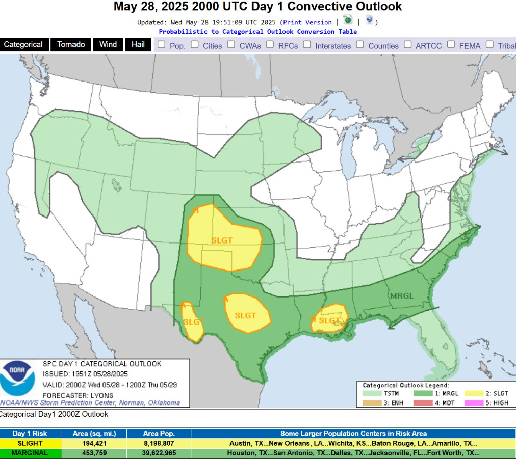
The several slight risk locations have watch boxes.
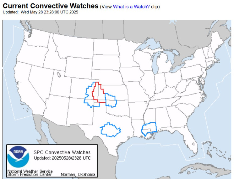
Tornado box in Eastern Colorado and Western Kansas
Precipitable Water | Next 7.5 Days

Heavy moisture from the Gulf of Mexico (yellow — red) is beaten back by Canadian troughs — and then resumes northward expansion on a 3-day cycle as frontal systems progress through the Lower 48.
Moisture with Tropical Storm Alvin is pulled into the U.S. Southwest on the periphery of an upper-level low that dips southward off western Baja California.
The end of the loop is next Wednesday = more “summer like” humidity and heat within a more ridge-like upper-level pattern.
Integrated Vapor Transport | Next 10-days

Keep reading with a 7-day free trial
Subscribe to Weather Trader to keep reading this post and get 7 days of free access to the full post archives.