


May 26, 2025 Monday Weather Update
Warming trend into weekend across Lower 48

Monday’s Weather Headlines | Memorial Day 2025
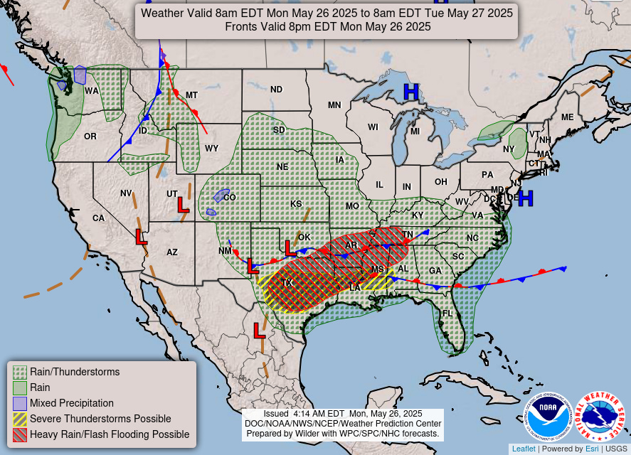
More heavy rain and storms along a stalled frontal boundary from Texas into the Southeast that has repeatedly drenched the region day after day. No change in this pattern for a while.
Atlantic tropical update: not expecting any development through at least 7-days, but chance for something in the Gulf of Mexico after Day 10 as the Atlantic hurricane season gets underway in June. No chances of a “pre-season” system.
Global models agreement — Eastern Pacific to see first storm [Alvin] before end of the month. NHC is up to 70% chance in 48-Hours in the Outlook.
Today’s Weather | Monday
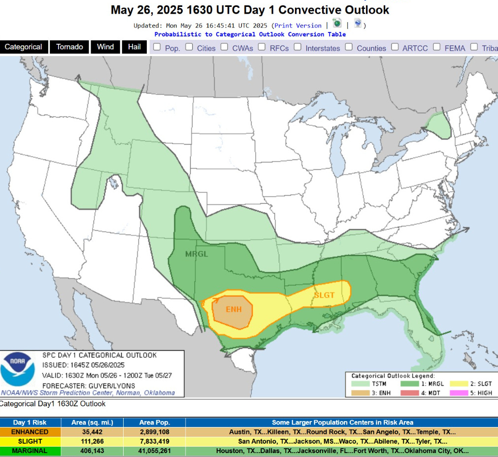
Enhanced Risk of Severe Weather including Austin, Texas today with potential for very large hail.

Current Satellite Imagery
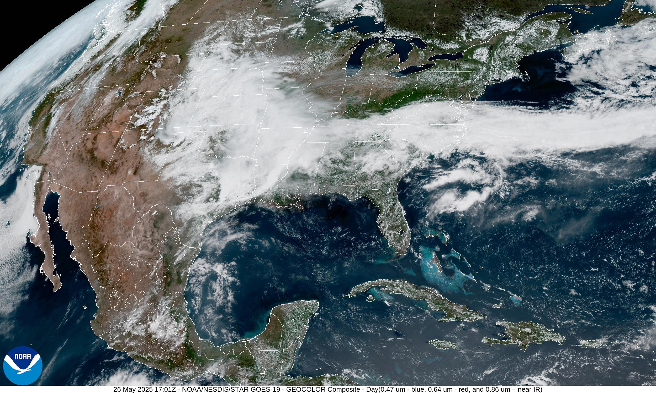
The Great Lakes, Northeast and the Southwest look great today with sunny skies. Beach goers in Florida should watch for pop-up thunderstorms.
Sadly, clouds and rain have socked in the Plains and mid-Mississippi River Valley over to the Carolinas.
Radar Loop: 1:08 PM ET
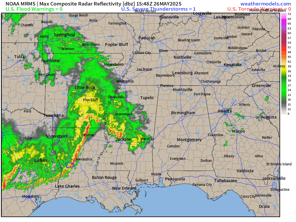
Squall line moving into Mississippi is warned for severe / gusty winds.
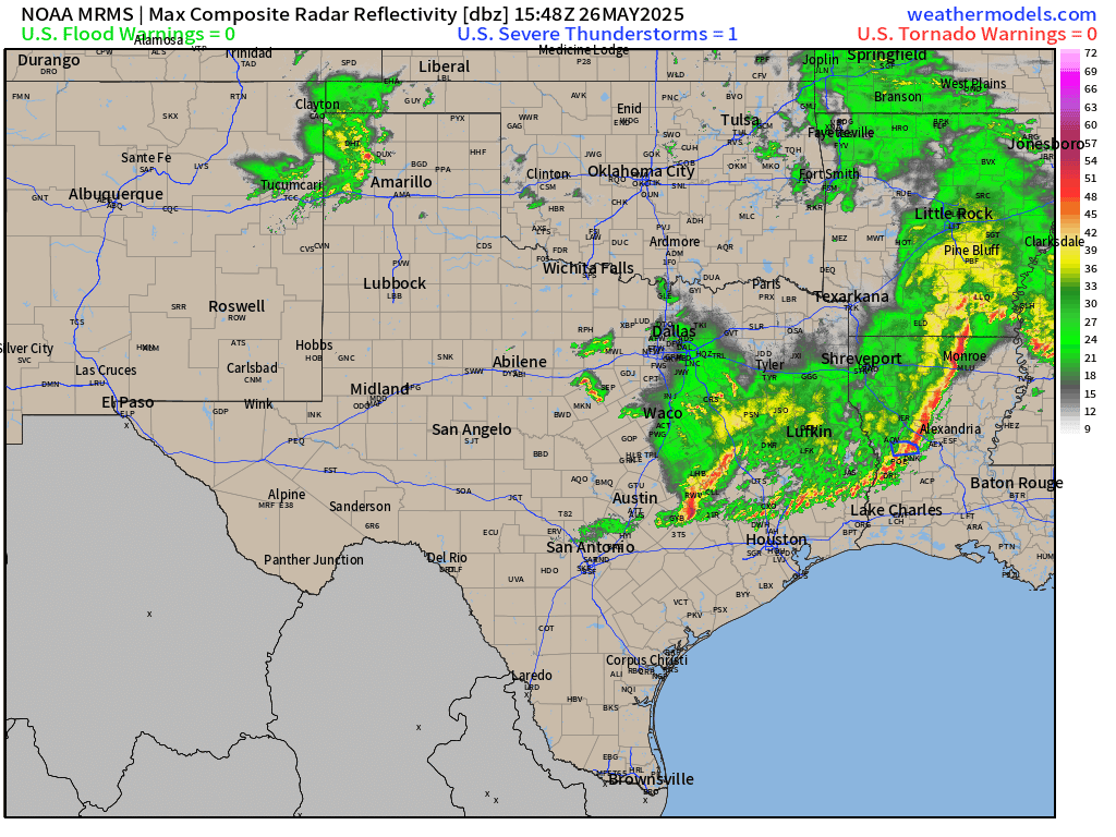
Rain and storms moving into Dallas / Fort Worth, and just north of Houston.
Integrated Vapor Transport | Next 10-days
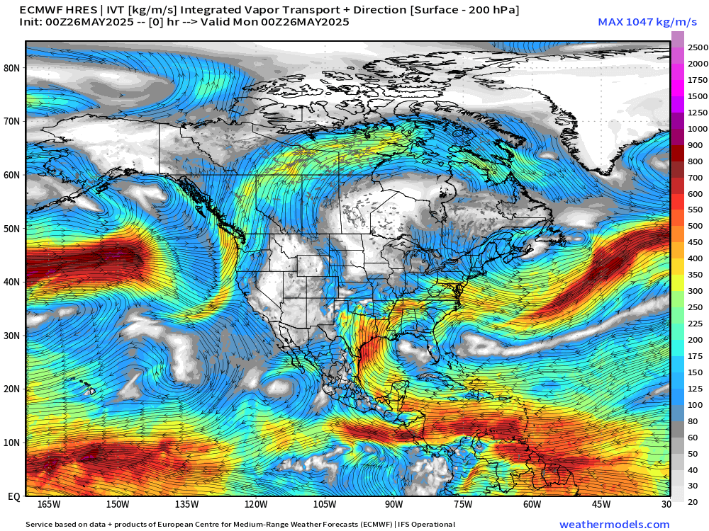
Caribbean and Gulf of Mexico are the primary source regions for the heavy rain across TX/OK and Mississippi River Valley. Tropical easterly flow across Central America will consolidate and circulate into Tropical Storm (or Hurricane) Alvin by Wednesday.
Note the little circulation in the eastern Gulf of Mexico as a tropical wave is captured / moved northward by the subtropical ridge — by Day 10.
We need to watch the Gulf for early-season TD or TS development with hybrid or not-totally tropical characteristics.
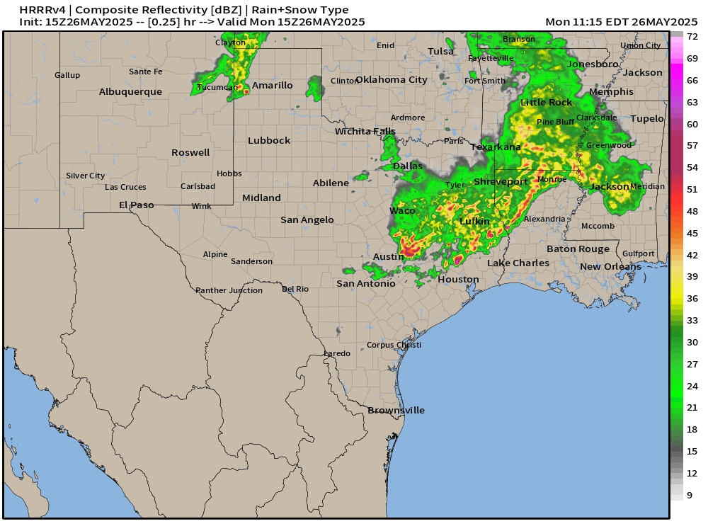
Memorial Day Simulated Radar | HRRR 15Z | Next 18-Hours

Storms entering Mississippi should hold together into Georgia by 2 AM ET, but hopefully losing their punch.
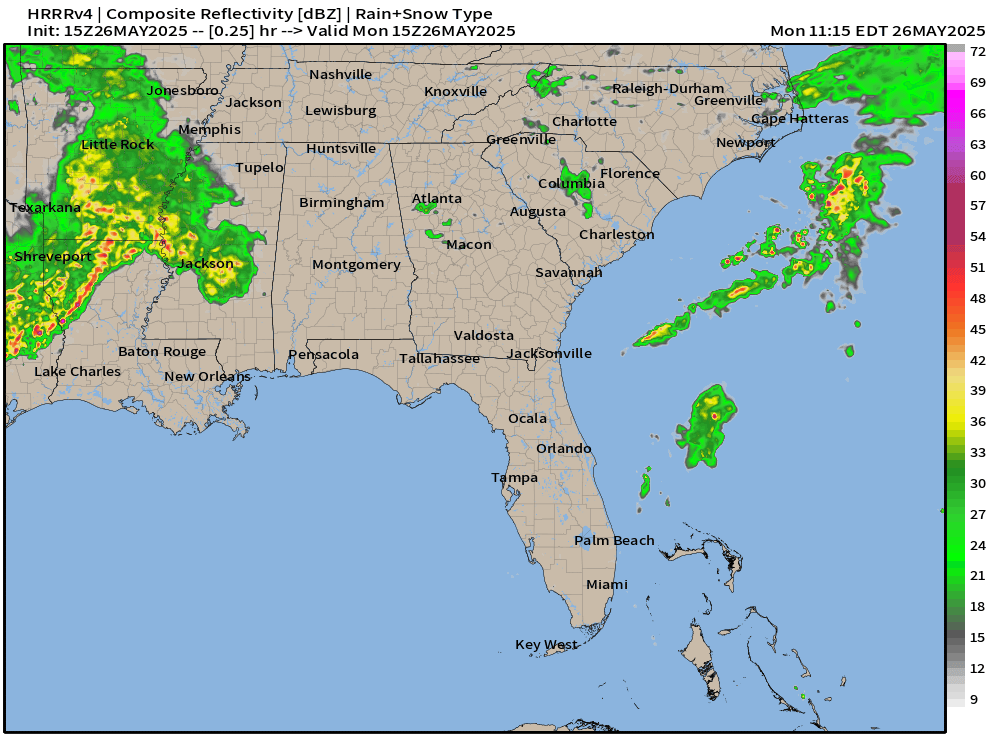
Storms in Texas will consolidate into another complex to move into Louisiana overnight and start the process over again for Tuesday.
NWS Rainfall Through Tuesday Morning 8 AM (21-hours)

1-2 inches across eastern 1/2 of Texas today. Generally 0.5” elsewhere but over a large area from Plains to Georgia and Florida peninsula.
NWS Precipitation next 72-Hours

Significant rain will add up to 2-3” from Texas into Georgia including Atlanta and Houston. Don’t need it.
High Temperatures Next 9-Days Tues May 27 - Wed June 4.

WARMING trend into this weekend and next week as 80s take over much of the Lower 48 (at least) with 257 million at least 80°F by next Wednesday June 4.
TROPICS
Keep reading with a 7-day free trial
Subscribe to Weather Trader to keep reading this post and get 7 days of free access to the full post archives.