


May 23, 2024 Very Active Hurricane Season Predicted by NOAA
17-25 Named Storms with 4-7 Major Hurricanes


All signals point to a very active Atlantic hurricane season for 2024: Accumulated Cyclone Energy (ACE) range of 150%-245% of the median.
17-25 Named Storms [blow through the alphabet]
8-13 Hurricanes
4-7 Major Hurricanes
Quick transition to La Nina conditions = less wind shear
High ocean heat content and warm SSTs in the tropical Atlantic + Caribbean
Above normal west African monsoon = strong/robust African easterly waves
Light trade winds
Long-term multi-decadal active era since 1995
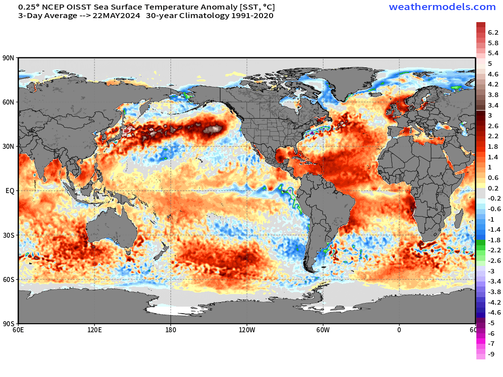
Ocean temperatures are well-above normal across the tropical Atlantic = plenty of fuel for major hurricanes.
Hard to bet against the exceptional forecasts from various agencies and private companies. However, as the Atlantic is a fickle or marginal basin, shorter term [sub-seasonal] variability could hamper development like dust outbreaks or upper-level troughs. 4 major hurricanes is within the expected range of NOAA’s expert assessment, which would be just above average. However, 7-10 would be gangbusters.
So far in 2024, 0 Northern Hemisphere tropical cyclones observed.
Atlantic Basin Tropical Weather Outlook

10% chance of further development with a surface trough centered over eastern Cuba. While environmental conditions are hostile for organized tropical storm development, the showers will lead to flooding concerns across the Caribbean.
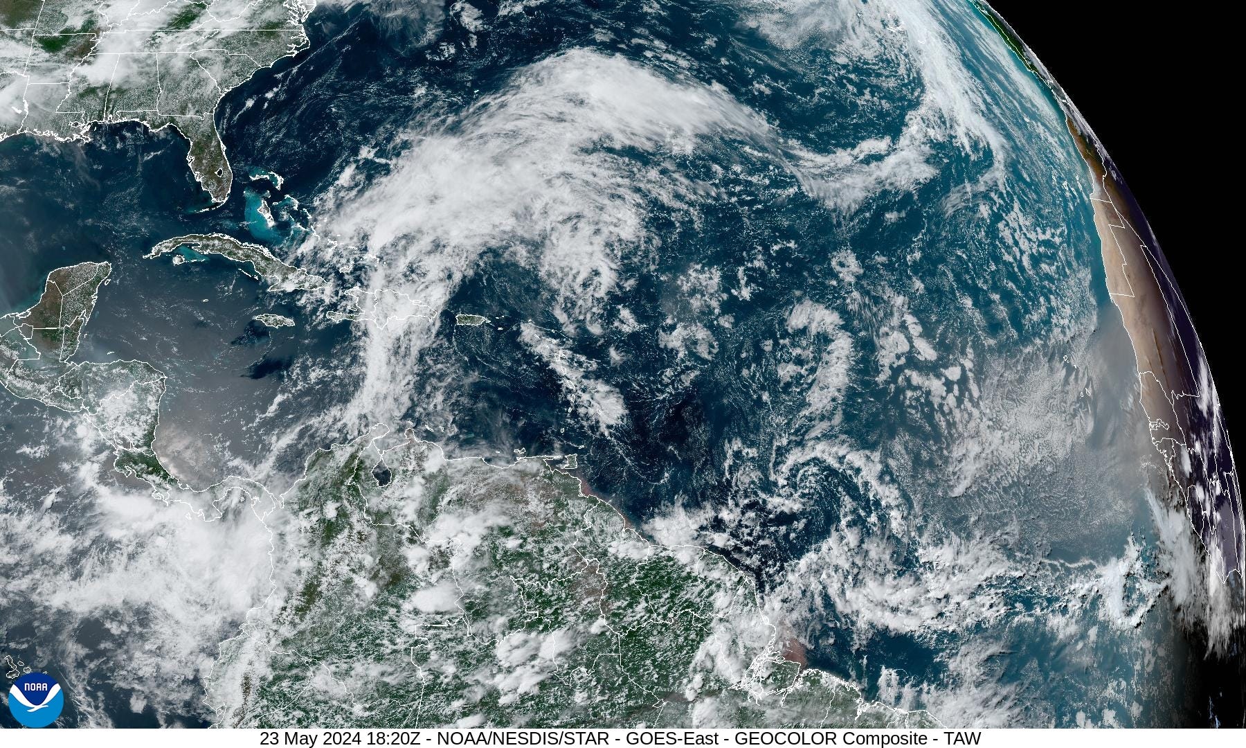
Saharan Air Layer and dust outbreak coming off the continent.
Eastern Pacific Tropical Weather Outlook
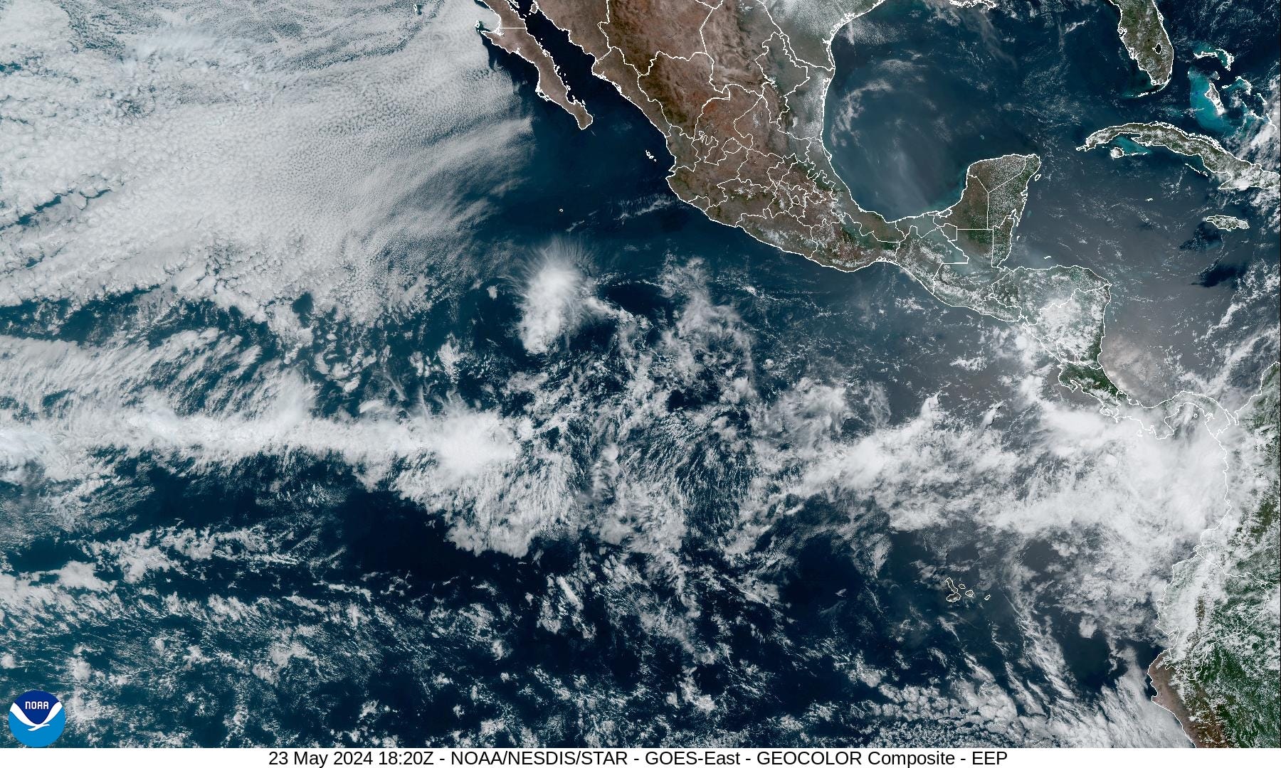
No areas of interest in the Eastern Pacific for the next 7-days. Very dry across Mexico and central America.
18-Hour Forecast | Simulated Radar | HRRR
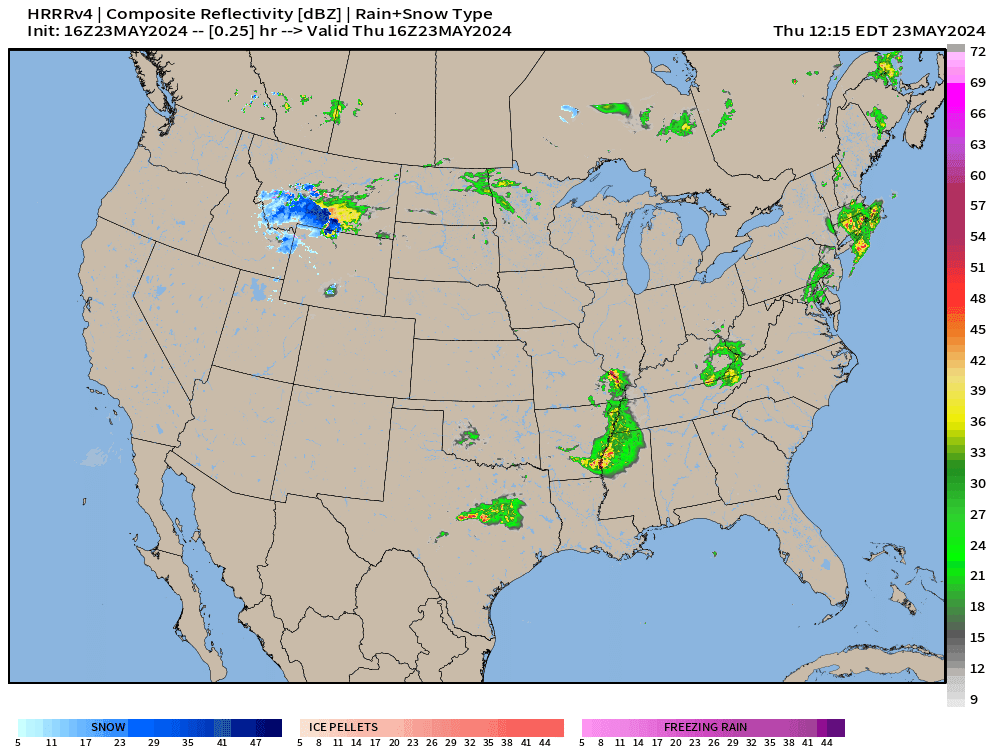
Yet another storm system developing across the upper Midwest with severe weather likely to develop and sweep eastward from Nebraska into Iowa and Minnesota during the evening.
Next 10-days Upper-Level Weather Pattern | ECMWF AIFS

NWS WPC 7-Day Precipitation Forecast | Watering Needs

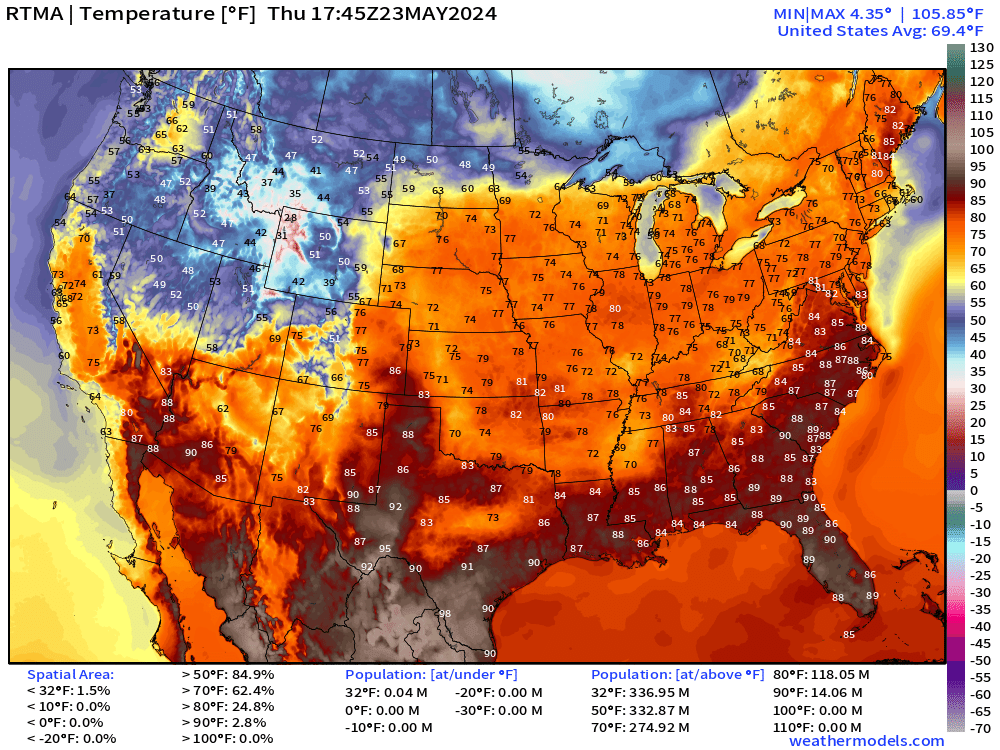
Thursday Temperatures 1:45 PM ET
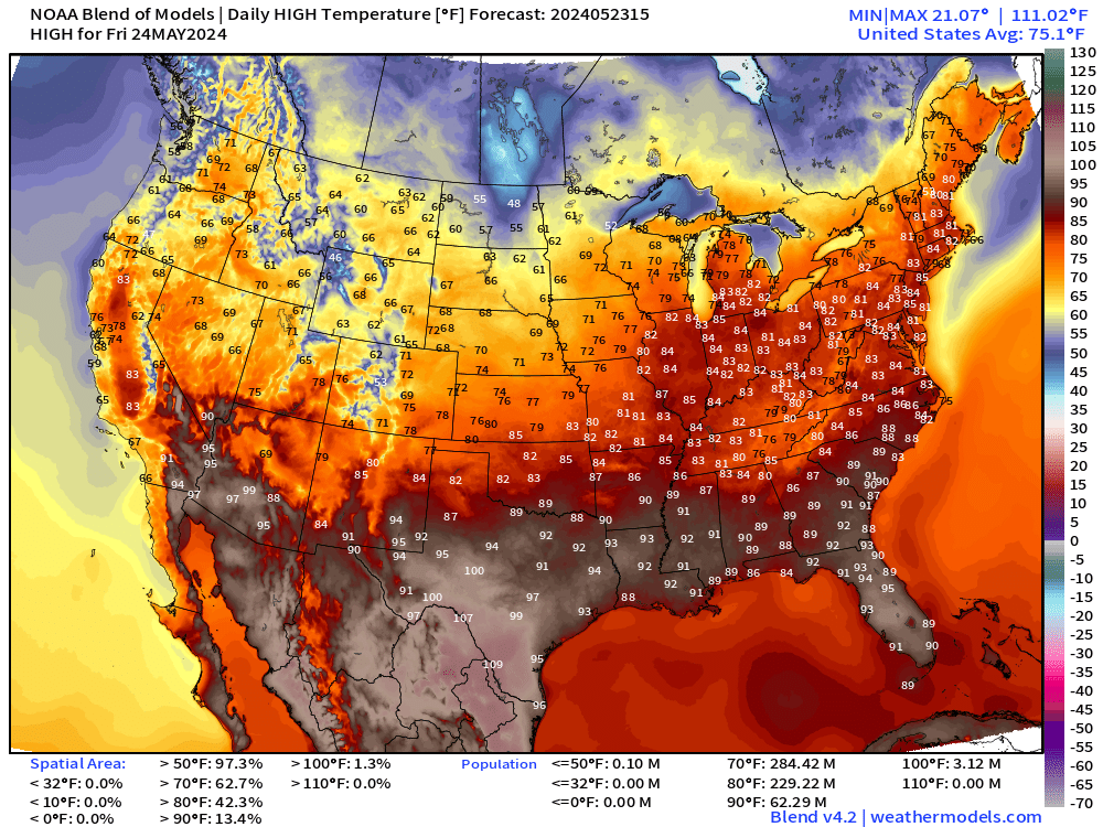
Thursday High Temperatures
Lower 48 Average: 75.1°F | 229 Million at/above 80°F | 62 Million at/above 90°F
Up to 110°F along the Rio Grande. Mid-90s in central Florida. Nice and warm in teh Great Lakes and Ohio Valley into New England in the 80s.
Much cooler air behind the cold front only in the 60s in the Dakotas.
Thursday Weather and Convective Outlook
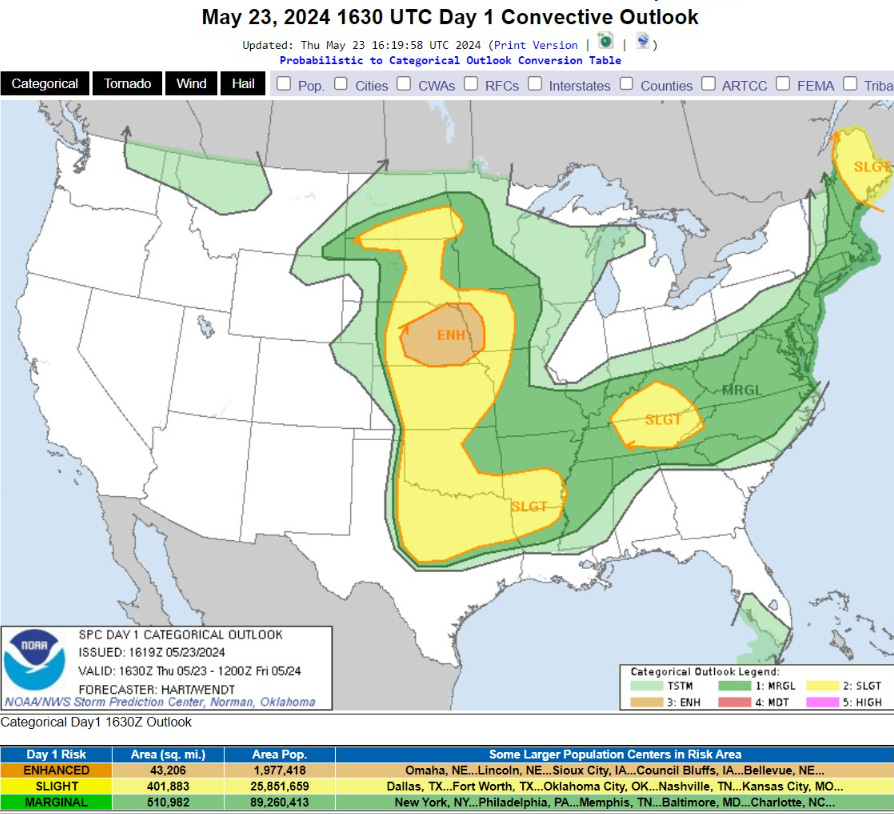
   ...THERE IS AN ENHANCED RISK OF SEVERE THUNDERSTORMS THIS EVENING
   AND TONIGHT OVER PORTIONS OF NEBRASKA AND WESTERN IOWA...

   ...THERE IS A SLIGHT RISK OF SEVERE THUNDERSTORMS OVER PARTS OF THE
   PLAINS STATES...MAINE...AND THE TENNESSEE VALLEY...

   ...SUMMARY...
   Severe thunderstorms are possible today across parts of the Plains,
   Tennessee Valley, and Maine.  A concentration of severe winds --
   some 75 mph or more -- is expected across a portion of the central
   Plains this evening into tonight.

Next 8-Days Weather Systems | ECMWF HRES

Forecast Farm | EPS 15-Day Precipitation + Anomaly [inch]


ECMWF Ensemble | 5-Day Temperature Anomaly
Days 1-5 | May 23-27, 2024

Days 6-10 | May 28 - June 1, 2024

Days 11-15 | June 2-6, 2024

Thank you to Subscribers and Supporters! Welcome to May 2024 — countdown to hurricane season in 8-days.
Maps sourced from weathermodels.com designed and innovated by yours truly! I actually create all of my content from scratch.