


May 22, 2025 Thursday Weather Update
Nor'easter drenching New England

Thursday’s Headlines:
Unusual Nor’easter drenching New England with 2-3” of rainfall
Continuing a break with severe weather
Atlantic tropical update: not expecting any development through at least 10-15 days into early June. Highly unlikely to see a “pre-season” tropical storm.
Eastern Pacific likely to see its first storm [Alvin] before end of the month. NHC is up to 50% chance in 7-days in the Outlook.
Cooler/well below normal temperatures from Midwest, Great Lakes, and Northeast keep a lid on any heat wave discussion until probably June.
NOAA out with its 2025 Atlantic Hurricane Season Forecast (will generate a new post once the webinar is over)
Today’s Weather | Thursday
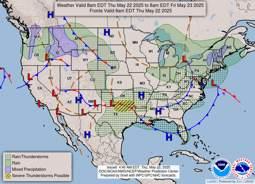
Developing Nor’easter down to 992 mb off New England in 18-24 hours with unusual intense rainfall on the backside — maybe some mixed precip in the mountains.
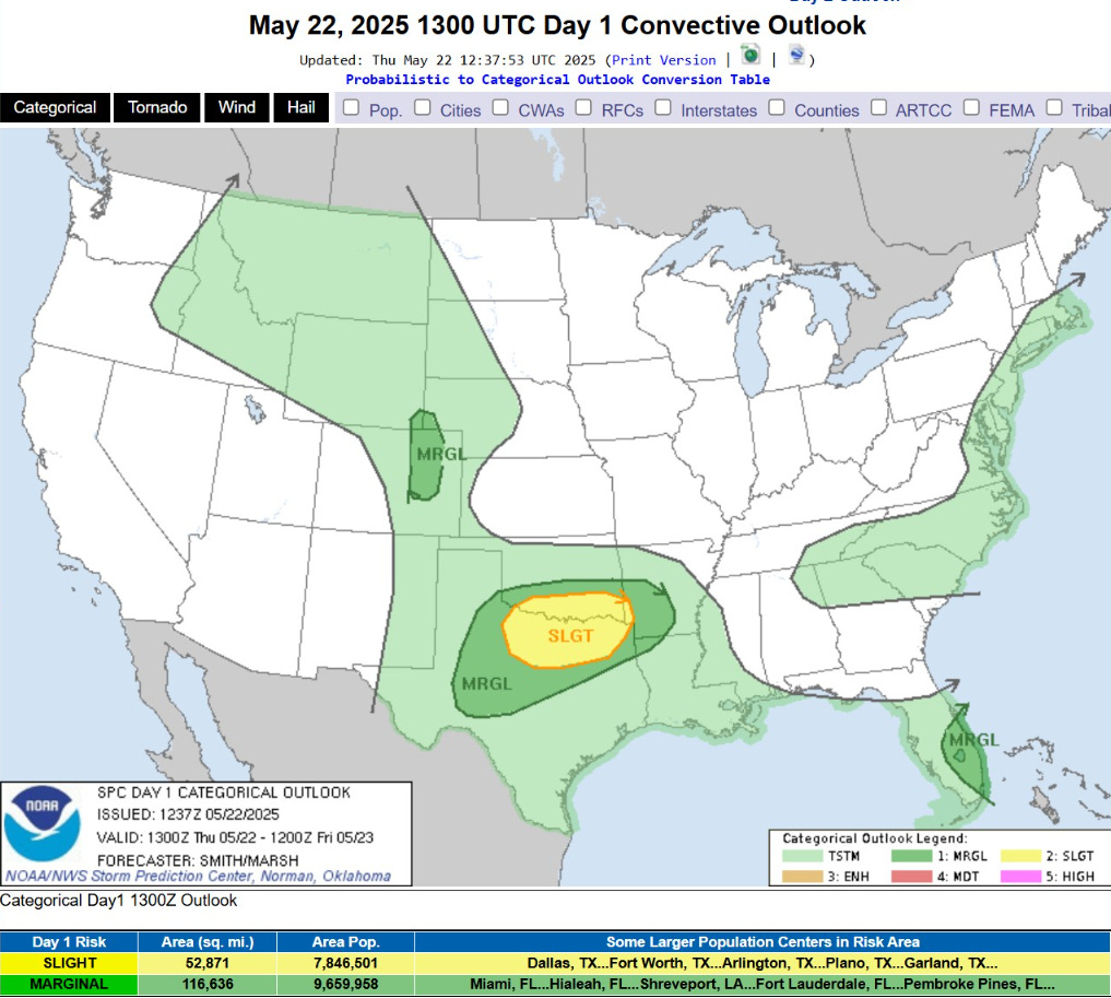
Severe Weather Outlook | Slight Chance in OK/TX
Mainly a gusty winds and large hail risk.
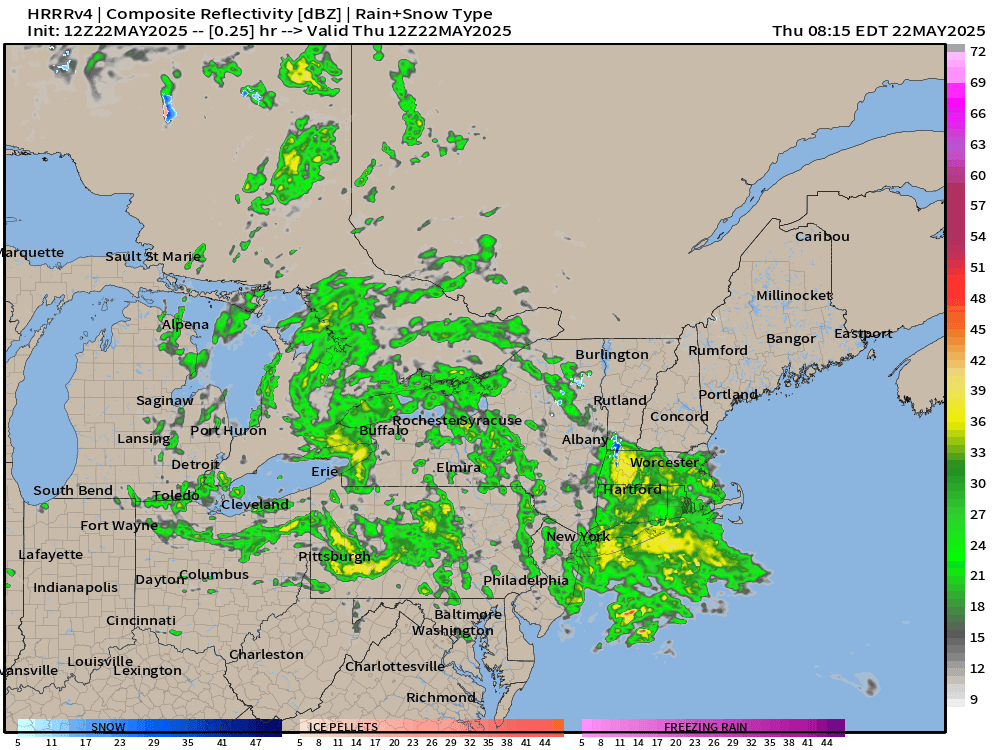
HRRR Simulated Radar Next 18-hours through Friday 2 AM ET
Vigorous convection in the cloud head of the Nor’easter will washout New England including Boston into this afternoon
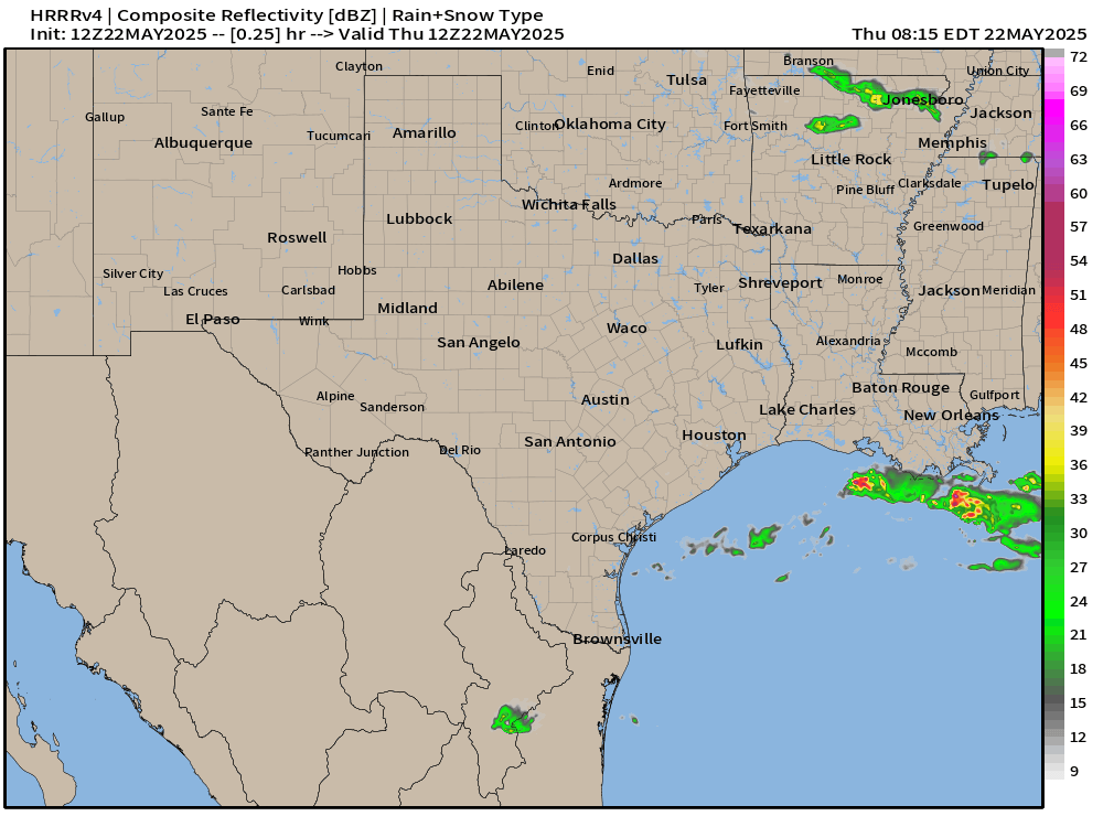
More rainfall for the Red River Valley and Dallas Fort Worth with SLIGHT chance of severe storms. However, these cells look quite intense from HRRR 12Z.
72-Hour Total Rainfall | NWS

Heading into this weekend, heavy rain returns to the mid-Mississippi River Valley and the Plains centered on Bentonville, Arkansas.
48-Hour Total Rainfall | Nor’easter

1-inch (yellow) over a wide area including NYC and Boston, maybe closer to 3-inches now in the red including Providence and Boston.
TROPICS
Eastern Atlantic Satellite Image
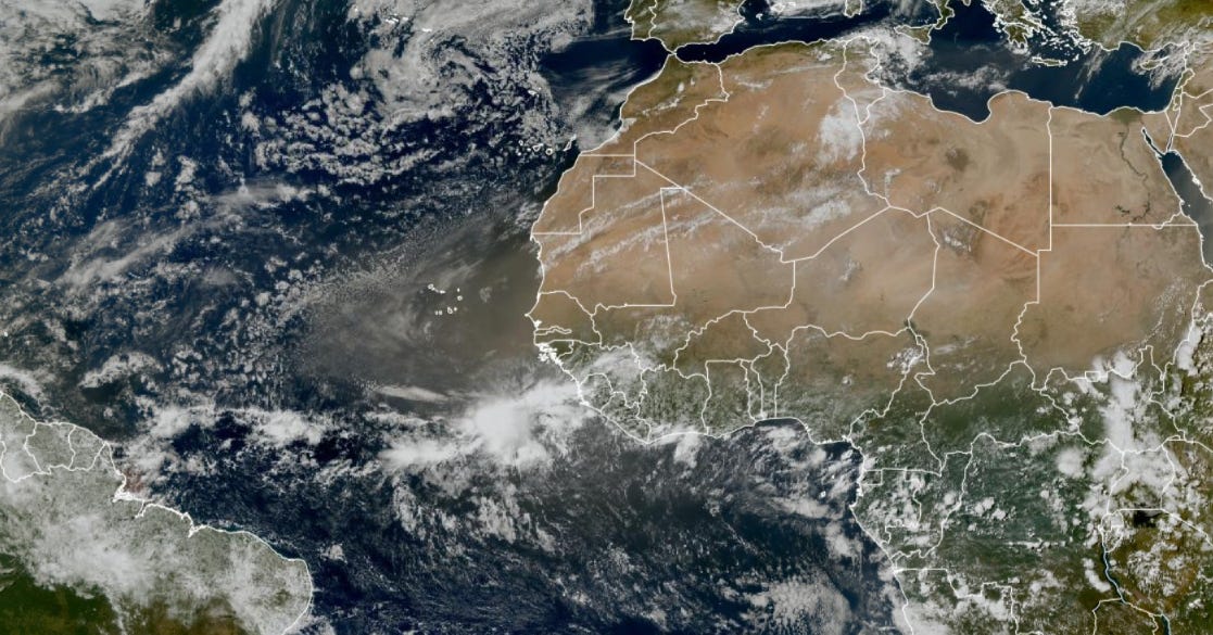
Very heavy dust coming off the African continent will travel westward into the Caribbean after 6-7 days.
Keep reading with a 7-day free trial
Subscribe to Weather Trader to keep reading this post and get 7 days of free access to the full post archives.