


May 21, 2025 Wednesday Weather Update
Indian Ocean twin tropical cyclones

Wednesday’s Headlines:
Twin tropical cyclones likely to develop around India in the next several days as the monsoon breaks down into massive gyre circulations
Finally taking a break with severe weather
Atlantic tropical update: not expecting any development through at least 10-15 days into early June. Highly unlikely to see a “pre-season” tropical storm.
Eastern Pacific likely to see its first storm [Alvin] before end of the month. .
Cooler/well below normal temperatures from Midwest, Great Lakes, and Northeast keep a lid on any heat wave discussion until probably June.
India and Northern Indian Ocean Tropical Cyclones
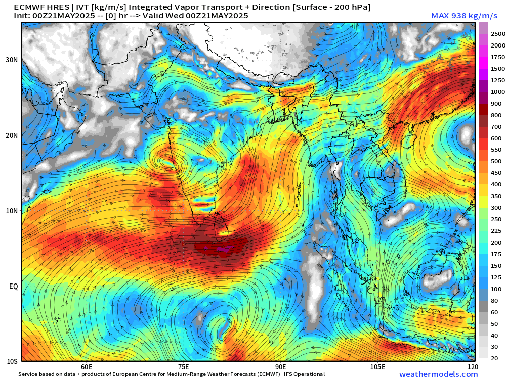
Integrated Vapor Transport (IVT) shows the massive circulations with the monsoonal flow breaking down into two tropical cyclones. Invest 93A is currently designated off the Gujarat coast of India and should slowly gain strength. The next name is Shakhti.
ECMWF 00z HRES has 970 mb at Day 6 with the western tropical cyclone in the Arabian Sea. The Bay of Bengal system might remain as a large tropical storm but still be impactful with extremely heavy rainfall along any coastline it reaches.


HAFS-A hurricane mesoscale model
Central pressure in the 960s mb should be a major hurricane assuming wind shear and dry air does not knock down the system prior to reaching peak intensity.


We’ll watch the next several days — and see how the A.I. driven systems forecast these tropical cyclones and provide clues for the Atlantic season ahead.
Interesting New Paper
Can AI weather models predict out-of-distribution gray swan tropical cyclones?
Will read and discuss this in the coming days …
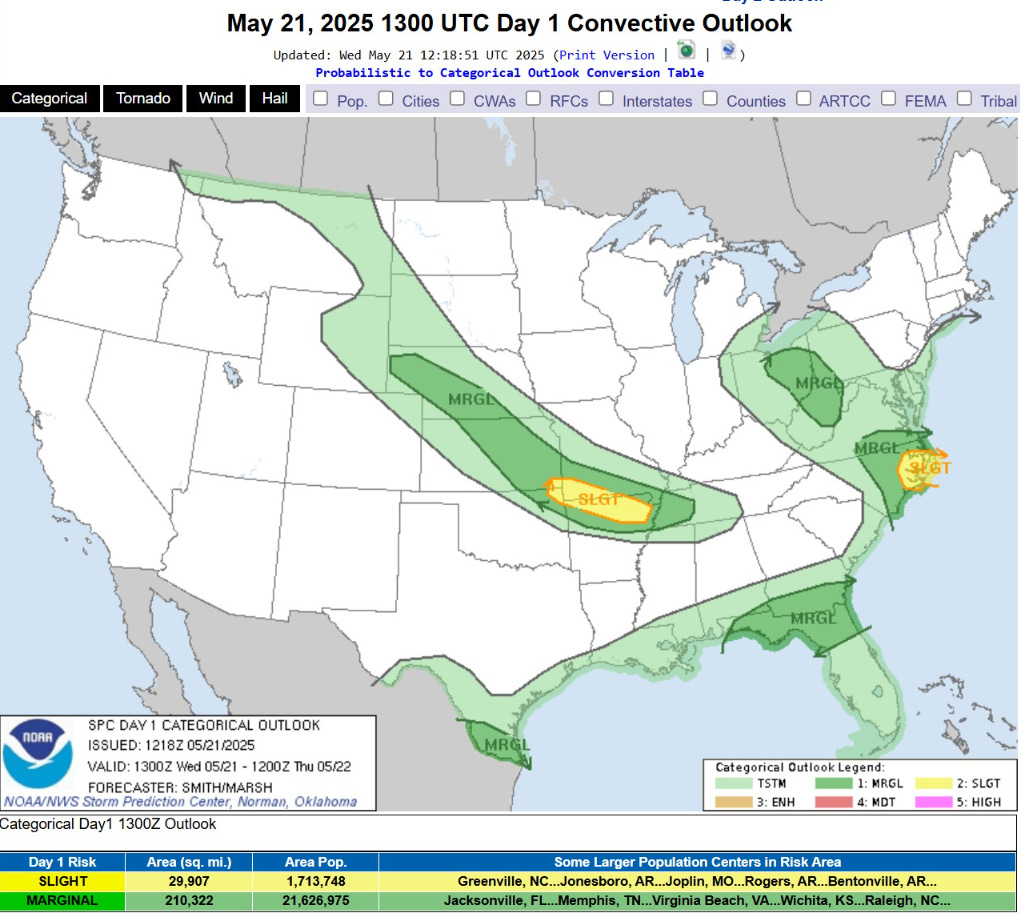
Today’s Weather | Wednesday

Finally taking a break from severe weather with only slight chances in a couple locations including northern Arkansas and coastal North Carolina. Otherwise, just garden variety thunderstorms.
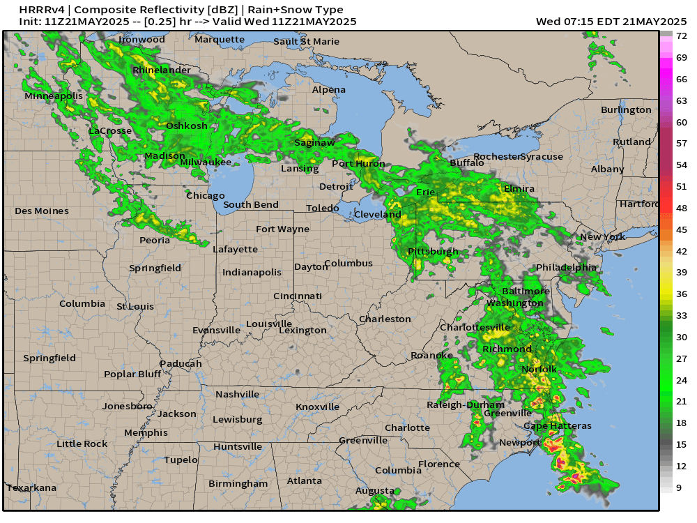
HRRR Simulated Radar Next 18-hours through Thursday 1 AM ET

Widespread drenching rainfall continues for the Great Lakes and Mid-Atlantic into the Northeast as a storm system develops — rare mid-May Nor’easter.
48-Hour Total Rainfall | NWS

1-inch (yellow) over a wide area including NYC and Boston, maybe closer to 2-inches.
Precipitable Water Next 5-days
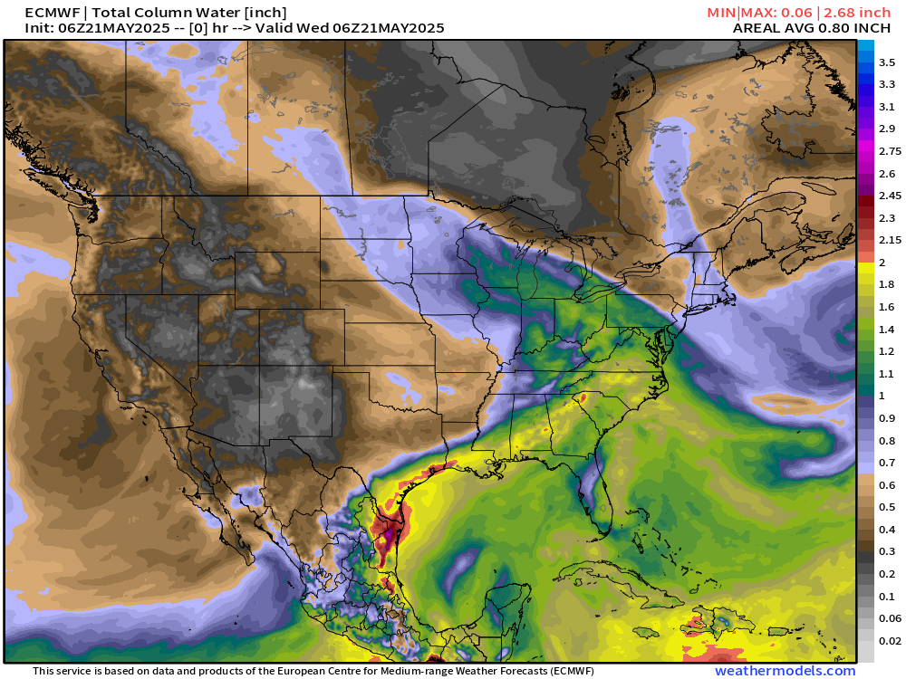
My favorite atmospheric variable (PWAT) — The Nor’easter drags a cold front through the Southeast to clear out and dry the eastern U.S. briefly.
But, moisture quickly returns out of the Gulf of Mexico flowing into Texas and the mid-Mississippi River Valley for heavy rainfall this weekend into Memorial Day.
TROPICS
Keep reading with a 7-day free trial
Subscribe to Weather Trader to keep reading this post and get 7 days of free access to the full post archives.