


May 21, 2024 Severe Weather Outbreak in Midwest
Cool shot with strong trough in week 2 across the Ohio Valley

So far in 2024, no Northern Hemisphere tropical cyclones observed.
Atlantic Basin Tropical Weather Outlook
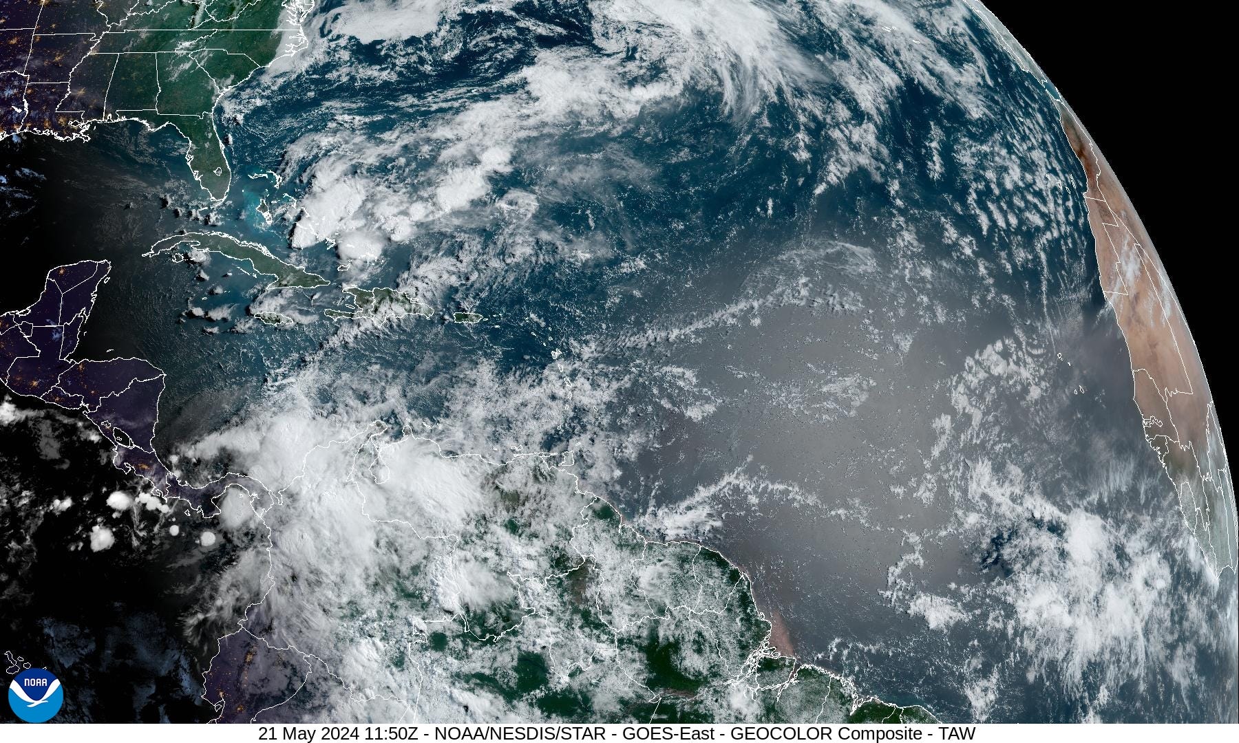
No activity expected in the next 7-days according to NHC tropical weather outlook.
The southern Caribbean in early June is a prime location for storm development. We’ll see if more ensembles pop up some low pressure signatures.
The sunshine glint on the tropics also shows light amounts of African dust with the Saharan Air Layer. A more significant SAL emerges later in the week.

Eastern Pacific Tropical Weather Outlook
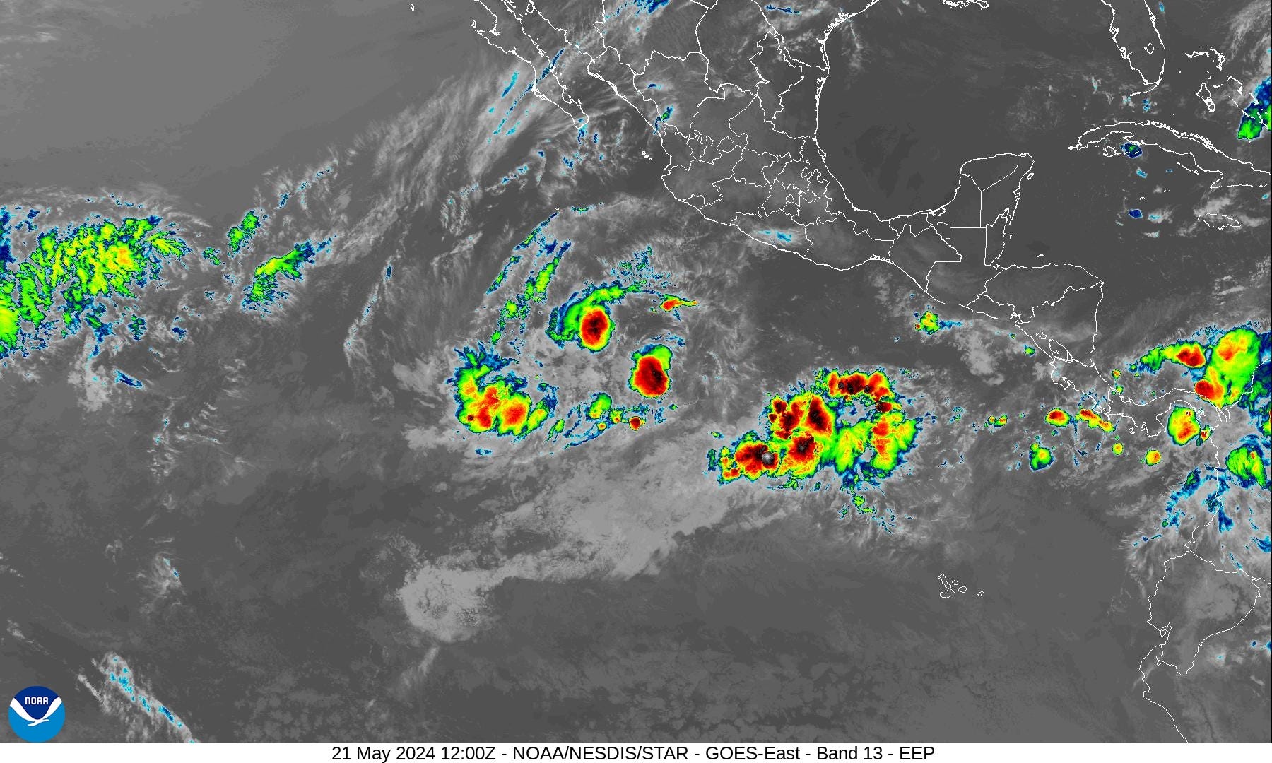

During a building La Nina, the Eastern Pacific would be quiet — even less activity than the neighboring Atlantic. Even thought EPAC hurricane season started May 15, nothing has developed. The NHC has no areas of interest in the 7-day outlook.
However, by first week of June, ensembles showing a development south of Mexico that should become the first Hurricane of the season.
18-Hour Forecast | Simulated Radar


Rainfall Chance | 12 Hourly
Through early evening (8 PM ET)
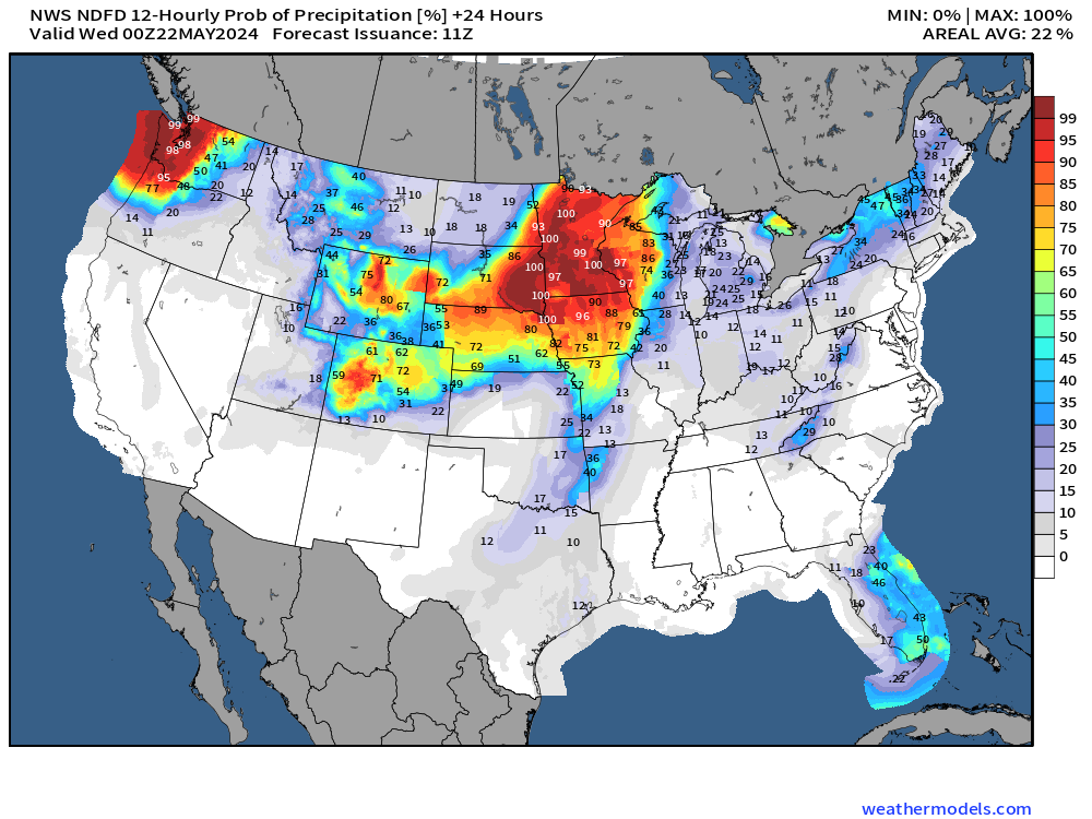
Into tomorrow morning (8 AM ET)

Next 10-days Upper-Level Weather Pattern | ECMWF AIFS
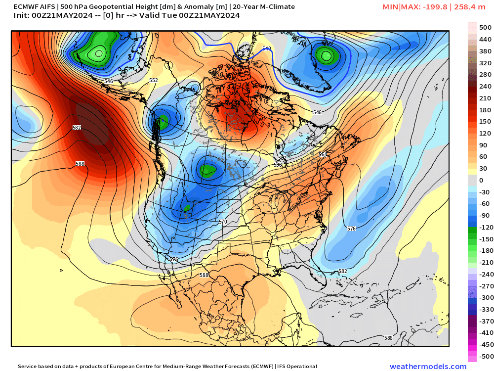
Check out that strong trough setting up shop across the Ohio Valley and eastern U.S. in the 10-day period. That’s a significant “cool signal” for late-May into early June.
Keep reading with a 7-day free trial
Subscribe to Weather Trader to keep reading this post and get 7 days of free access to the full post archives.