


May 20, 2025 Tuesday Weather Update
Cooler conditions into Memorial Day across northern tier

Good Morning!
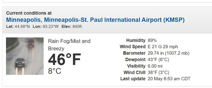
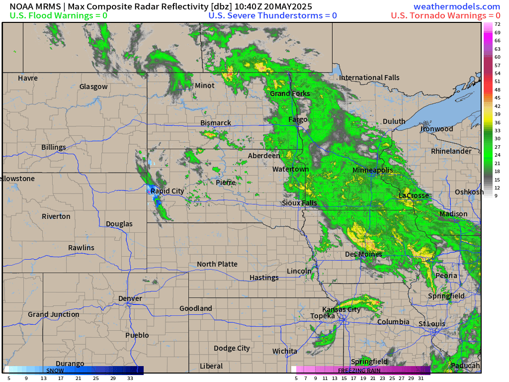
Steady rain this morning across the Midwest centered on Minneapolis with gust winds nearly 30 mph out of the East and rain/fog/mist. Blustery!
There is even some snowfall west of Rapid City, South Dakota on this May 20th.
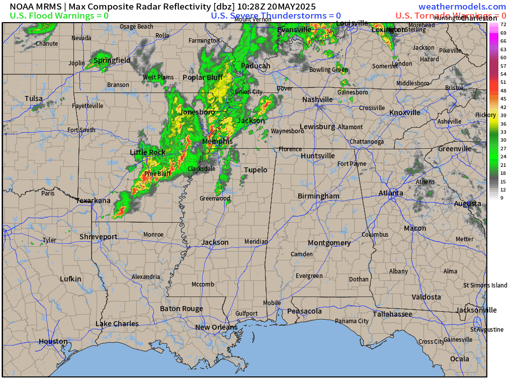
Further south in the mid-Mississippi River Valley, showers and storms moving from Little Rock into Memphis, but not severe. Otherwise, quiet and sunny/clear away from this sprawling storm system.
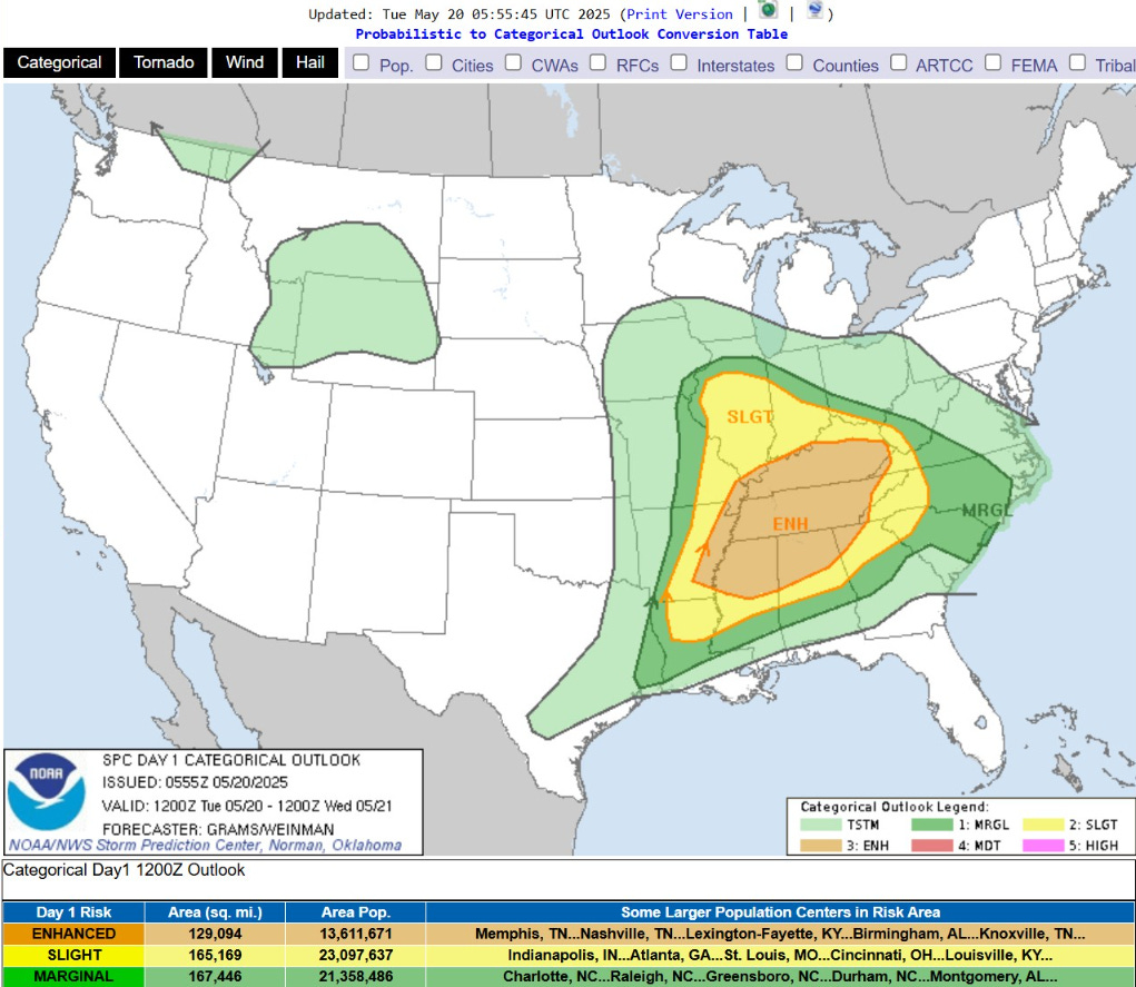
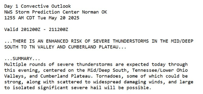
In the warm sector, yet again heavy rain and ENHANCED potential for severe weather centered on Tennessee and Kentucky and MS/AL/GA. The main threat is hail but a few strong tornadoes could spin up in the strongest supercells.

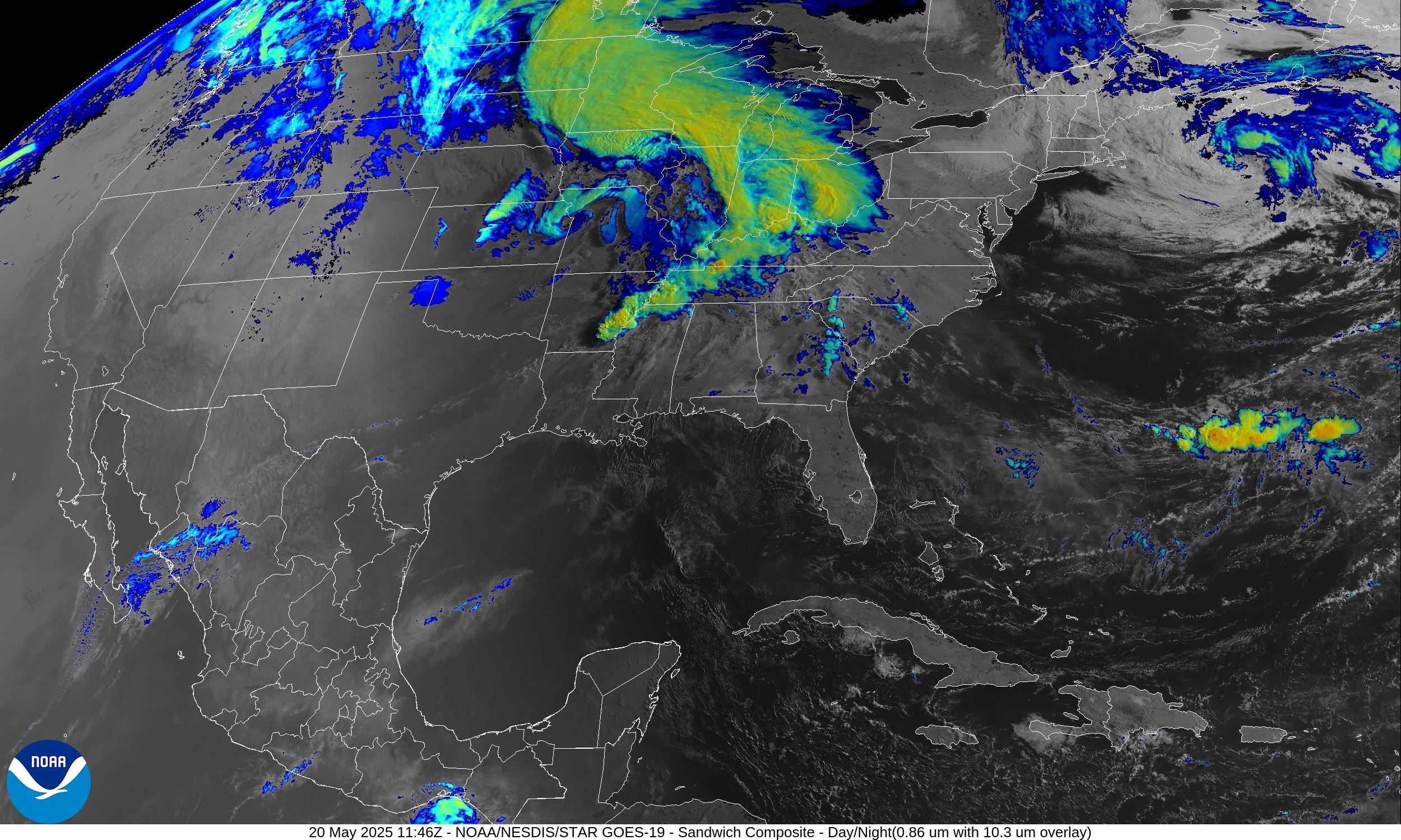
HRRR Simulated Radar Next 18-hours through Wednesday 12 AM ET

The band of heavy rain extends across the Midwest and Great Lakes for a cool, blustery day. Along the cold front and colliding with the warm sector — risk of severe weather, otherwise, more heavy rain.

NWS Rainfall through Wednesday morning 8 AM
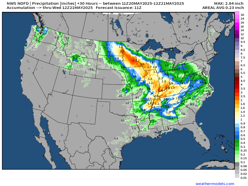
Minneapolis > 2” of rainfall, and Chicago, Indy, Cincy with 1”-2”
Today’s Headlines:
More severe weather in the warm sector of storm system centered on Tennessee Valley.
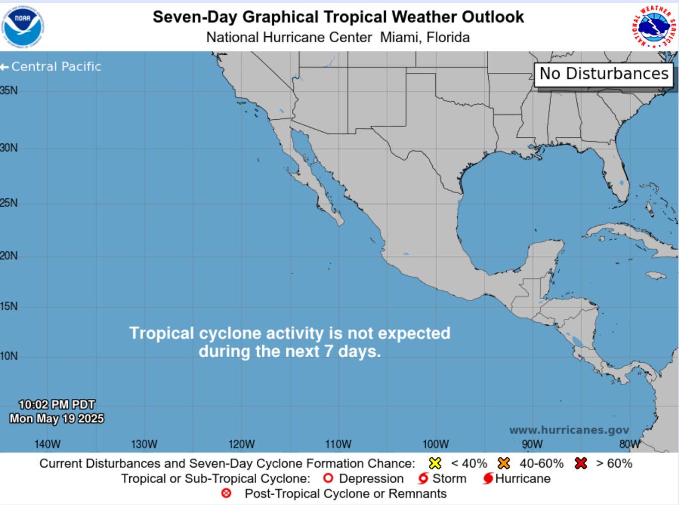
Atlantic tropical update: not expecting any development through at least 10-15 days into early June. Unlikely to see a “pre-season” tropical storm.
Eastern Pacific should see its first storm [Alvin] before end of the month. .
Cooler/well below normal temperatures from Midwest, Great Lakes, and Northeast keep a lid on any heat wave discussion until probably June.
Eastern Atlantic Satellite Image
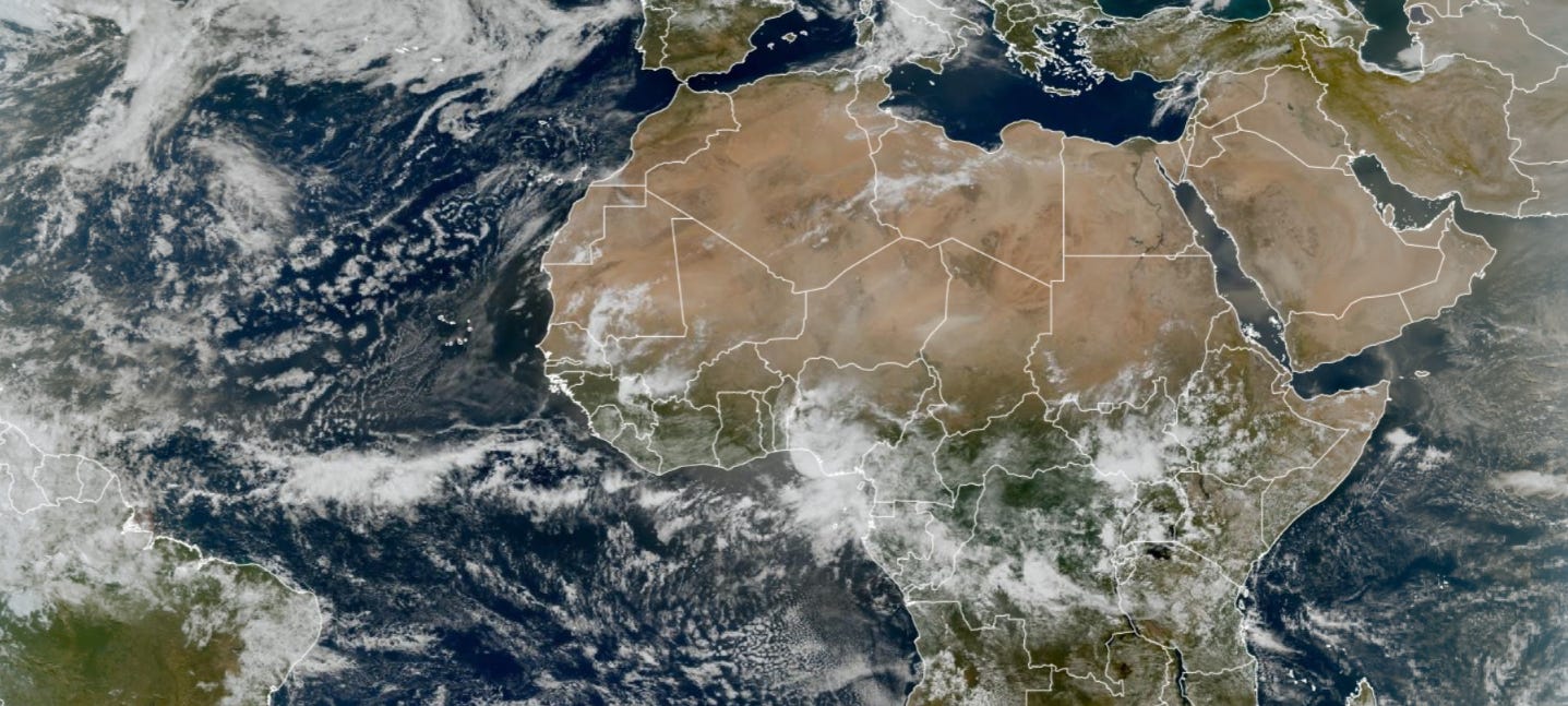
Still watching a dust cloud over Africa — major conflagration of Saharan sand lofted into the lower-atmosphere with some of this expected to blast off into the Atlantic.

Satellite channels that highlight dust show the enhanced concentrations over north Africa into the Arabian Peninsula.
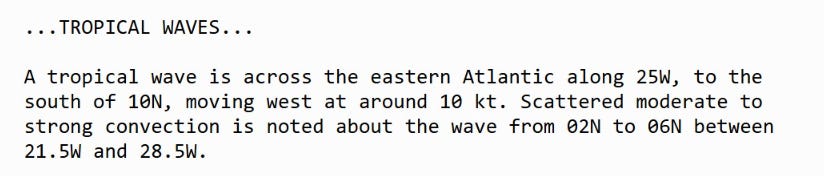
We can also see 3 tropical waves … one over the Atlantic, and two more backed up into equatorial Africa.
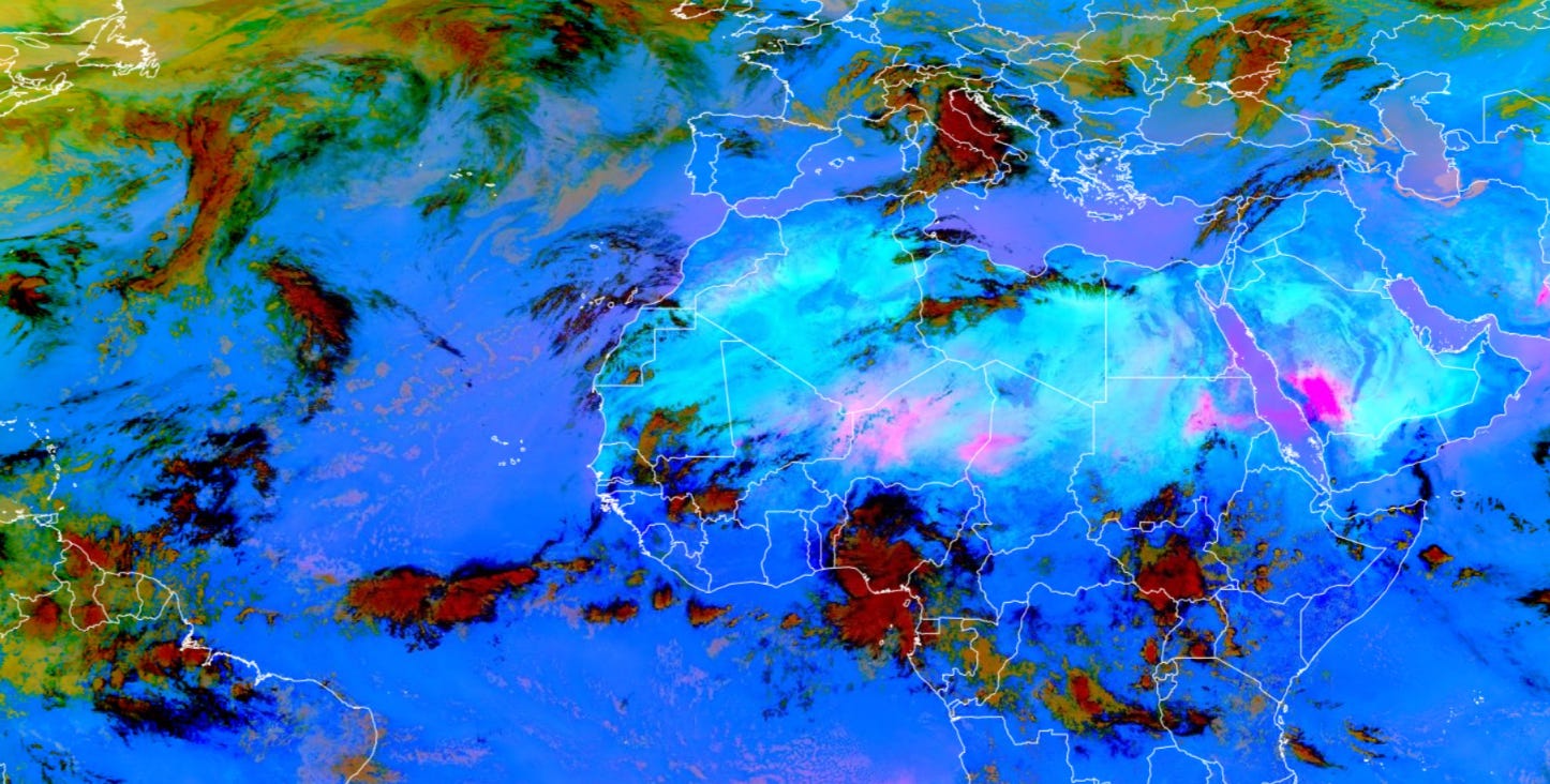
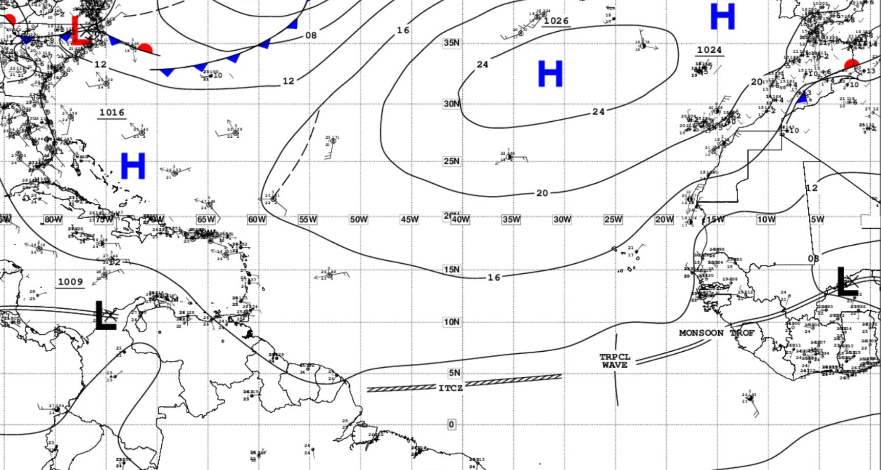
The ITCZ is along a southerly latitude of 4°N with a tropical wave along 25°W — quite vigorous for mid-May.
Tropical Atlantic Satellite Imagery
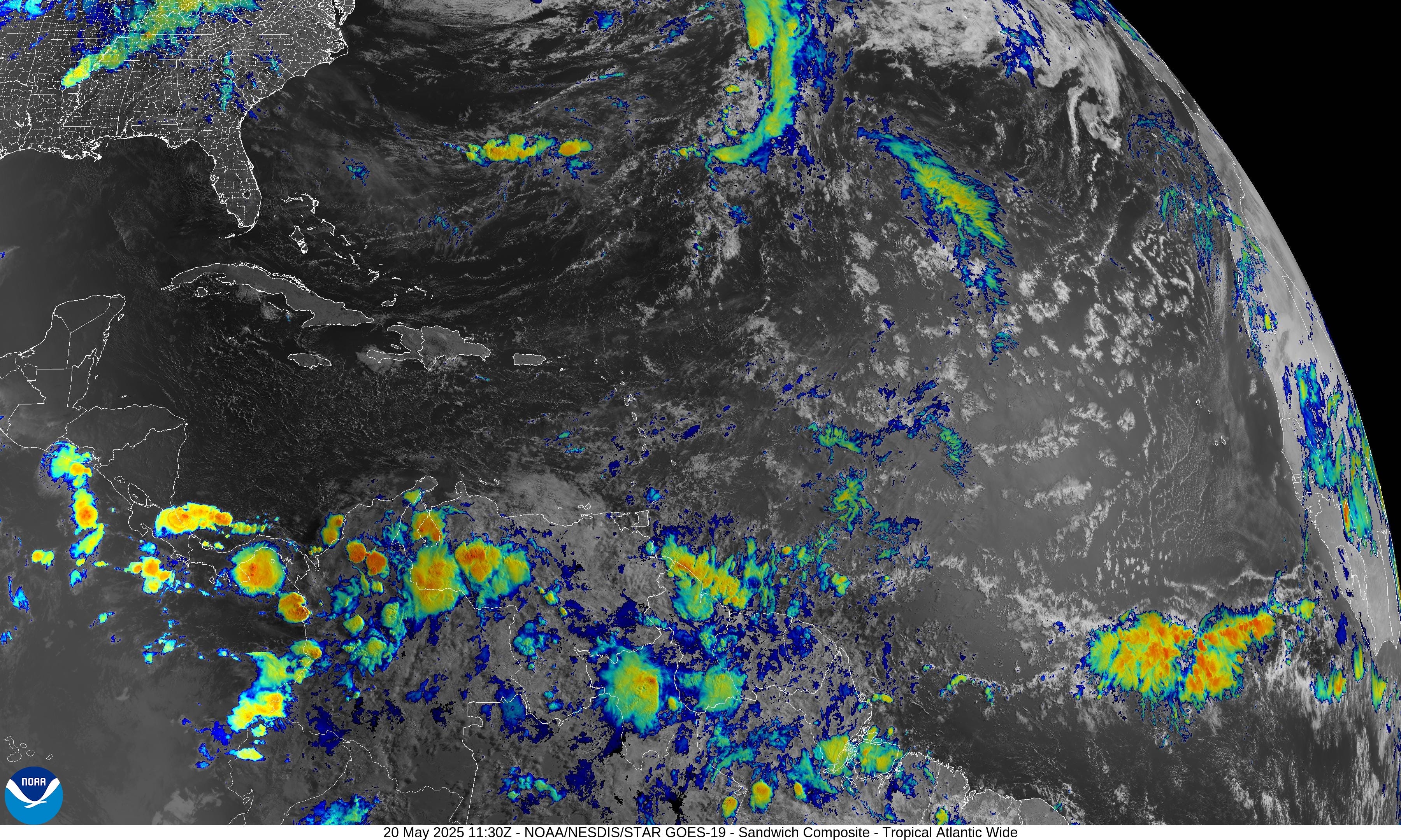
The Gulf of Mexico and Caribbean are completely clear.
The ensembles do show 2 ensembles in the Gulf of Mexico, but one looks to be a “crosser” from the Eastern Pacific, and another a weak, perhaps non-tropical system. The rest of the Atlantic is expected to remain dead quiet for the next 15-days.

Eastern Pacific Tropical Update

No organized convection aside from the ITCZ or monsoon trough with broken showers in a band.

Here in the Eastern Pacific, a majority of ensembles including the main HRES (control) show a storm developing by Day 9-11 just before the end of the month. The system would parallel the coast of Mexico — maybe impact the coast — can’t rule that out, but at tropical storm intensity, but still uncertain until something develops.


Satellite Imagery This Morning Across Lower 48
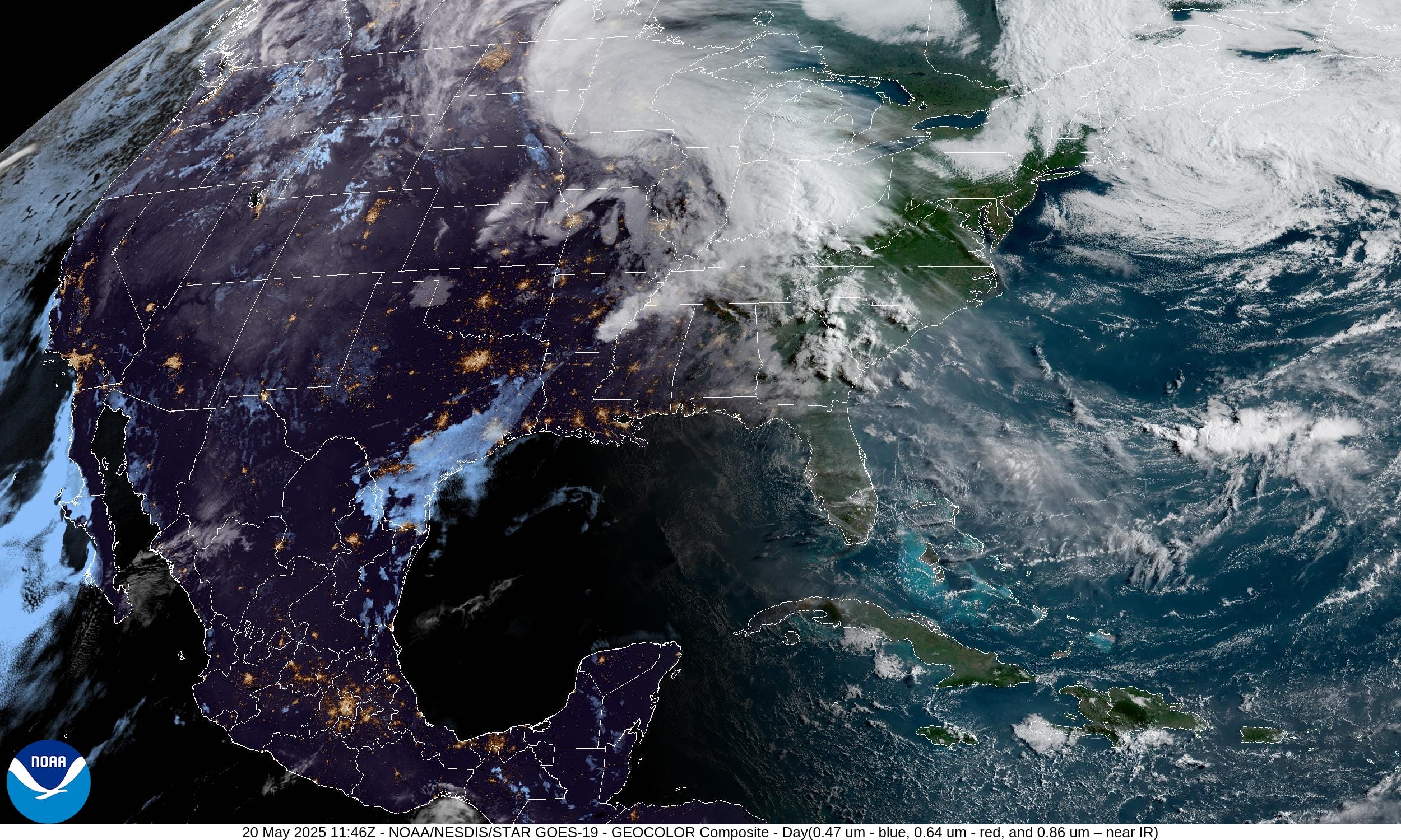
Impressive comma cloud with a strong mid-May low pressure over the Midwest with heavy rainfall.
Some storms extend into the mid-Mississippi River Valley. Otherwise, the rest of the Lower 48 is quiet.
High Temperatures Today | Tuesday May 20, 2025

Keep reading with a 7-day free trial
Subscribe to Weather Trader to keep reading this post and get 7 days of free access to the full post archives.