


May 2, 2025 Friday Weather Update
One more day of widespread storms before blocking pattern
Good Morning!
Rain and storms including some severe cells around Memphis along Interstate 40 are moving along the stalled frontal boundary that’s been in place for days. Daytime heating will destabilize the moist atmosphere and fire up storms in clusters that could become severe.
Who writes and researchers this Newsletter? Dr. Ryan N. Maue [X https://x.com/ryanmaue] with 20-years experience of daily weather model production and analysis. You may have seen my weather maps! I live in Atlanta but was born and raised in Northern Michigan. I know snow, and southern heat and humidity.
Radar: 9:50 AM ET
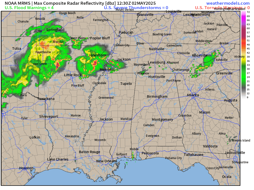
Yet more rain in north Texas and southern Oklahoma along the Red River Valley

Today’s Weather
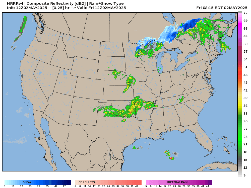
HRRR next 18-hours through 2 AM ET on Saturday
Still some scattered snow showers up around Lake Superior into mid-day with cold air still in early May in Ontario.
Clusters of storms develop throughout the day and quickly reach severe limits from Texas to Tennessee.

Max Radar next 18-Hours to summarize today’s shower and storm coverage:

Frontal Boundaries this morning 8 AM and Weather on Friday

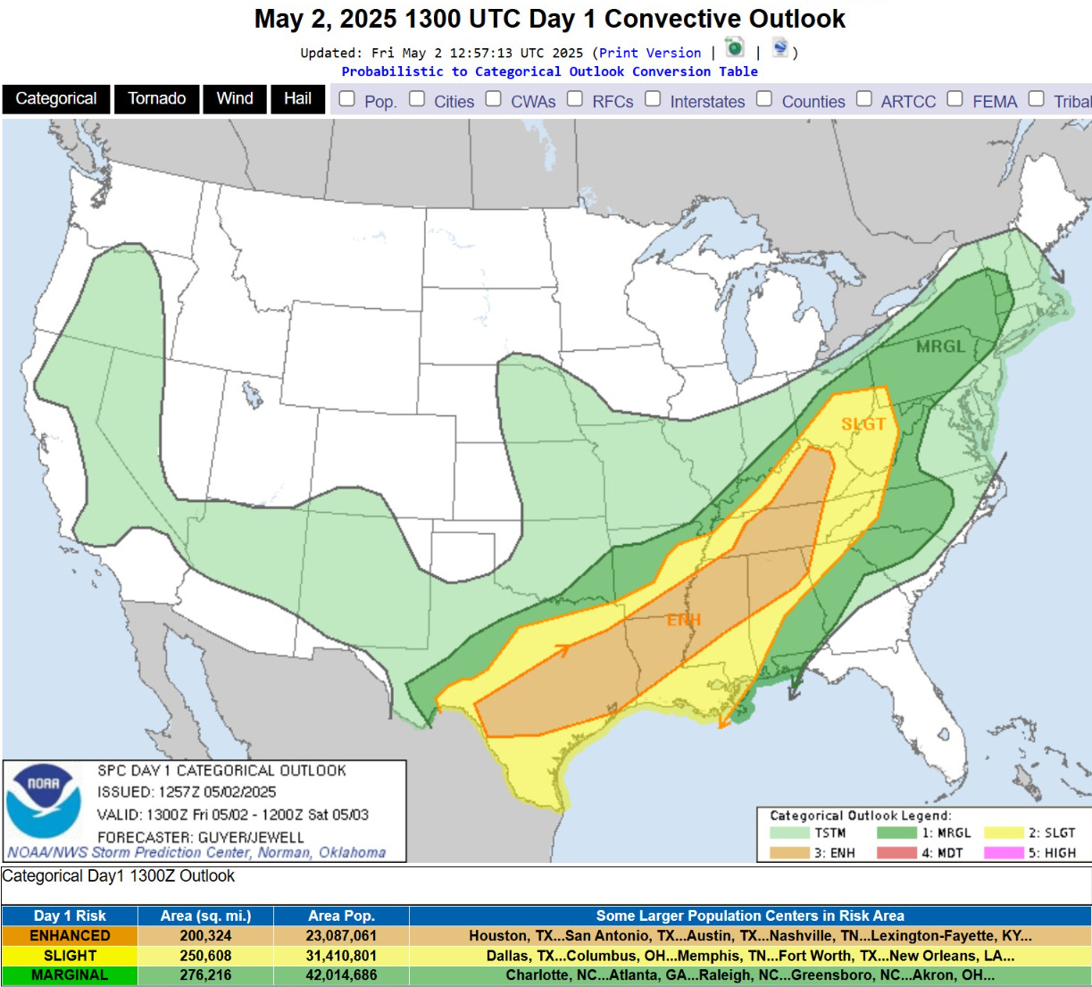
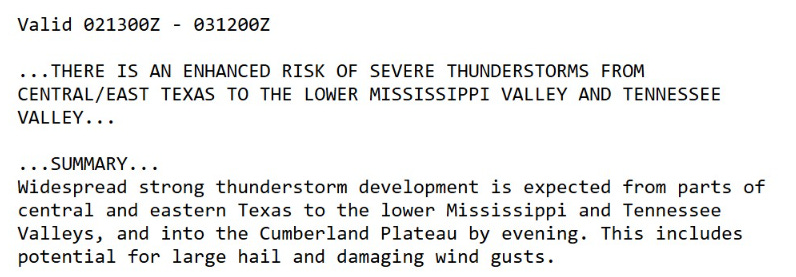
Severe Storm Outlook | Enhanced for 23 million+
Temperature Analysis | 9:00 AM ET

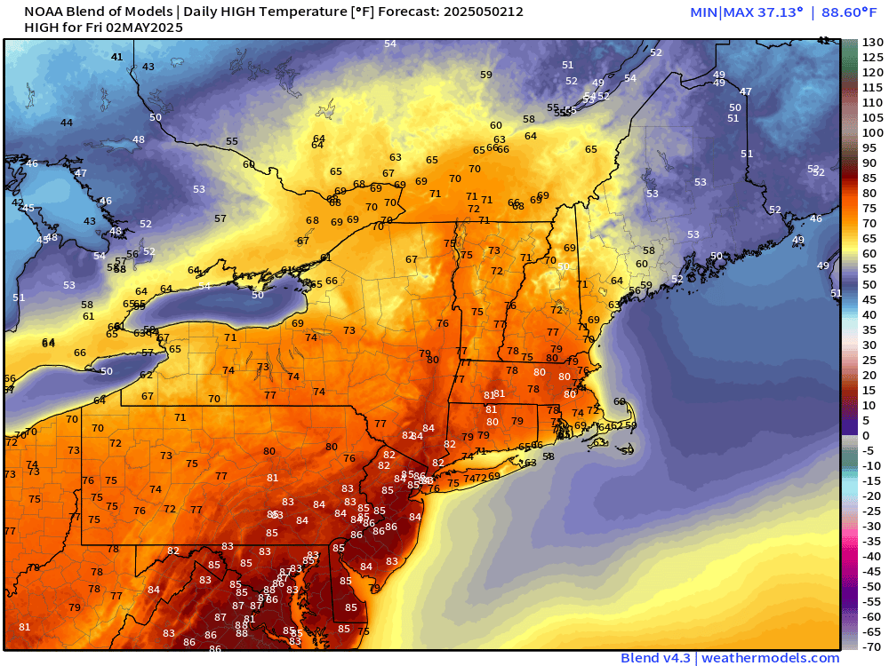
70s already pushing into Philadelphia and Washington D.C. this morning as a beautiful and warm day is ahead.
Temperature Anomaly | 9:00 AM ET

Overall the Lower 48 is 1.9°F above normal
Today’s High Temperatures | Friday
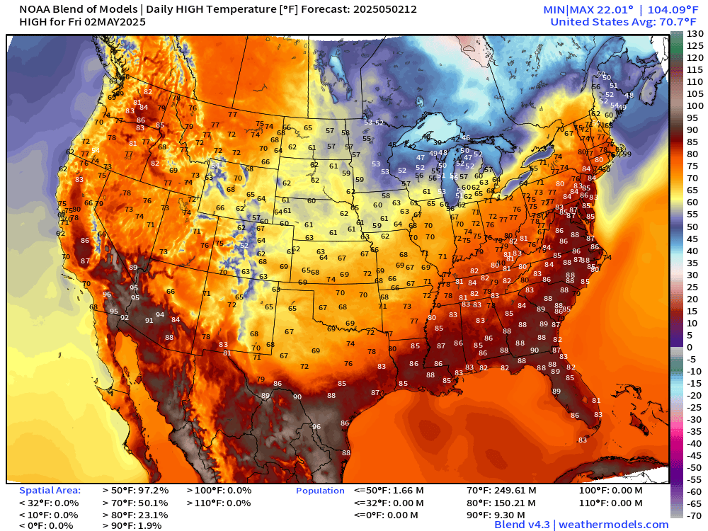
80s for 150-million across the Lower 48 with 84°F into NYC

70s into Maine and Montreal more like mid-Spring!
Satellite Imagery this Morning
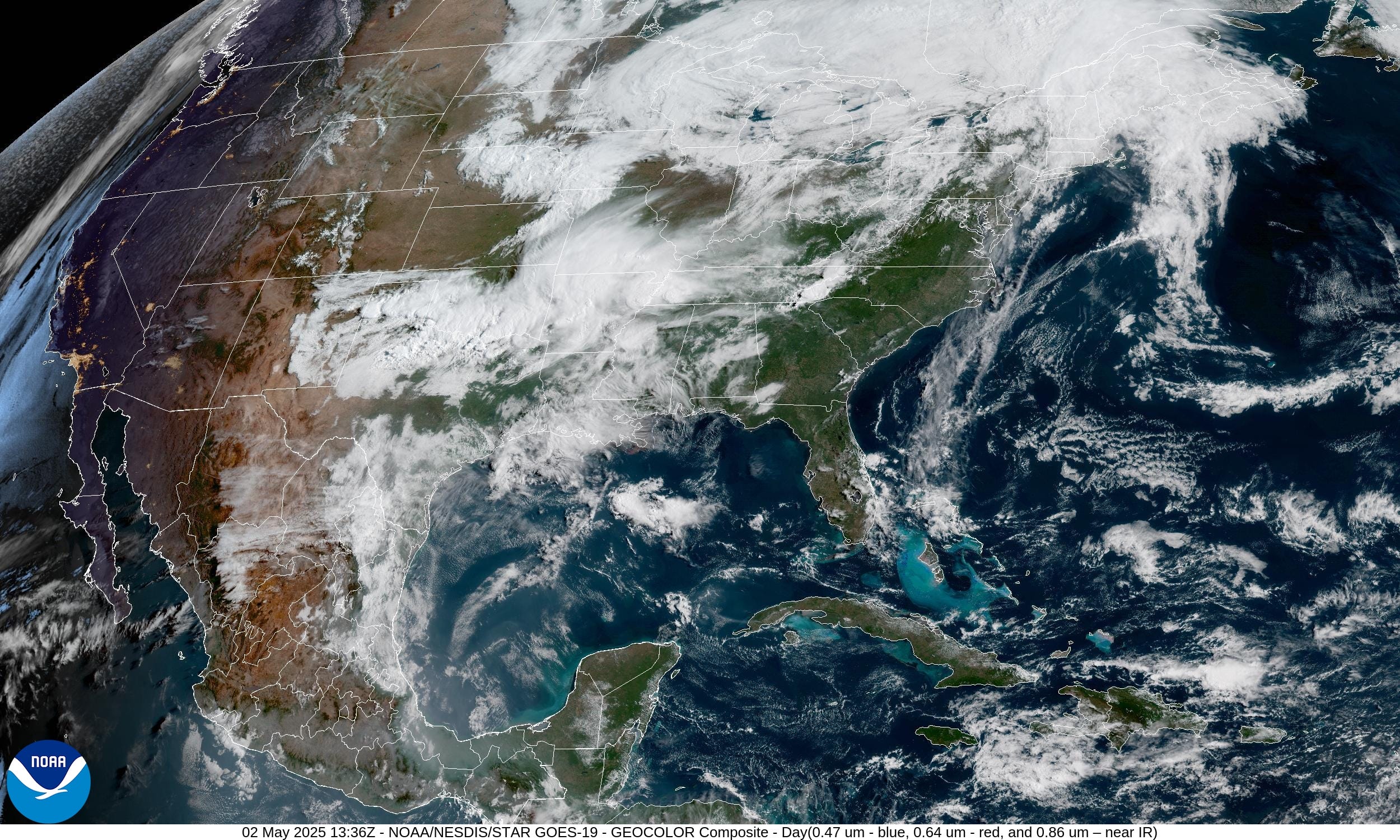
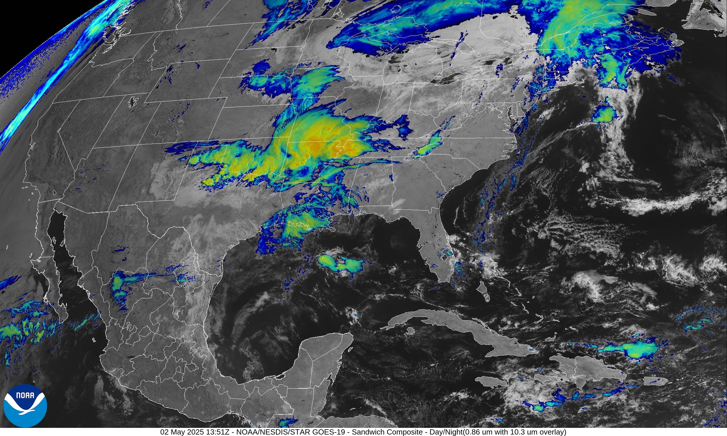
Convection from north Texas to Memphis but widespread clouds in the Great Lakes and New England.
Ridge over 2 Cut-off Trough — Blocking Pattern
Sunday 06z —> Tuesday 06z from EPS 00z Ensemble Mean
Two cut-off lows spin into the Southwest and Ohio River Valley over the next few days beneath a ridge due to “Rossby wave breaking” typical in Spring as the jet stream slows down and is more apt to buckle or retrograde. We see this in Europe especially in March and April across the Mediterranean.
This pattern is cool with added clouds but also the Canadian air is advected southward around the mid-level trough circulations.


By Late Sunday, the simulated water vapor imagery shows the moisture plume off the Atlantic onshore into the Mid-Atlantic and bending around into the Northeast.

All new paid subscribers can use this coupon link to receive 20% off the Newsletter and receive all daily updates heading into hurricane season.
Low Temperatures on Saturday
Keep reading with a 7-day free trial
Subscribe to Weather Trader to keep reading this post and get 7 days of free access to the full post archives.