


May 2, 2024 Eastern Warmth with 200 million in the 80s
Heavy rain and clouds for central U.S. continue

Top story for May 2nd for 200 million Americans will be early summer-time heat with temperatures at least 80°F into Chicago, Indy, Philly and NYC

High temperatures will be 18°F above normal in the Ohio Valley. This is the mini-heat wave advertised for more than a week.

Next 10-days Upper-Level Weather Pattern | ECMWF AIFS
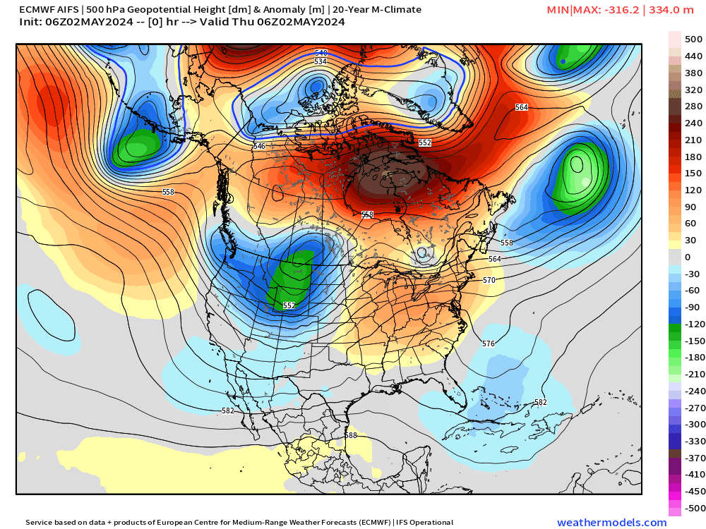
Looking ahead for the next 7-10 days, we see a parade of troughs digging into the Western U.S. and then eventually moving east into the Midwest and Northeast by May 12th. This will herald a pattern shift to more ridging over the Pacific Northwest and development of a major heat dome centered upon Idaho.
NWS WPC 7-Day Precipitation Forecast | Watering Needs
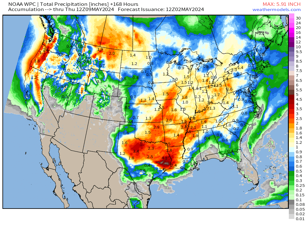
Plenty of rainfall across much of the Lower 48 with notable exception being the Florida peninsula. Over 2-inches across Texas will keep temperatures in check. For early May, not too bad in the rainfall department.
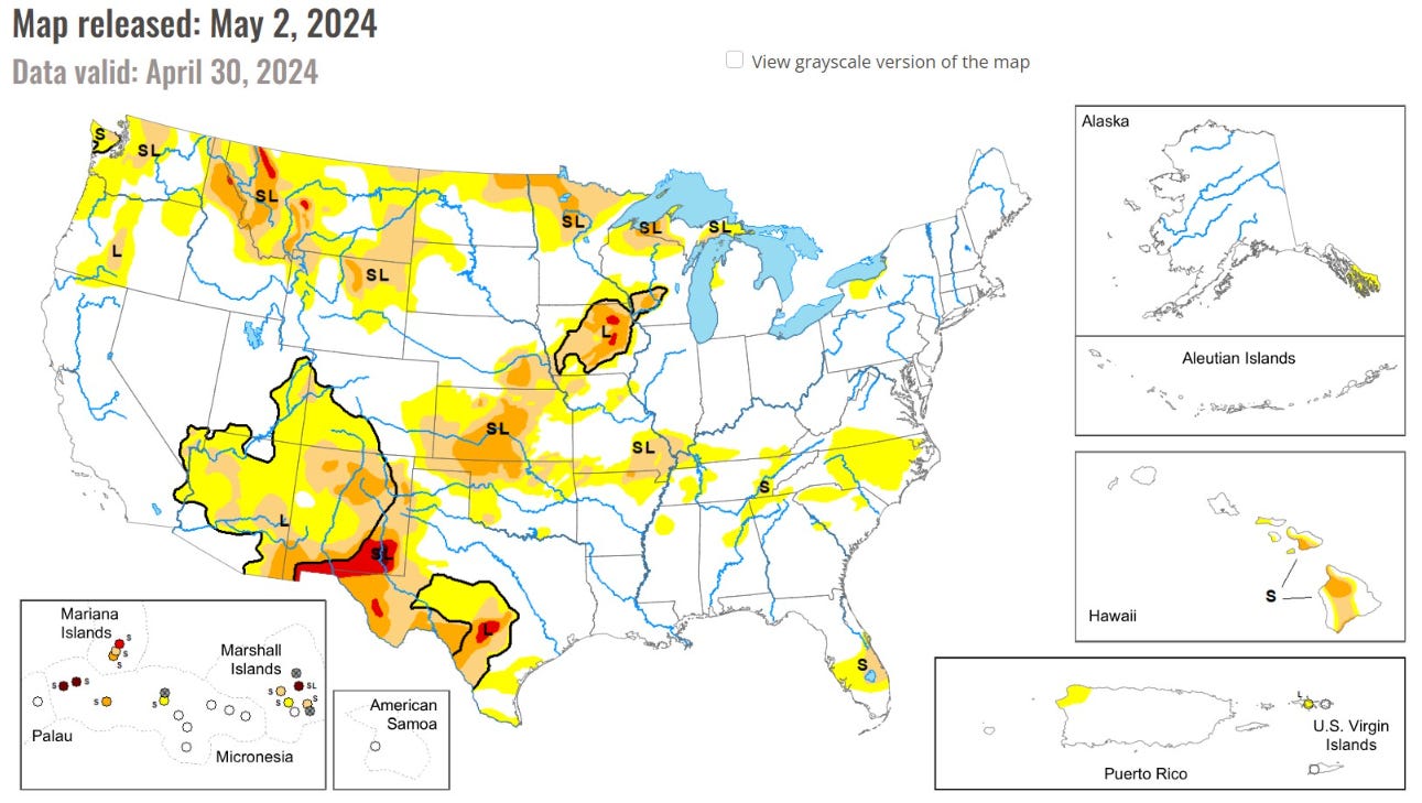
The newest Drought monitor Map was released this morning. For growing regions, Iowa and Kansas are the major concern for drought / dryness heading into May. However, precipitation is in the forecast at least 1-2 inches across the Plains in the next 7-days w/o much heat threat.
Thunderstorms and rainfall today: HRRR next 18-hours through Friday 12 AM

Welcome rainfall across Iowa and the Mississippi River valley today.
Precipitation Next 48-Hours

Keep reading with a 7-day free trial
Subscribe to Weather Trader to keep reading this post and get 7 days of free access to the full post archives.