May 19, 2025 Monday Weather Update
Moderate risk for severe weather including intense tornadoes
Good Monday!
Sadly, another regional severe weather outbreak will fire this afternoon across the central Plains into the middle Mississippi River Valley with the risk of long-track supercells with intense tornadoes.
This is more like an early spring weather pattern instead of mid-May due to the cold air continuously invading the Lower 48 from Canada.
HRRR Simulated Radar Next 18-hours through Tuesday 4 AM ET
A storm system spinning over the Dakotas has plenty of lift and upper-level wind support to easily fire supercells in the warm sector later this afternoon.
Convective init along a line from Tulsa to Dallas / Fort Worth around 4-5 PM CT will evolve into a massive blob of storms clusters and complex that could linger into the early morning hours across the southern Great Lakes.
Moderate Risk = OKC, Tulsa, Springfield, Missouri —> Tornado (Significant > 10%) for a large population > 17 million
Highest tornado risk is centered on eastern Oklahoma, but could see some from DFW to just west of St. Louis.
Today’s Headlines:
Regional severe weather outbreak across the Plains — yet again.
Atlantic tropical update: 3 ensemble members (6%) with tropical storm development in the Gulf —> highly unlikely but theoretically possible.
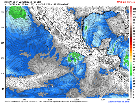
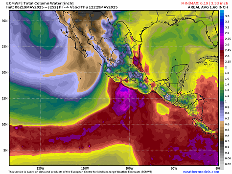
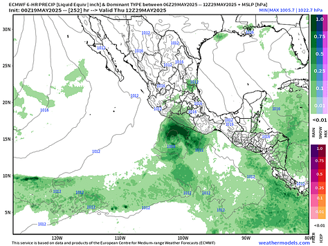
Eastern Pacific could see its first storm [Alvin] before end of the month.
This is a wet pattern with considerable rainfall totals across the central U.S. but Florida is exempted in a major way with temperatures into the upper-90s.
Cooler/below normal temperatures from Midwest, Great Lakes, and Northeast keep a lid on any heat wave discussion until probably June.
Eastern Atlantic Satellite Image
The ITCZ is along a southerly latitude of 2°N as a continuous band of clouds and showers. To the north, dust from a strong Saharan Air Layer (SAL) outbreak bursting off the African continent.
Dust Next 7-days
There are a few major source regions of dust / sand particles that can be pulled up into the lower atmosphere by the strong winds over the extremely hot desert. Libya, Algeria, Chad, and western Africa continuously see hazy, dusty skies. Next 7-days shows the majority of the dust remains bottled up over the Continent. But this amount of dust/sand could easily eject into the Atlantic if the mid and upper-level winds were more favorable.
Tropical Atlantic Satellite Imagery
The Gulf of Mexico and Caribbean are completely clear.
We still have 3 ensembles with storms in the Gulf of Mexico, which is a minimal probability or chance of a tropical storm < 6%. Please don’t worry about anything for the next 7-days.
Eastern Pacific Tropical Update
Here in the Eastern Pacific, a majority of ensembles including the main HRES (control) show a storm developing by Day 9-11 just before the end of the month. The system would parallel the coast of Mexico — maybe impact the coast — can’t rule that out, but at tropical storm intensity, but who knows.


Satellite Imagery This Morning Across Lower 48
Large, sprawling storm system with extensive cloud cover with the low centered on South Dakota.
Keep reading with a 7-day free trial
Subscribe to Weather Trader to keep reading this post and get 7 days of free access to the full post archives.


