


May 16, 2025 Friday Tropical Update
Transition to cooler pattern

Good morning!
Glad we made it to Friday! Just over 2 weeks until the start of Atlantic hurricane season. The Eastern Pacific is already underway but no signs of development in either basin for at least the next 7-10 days. Thereafter, we might see our first system in the Eastern Pacific along the coast of Mexico heading into the end of the month.
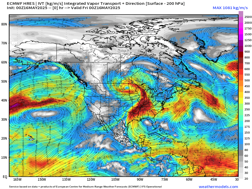
My second favorite parameter is the Integrated Vapor Transport (IVT) along with the deep layer winds moving around the moisture. We can see the east to west movement of moisture and storms in the tropics, and the west to east movement of weather systems in the middle latitudes. Non-tropical low pressure systems work with subtropical ridges to grab moisture out of the tropics via atmospheric rivers providing much of our rainfall and storms across the Lower 48 on a daily and weekly basis.
Storm system in the Midwest moves east into the Northeast and generally weakens but the frontal boundary continues to pull up Gulf of Mexico moisture
Return flow around a ridge in the Gulf streams moisture into Texas and the central Mississippi River valley next week for our next storm system
Ridging continues across the Gulf into next week, but the Northeast and Great Lakes remain under cooler, unsettled northwesterly flow out of Canada.
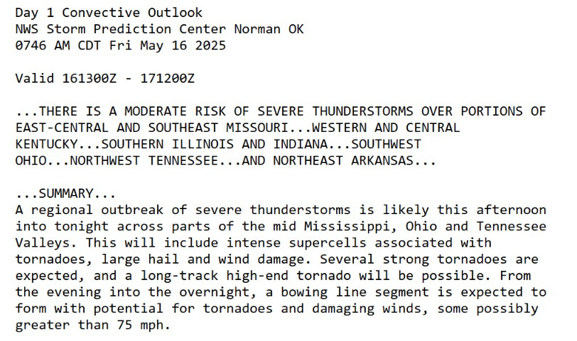
Regional Severe Weather Outbreak | SPC Moderate Risk
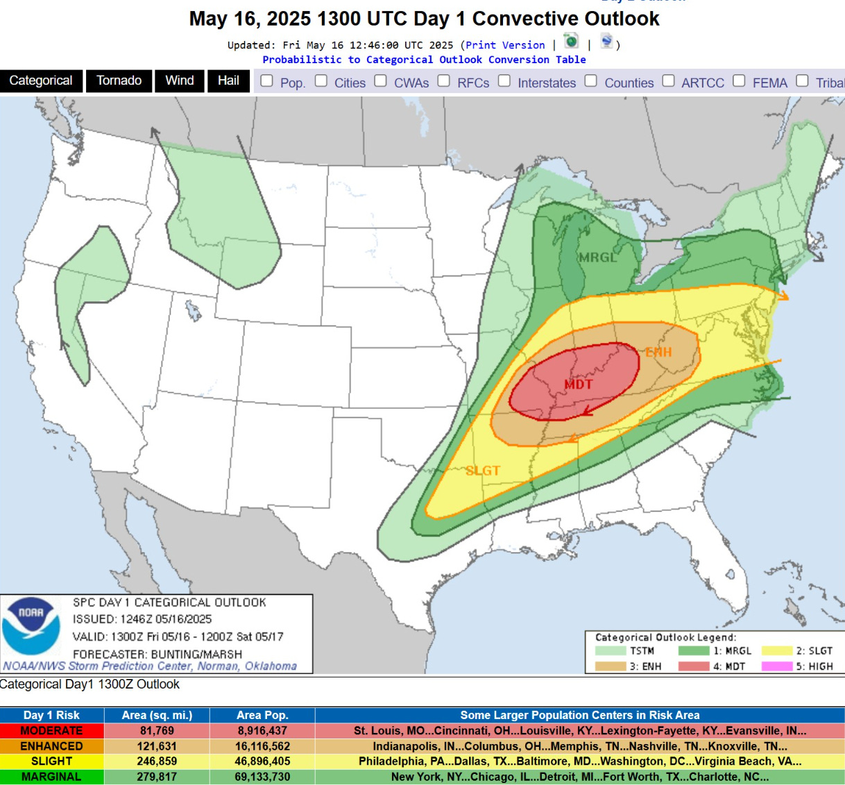
Later this afternoon, another round of supercells develops across Missouri and Arkansas and pushes east into the Ohio River Valley.
RRFS-A Radar Simulation | Severe Weather Moderate Risk
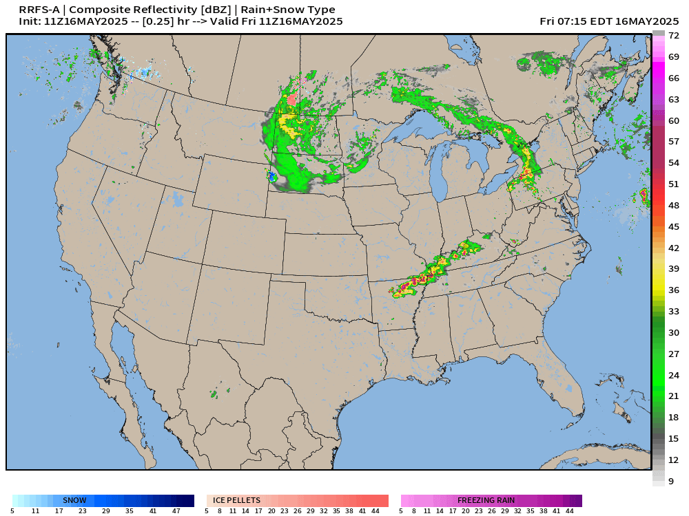
Next 18-hours through Saturday 1 AM

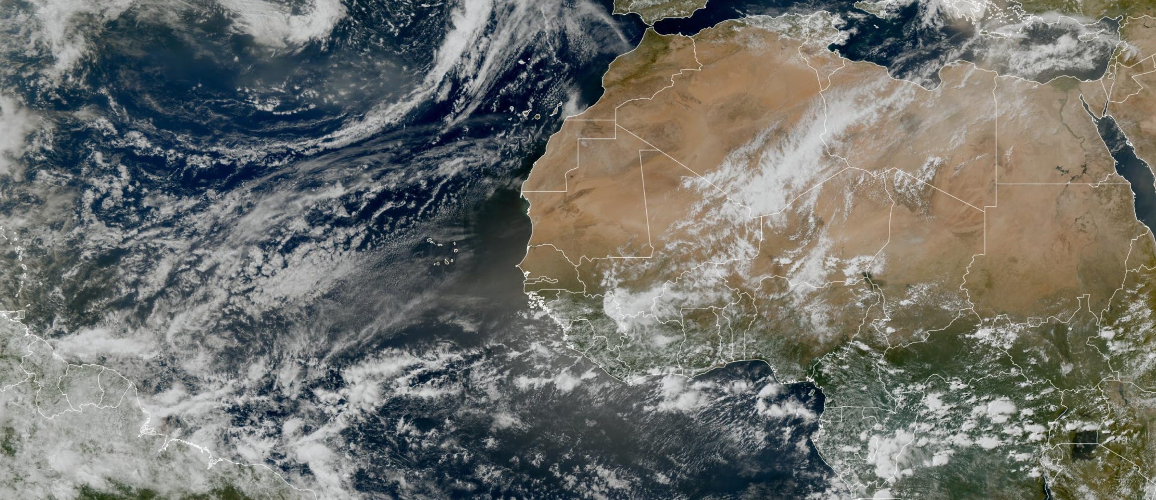
Eastern Atlantic Satellite Image
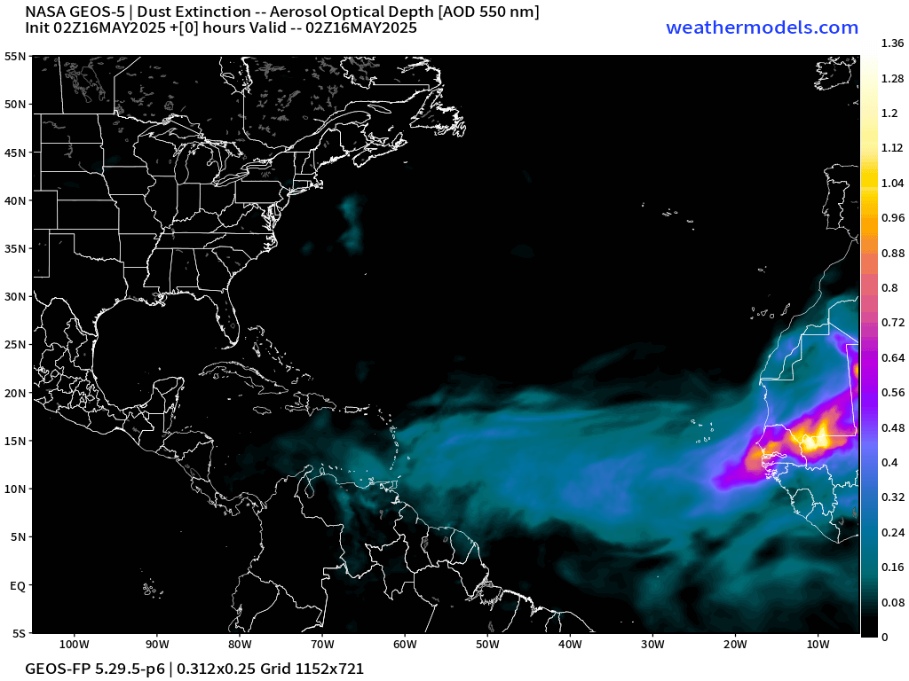
No distinct tropical waves with convection across the Atlantic — still too early in the season. Instead, lots of dust from the Sahara Desert.
The dust drifts across the tropical Atlantic day after day from May to July (next 48-hours loop)
There are a few major source regions of dust / sand particles that can be pulled up into the lower atmosphere by the strong winds over the extremely hot desert. Libya, Algeria, Chad, and western Africa continuously see hazy, dusty skies.

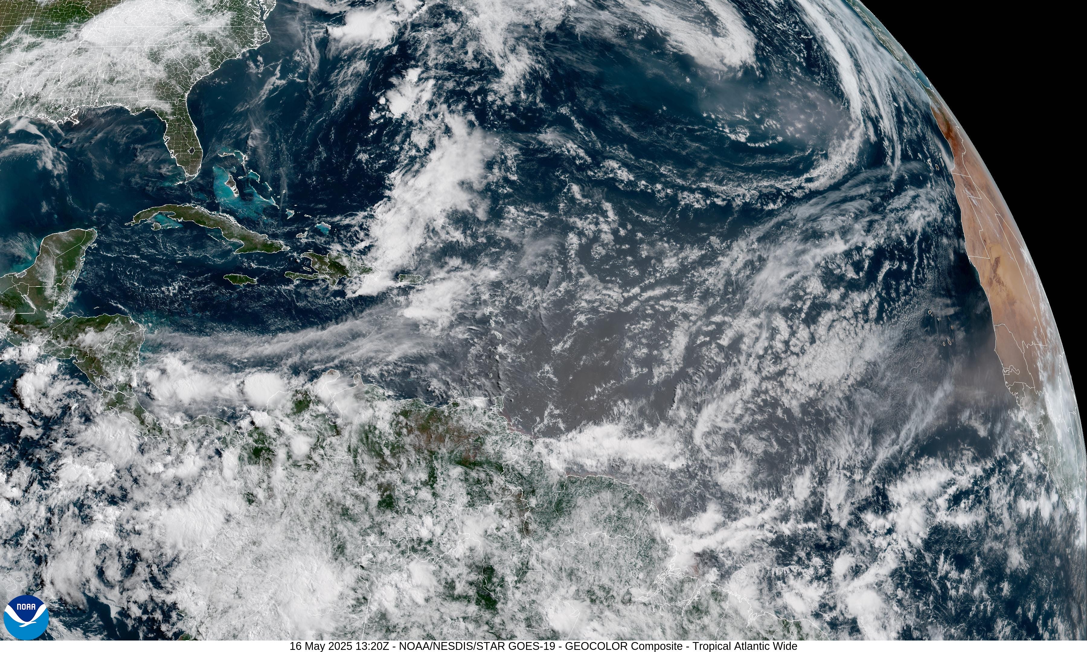
Tropical Atlantic Satellite Imagery
The haze and dust is apparent into the Lesser Antilles
No tropical storm tracks in the Atlantic during the next 15-days from ECMWF EPS Ensembles (00Z)

Eastern Pacific Infrared Satellite
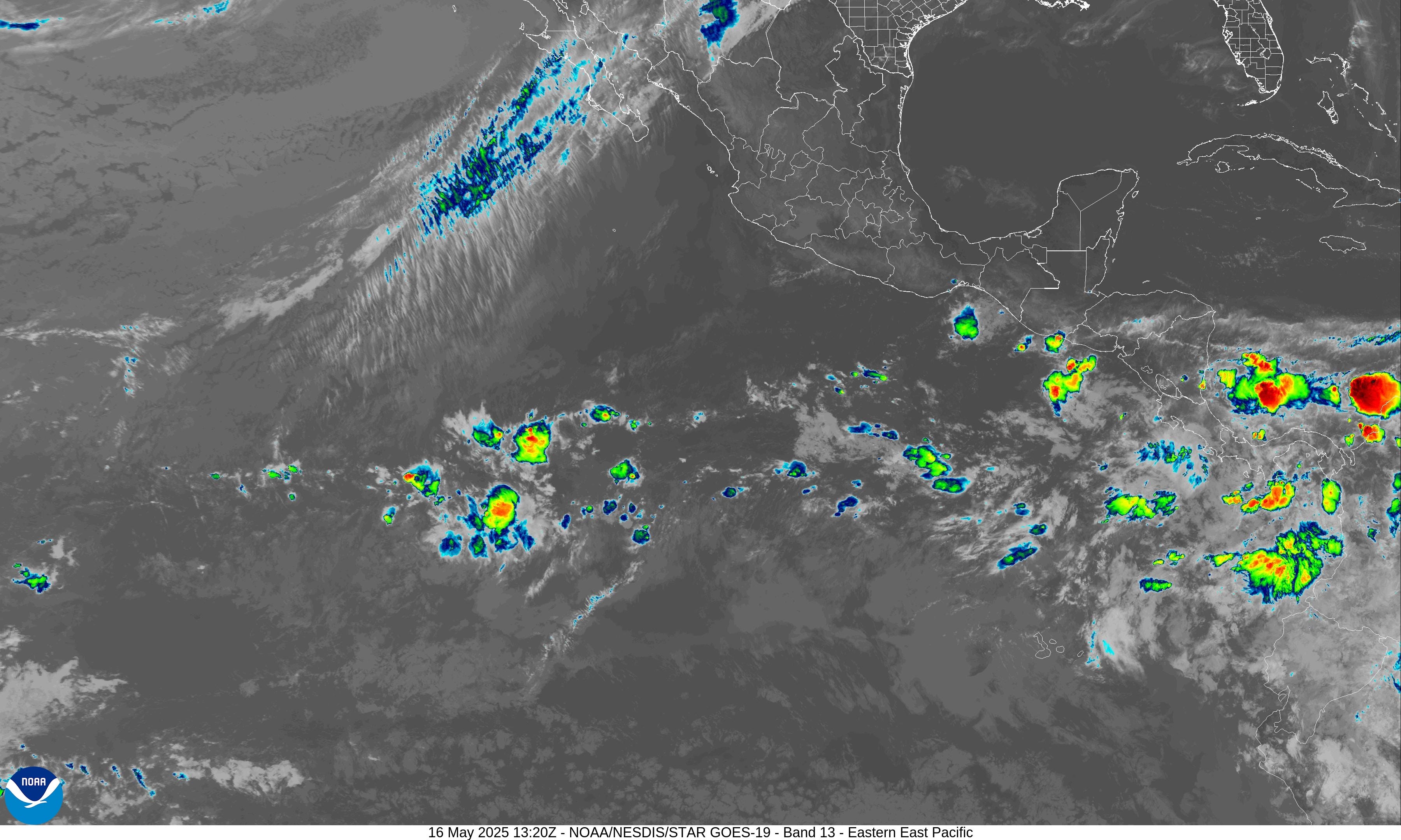
Eventually we’ll see convection increase around Central America, but not for 7-10 days to spin up a storm.
ECMWF AIFS (06z) at Day 14 does have a tropical storm — this weak/smooth depiction in the A.I. trained model could be a hurricane.

Only a few ensembles show something through 10-days.

Satellite Imagery This Morning Across Lower 48

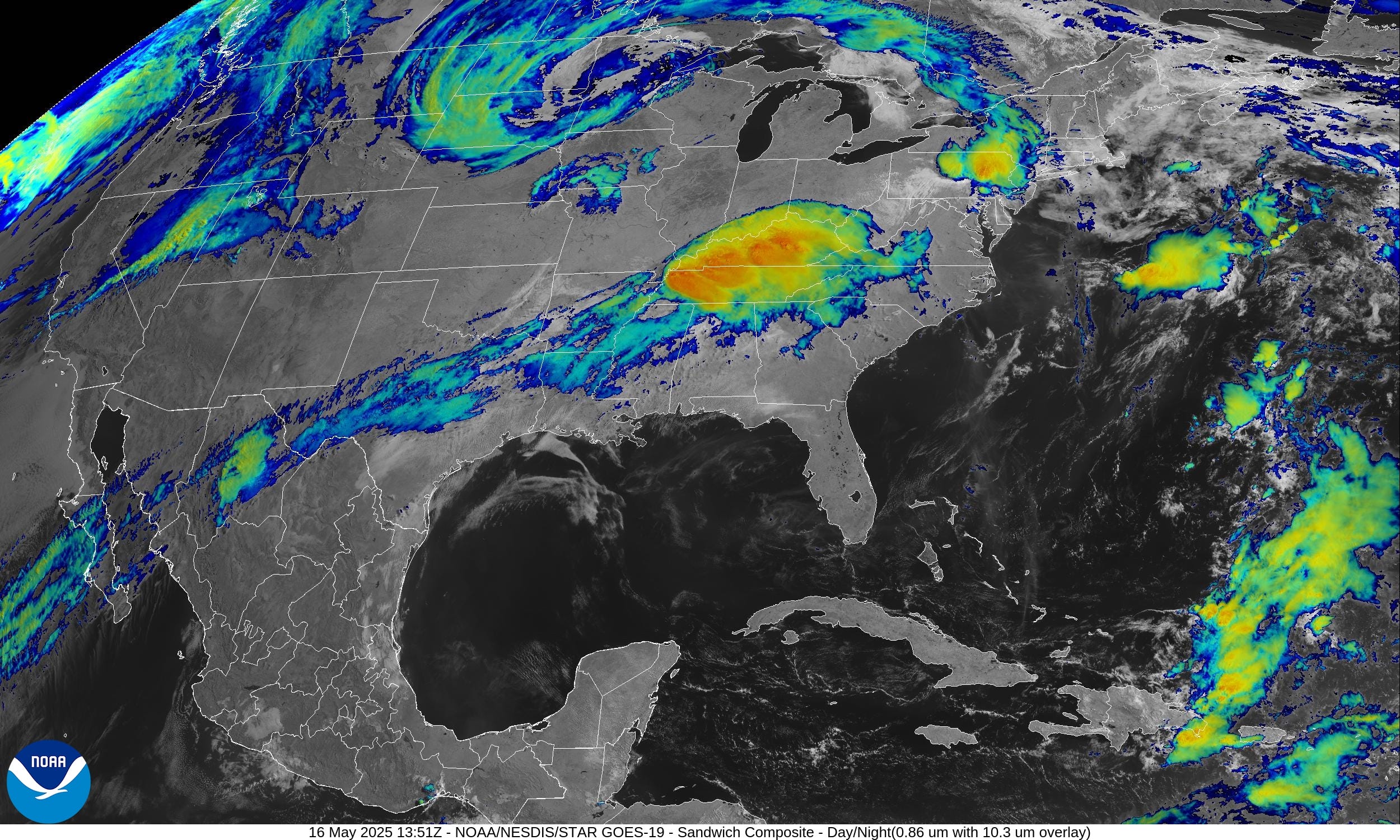
Ongoing storms over Kentucky show up as a convective blob. The main low pressure is over Minnesota.
Current Radar: 9:44 AM ET

Heavy rain and some severe level winds heading mainly through Kentucky and northern Tennessee. More substantial storms will fire again later this afternoon and tread over the same region.
Frontal Boundaries at 8 AM | Weather on Friday
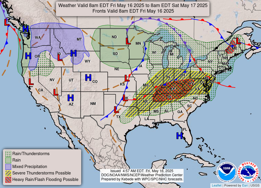
Major severe weather risk (MODERATE) along band of storms that will develop this afternoon and push into KY/TN
High Temperatures Today | Friday May, 16 2025
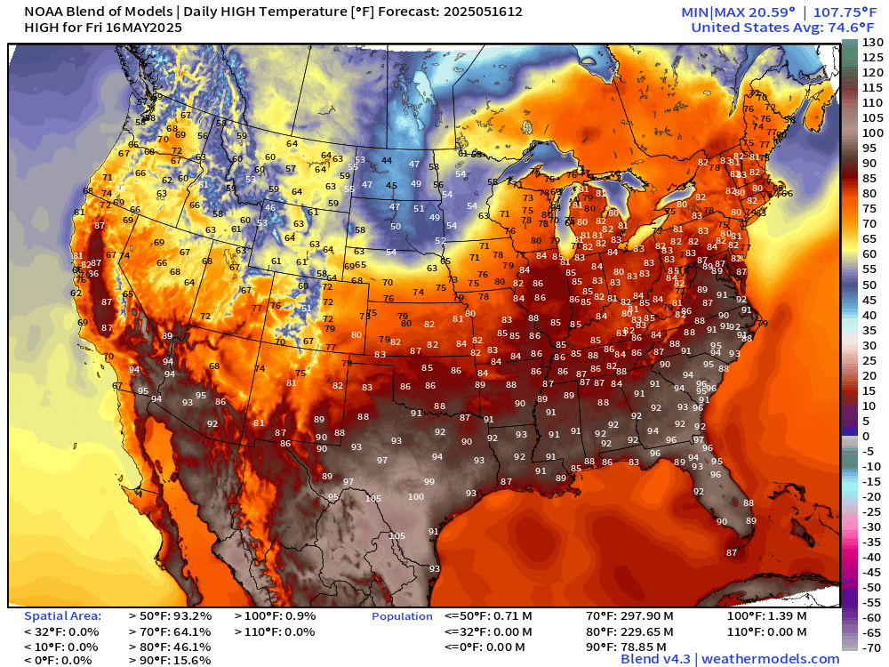
74.6°F is the Lower 48 average high temperature with 230 million at least 80°F, and 80 million above 90°F
Temperature Analysis | 9:15 AM ET

Temperature Anomaly | 9:15 AM ET
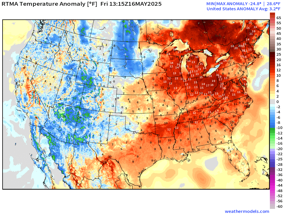
Overall the Lower 48 is only +3.2°F and above normal [1991-2020] with western chill almost balancing out the warmth centered on the Midwest and Great Lakes
Temperature Anomaly | Daily average Friday (today) to next Saturday

Cooler pattern ahead for the Midwest then Great Lakes + Northeast as a series of troughs move through the northern Lower 48
Keep reading with a 7-day free trial
Subscribe to Weather Trader to keep reading this post and get 7 days of free access to the full post archives.