


May 16, 2024 Heavy Rain Across Texas
Tropical Weather Outlooks resume for 2024

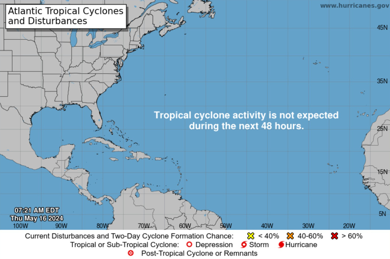
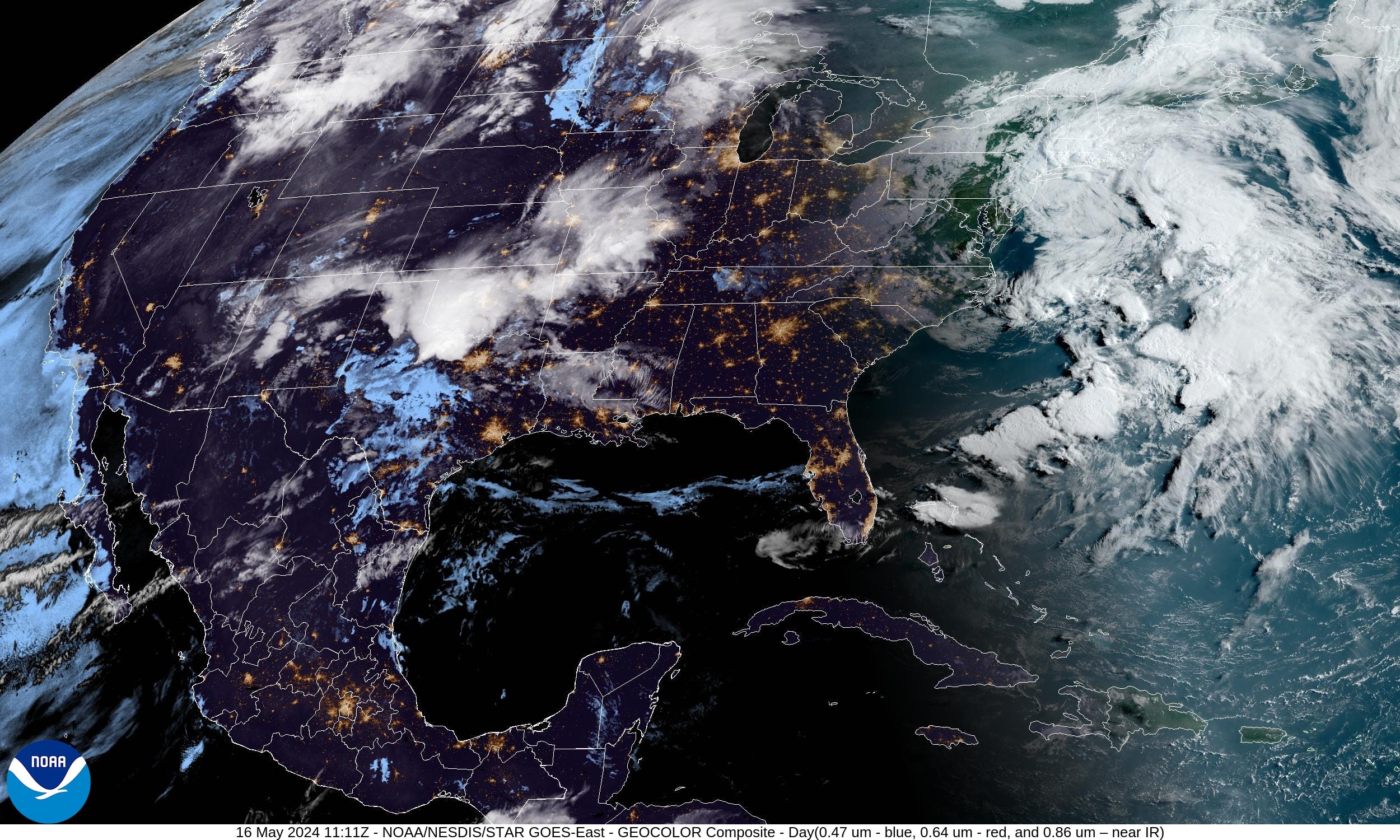
Atlantic Basin Tropical Weather Outlook
The National Hurricane Center has resumed its Tropical Weather Outlook (TWO) for the 2024 Atlantic Hurricane Season for the next 48-hours and 7-days. The official beginning of the season is on June 1st, but recent years have seen activity in May, so reasonable to post an outlook to keep an eye on the tropics.
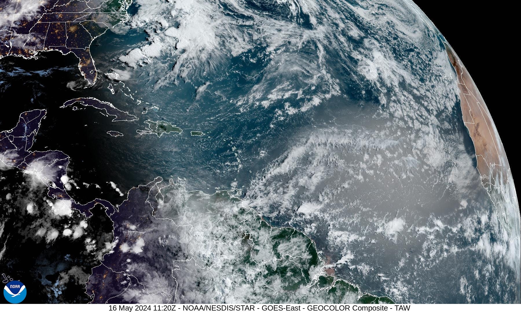
A light Saharan Dust Layer shows up with the sun angle in the Atlantic tropics

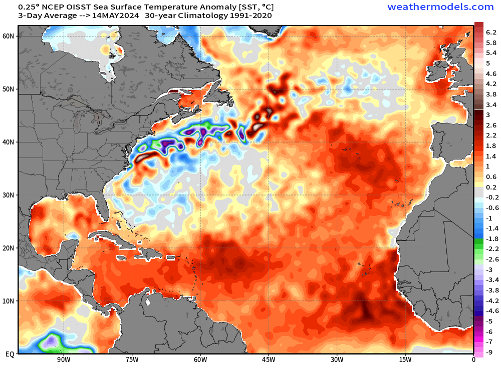
Atlantic SSTs remain elevated — much above normal in the tropics.
Eastern Pacific Tropical Weather Outlook
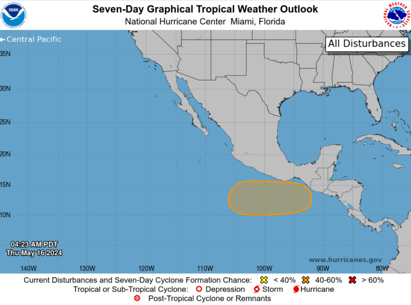
The Eastern Pacific Hurricane Season started on Wednesday (May 15th) and we are watching an area south of Mexico for development (40%) but with very limited ensemble model support.
Lower 48 Weather Roundup
A storm system across Texas is the focus of heavy rain and potentially severe thunderstorms later on Thursday.
Sunny and warm/dry day across the Southeast including Atlanta in the mid-80s.
The HRRR model simulated radar for the day shows the development of a squall line across central Texas moving ESE into New Orleans by late evening. Boatloads of Gulf of Mexico moisture are being pulled northward.
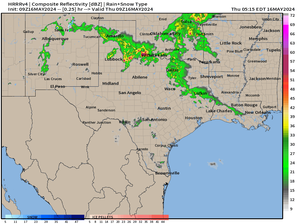

The integrated vapor transport (IVT) and precipitable water match up across Texas with the influx of Gulf moisture. A circulation off the mid-Atlantic coast will provide some scattered showers but not much else. Also, showers along a frontal boundary moving through the Great Lakes.


Next 10-days Upper-Level Weather Pattern | ECMWF AIFS
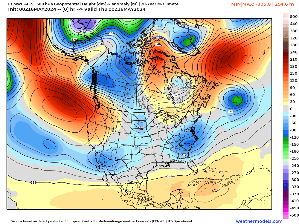
Strong troughing across the Pacific Northwest will dig into the northern Rockies. The result is much below normal temperatures = chilly into early next week.
Ridging over Mexico strengthens = very hot > 100° to 110°F mainly centered upon the Rio Grande. Interesting, the extreme heat does not advance into north Texas including Dallas as much with only 90s — could be much, much worse. Will need to watch into the longer range toward end of May to see if this subtropical ridge can expand north.


The ECMWF IFS full-physics model does NOT have the tropical cyclone in the Bay of Bengal that the AIFS continues to show.
Maybe spoke too soon about the skill or predictability of tropical cyclones in the A.I. system. This is Day 9-10.


NWS WPC 7-Day Precipitation Forecast | Watering Needs


Plenty of rainfall now for the Ag regions of the Plains into the Southeast over the next several days with multiple storm systems progressing from west to east across the Lower 48.
Keep reading with a 7-day free trial
Subscribe to Weather Trader to keep reading this post and get 7 days of free access to the full post archives.