


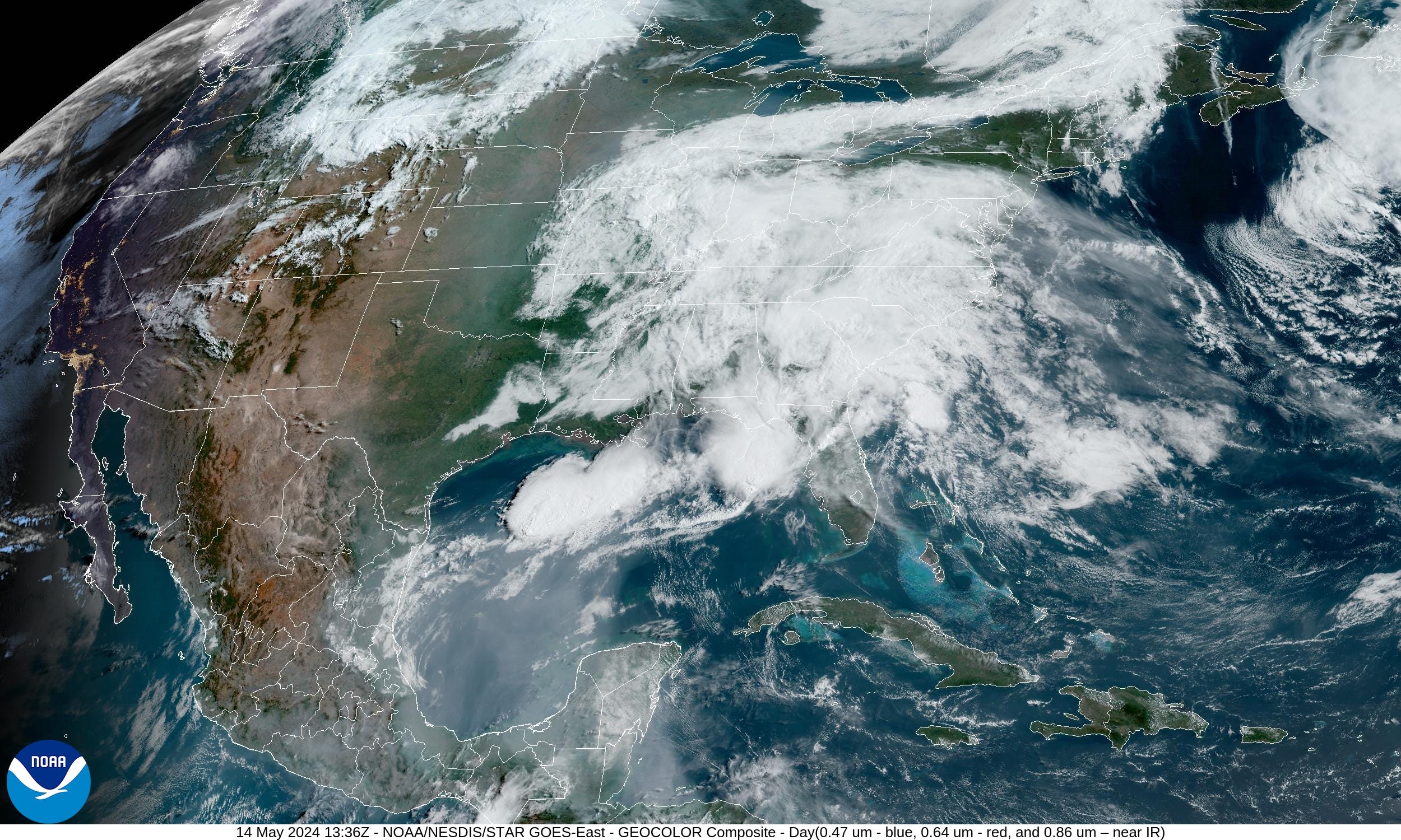
May 14, 2024 Cloudy Eastern U.S.
Scattered showers continue but severe weather limited

Yet another damp day across the Southeast into the Mid-Atlantic today. Scattered showers and storms will pop up during the day and move eastward with a relatively weak storm system. Today’s severe weather risk remains slight (1/5) with thunderstorms in Georgia and Florida the main issue.
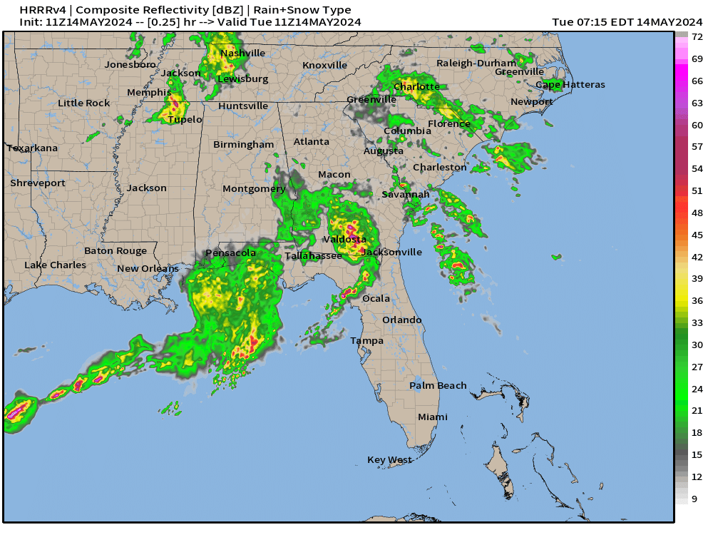
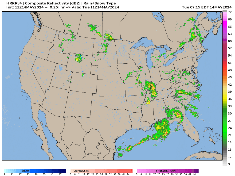
The next 18-hours simulated radar from HRRR (11z) shows showers becoming more isolated during the afternoon. However, some thunderstorms will be strong and produce heavy rain.
Another weak system moves into the central Plains with some light showers. Precipitation totals will remain rather low (< 0.5”) in the main growing regions.
1-2 inches of rainfall across north Florida — which is welcome. More would be better south of Interstate 4.
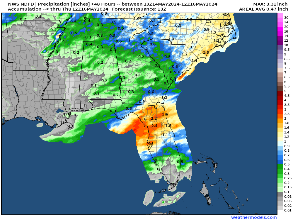
Around an inch of rain over the next 48-hours centered on Virginia.

Next 10-days Upper-Level Weather Pattern | ECMWF AIFS
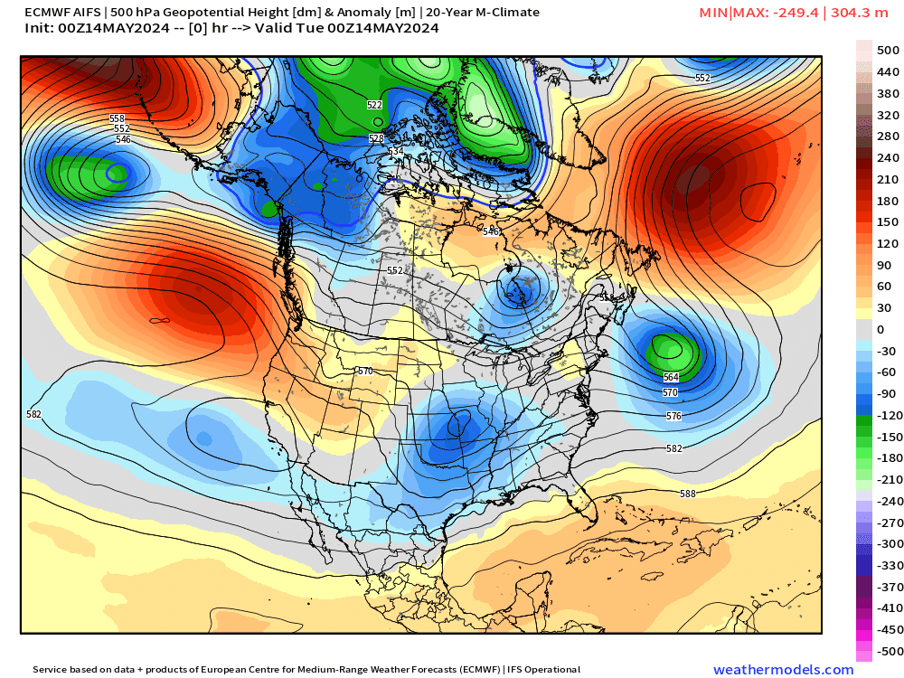
Upper-level troughs digging into the western U.S. over the next 10-days are impressive for mid-May. Their origin is the far north Pacific and Alaska so that Canadian Arctic influence on the western Lower 48 continues for the next 2-weeks suggesting cooler than normal temperatures — perhaps significantly so — heading into the 3rd week of May.
NWS WPC 7-Day Precipitation Forecast | Watering Needs
Keep reading with a 7-day free trial
Subscribe to Weather Trader to keep reading this post and get 7 days of free access to the full post archives.