Good morning!
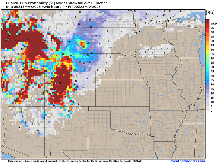
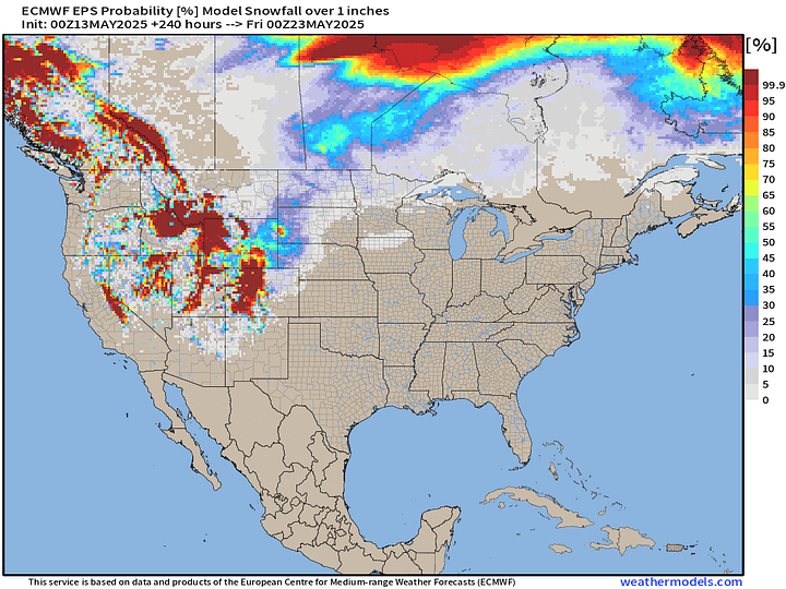
Looking ahead into the weekend and early next week, ECMWF model showing a chilly situation in the Rockies with heavy snowfall likely behind a strong cold front with yet another trough in the Southwest U.S.
Total snowfall through 10-days is significant for the Rockies with highest elevations seeing 1-2 feet.
Moisture from the Plains will back westward into the mountains and be plenty cold enough for snowfall. Good question if Denver will see some snow.
Probability of 1-inch or more snowfall in next 10-days. I thought we were done with winter, but I guess not.


Upper Level (500 mb) Height Anomaly at +162H valid at Monday 18z (May 19)
The cold trough will dip temperatures in the Southwest 10-20°F below normal including Phoenix. Meanwhile, ridging downstream over Texas and the Southeast centered over the Gulf of Mexico will keep temperatures much higher than normal with humidity — more early summerish pattern.
However, the colder than 30°F below normal over Wyoming, South Dakota, and Nebraska should be enough for heavy snowfall and potential “Winter Storm” conditions. Still 5-6 days off, so the models could back off.
14°F to 16°F above normal on May 19 in Texas is good for 90s and 100s.
Atlantic Satellite Image
Dust is heavy off the African coast and you can see the clouds are almost obliterated. Way too dry and warm above the surface to allow convection = very stable.
Satellite Imagery This Morning Across Lower 48
Washout underway in the Mid-Atlantic with persistent showers but not severe.
Otherwise, clearing out finally as the long-lived trough is eroded by the warm May sunshine. More pop-up storms will be a threat this afternoon.
Current Radar: 11:08 AM ET
Soaking rain from coastal NC into Virginia through D.C. and now Pennsylvania.
Frontal Boundaries at 8 PM | Weather on Tuesday
Heaviest rain centered on Washington D.C. today.
High Temperatures Today | Tuesday May, 13 2025
75.2°F is the Lower 48 average high temperature with 251 million at least 70°F, less than yesterday. 7 million in Texas on the dot at least 100°F
Temperature Analysis | 10:30 AM ET
Eastern half of the Lower 48 is almost entirely in the 70s
Temperature Anomaly | 10:30 AM ET
Overall the Lower 48 is +3.4°F and above normal [1991-2020]. Chilly air into California and Nevada, well below normal. 20°F above in the Midwest and even warmer in Canada.
Please Sign up or Subscribe for the 2025 Atlantic Hurricane Season
If you missed out on a coupon, then this link / button will provide annual upgrade at the previous $50/year.
The growth of this newsletter up the Leaderboard is key to expanding the maps and analysis to the wider Substack audience. While politics is king on this platform, I’m hopeful that thoughtful data viz and weather + climate can break through the noise.
Keep reading with a 7-day free trial
Subscribe to Weather Trader to keep reading this post and get 7 days of free access to the full post archives.


