


May 13, 2024 Soggy Southeast
Unsettled pattern continues through week across Lower 48

Rain and thunderstorms are moving across the Southeast this morning with embedded severe thunderstorms pushing through the Florida panhandle around Pensacola. Very heavy rain is a threat / risk along Interstate 10 into Tallahassee throughout the day as cleanup from tornadoes continues.
Cloud cover from Texas into the Southeast is keeping temperatures in check today.

Radar at 11 AM ET shows a batch of heavy, soaking rainfall moving eastward along the Gulf Coast.
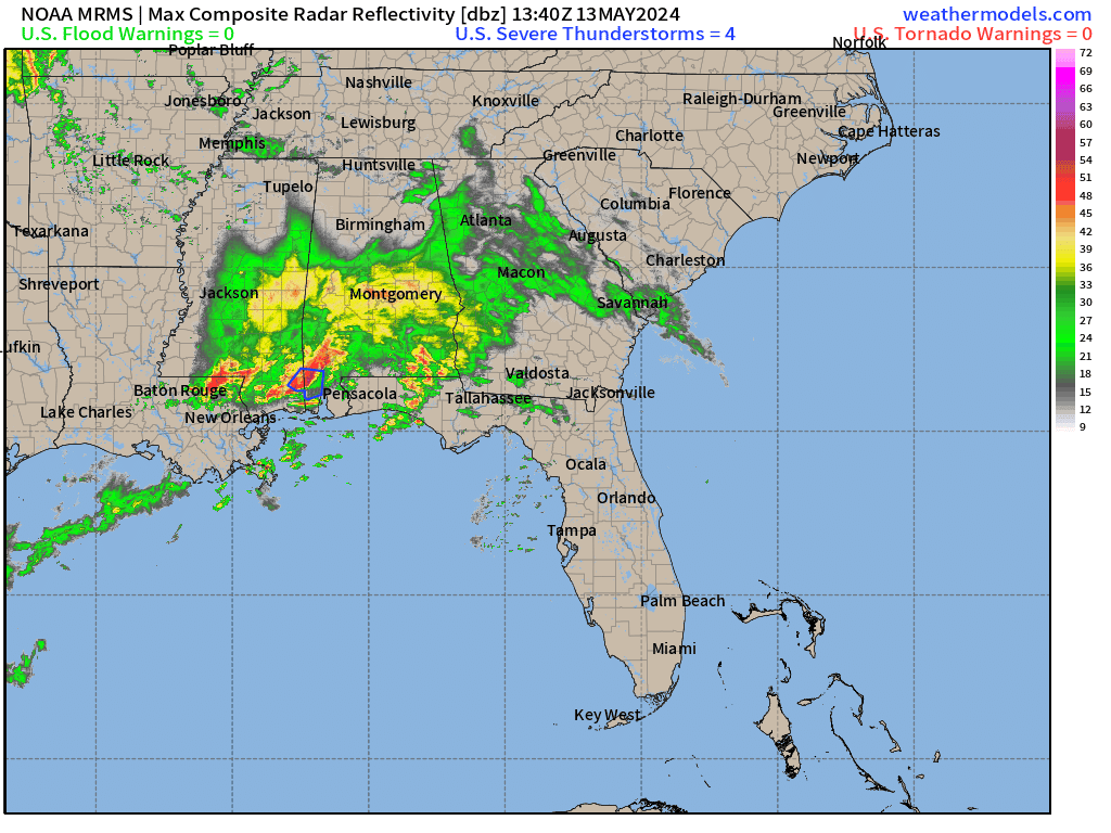
The 48-hour simulated radar shows another wave of rainfall developing in Texas later today and then repeating along a path into New Orleans and across into Florida by Tuesday morning. Rainfall totals could exceed 6-inches from Mobile to Panama City.

Next 10-days Upper-Level Weather Pattern | ECMWF AIFS
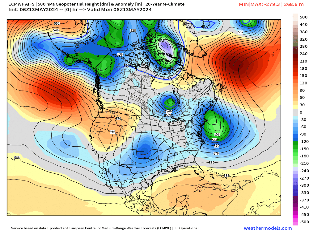
A sequence or parade of troughs continues to show up in the extended range from the A.I. version of ECMWF IFS. This will bring cooler air out of Canada to combine with moisture from the Gulf of Mexico fueling soggy conditions across the southern U.S. for the next week. This means no sustained heat waves or heat dome development at least through May 22.
Bay of Bengal Cyclone
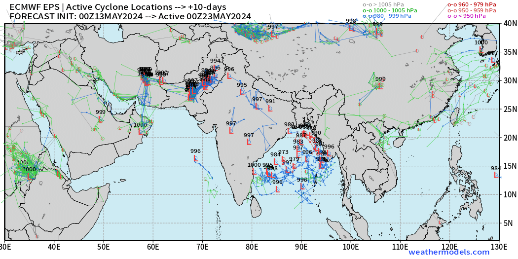
ECMWF ensemble guidance + AIFS shows the development of a tropical cyclone in the Bay of Bengal by next week, and some solutions show it as being intense.

The ECMWF AIFS has shown the Tropical Cyclone in several recent runs in the 10-day range suggesting the AI system has some predictability skill in longer-ranges at least in the Indian Ocean with a westerly wind burst. We’ll see if that predictive success translates the Atlantic.
NWS WPC 7-Day Precipitation Forecast | Watering Needs
Keep reading with a 7-day free trial
Subscribe to Weather Trader to keep reading this post and get 7 days of free access to the full post archives.