


May 12, 2025 Monday Weather
Earliest, hottest records across Texas this week

Good morning! A new week — and heading into Atlantic hurricane season in under 3-weeks. Quick look at the ocean temperature anomaly this year compared to last in the Atlantic. Huge difference … and that probably explains the less aggressive seasonal forecasts from groups that have so far released their forecasts.
SST Anomaly comparison from 2025 and 2024 for the past 30-days
2025
Overall Sea Surface Temperature (SST) anomaly is neutral to actually below normal (1991-2020) across the Main Development Region. Slightly above normal in the Caribbean and Gulf of Mexico as well as in the subtropical Atlantic around Bermuda.

2024
Amazing to see the extreme warmth across the Atlantic last year at this time across the entire Main Development Region and especially in the Eastern part of the basin. However, even with that warm water, tropical waves didn’t take advantage, instead emerging off the African coast too far to the north over cooler water (actual T).

Heading into early part of the Atlantic hurricane season, we look at the African or Saharan Air Layers + dust across the desert. Intense dust concentration especially in Algeria and Egypt, but that won’t be coming across the Atlantic in such ferocity, instead drifting eastward with the prevailing westerly winds in North Africa.

Some dust coming across the Atlantic, but it does not look severe, but adds a noticeable haze in the satellite imagery.

Atlantic Satellite Image
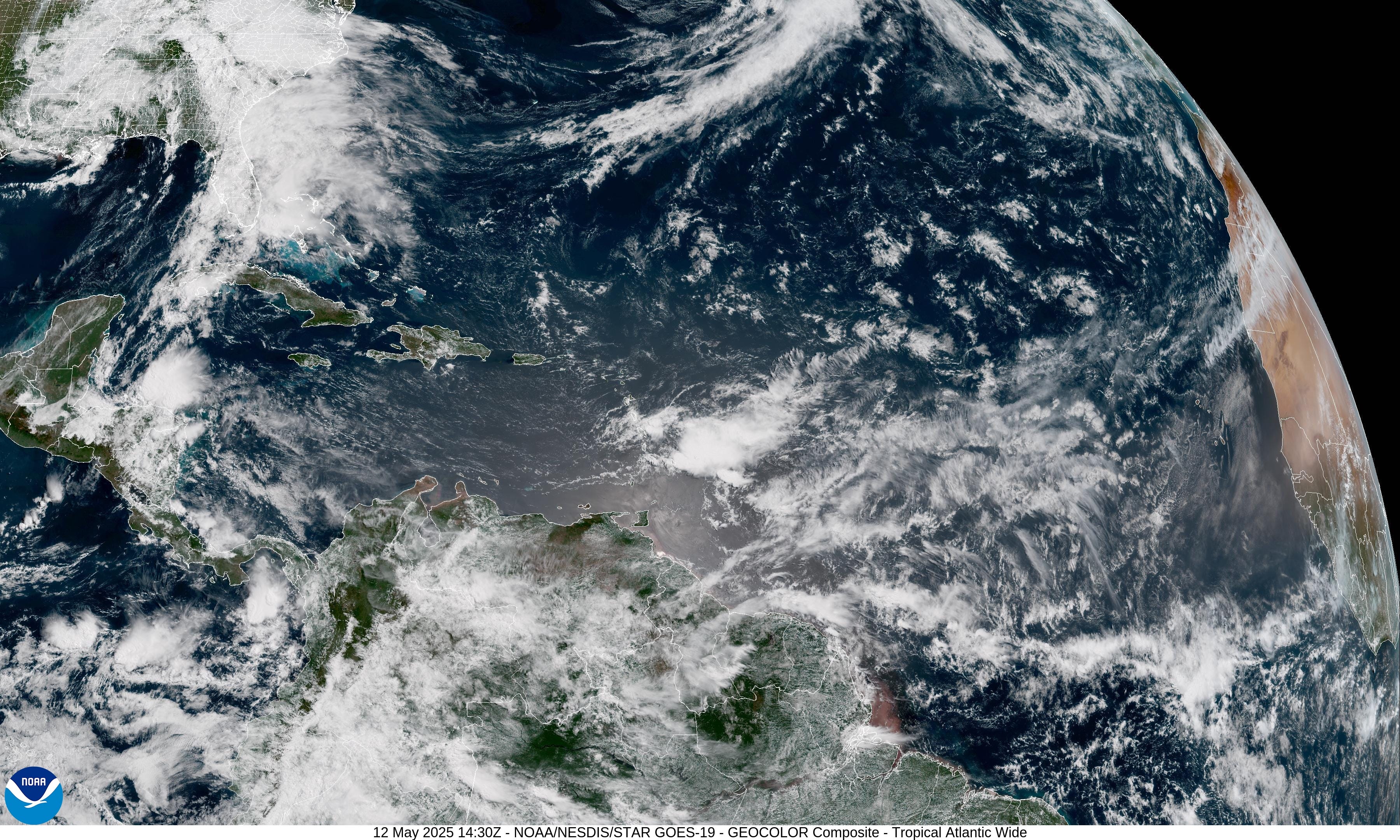
Some convection approaching the Lesser Antilles but the entire tropical Atlantic is otherwise quiet.
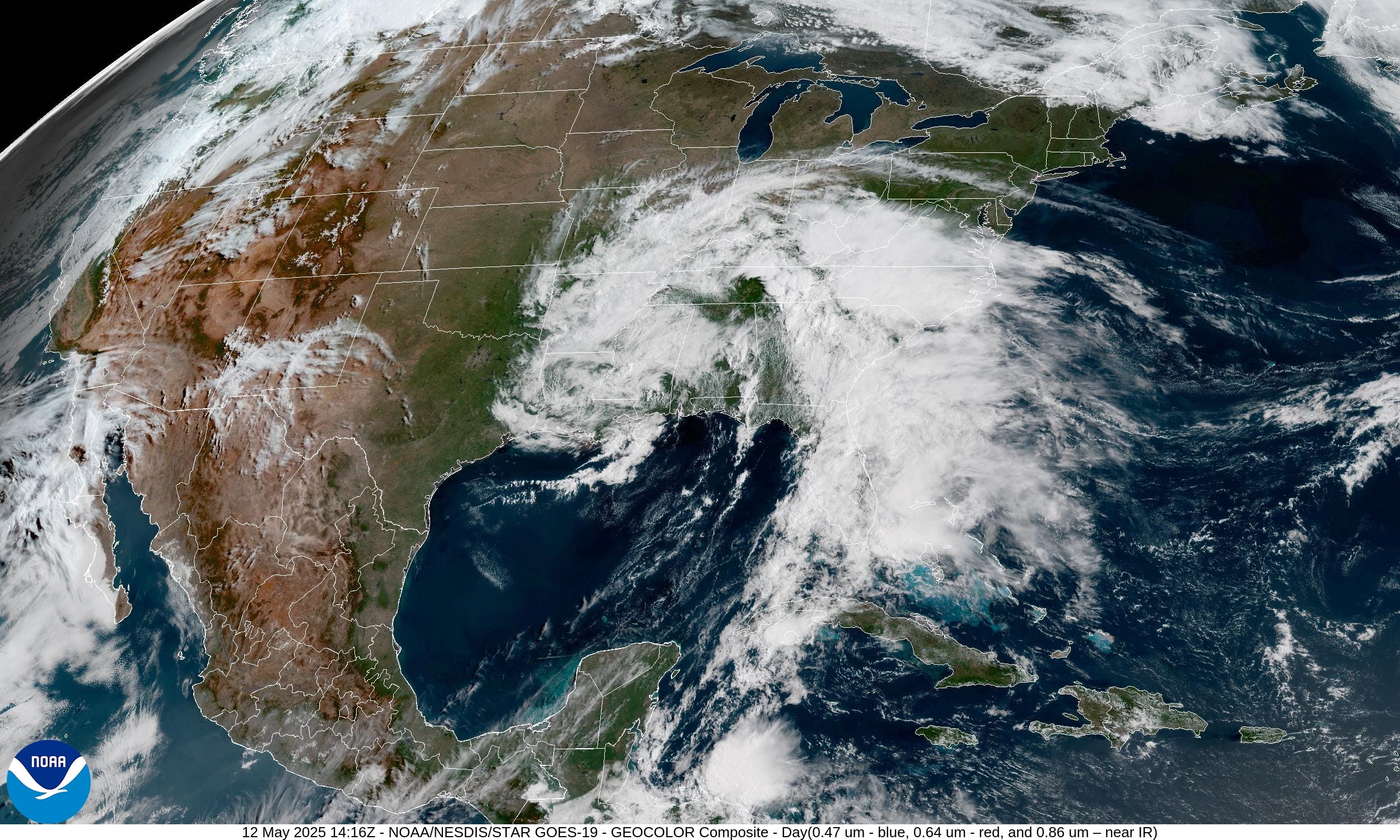
Satellite Imagery This Morning Across Lower 48
Same story as the past few days with our storm system — cut-off low + moisture feed into the Southeast U.S. Also showers both rain and snow across the Northwest.
Current Radar: 10:40 AM ET
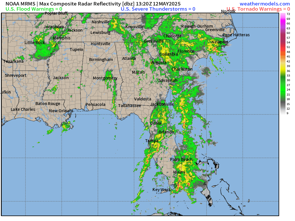
No severe weather just drenching rain in Florida up into the Carolinas, which is beneficial over the parched Sunshine State. The center of circulation of the cut-off low has mainly dried out but daytime heating with sun poking through the breaks in the clouds will pop up more thunderstorms.
Frontal Boundaries at 8 AM | Weather on Monday

Active weather mainly heavy rain across Florida and into the Mid-Atlantic as the storm system finally lifts northward.
Moisture coming into the West Coast and Rockies will keep temperatures cooler.
High Temperatures Today | Monday May, 12 2025
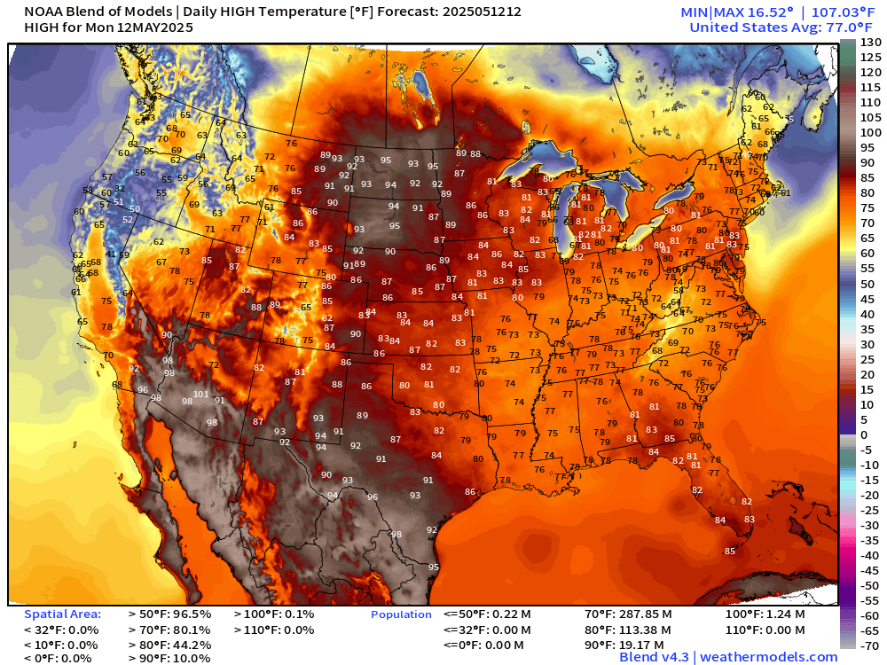
77.0°F is the Lower 48 average high temperature with 288 million at least 70°F.
No 90s in Florida today with the clouds and rain, but mid-90s in the Dakotas will make up for the areal coverage.
Temperature Analysis | 10:00 AM ET

60s and 70s across the Lower 48 heading into 10 AM hour
Temperature Anomaly | 10:00 AM ET

Overall the Lower 48 is +5.8°F and above normal [1991-2020]. 10°F to 20°F above normal across the Rockies into the Dakotas, Midwest and now the Great Lakes.
Please Sign up or Subscribe for the 2025 Atlantic Hurricane Season
If you missed out on a coupon, then this link / button will provide annual upgrade at the previous $50/year.
The growth of this newsletter up the Leaderboard is key to expanding the maps and analysis to the wider Substack audience. While politics is king on this platform, I’m hopeful that thoughtful data viz and weather + climate can break through the noise.
Keep reading with a 7-day free trial
Subscribe to Weather Trader to keep reading this post and get 7 days of free access to the full post archives.