


May 11, 2025 Mother's Day Weather
Extreme heat in Texas this week
Good morning and Happy Mother’s Day!
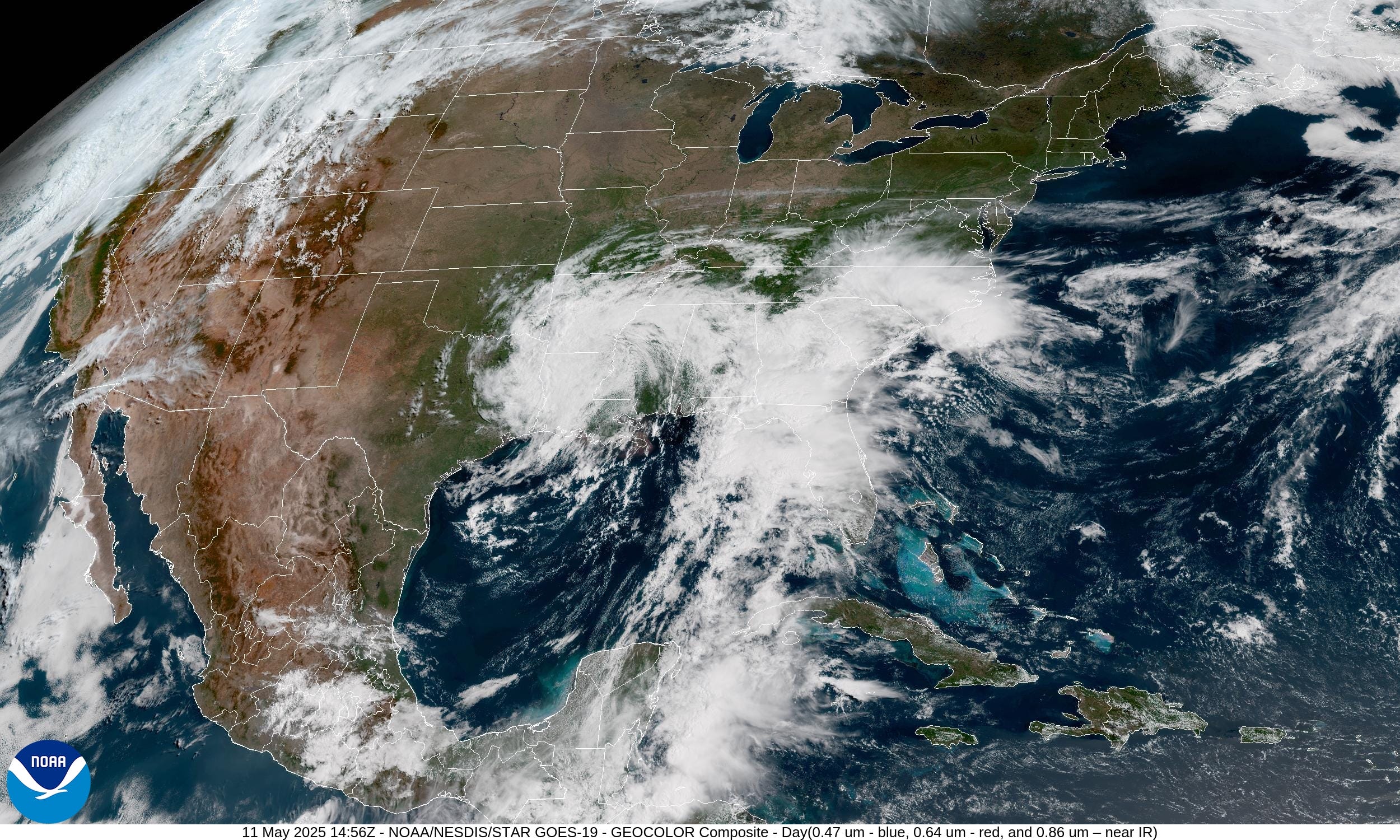
Satellite Imagery This Morning
The cut-off low has retrograded westward in the past 24-48 hours with a swirling and compact cyclonic cloud head behind a moisture plume or atmospheric river out of the Gulf and Caribbean.
Brilliant sunshine in the Plains, Great Lakes, and Northeast!
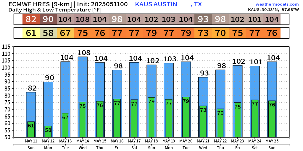
Extreme Heat Coming to Texas | Wednesday
Forecast models and the humans have been trending upward with maximum highs peaking on Wednesday. ECMWF is by far the hottest with 110°F in Austin, which is probably overdone, but hard to discount considering the success of this model simulating previous episodes of all-time record breaking heat.
GFS does have 102°F in Dallas / Fort Worth and 107°F in Austin and San Antonio.


ECMWF Ensemble Distribution of Temperatures
Primary tool we use to forecast the range of possible temperature outcomes in the next 2-weeks it the ECMWF ensemble = 51 ensembles or similar forecasts run with the same model but tiny changes in the initial conditions. By Days 3-5, those tiny changes amplify around the world to generate significantly different weather outcomes. However, we don’t necessarily want a large spread or variance in the ensembles, but as narrow as possible 25% - 75% interquartile range …
No doubt about the extreme heat in Austin coming this week and continuing well-above normal through the month of May. No surprise — ridge > trough = summer like extreme heat.

One trajectory through the ensemble collection (1 out of 51) is the “control” or forecast that does not have any added noise to the initial conditions. That is quite a 15-day forecast for Austin — plenty of 100s.
Current Radar: 11:04 AM ET
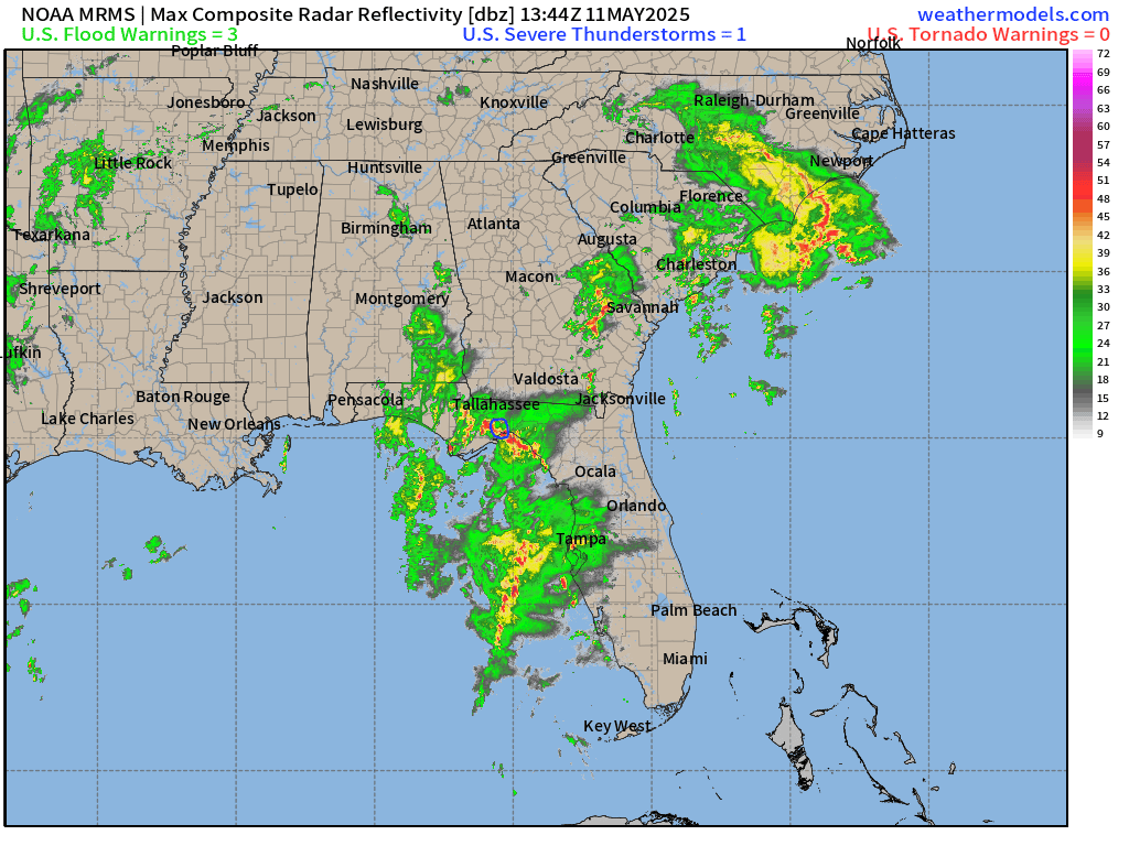
Heavy rain in the Florida panhandle this morning extending into SE Georgia and the Carolinas. On the back side of the low, just lighter rain in Arkansas and Texas. Gloomy day with the cloud cover, however.
Frontal Boundaries at 8 PM | Weather on Sunday

Chance of some severe storms [SLIGHT RISK] in Montana this evening. More heavy rain continues for the Southeast. A late season storm system for the Pacific Northwest including northern California with rainfall and mountain snow.
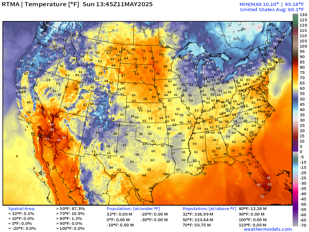
High Temperatures Today | Saturday May, 10 2025

76.7°F is the Lower 48 average high temperature with 264 million at least 70°F. We lost the 90s in Florida today, but area wise, the Dakotas pick up the slack. However, not for population!
Temperature Analysis | 9:45 AM ET
60s and 70s across the Lower 48 heading into 10 AM hour earlier
Temperature Anomaly | 9:45 AM ET

Overall the Lower 48 is +5.0°F and above normal [1991-2020]. 20°F to 25°F above normal across the Rockies into the Dakotas.
Please Sign up or Subscribe for the 2025 Atlantic Hurricane Season
If you missed out on a coupon, then this link / button will provide annual upgrade at the previous $50/year.
The growth of this newsletter up the Leaderboard is key to expanding the maps and analysis to the wider Substack audience. While politics is king on this platform, I’m hopeful that thoughtful data viz and weather + climate can break through the noise.
Keep reading with a 7-day free trial
Subscribe to Weather Trader to keep reading this post and get 7 days of free access to the full post archives.