


May 1, 2024 Significant Central US Rainfall Continues
Yet another storm system for the central U.S. with heavy rain and thunderstorms

April 2024 finished up much warmer than normal across much of the Lower 48. However, there is nuance to the temperatures depending upon how you examine the monthly means e.g. minimum, maximum, or average.
The Low temperatures outpaced the highs especially across the Ohio Valley and Midwest. Florida was notably cooler than normal along with the Southwest.
Precipitation and cloud cover largely determines the variability of temperature across much of the U.S. in April as well as the predominant moisture flow either dry out of Canada or moist from Gulf of Mexico.
Of course, a 30-day chunk of the calendar is what we call April but Mother Nature operates on a variety of time scales including daily, weekly and sub-seasonally. During any 4-week period, any location can experience multiple flow regimes so the mean is probably less informative than the variance otherwise known as the weather.


Precipitation anomaly in terms of inches (not %) shows the areas where much above normal rainfall fell including east Texas, Missouri into IL/IN along I-80 into western PA, and the upper-Midwest. A strip of heavy rain also hit the FL panhandle.
However, deficits occurred in the areas in brown.

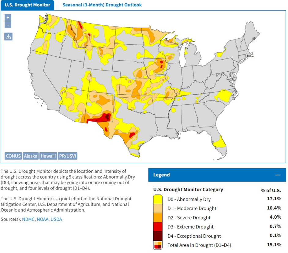
Of course, it’s the actual rainfall amounts that matter especially for the drought indicator.

The Drought dot gov monitor updates tomorrow. But your eyeball can match up the areas of dryness with the April precipitation anomaly map e.g. Iowa is being left out as well as Kansas. The Southeast, Northeast, and Mid-Atlantic are drought-free.
NWS WPC 7-Day Precipitation Forecast | Watering Needs
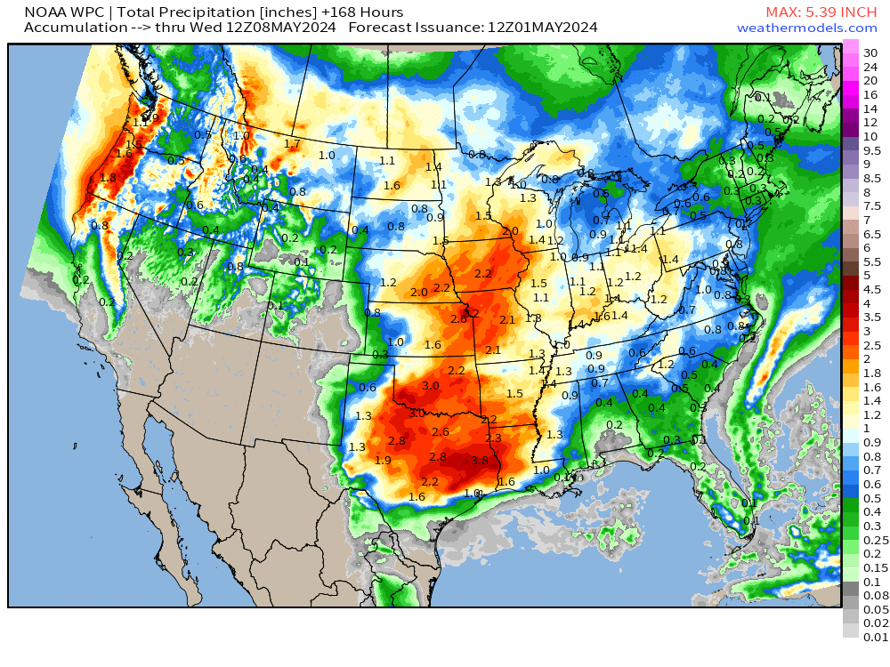
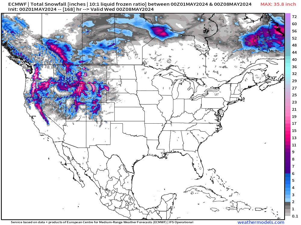
Good news for Iowa and the central Plains + Texas for significant rainfall totals this coming 7-days. Also, more moisture for the West Coast including mountain snow.
The rain/clouds will keep temperatures down across the central U.S.
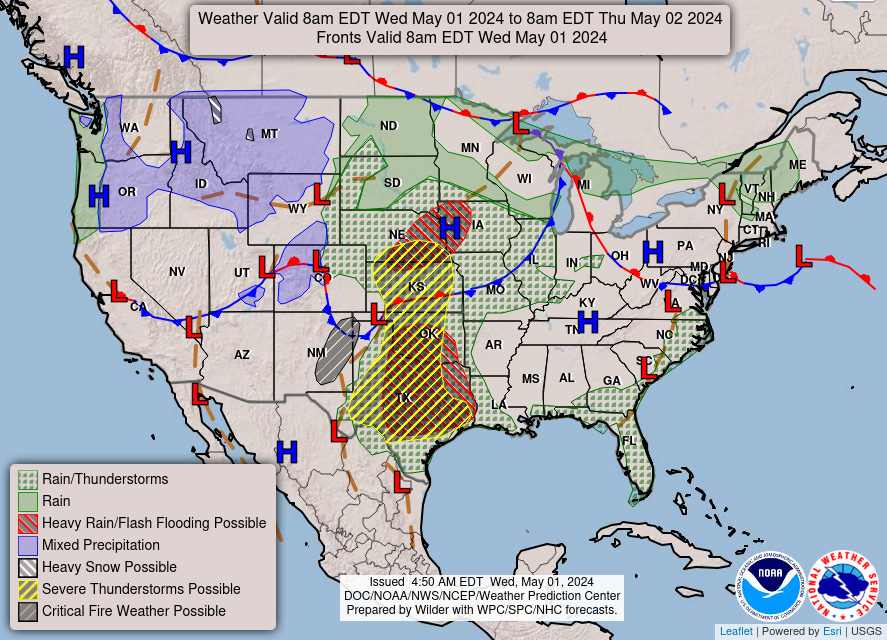
Thunderstorms and rainfall today: HRRR next 18-hours through Thursday 1 AM

Severe weather most likely across Texas and western Oklahoma.
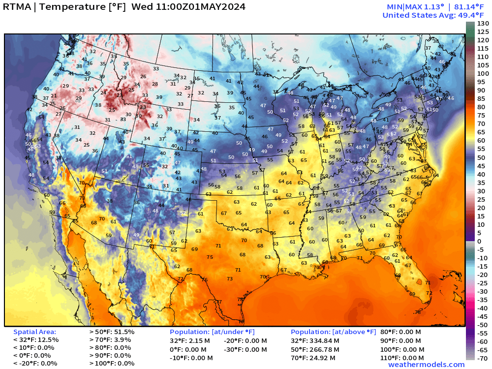
Wednesday High Temperatures

Precipitation Next 48-Hours


Wednesday Morning Temperatures 7:00 AM ET
Monday Weather and Convective Outlook
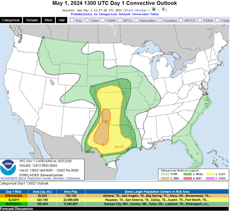
  ...SUMMARY...
   The greatest threat today for large to very large hail, severe
   thunderstorm gusts and a few tornadoes will be in western Oklahoma,
   the eastern Texas Panhandle and northwest/west-central Texas.
Next 8-Days Weather Systems

Still an early spring looking pattern with troughs digging into the Western U.S. spawning surface lows across the northern Plains. The flow off the Gulf of Mexico means plenty of moisture and cloud cover for heavy rainfall over the next week across the central U.S. and then slightly weakening as the fronts move eastward.
No heat dome development for the next week.
Forecast Farm | 15-Day Precipitation Anomaly [%]

No surprise about lack of rain across the Southwest — so the 0% isn’t so important. However, dryness across Florida continues. Otherwise, the Lower 48 is generally wetter than normal over the next 2-weeks.
ECMWF Ensemble | 7-Day Temperature Anomaly
Next 7-Days | May 1-7

Wee 2 | May 8-14

7-Day Snowfall Forecast
Thank you to Subscribers and Supporters! Welcome to May 2024 — countdown to hurricane season in 31-days.
Maps sourced from weathermodels.com designed and innovated by yours truly! I actually create all of my content from scratch.