


March 9, 2025 Sunday Weather Update
Spring warmth east of the Rockies ahead of powerful storm

Good evening and welcome to Daylight Saving Time, until November 2.
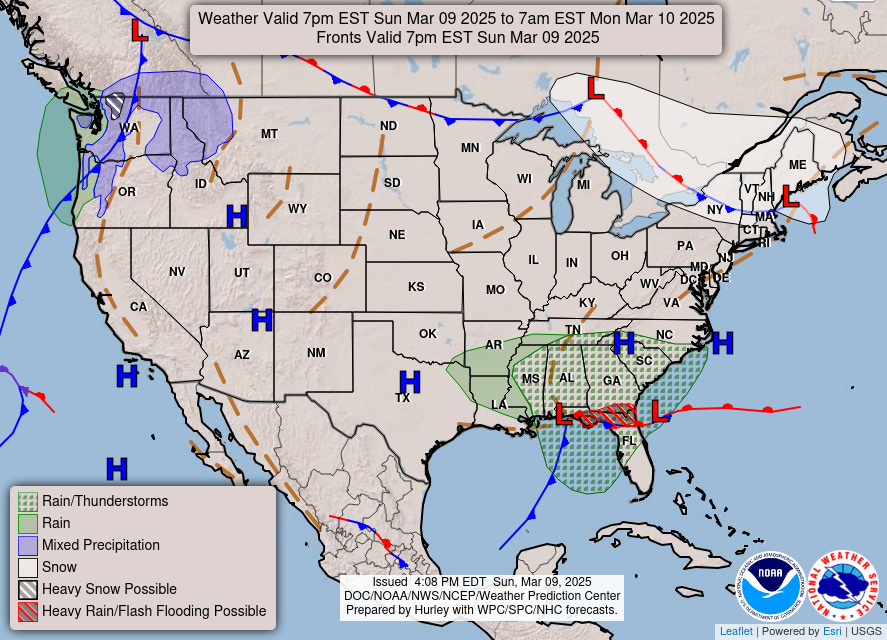
Picturesque satellite imagery earlier this evening with the comma shape of a storm system centered over the Gulf coast. A frontal boundary separates warm, moist tropical air in the Gulf from much cooler, wedge like air over the Southeast. The main issue is heavy rainfall in the Florida panhandle, but it’s welcome precipitation to prevent any drought or serious deficits from mounting.
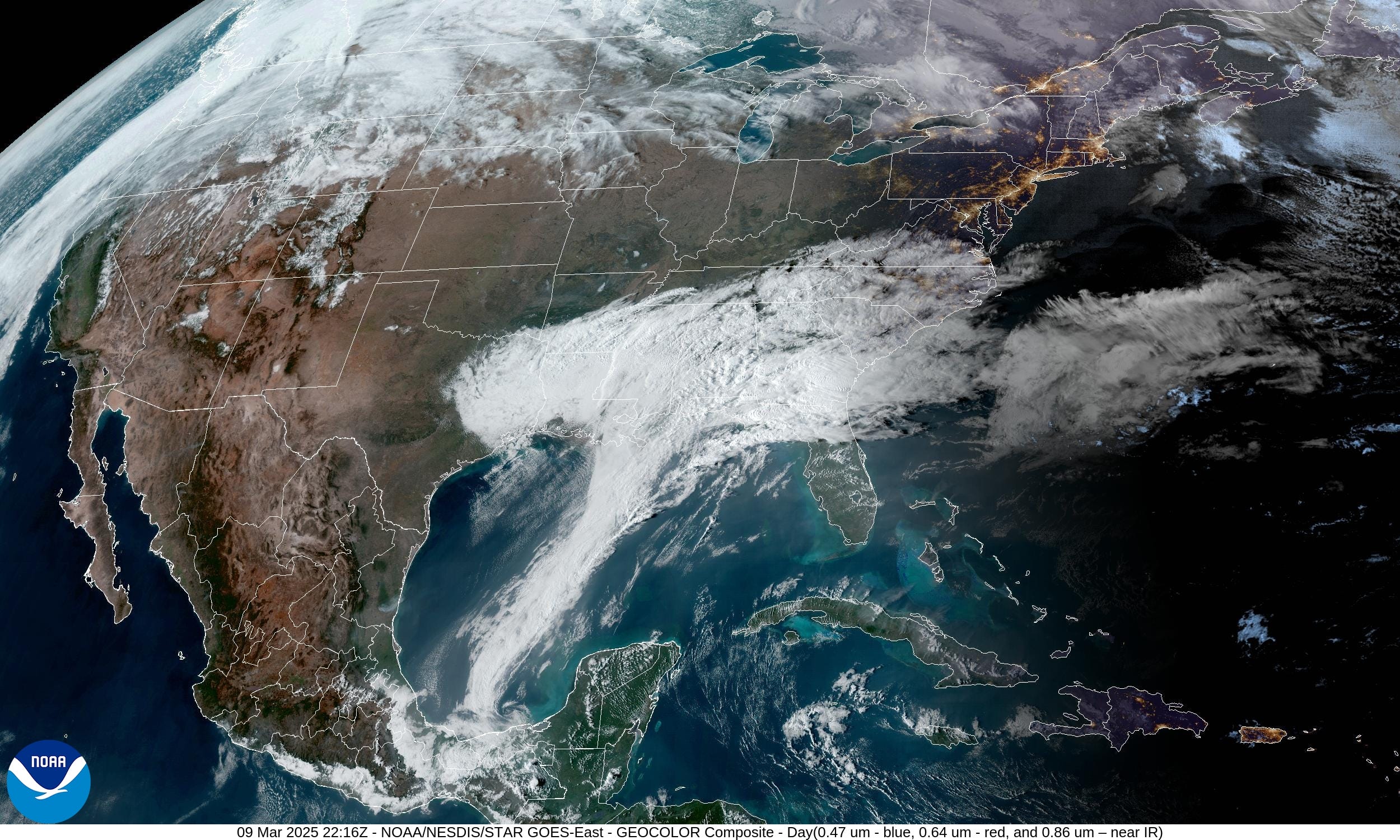
The rest of the Lower 48 is rather quiet with only some light snow showers in New England.
Warmth on the Way | Highs Next 9-days

So nice to see 70s and 80s on the weather maps again especially here in the Southeast. Spring has almost sprung. Ahead of the huge storm system this week,
Highs on Thursday and Friday


East of the Rockies, very warm in the 60s and 70s! Except for New England. Sad!
Top story for the week will be the very powerful storm system in the central U.S. with minimum pressure in the low-970s mb — rare over land. However, this system develops east of the Rockies (Lee low) with a strong cut-off low or cold mid-level trough. However, the overall upper-level pattern remains in-tact with the polar vortex (purple and white fuzzball over Hudson Bay) still providing the western Lower 48 with winter weather.
Tropopause Potential Temperature Next 8-days | GFS 18z

By 5-days, the central pressure drops in the 970s across Nebraska with a very tightly wound mature cyclone. However, there isn’t much moisture available for the system at all. It’s more of a cold-core cut-off low that crosses the Rockies and drops pressure adiabatically (PV conservation). Really not expecting much to happen with the storm until the Gulf of Mexico moisture stream can be tapped, and the low tracks into the Great Lakes to capture Pacific origin moisture.
Friday GFS | 120-hours


Saturday GFS | 150-Hours


Keep reading with a 7-day free trial
Subscribe to Weather Trader to keep reading this post and get 7 days of free access to the full post archives.