


March 4, 2025 Tuesday Weather Update
Very powerful storm system whipping severe storms

Rough weather day for Tuesday!
Exceptional storm system intensifying across the Central US this morning with severe weather ahead of a cold front.
Earlier this morning, hurricane force wind gusts accompanied storms through the Dallas/Ft. Worth metroplex leading to roof damage. The winds within the storms are bad enough, but high wind warnings continue outside of the main squall lines on the back-side of the occluding (maturing) extratropical cyclone.

By midnight, the cyclone is probably at minimum pressure (975 mb) — very low for an over-land system. No problem reaching 975 mb over the ocean with the availability of diabatic energy (moisture flux) from the ocean surface w/lower friction. But over dry land, 975 mb is about as low as the pressure can get even in late winter.


Exceptional upper-level “baroclinic” energy is fueling the circulation w/strong winds through the atmospheric column. This looks like a “bowling ball” on the isentropic potential vorticity (IPV) map with connection to the “polar vortex” and cold-pool of air over Canada. Textbook.


Surface Fronts at 7 PM ET
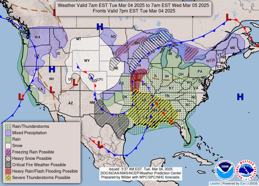
The map is quite busy with the entire Lower 48 seeing some sort of weather, but the main focus is on the severe storms in the South and the winds (!) leading to blizzard conditions where snowfall occurs e.g. Omaha, Nebraska.
Maximum Wind Gusts | Next 3-days | NWS NDFD


Red on the maps is > 50 mph wind gusts. Some locations will top out at 70 mph!
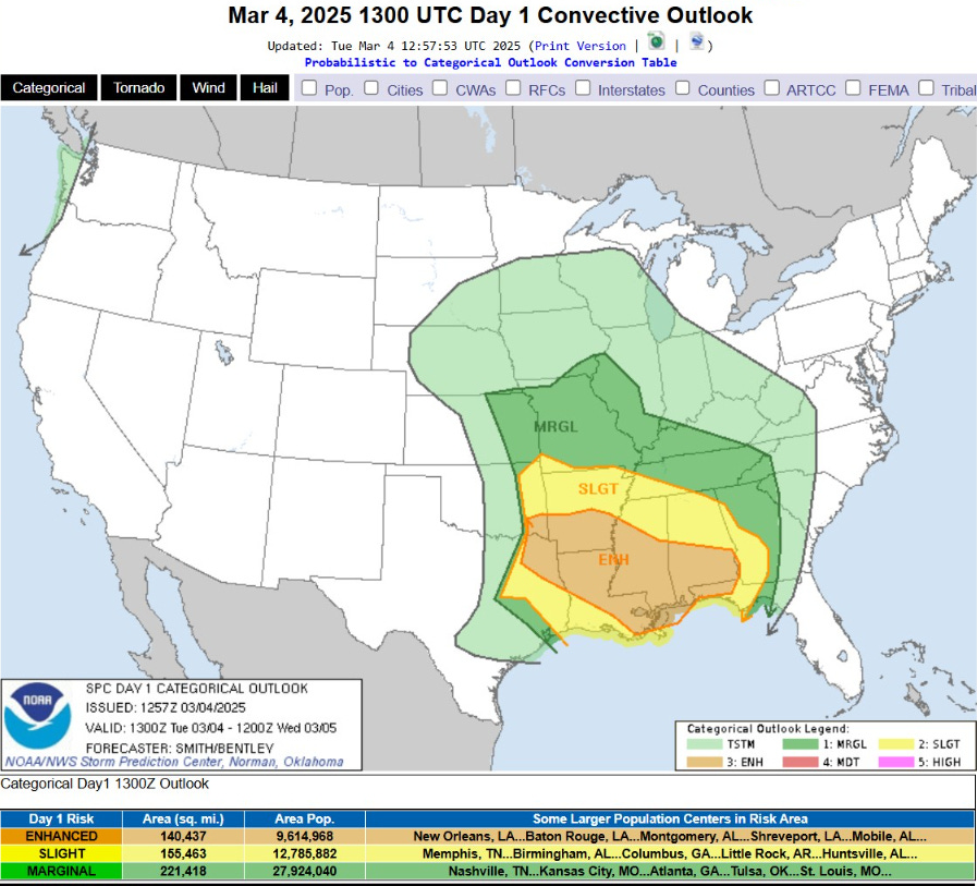
SPC Severe Weather Outlook | Day 1 | Into Wednesday morning
Keep reading with a 7-day free trial
Subscribe to Weather Trader to keep reading this post and get 7 days of free access to the full post archives.