


March 31, 2025 Monday Weather Update
Excessive rainfall and thunderstorms from Gulf of Mexico moisture feed

Good Evening, last day of March!
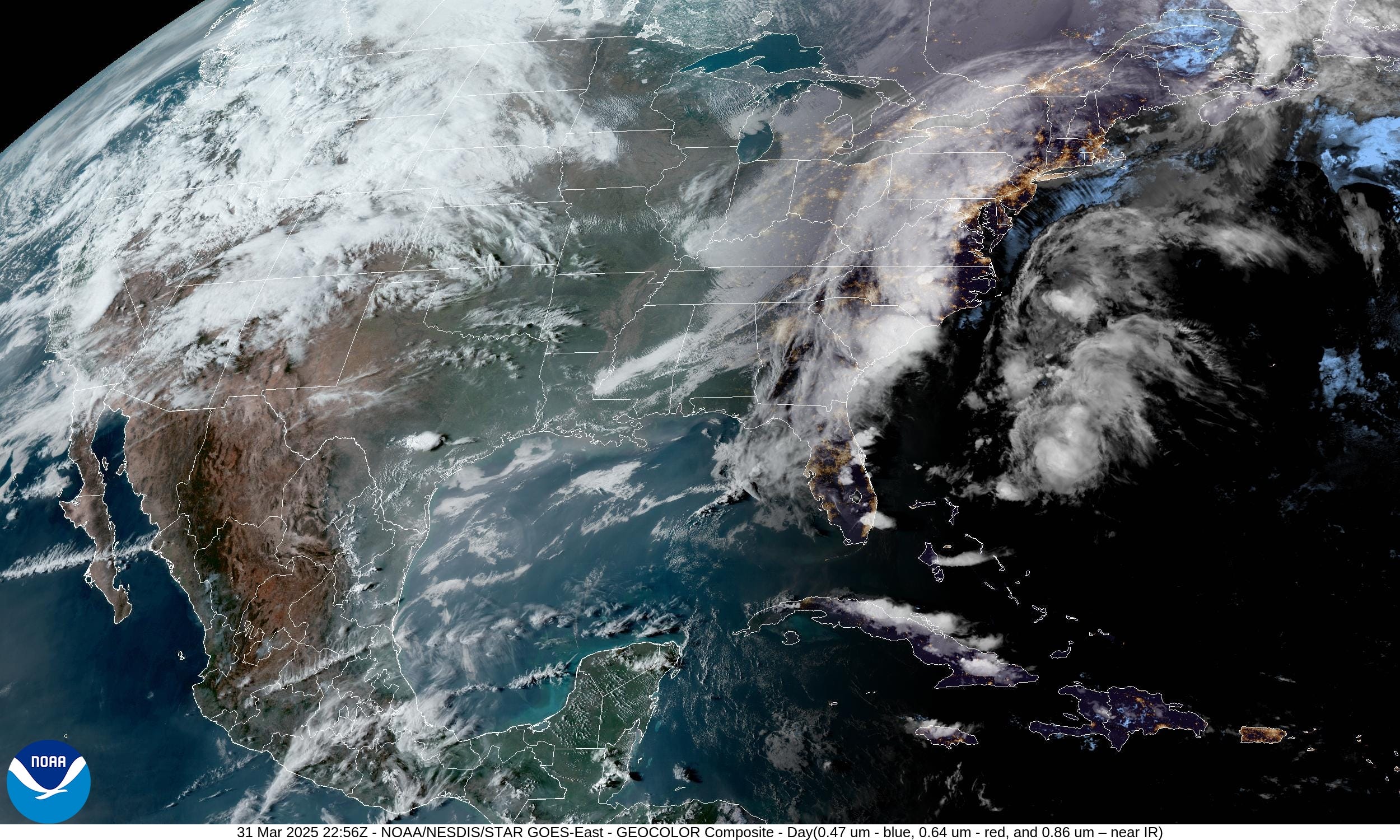
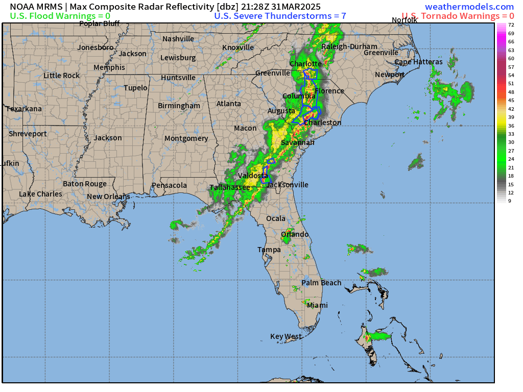
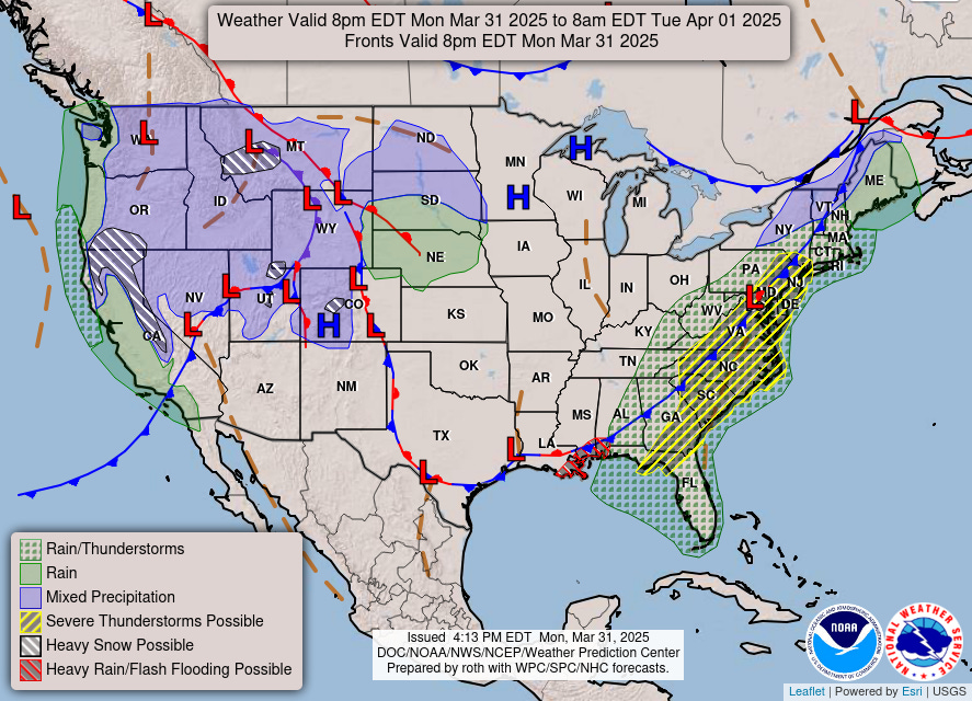
Showers and thunderstorms swept through the Southeast today with some damaging winds especially around Atlanta. The line of storms will move off the Atlantic coast in the next few hours, and clearing will mean a beautiful Tuesday.
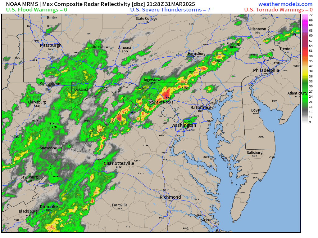
Storms approaching Washington D.C. and Philadelphia are still under severe levels.
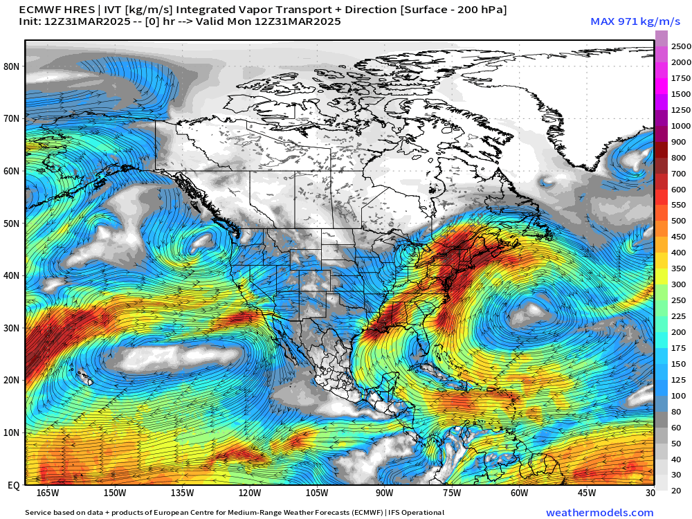
This is part of a weather pattern that remains stuck for the next several days. Warm plumes of moisture out of the Gulf of Mexico will flow northward just like atmospheric rivers that pound the West Coast.
Mid-level troughs + surface cyclones to the west — and subtropical ridge to the east off the U.S. Southeast coast = channel of moisture that will inundate the Mississippi River Valley mainly centered on Little Rock, Memphis, and Cincinnati.
Then, the flow turns out of the north and northwest meaning back to “polar vortex” and late-winter chill east of the Rockies, especially in the Great Lakes.
Integrated Vapor Transport Next 10-days
For any readers that wish to subscriber for full (non-paywalled) posts for the next year, then I’m offering a coupon for the next few days (March 31). I am very appreciative of my current crop of loyal readers, some of whom have consumed almost 600 posts in the past 1.5 years. Hopefully they are valuable especially in the coming Spring months with planting, gardening, and landscaping!
Next 9-days High Temperatures

A mini-heat wave will build from Wednesday into Saturday across the Southeast with some places flirting with 90°F including Atlanta (earliest is April 23, 1980). Then, a strong trough/cold front blasts through the eastern U.S. from Canada cooling down dramatically — or back to reality of early Spring.
HRRR simulated radar next 18-hours

By Tuesday morning, all of the rain is gone from Northeast and the eastern U.S. gets a little break before the next storm system cranks up for a multi-day severe weather episode.
Moisture across the Western U.S. will continue to pile up mountain snowfall. Also, rainfall dips into California with an area of low pressure off the Oregon coast. That rain/snow is quite welcome to start April across California! And even more snow for Denver in the coming days, maybe not so welcome.
Frontal boundaries this evening and weather into Tuesday morning
Temperature Analysis | 6:15 PM ET


Didn’t get above freezing in Northern Michigan this afternoon. However, very warm in the 70s and 80s from Washington D.C. to Philadelphia and NYC.

Keep reading with a 7-day free trial
Subscribe to Weather Trader to keep reading this post and get 7 days of free access to the full post archives.