


March 29, 2025 Saturday Weather Update
Widespread severe weather outbreak on Sunday

Good Evening!
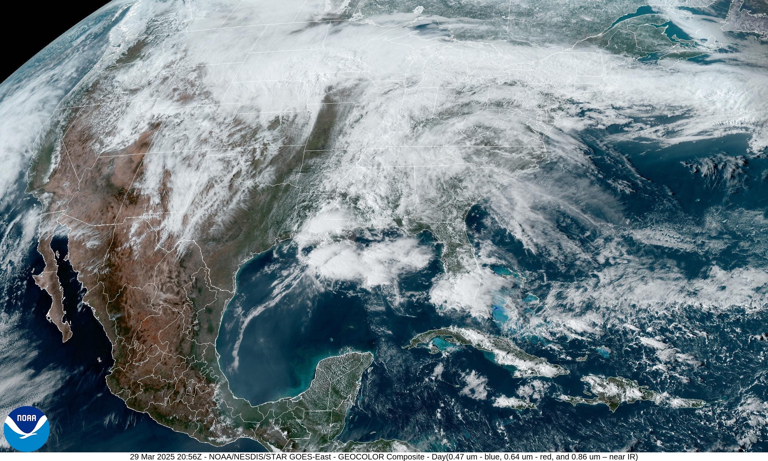
Warm, humid airmass across the eastern U.S. setting stage for severe weather outbreak on Sunday. Then, the moisture feeds continue out of the Gulf of Mexico leading to potential for excessive/flooding rains across the Mississippi, Tennessee, and Ohio River Valleys next week.
For any readers that wish to subscriber for full (non-paywalled) posts for the next year, then I’m offering a coupon for the next few days (March 31). I am very appreciative of my current crop of loyal readers, some of whom have consumed almost 600 posts in the past 1.5 years. Hopefully they are valuable especially in the coming Spring months with planting, gardening, and landscaping!
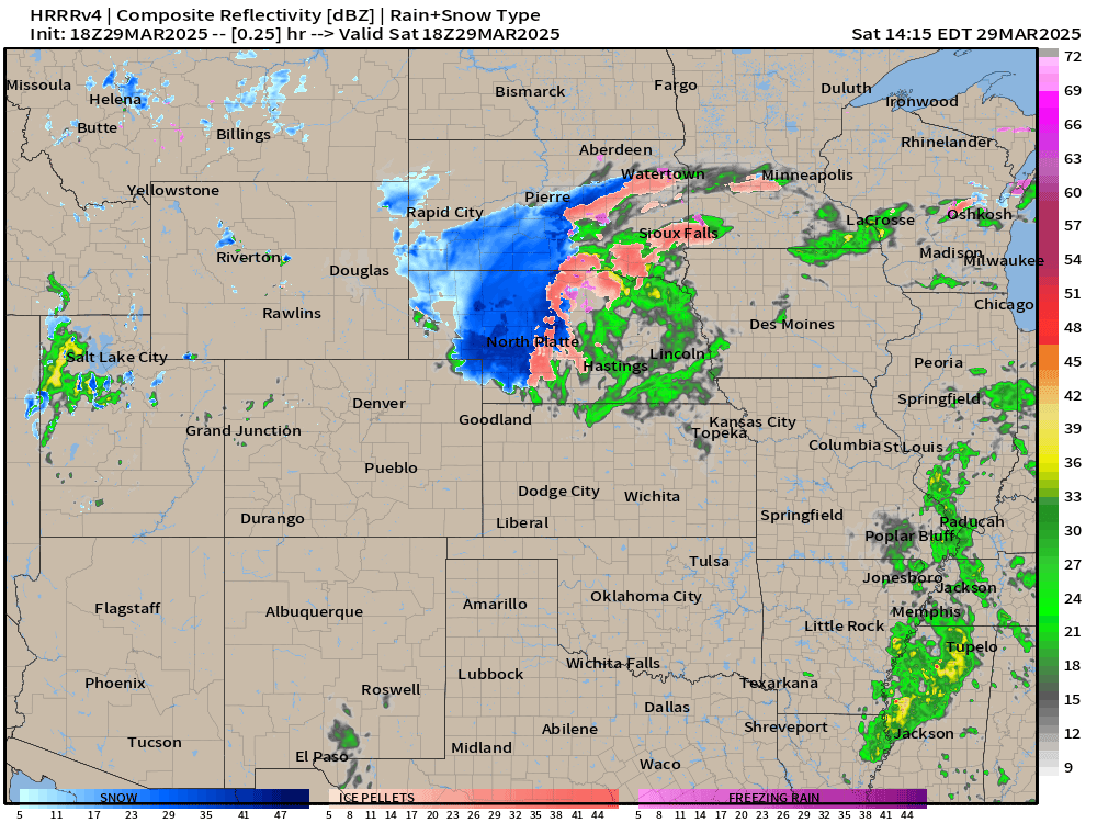
HRRR simulated radar next 18-hours
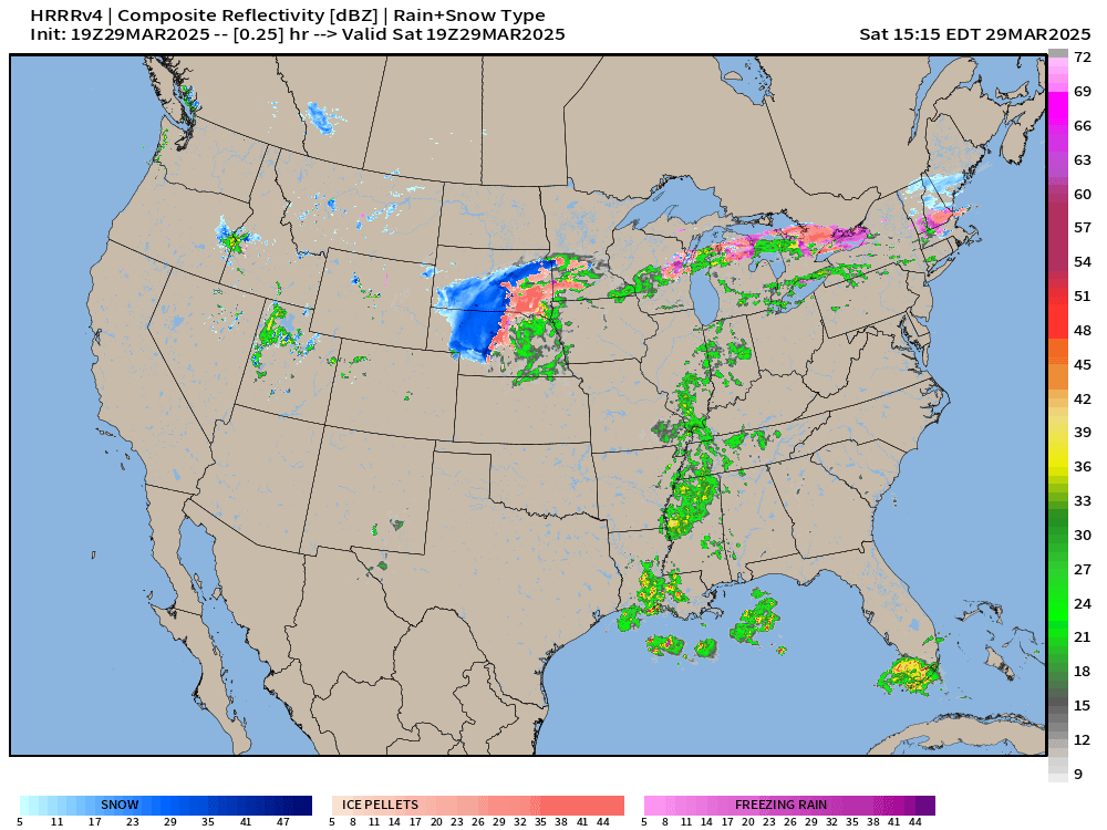
Watching for thunderstorms to fire later this evening and into the overnight hours across OK/KS, but they will sputter out into Missouri by morning.
Complete mess of snowfall, sleet, and freezing rain on the backside of the low pressure center north of a strong warm front. The UP of Michigan will see a foot of system snowfall, and then accumulation of ice from northern Wisconsin into Michigan and Ontario, then New England.
Today’s Convective Outlook into early Sunday morning
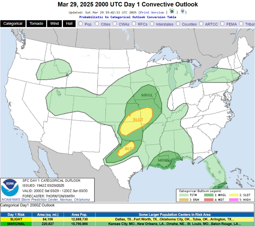
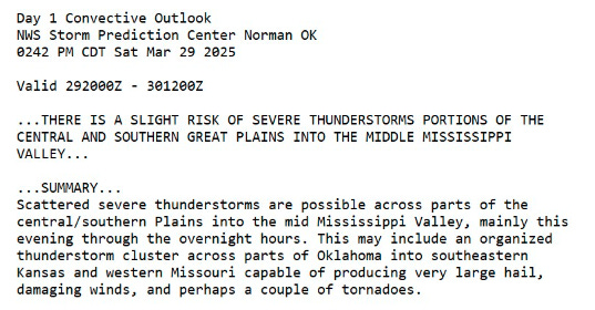
Two main areas of SLIGHT risk for severe storms including hail and gusty winds, and a couple of tornadoes.
Temperature Analysis | 4:45 PM ET

188 million at/above 70F this afternoon with a strong frontal boundary between spring warmth and winter to the north. A sharp gradient cuts through Long Island and into NYC with temperatures in the 80s being replaced by 40s — or even 30s in Boston with chilly onshore flow.
Keep reading with a 7-day free trial
Subscribe to Weather Trader to keep reading this post and get 7 days of free access to the full post archives.