


March 28, 2025 Friday Weather Update
Winter mess across Midwest and Great Lakes into New England

Good Morning!
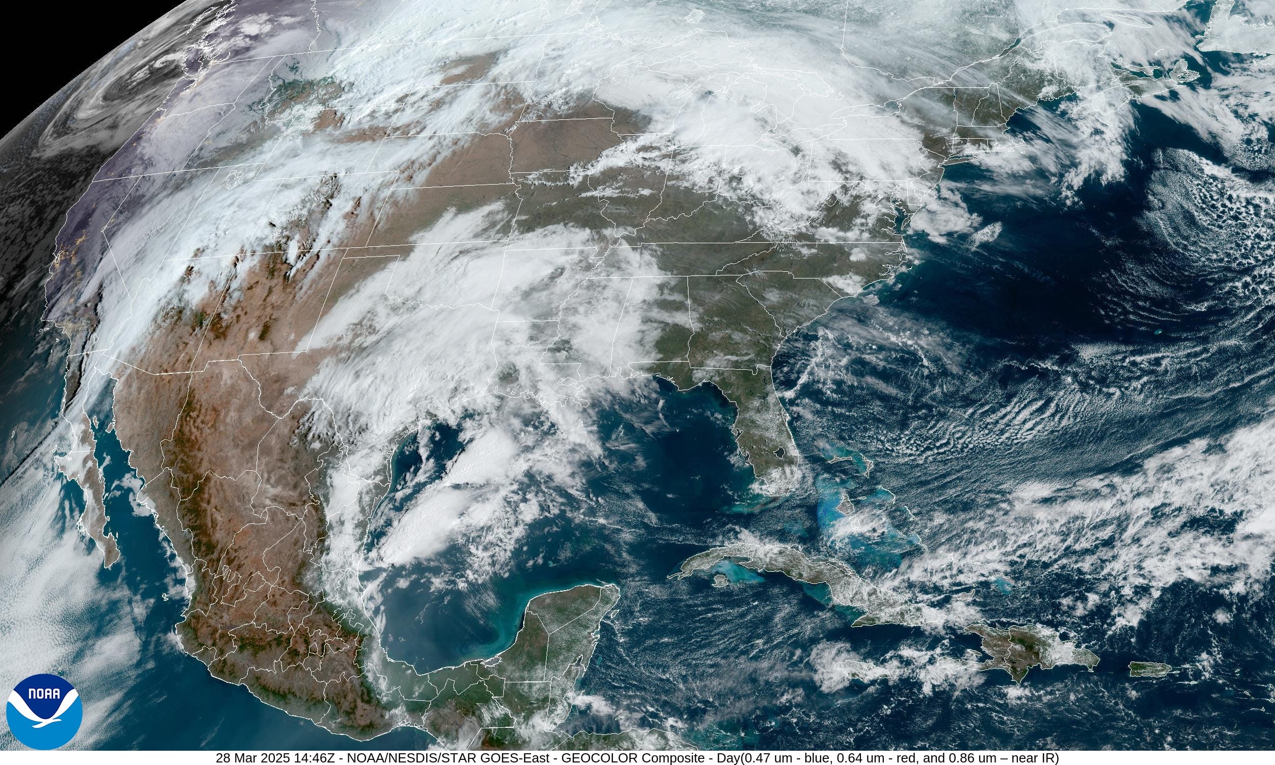
Active weather today across the upper-Midwest and Great Lakes along with Texas and Louisiana. Outside of the clouds and rain, very warm temperatures on this late March Friday.
For any readers that wish to subscriber for full (non-paywalled) posts for the next year, then I’m offering a coupon for the next few days (March 31). I am very appreciative of my current crop of loyal readers, some of whom have consumed almost 600 posts in the past 1.5 years. Hopefully they are valuable especially in the coming Spring months with planting, gardening, and landscaping!
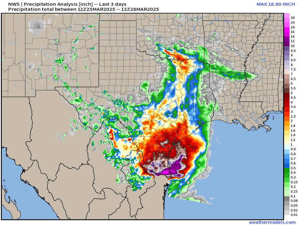

Precipitation analysis across South Texas shows almost 19" of rainfall on Harlingen, Texas but the station clunked out last night, so not sure if there's a bucket working there. Rainfall consistent with a slow moving tropical storm. Instead this was a weak cut-off trough able to draw up Gulf of America moisture on shore in a highly divergent upper-level environment. Models seemed to do a good job on overall maximums, but placement was off. I presume this precipitation will be enormously beneficial for recharging aquifers and soaking the landscape with seemingly a year’s worth of water all at once.
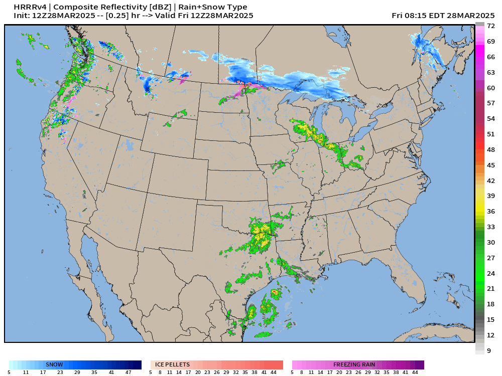
HRRR simulated radar next 18-hours

Quite a mess of rain, snow, sleet, and freezing rain with ice accumulations from northern Minnesota into the UP of Michigan. Then by later this evening, the precipitation streams into Montreal and northern New England. Significant snowfall and ice accumulations!
The upper-level low is now moving out of Texas — finally, but significant showers and storms possible with flooding potential around Houston with the heating of the day.
Temperature Analysis | 10:45 AM ET

Less than 1 million population at/below freezing, and pushing 40 million at 70°F!
Temperature Anomaly | 10:45 AM ET
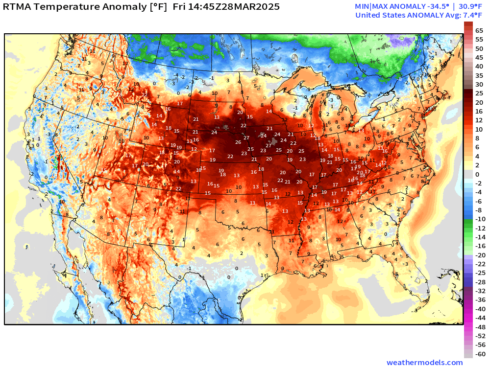
Western half of the Lower 48 is well above normal. Overall the Lower 48 is +7.4°F above normal
Weather into Saturday Morning | Fronts 8 AM ET

Still threat of heavy rain or flash flooding including Houston today.
Radar Next 48-Hours | HRRR into early Friday afternoon


Quite a mess of winter weather including snow and sleet + freezing rain cruising through the upper-Midwest into the Great Lakes including the UP of Michigan and then into New England.
Significant Ice Accumulations


Storm Systems + Precipitation Type Next 6-Days
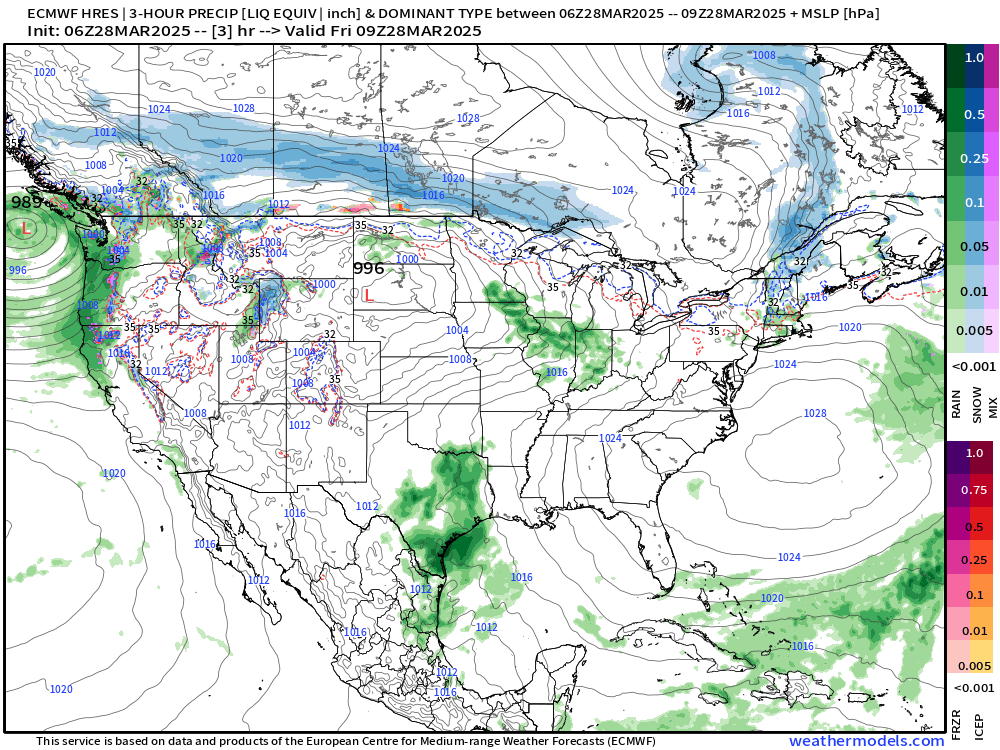
Storm 1: Severe weather [Enhanced Risk Day 3] along/east of the Mississippi River valley into Illinois and Indiana on Sunday with a storm system that forms in the Plains and tracks into the Great Lakes and Northeast.
Storm 2: Another powerful system centered over Midwest next Tues/Wed with a trailing cold front that looks impressive on ECMWF precipitation (QPF). More snowfall on the backside of the low with the cold air in Canada.
Day 3 Convective Outlook | Enhanced Risk
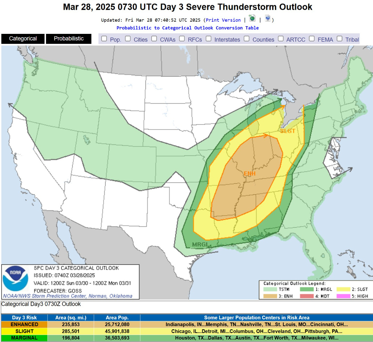
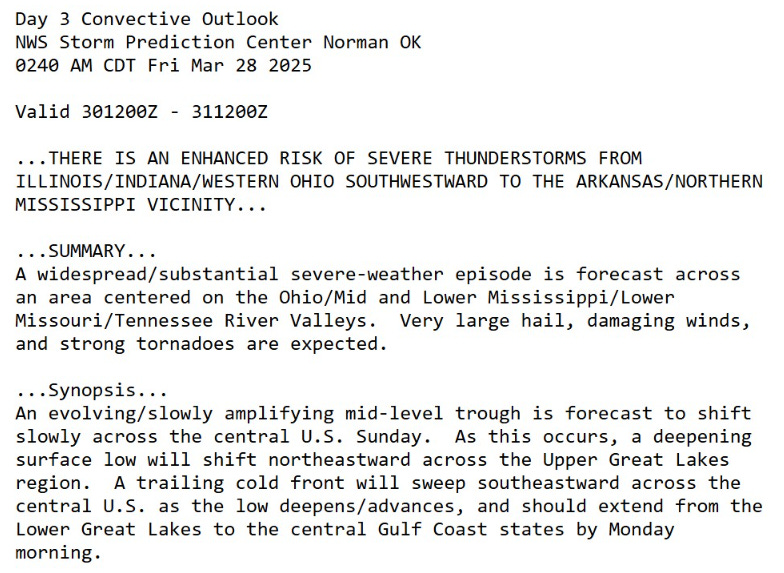
Tomorrow we’ll have better details on the overall impacts from this expected “widespread” severe-weather episode.
Keep reading with a 7-day free trial
Subscribe to Weather Trader to keep reading this post and get 7 days of free access to the full post archives.