Good Morning!
A couple areas of active weather this morning that will continue on into the afternoon: South Texas deluge with an upper-level trough + thunderstorms in Missouri and Illinois.
The West Coast sprawling cyclone has continued to weaken as it has matured. However, a convective band associated with the cold front has pushed inland with continued bands of precipitation for the next 24-hours.
HRRR simulated radar next 18-hours
The vast majority of the Lower 48 is dry and mild = beautiful early Spring day.
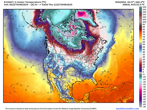
Temperature Analysis | 10:00 AM ET
Only 3 million population at/below freezing at 10 AM. That’s progress toward Spring.
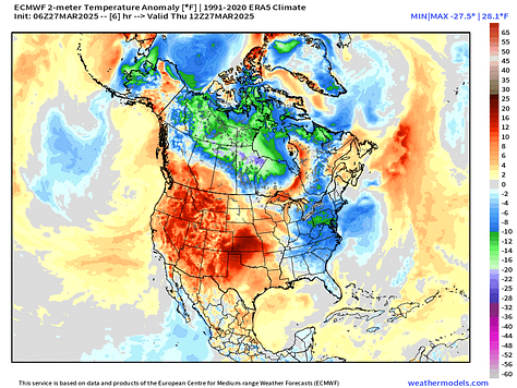
Temperature Anomaly | 10:00 AM ET
Western half of the Lower 48 is well above normal. Overall the Lower 48 is +6.6°F above normal
Current 12Z Thursday Upper-Level and Surface Parameters
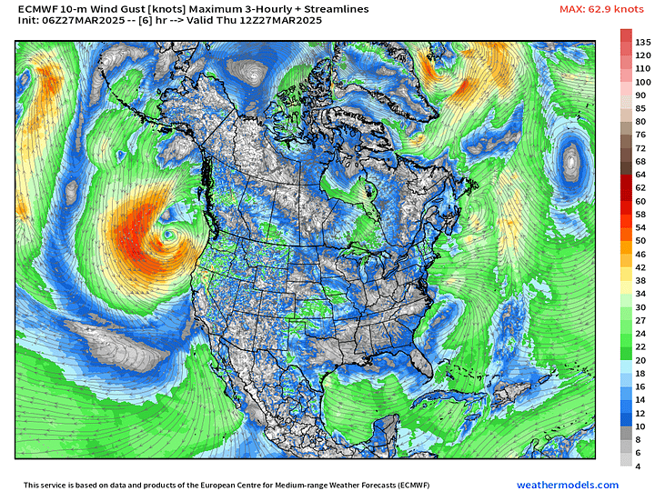
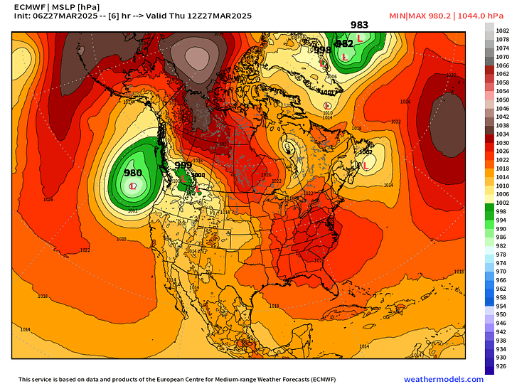
The large cyclone off the West Coast has filled to about 980 mb but has a very large circulation embedded with an upper-level low dragging moisture out of the subtropics into atmospheric river like bands lashing the coast.
High pressure dominates over the Southeast U.S. On the backside of the ridge is a slight weakness or trough over Texas pulling a plume of Gulf of America moisture into the state. That moist flow will surge northward up the Mississippi River Valley to help fuel continued wet weather this weekend with potential for severe weather.
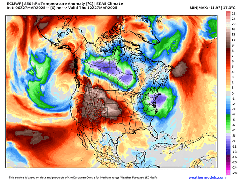
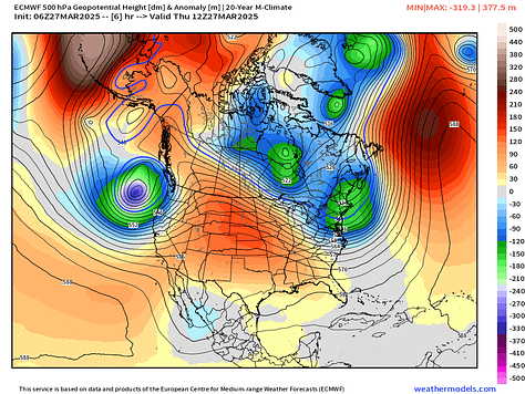
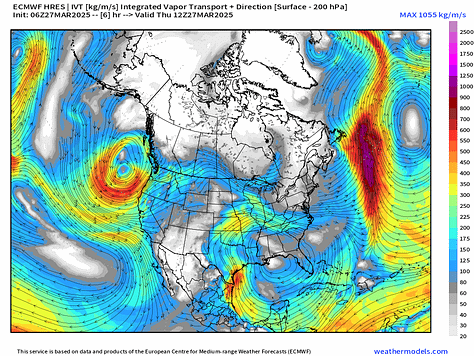

Thursday Slight Risk of Severe Thunderstorms
2 areas of “slight risk” with heavy rain accompanying storms in South Texas.
Weather into Friday Morning | Fronts 8 AM ET
Radar Next 48-Hours | HRRR into early Friday afternoon
Quite a mess of winter weather including snow and sleet + freezing rain cruising through the upper-Midwest into the Great Lakes including the UP of Michigan and then into New England.
Precipitation Totals Next 48-Hours
Storm Systems + Precipitation Type Next 6-Days
Storm 1: Severe weather [15% chance Day 4] along/east of the Mississippi River valley on Sunday with a storm system that forms in the Plains and tracks into the Great Lakes and Northeast.
Storm 2: Another powerful system centered over Iowa next Tues/Wed
Keep reading with a 7-day free trial
Subscribe to Weather Trader to keep reading this post and get 7 days of free access to the full post archives.


