


March 26, 2025 Wednesday Weather Update
Flooding likely in South Texas + Severe Weather in Washington State

Good Evening!
Active weather in the Pacific Northwest and far south Texas this afternoon into tomorrow. Very warm temperatures extending from the West into the Southeast with a trough and northwesterly flow keeping the Midwest, Great Lakes, and Northeast a bit chilly.
Temperature Analysis | 5:15 PM ET

Temperature Anomaly | 5:15 PM ET

Western half of the Lower 48 is more than 20-25°F above normal. Overall the Lower 48 is +9.9°F above normal
Western U.S. Powerful Storm
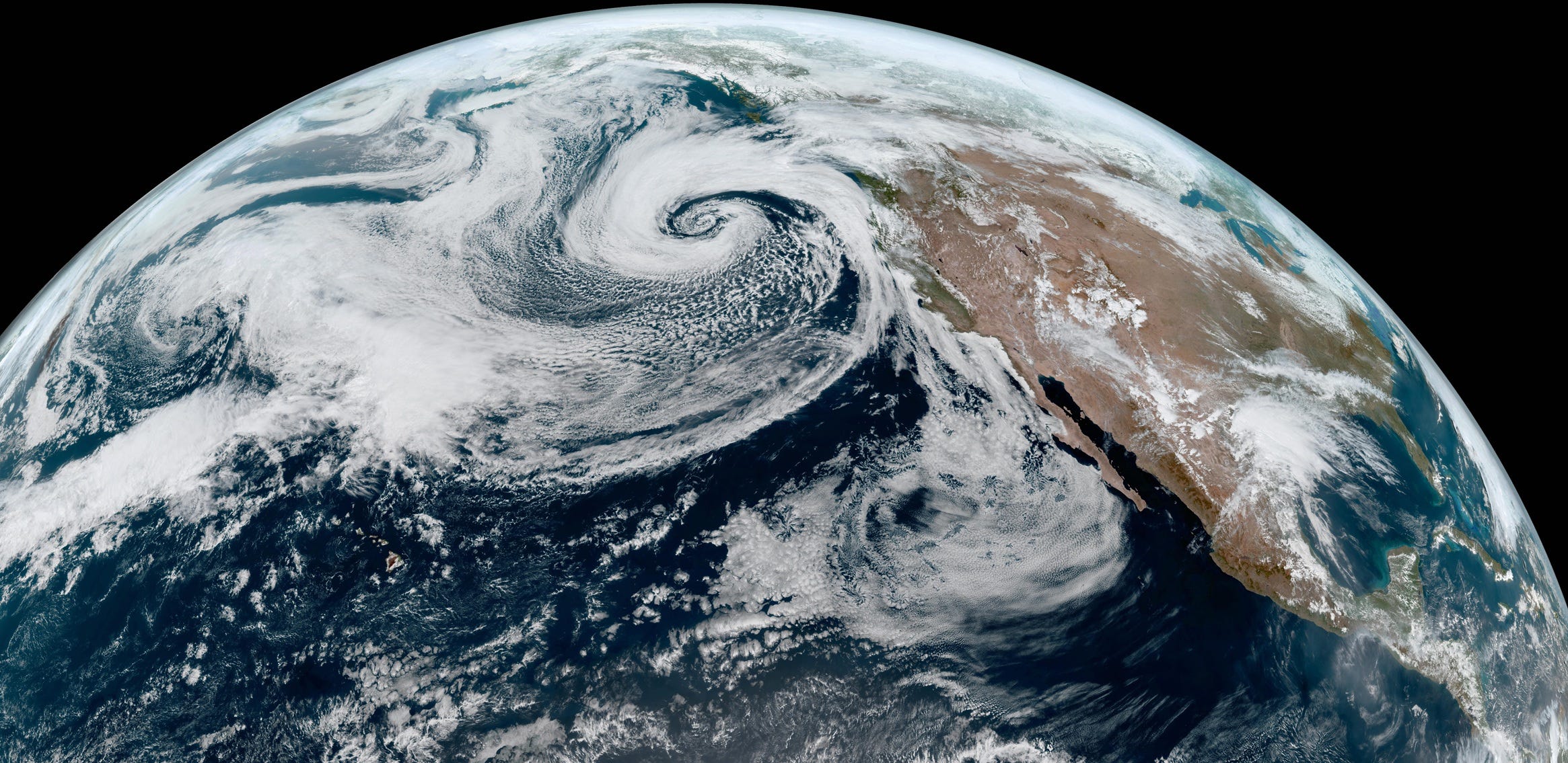
Powerful 976 mb cyclone sprawling off the Oregon/Washington coast tracking eastward over the next 24-hours. The storm is mature and in a “warm seclusion” state so it is done intensifying. However, the impacts including severe weather are spreading out ahead of the storm into the coast, which is very warm. The added moisture will supply plenty of fuel (CAPE) for severe thunderstorms.
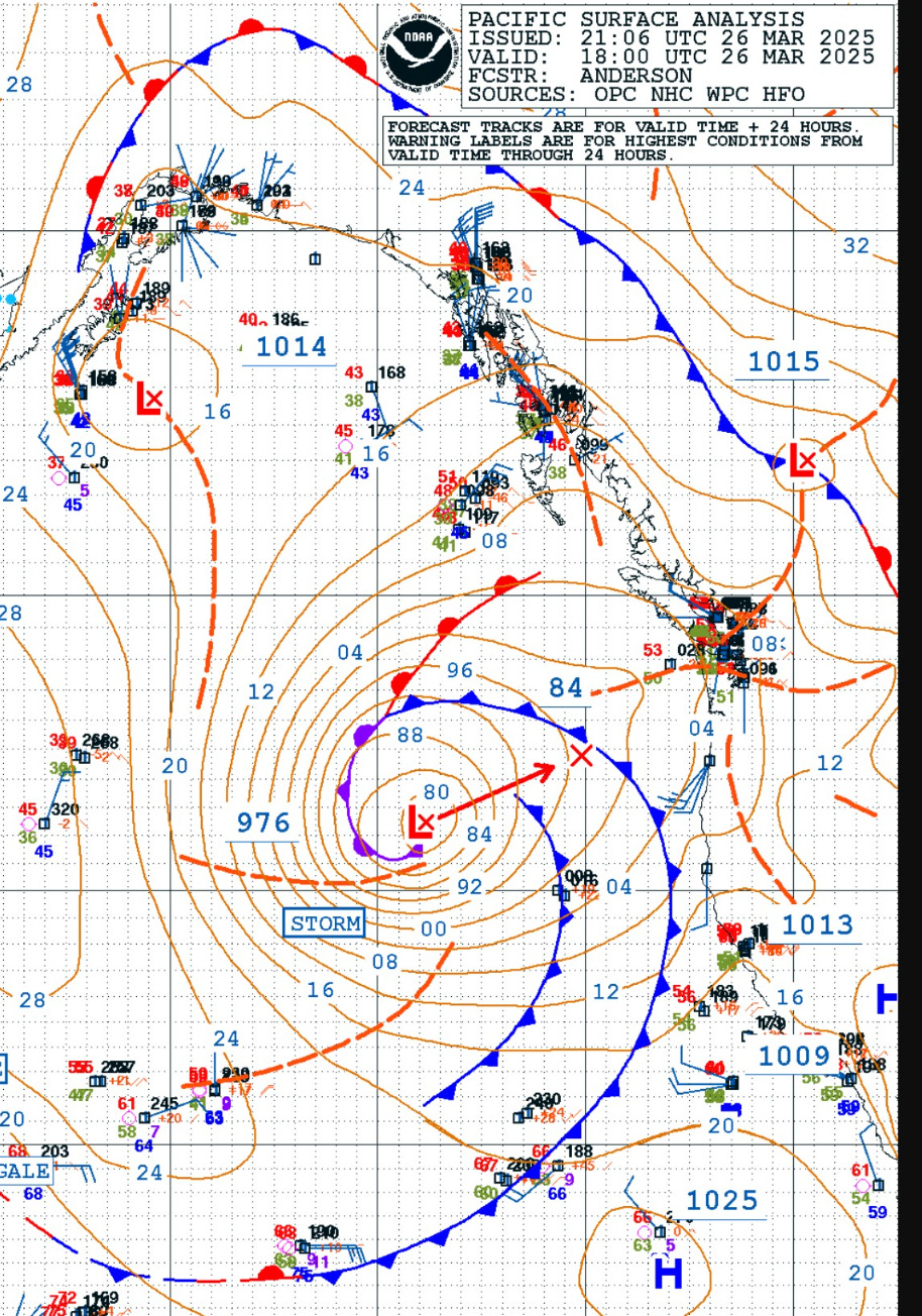
00Z Thursday Upper-Level and Surface


The storm is within / stacked under an upper-level trough that is particularly deep for early Spring with connections to the polar vortex leftovers from Gulf of Alaska.
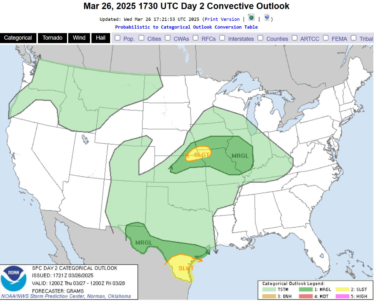
Slight Risk of Severe Thunderstorms
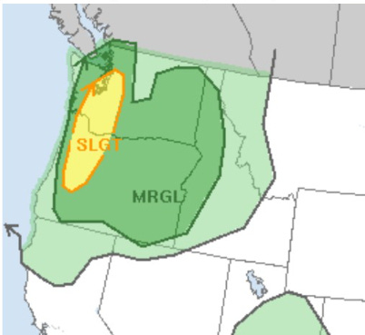
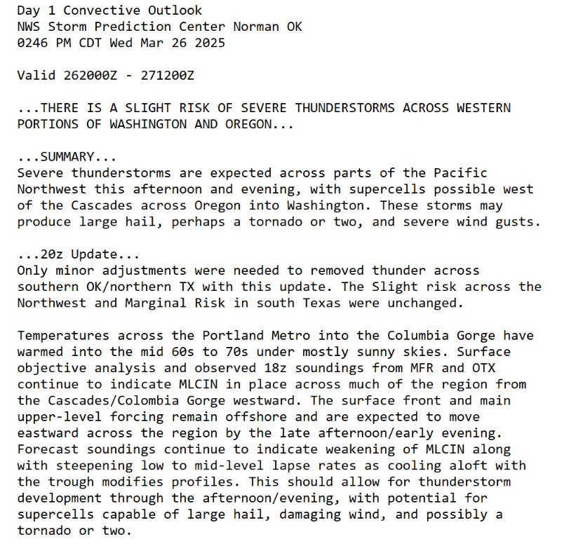
Could be a tornado or two + very large hail and severe wind gusts
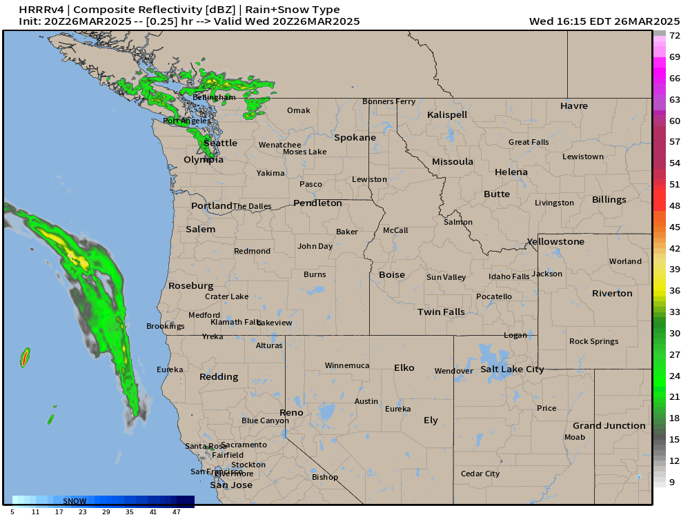
Supercells could develop in the next few hours and head north from Portland to Seattle.
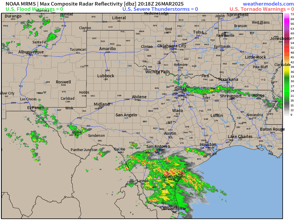
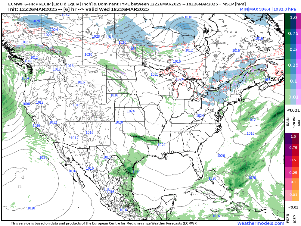
South Texas Storm System
Precipitation Next 18-hours | HRRR
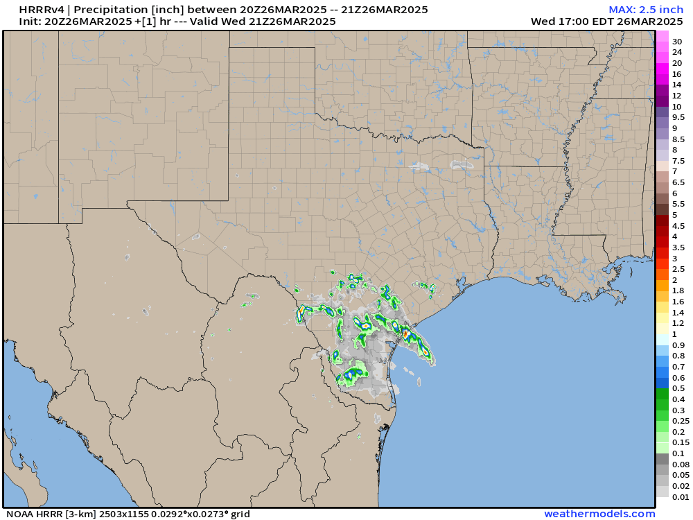
Model cycles show 10-12” of rain in 18-hours where slow moving cells dump tremendous amounts — very rare — almost like a landfalling tropical storm you’d see in July or August!
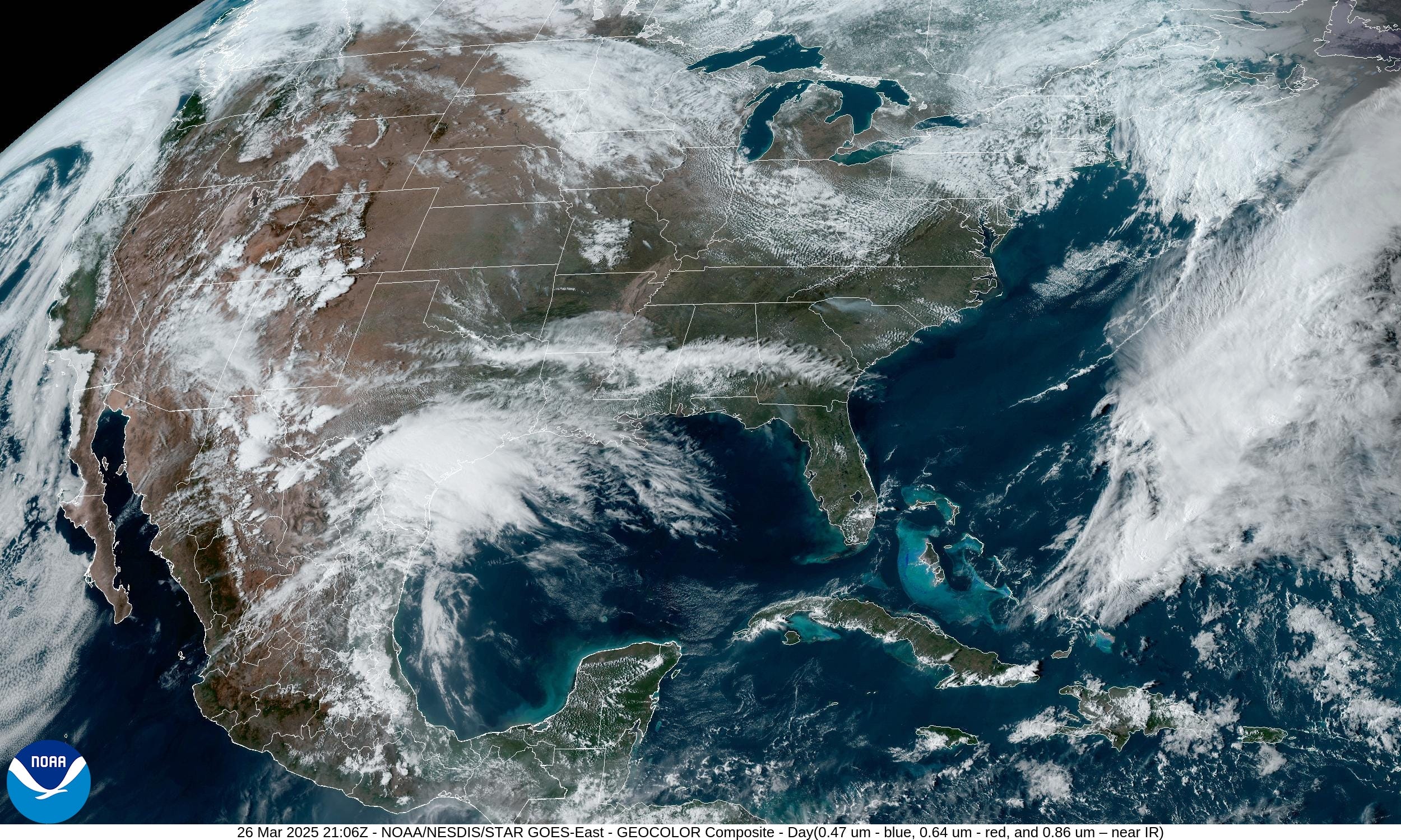
The satellite imagery looks like a large tropical depression or storm — it’s not, but the impacts will be significant in terms of flooding.
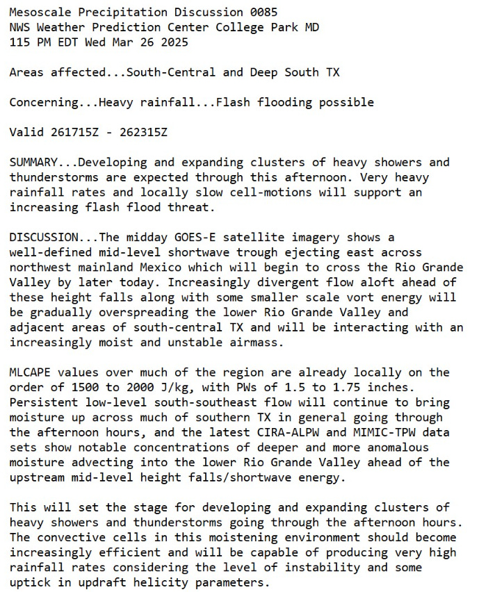
Mesoscale Discussion
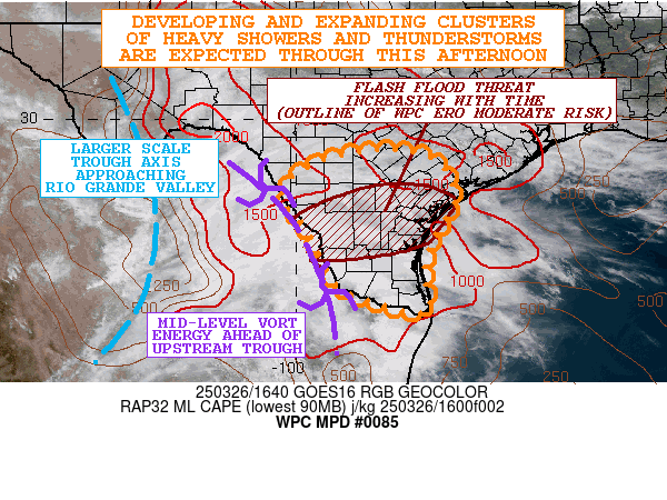
Highly divergent flow aloft + trough + moisture and heat = very heavy rain rates.
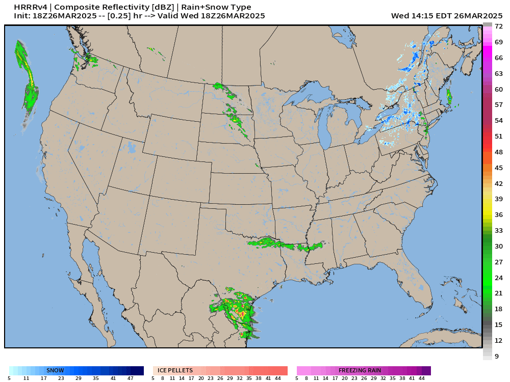
Current Radar through 4:38 PM CT
Weather into Thursday Morning | Fronts this evening
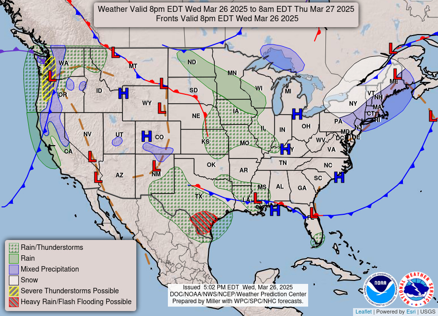
Two areas of significant impacts: Washington/Oregon + Texas
Radar Next 48-Hours | HRRR into early Friday afternoon
Rain continues into Friday across Texas!
Thunderstorms will fire across the central Plains and head into IL/IN through the afternoon on Thursday.
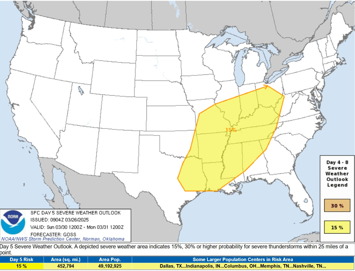
Storm Systems + Precipitation Type Next 7-Days
Storm 1: Severe weather [15% chance Day 5] along/east of the Mississippi River valley on Sunday with a storm system that forms in the Plains and tracks into the Great Lakes and Northeast.
Storm 2: Another powerful system centered over Iowa next Tues/Wed
Keep reading with a 7-day free trial
Subscribe to Weather Trader to keep reading this post and get 7 days of free access to the full post archives.