


March 25, 2025 Tuesday Weather Update
Comfortable and quiet weather across Lower 48 this afternoon

Good Afternoon!
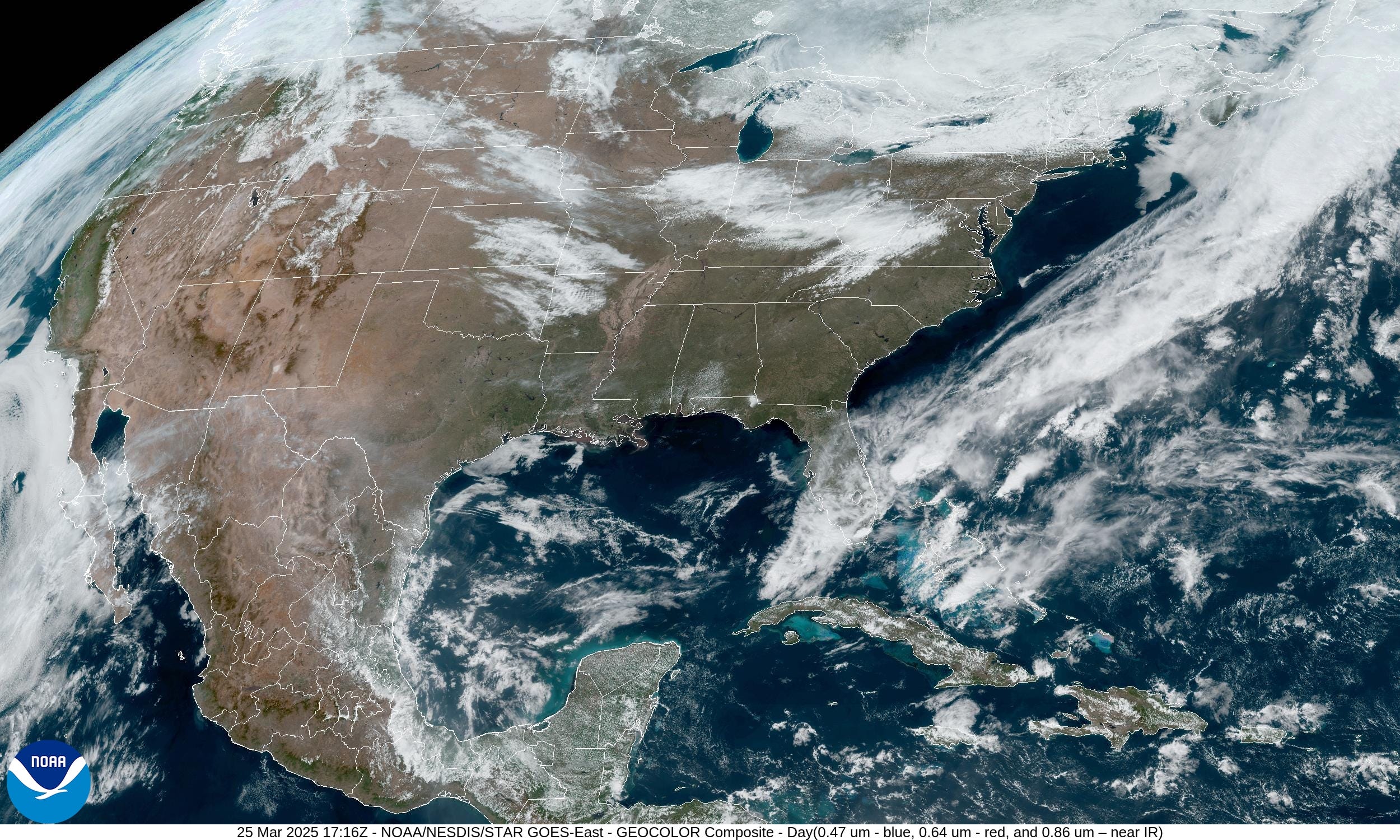
Most of the Lower 48 is enjoying beautiful weather on Tuesday with warm temperatures and sunny skies — a sure sign of Spring in the air.
High Temperatures over the next 9-days — through Thursday April 3rd:
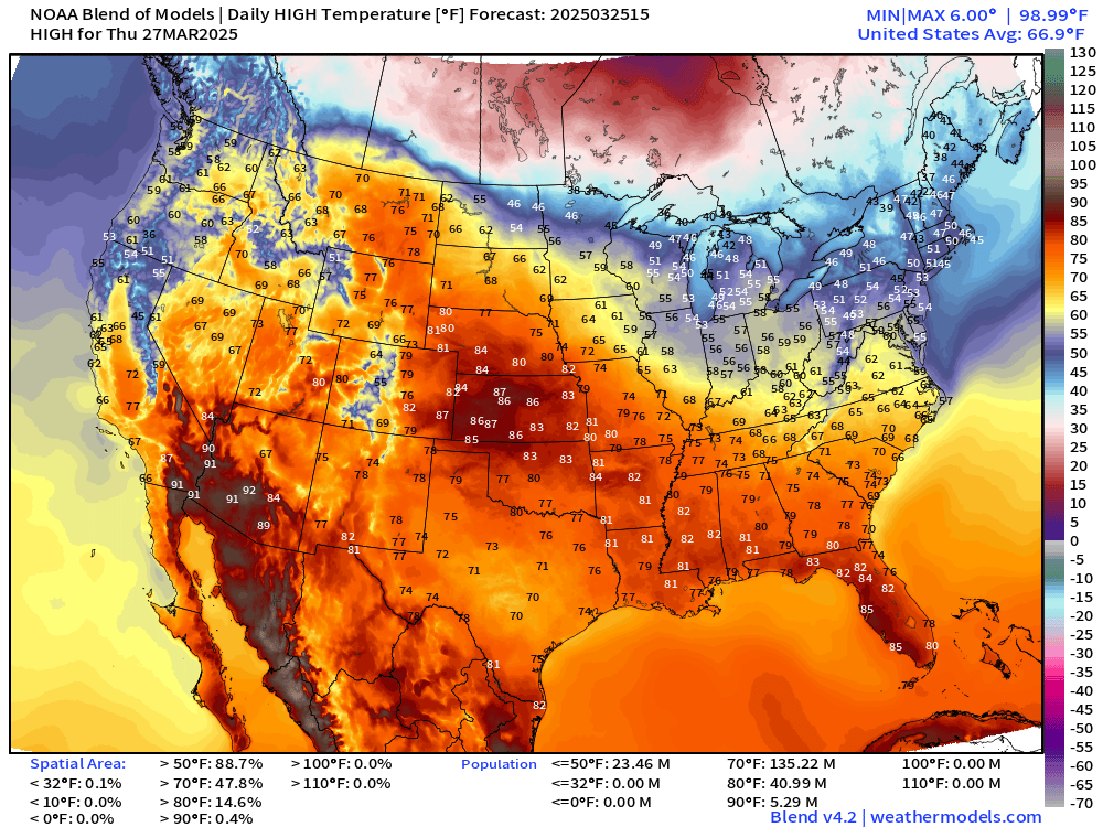
Our next storm system drags down some colder Canadian air for the weekend, but then we see a warm up into next week.
Overall the temperature anomalies are highly positive for the next few days with only a brief interlude of below normal across the Midwest and Great Lakes.
Today’s Weather:
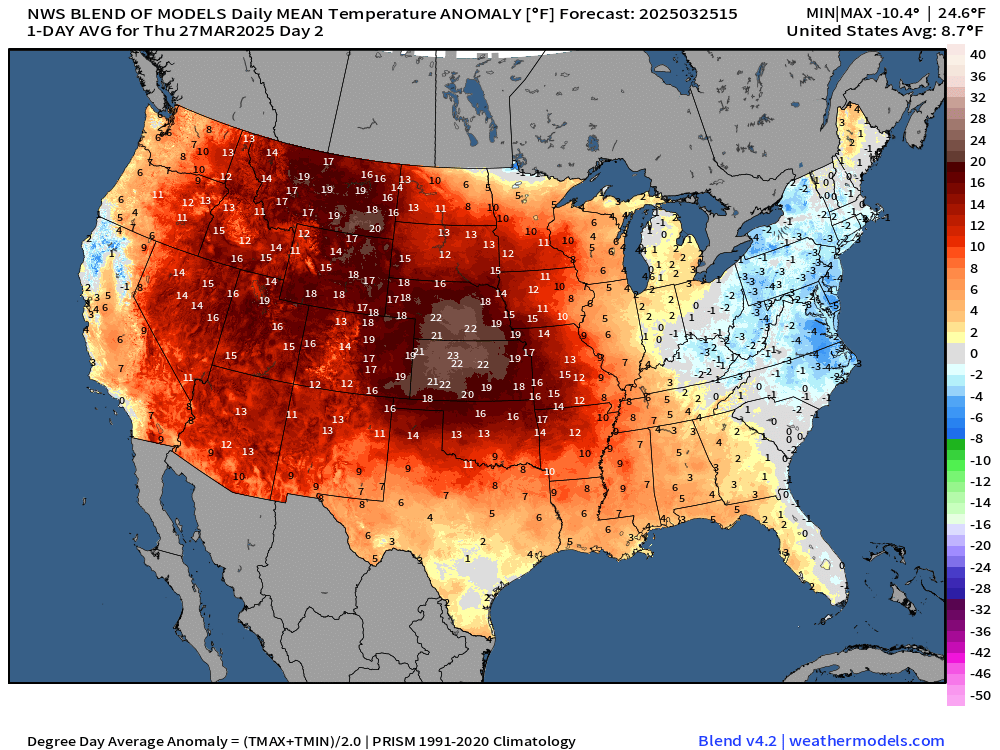
Temperature Analysis and Anomaly | 1:00 PM ET


Temperatures are +7.6°F above normal for the Lower 48 with only “cool” spots in the Great Lakes with Michigan still suffering winter only in the 20s and 30s.
More than 100 million population at/above 70°F
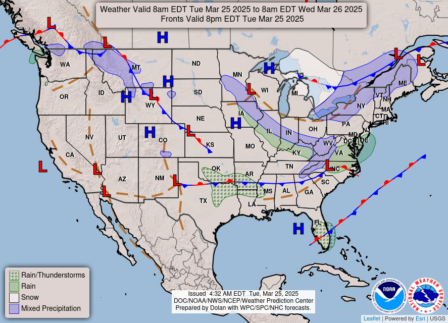
Frontal Boundaries this Evening
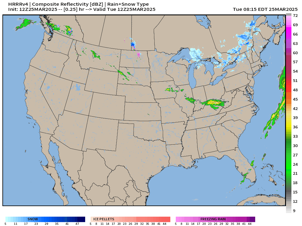
Radar Next 48-Hours | HRRR into Thursday morning
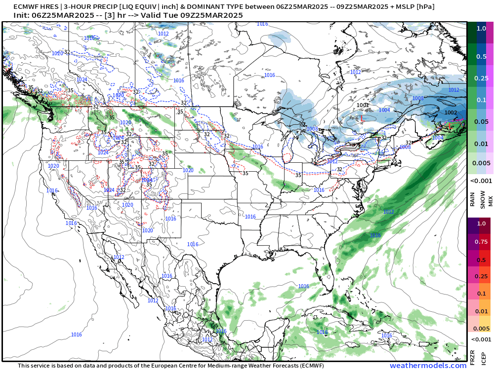
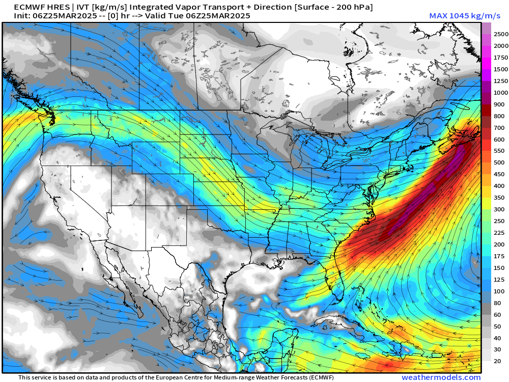
Considerable rain comes across northern Mexico into south Texas into early Thursday for some enormous rainfall totals. Very odd for this time of year!
Snowfall through Tuesday Morning

Still scattered light snow showers in the cold air across the Great Lakes and Northeast, but limited accumulations.
Storm Systems + Precipitation Type Next 6-Days
The moisture into south Texas is pulled out of the Gulf of America, and then that blog moves into the central U.S. ahead of our next storm system that may focus severe weather mainly on Sunday.
SPC is watching Sunday for the highest chance (15%) of severe weather way out on the Day 6 Convective outlook. This is the map for March 30th.
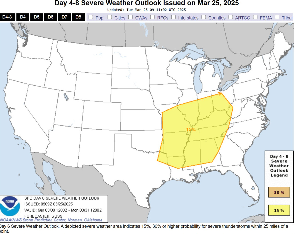
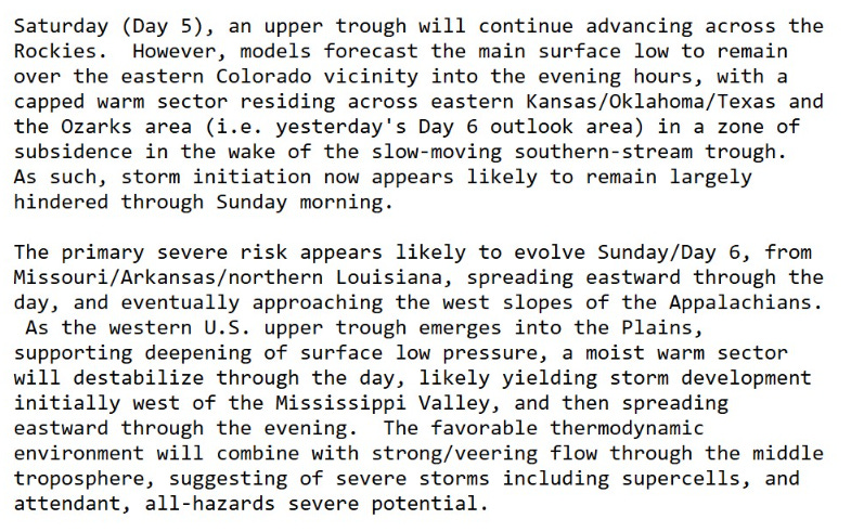
Plenty of moisture and warmth to combine ahead of an upper-level trough pushing through the Plains on Sunday …
Keep reading with a 7-day free trial
Subscribe to Weather Trader to keep reading this post and get 7 days of free access to the full post archives.