


March 24, 2025 Monday Weather Update
Transition to Spring well underway

Good Morning!
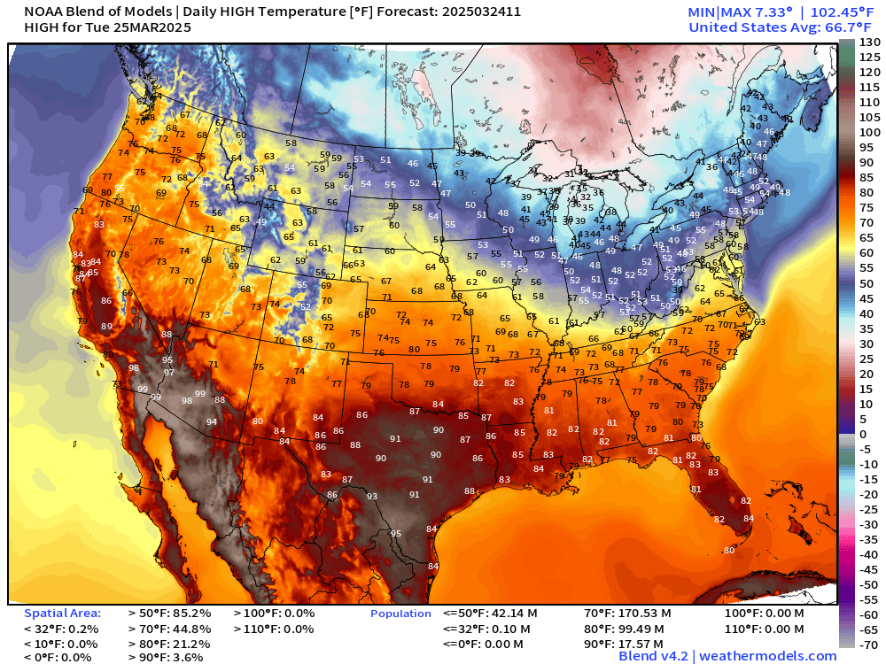
Warmth out west with a strong ridge will eventually push east into this weekend until the next storm system drags yet more colder Canadian air into the Midwest, Great Lakes, and Northeast for the beginning of April. Slowly but surely, we’re warming up across the Lower 48 with nationwide averaged high temperatures in the mid-60s, but plenty of 80s by area and population into the weekend.
Precipitable Water Next 6-days
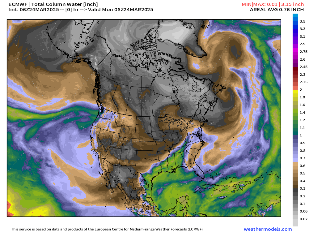
For severe weather in the Plains and up the Mississippi River valley, we look for moisture out of the Gulf of America surging northward. Into this weekend, return flow (green and yellow) finally punches into the dry continental air mass (gray colors) combining with late March warmth to fire convection and thunderstorms. We just need an area of low pressure — and we’ll get a storm forming in the lee of the Rockies by Saturday. Thus, potential severe weather outbreak Sat/Sun in the center of the Lower 48.
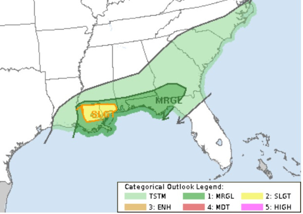
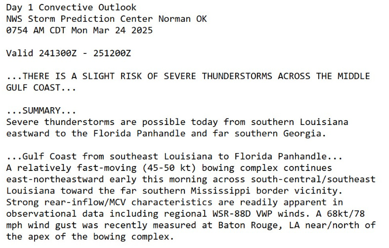
Today’s Weather

Storm system in the Great Lakes and Northeast with a trailing cold front. At the tail end in Louisiana, slight chance of severe weather with mainly gusty winds as the primary threat.
Radar Valid through 8:30 AM CT
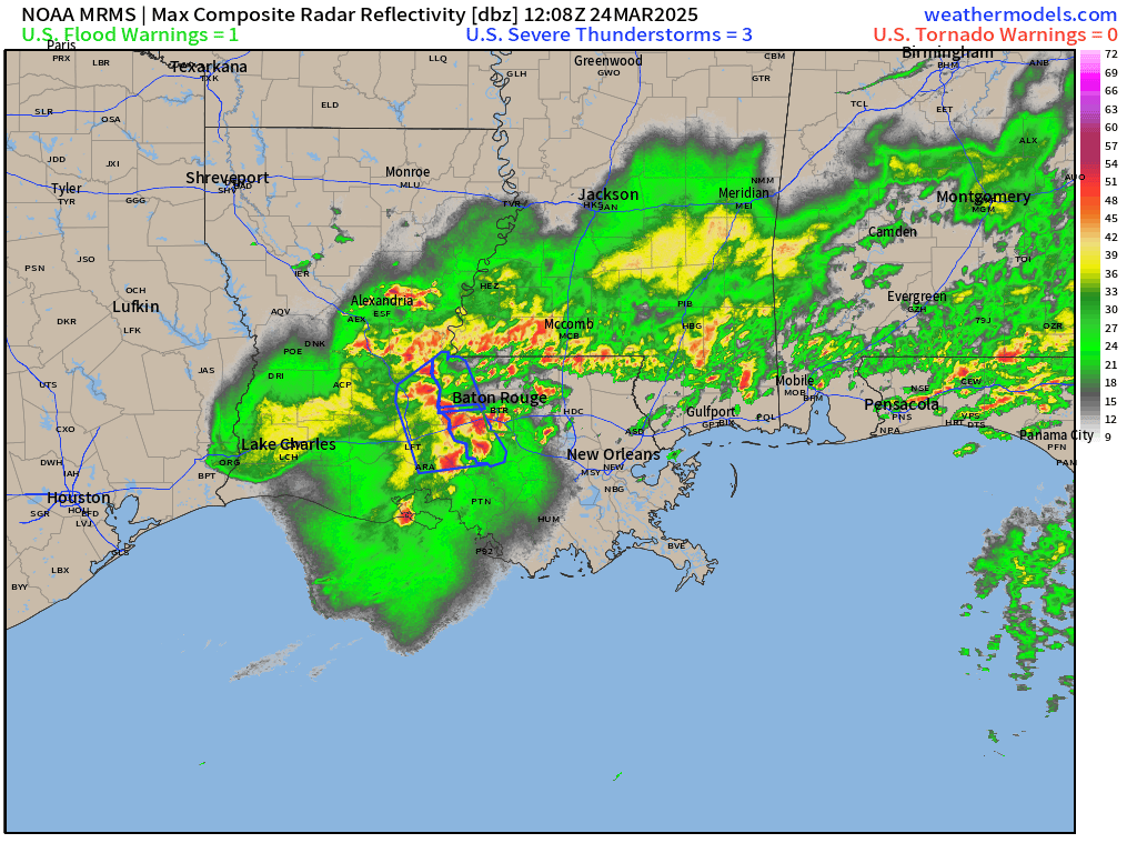
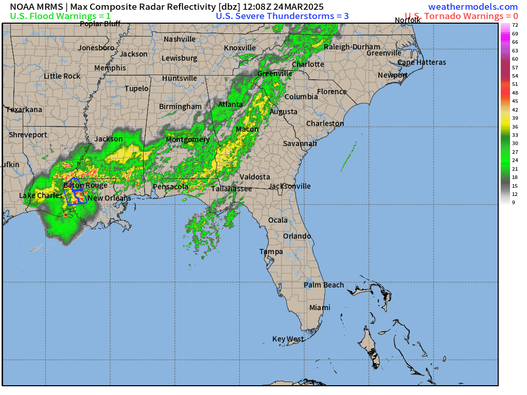
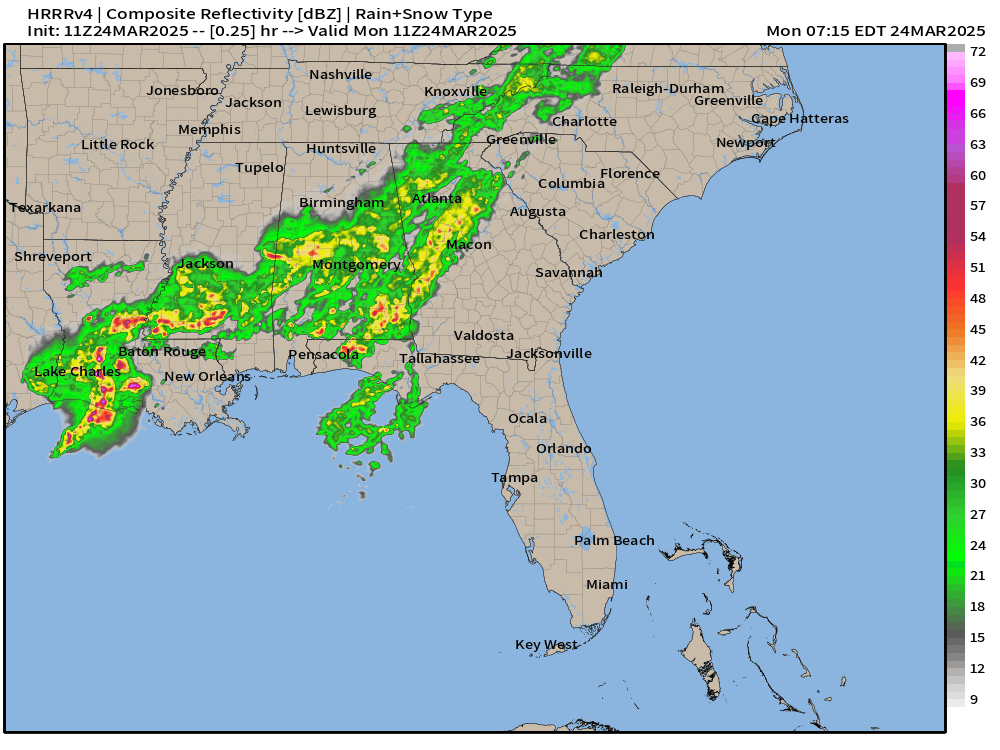
Travel along Interstate 10 from Louisiana into MS/AL and later in the Florida panhandle might be adventurous with this fast moving thunderstorm complex.
Soaking rains across South Georgia —> Welcome news to agriculture.
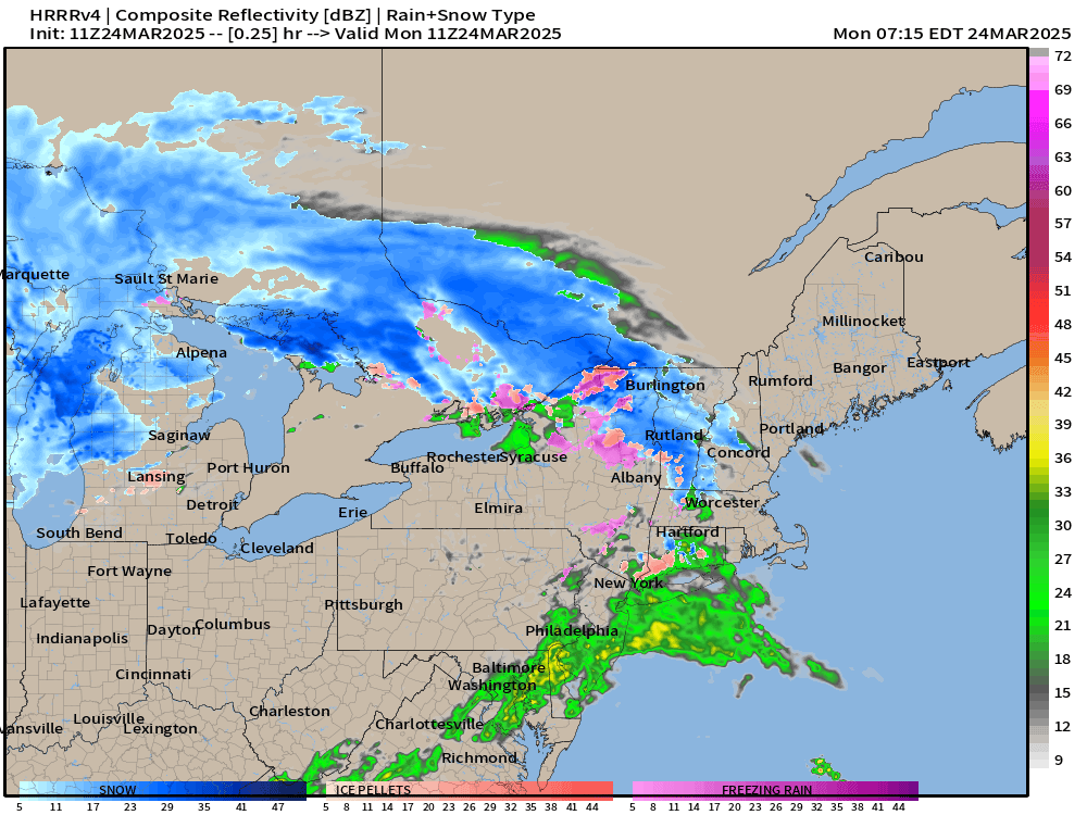
Radar Next 18-Hours | HRRR
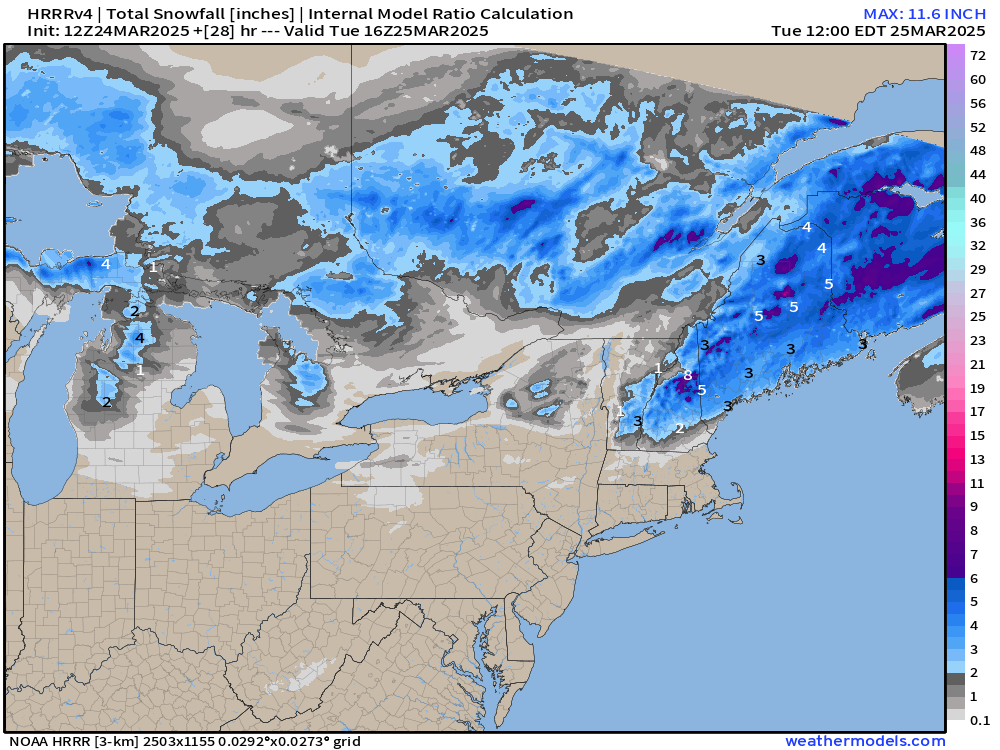
Snowfall through Tuesday Morning
Temperature Analysis 8:30 AM ET

Only 22.6 million below freezing, seasonable for March 24.
Temperature Anomaly Analysis | 8:30 AM ET

Overall the Lower 48 is +3.0°F above normal with the warmest compared to climatology over Montana, where there is large variability in early Spring.
Storm Systems + Precipitation Type Next 6-Days
Keep reading with a 7-day free trial
Subscribe to Weather Trader to keep reading this post and get 7 days of free access to the full post archives.