


March 18, 2025 Tuesday Weather Update
Ridge builds across Western US

Good Evening!
Warm day across the eastern half of the Lower 48 with brilliant late winter sunshine. The area of low pressure that was briefly watched for subtropical development yesterday by NHC has merged with a frontal boundary into an extratropical cyclone.
In the Gulf of America, the SpaceX Dragon capsule splashed down along the Florida Big Bend coastline south of Tallahassee into lower-60s °F waters greeted by dolphins.
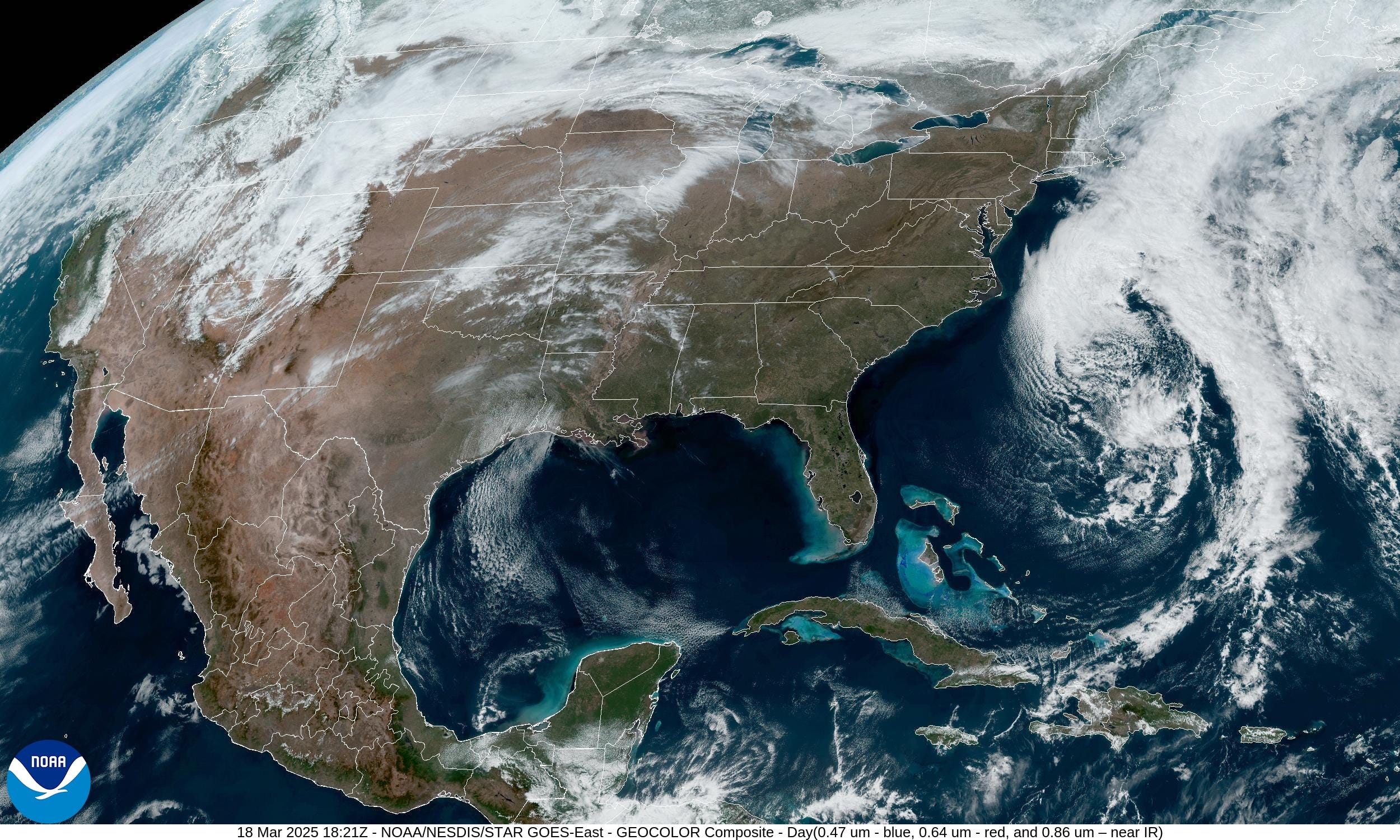

Fronts this Evening at 8 PM

Our next storm system is taking shape in the Lee of the Rockies east of Colorado —> Colorado Lee Low with more moisture on the backside from the Pacific setting the stage for a decent late-winter snow storm across many states.
Storm Systems + Precipitation Type Next 8-Days
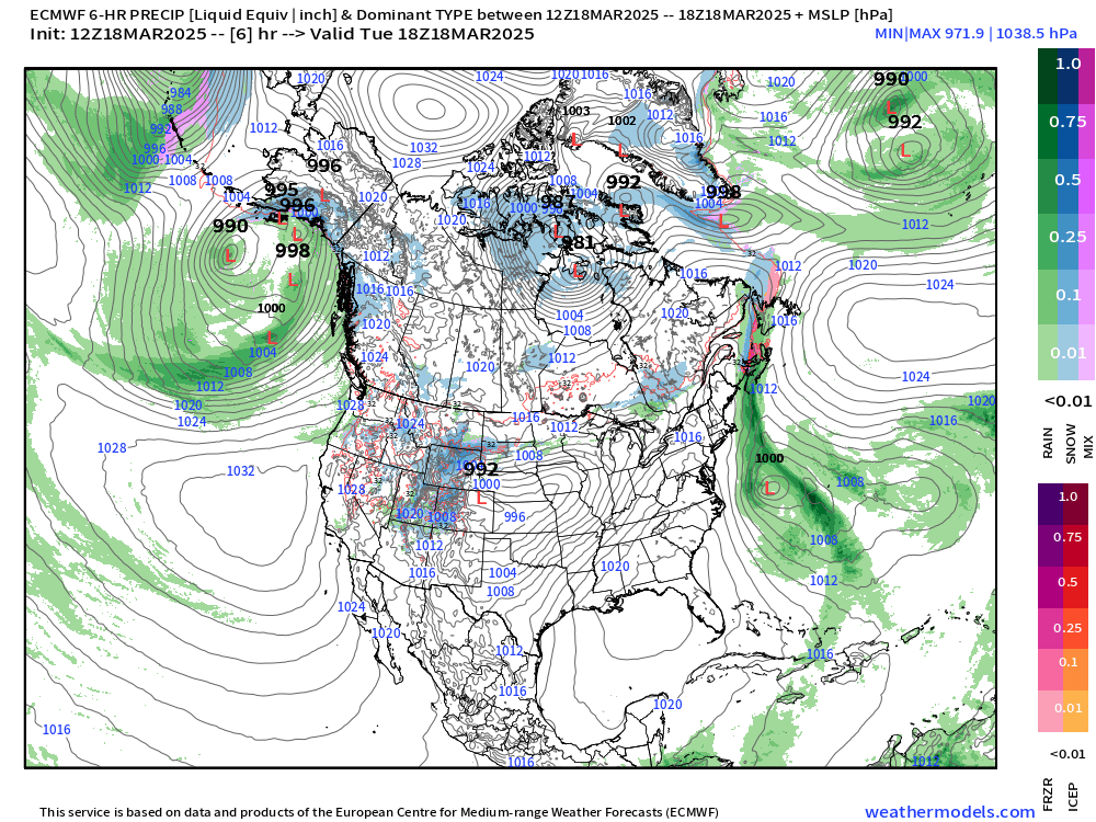
Another storm system in the Great Lakes would be on the horizon next week, otherwise a nice quiet period ahead due to a blocking ridge forming across the Western U.S. to slow down this progressive pattern we’ve been in for a few weeks.
HRRR 18z | into early Thursday Afternoon
Keep reading with a 7-day free trial
Subscribe to Weather Trader to keep reading this post and get 7 days of free access to the full post archives.