


March 15, 2025 Saturday High Risk Severe Outlook
Significant tornado outbreak likely across South

Good Morning! Another very rough weather day ahead with likely tornado outbreak across the South from Alabama to Georgia.
SPC’s convective outlook for Day 1 (into Sunday morning) shows a high risk from Jackson, Mississippi to Birmingham, Alabama.
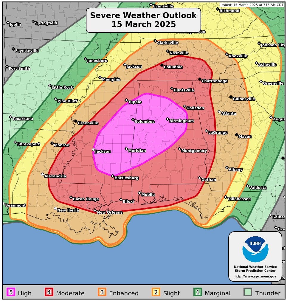
Total population under High Risk: 3.36 Million + Another 10.5 million under moderate risk.

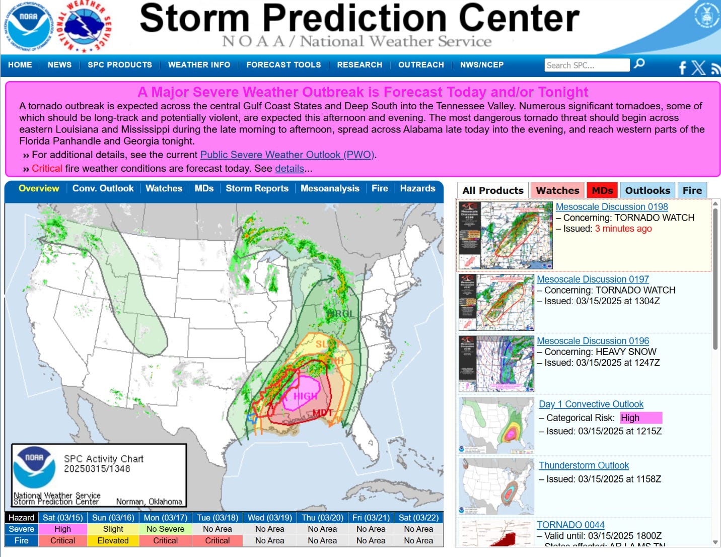
The home page for SPC has the banner headline at the maximum High Risk fuchsia color.
GeoColor Satellite Image: 10 AM ET
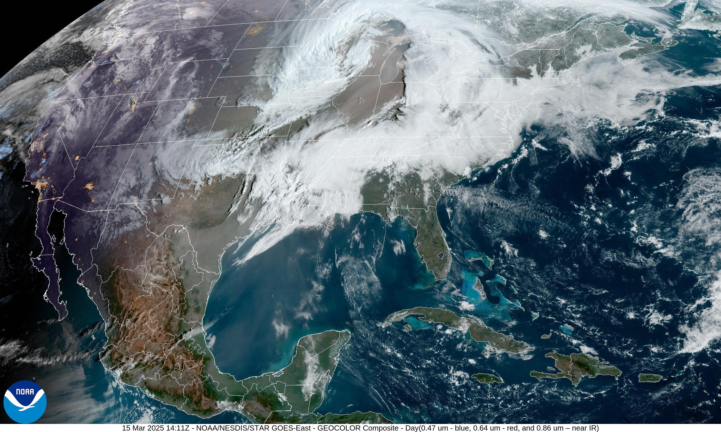
The main area of low pressure is over Minnesota and Wisconsin in the 979 mb to 981 mb range. A secondary area of low pressure along the frontal boundary in the Deep South is focusing moisture near the surface and low-levels into a developing thunderstorm complex. Morning severe weather warnings extend from central Louisiana into western Tennessee.
You can see the dust cloud from the Plains extreme winds wrapped into the low pressure center over Chicago.
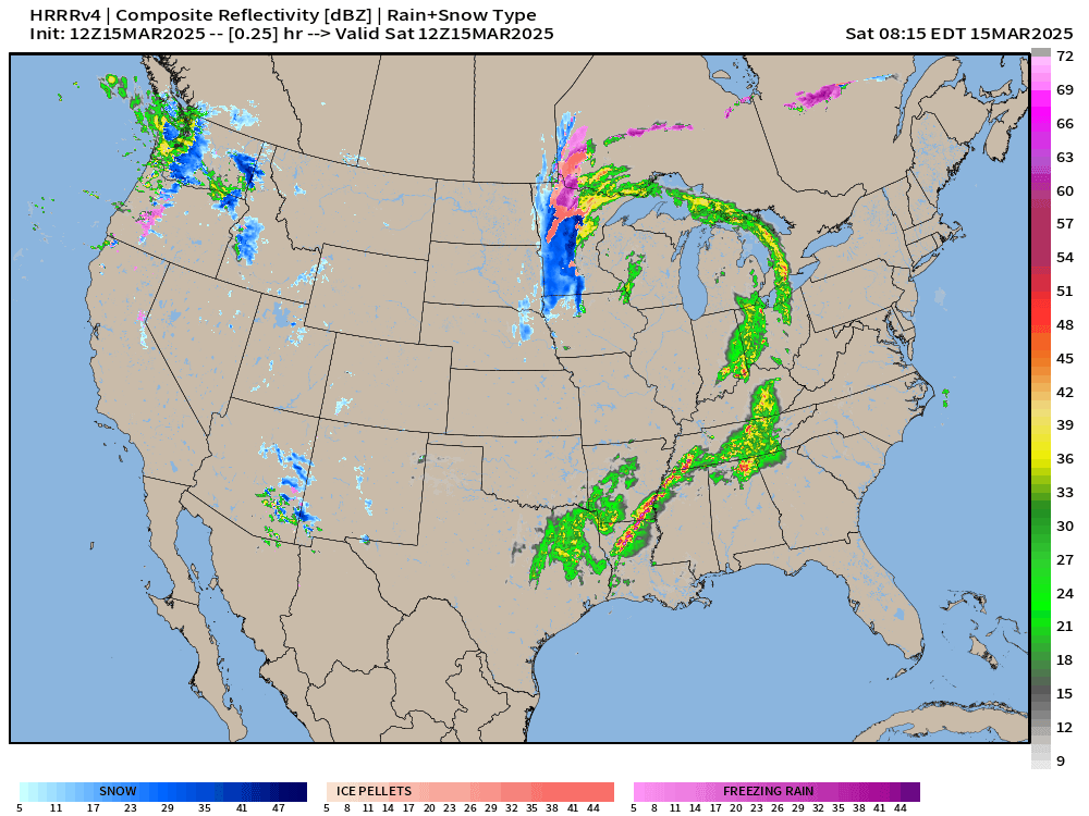
Radar 10:24 AM ET
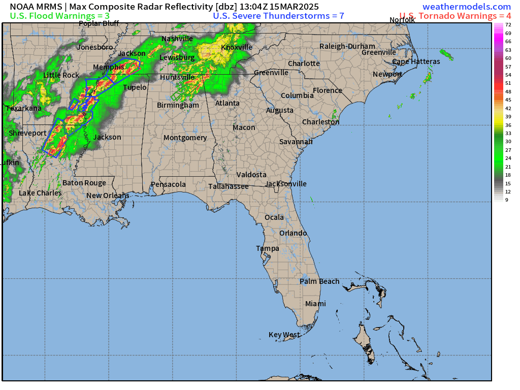
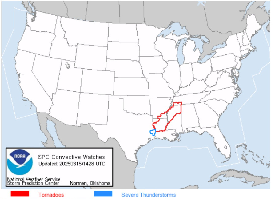
Current watches at 10:30 AM ET
Next 48-hours from HRRR | Overview
You can see the spin/circulation with the secondary area of low pressure into the Tennessee River Valley later on Sunday. Thunderstorms continue tomorrow along the entire East Coast, but less severe risks.
Synoptic Setup


A broad trough with embedded minima in height covers the entire western half of the Lower 48. The main parent cyclone is co-located with a mid-level trough and maintains a 979 mb central pressure.
At the base of the broader [cold-core] trough centered over north Texas, an intense mid-level (500 mb) jet stream over 100-knots will aid in the development of thunderstorms and provide significant wind and shear for potential of rotating supercells embedded with Quasi Linear Convective System (QLCS) in the Deep South from Louisiana to Georgia.
Precipitation Type Next 6-Days

The next storm system arrives out of the Western U.S. by Tuesday a Rocky Mountain Lee Cyclone development (+96 hours). The main impacts look like SNOW on the backside of the low in the upper-980s to lower-990s mb central pressure. The tail end of the frontal boundary may have some risk of severe weather, but does not look as ominous as what we’re facing today.
Keep reading with a 7-day free trial
Subscribe to Weather Trader to keep reading this post and get 7 days of free access to the full post archives.