


March 13, 2025 Thursday Weather Update
Two day severe weather outbreak from Midwest into Southeast

Good evening!
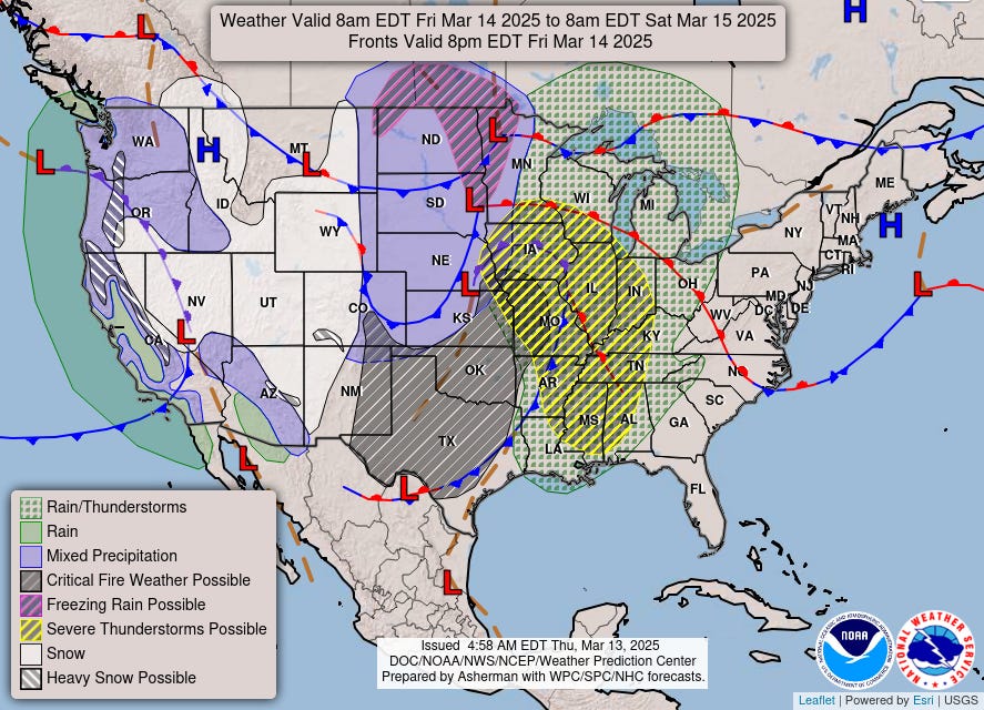
Powerful Central Plains storm system will be highly impactful with high winds across a huge area even outside of severe thunderstorms.
Two areas of potentially widespread severe weather for Friday and Saturday ahead of strong mid-level wind maxima or jet streak (at 500 mb) providing spin for tornadoes. The cold-core low will promote downward momentum transport and downburst winds plus large hail. This late winter storm system has the potential for widespread damage.
Frontal Positions Friday Evening
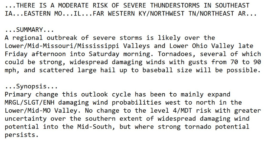
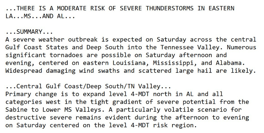
Moderate Risk of Severe Weather centered over St. Louis and Peoria
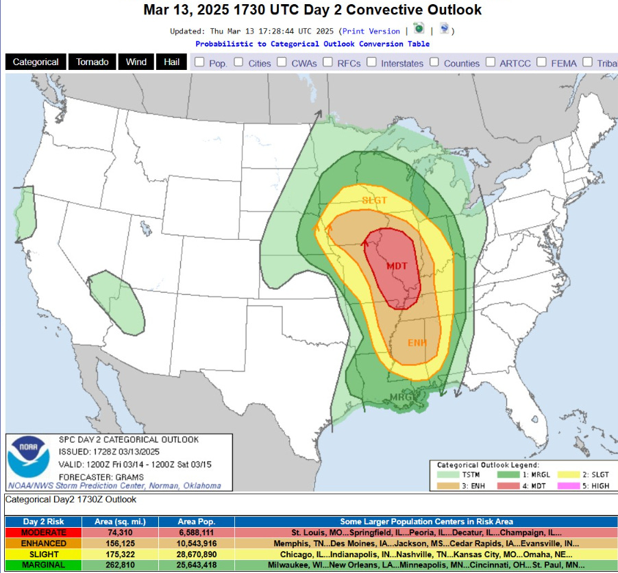
SPC highlights 70-90 mph wind gusts, baseball size hail, and potential for strong tornadoes
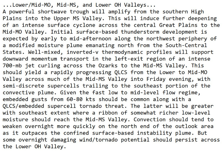
SPC discussion on the synoptic setup: rapidly progressing QLCS with embedded semi-discrete supercells.
From the simulated water vapor imagery, we can see the curling of the low-pressure center across Kansas into Minnesota into Friday evening. Initial convection blows up in Missouri and quickly radiates to the ENE away from the low’s center.

HRRR 18z | Late Friday into Saturday morning
Simulated radar shows the squall line formation and rapid movement east with weakening into the early Saturday morning hours across Michigan and the Ohio River Valley.

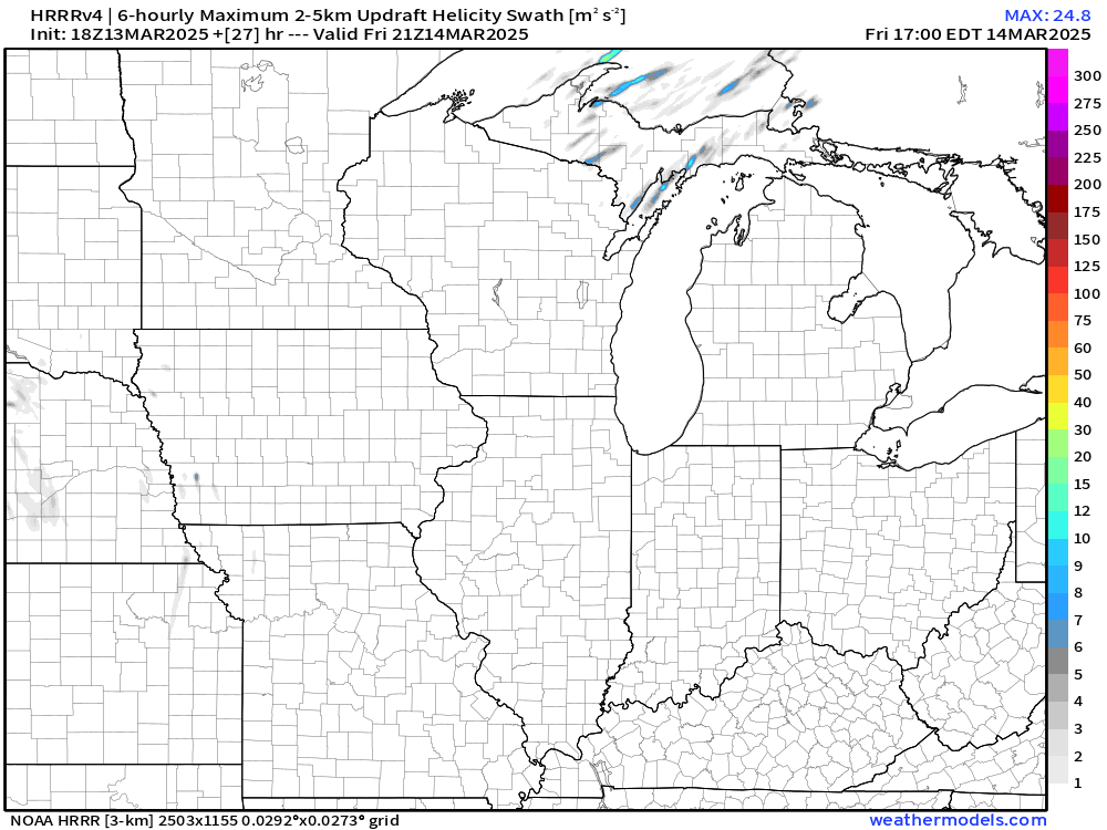
Helicity Swath Maximum over 6-hours
Significant rotation potential for any embedded supercells that will then track within the QLCS (Quasi-Linear Convective System)
Saturday (Day 3) Convective Outlook
Focus shifts to the Gulf coast from Louisiana into Mississippi and Alabama for a Moderate Risk of Severe Thunderstorms.
Numerous significant tornadoes, widespread damaging wind swaths and scattered large hail
Particularly volatile scenario for destructive severe remains evident in the afternoon and evening on Saturday
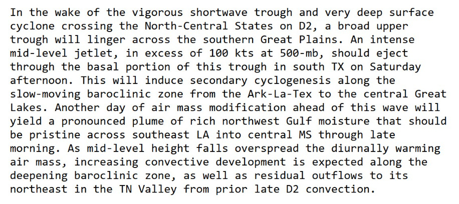
“Slow moving baroclinic zone” with secondary cyclogenesis with rich Gulf of Mexico moisture plume
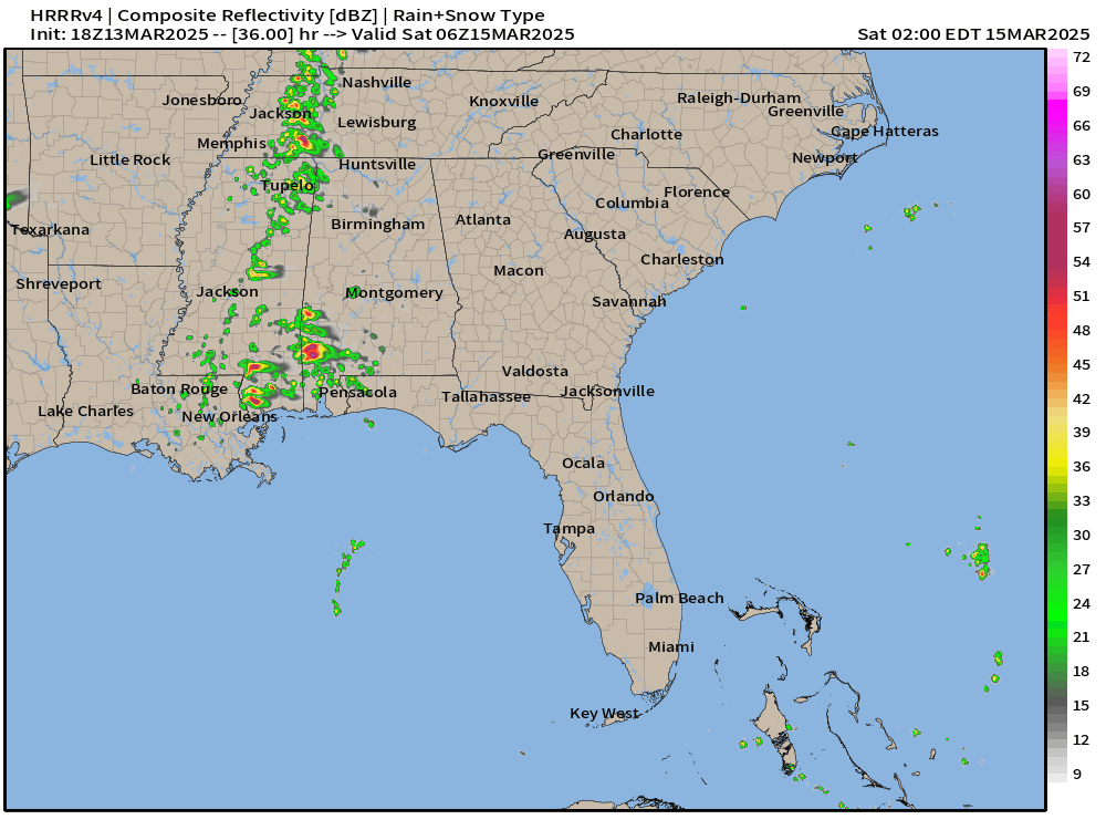
HRRR Simulated Radar extends through early Saturday afternoon, so we’ll have a major severe weather outbreak underway by the middle of the day.
Significant swaths of helicity favorable for strong, long-track tornadoes

Significant Tornado Parameter indicates high values within and around the supercells modeled by HRRR.

I will update HRRR for 12z in a post Friday morning to provide the play-by-play for the south’s severe weather outbreak.
Keep reading with a 7-day free trial
Subscribe to Weather Trader to keep reading this post and get 7 days of free access to the full post archives.