Good evening!
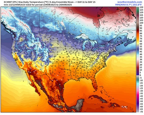
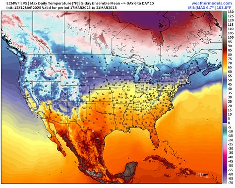
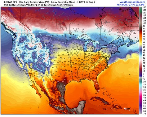
Much warmer weather overall east of the Rockies — ahead for the next 2-weeks — of course, as we head into Spring. However, we will need to watch for some Canadian troughs that could bring surprise snowfall to the Great Lakes.


GFS 18z Dynamic Tropopause Next 10-days
Quick look ahead for the next 10-days to show the parade of high amplitude troughs in a progressive pattern from the North Pacific across the Lower 48 into the Atlantic.
Interesting to see the “polar vortex” white fuzzball still within striking distance of the Lower 48 up around Hudson Bay. This is a new PV anomaly replacing the current one that moves and dissipates over Greenland. This represents still harsh winter weather for Canada.
Central U.S. Storm System | Precipitation Type Next 6-days
By Friday, the central pressure drops in the low-970s across Nebraska with a very tightly wound mature cyclone, and maintains that pressure into Minnesota on Saturday. ECMWF 18z does not have much of a secondary surface low in the Southeast any longer. That may limit the severe weather potential for folks in the South.
Keep reading with a 7-day free trial
Subscribe to Weather Trader to keep reading this post and get 7 days of free access to the full post archives.


