


March 11, 2025 Tuesday Weather Update
Severe weather outbreak coming Friday into Weekend

Good evening!
Another very quiet weather day across much of the Lower 48 with widespread Spring-like warmth with sunshine. No complaints here in Atlanta even though it was very chilly — only 32°F at my house away from the urban heat island.
GFS 18z Dynamic Tropopause Next 10-days
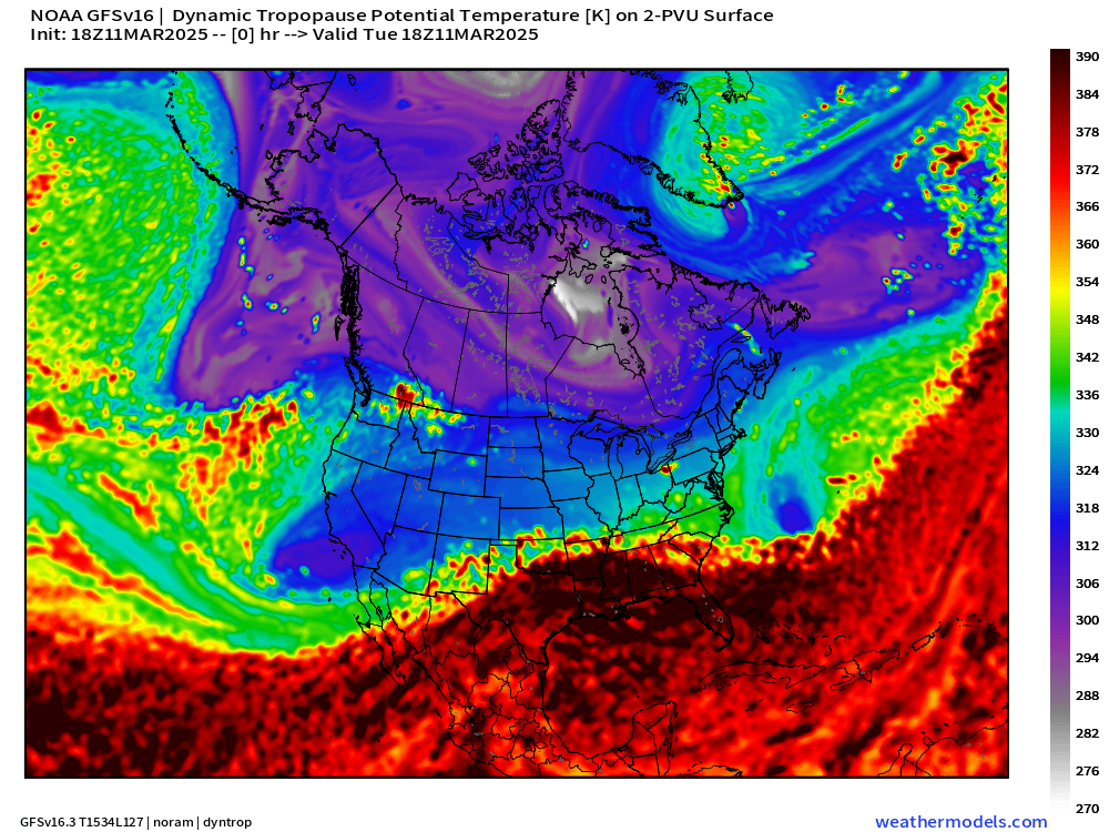
Quick look ahead for the next 10-days to show the parade of high amplitude troughs in a progressive pattern from the North Pacific across the Lower 48 into the Atlantic. A general retreat of the polar front east of the Rockies is welcome news for onset of Spring.
This Evening Satellite Imagery
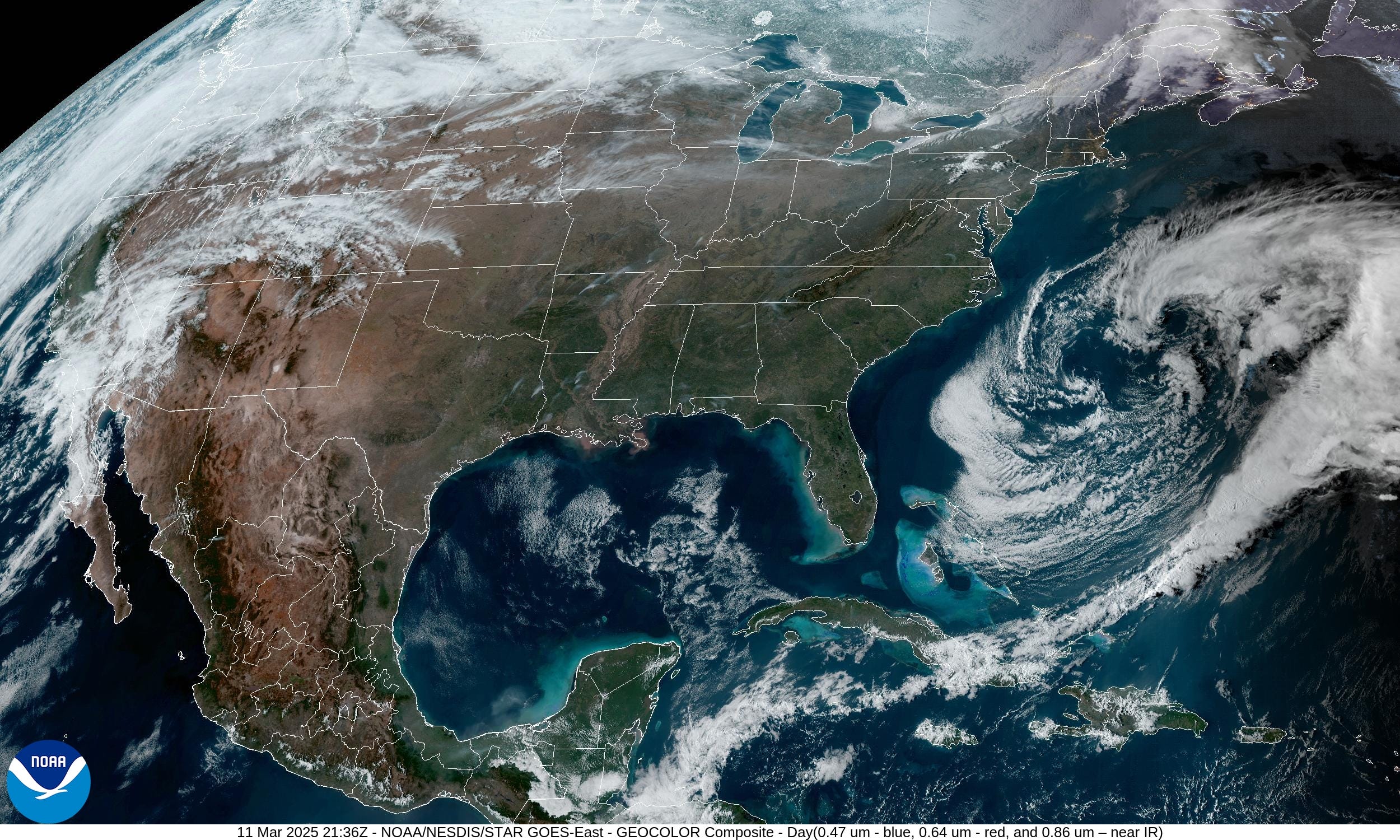
5:36 PM EDT imagery — only active weather is across California and the Pacific Northwest. Picture perfect weather from Texas to Florida into Michigan and New England.
Heading into Spring | Highs Next 9-days

The Canadian cold pool still exists and it tries repeatedly to crash into the Lower 48 through the Midwest and Great Lakes. However, it can only battled back the subtropical warmth for 1-2 days, and then the next weather system or ridge/trough is on the way.
Central U.S. Storm System
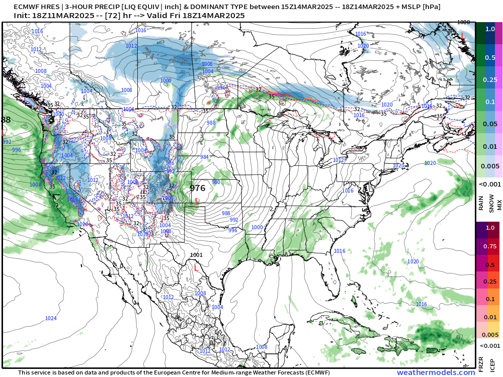
By Friday, the central pressure drops in the low-970s across Nebraska with a very tightly wound mature cyclone. However, there isn’t much moisture available for the system at this juncture. It’s more of a cold-core cut-off low that crosses the Rockies and drops pressure adiabatically (PV conservation). Really not expecting much to happen with the storm until the Gulf of Mexico moisture stream can be tapped, and the low tracks into the Great Lakes to capture Pacific origin moisture. At the same time, kinematics/dynamics come into play across Texas into the Southeast with a strong 500-mb jet streak.
Friday ECMWF 18z | 75-hours


The Friday afternoon satellite imagery across the central U.S. will be amazing with a serpentine or coiled low-pressure system maturing and moving NE into the Great Lakes — stacked with the mid-level trough.
Saturday ECMWF 18z | 99-Hours


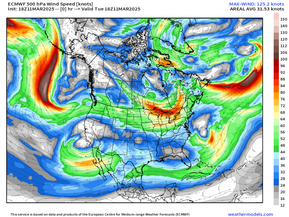
The 500 mb trough intensifies again but is much larger by Saturday. A major jet streak arrives out of the Southwest into Texas and then Southeast into Ohio Valley into Saturday. Major problems with this level of upper-level wind speed and potential shear.
SPC is watching areas east of the Mississippi on Friday and Saturday.


   ...Days 4-6/Fri-Sun - Mid/Lower MS Valley to the Southeast and
   Mid-Atlantic...

   An intense spring storm system will deliver a multi-day severe
   weather episode to portions of the central and eastern U.S.
   beginning Friday and continuing through the weekend. All severe
   thunderstorm hazards are expected, including widespread damaging
   winds, tornadoes (some strong), and large hail.

   On Friday, an anomalously intense upper cyclone is forecast to
   deepen as it tracks northeast across the southern/central Plains to
   the Upper Midwest. An intense jet streak (greater than 100 kt at 500
   mb) will overspread the Ozarks and Mid-MS Valley during the
   afternoon into the overnight hours. Likewise, a low-level jet will
   intensify Friday night to 65+ kt. As intense surface cyclogenesis
   occurs, southerly low-level flow will transport modest moisture as
   far north as eastern IA, southeast MN and southern WI. Deeper
   boundary-layer moisture will remain focused southward from the
   Mid-South toward the Lower MS Valley/central Gulf coast.
   Nevertheless, strongly forced convection within intense deep-layer
   flow will pose a widespread risk for severe (potentially significant
   severe) thunderstorm winds and tornadoes from late afternoon into
   the overnight hours across a large area centered on the Mid/Lower MS
   Valley vicinity.

   On Saturday, the upper cyclone over the Upper Midwest will lift
   northeast into Ontario, but a larger-scale upper trough will remain
   over the Plains. The Plains trough will intensify and spread east
   toward the MS/OH Valleys. This will maintain the eastward
   progression of a strongly forced line of convection from the Ohio
   Valley south/southwest into the Deep South/central Gulf coast
   vicinity through Saturday night. Portions of the Deep South into GA
   may see multiple rounds of severe convection with a mix of both
   supercell and QLCS storm modes potentially moving across the region,
   posing a concern for damaging tornadoes and swaths of severe winds.

   On Sunday, the system will continue to shift east, with a moist
   airmass and strong deep-layer flow continuing to support a line of
   convection producing damaging winds into the Carolinas and
   Mid-Atlantic vicinity.
Keep reading with a 7-day free trial
Subscribe to Weather Trader to keep reading this post and get 7 days of free access to the full post archives.