


March 11, 2024 Warm Eastern US
Denver looking at a significant snowstorm Thursday

Warmth until early next week (March 18-19) then a chance of freeze/frost in the Southeast
Extended period of “Arctic” air descends upon Lower 48 for following week
Another “boatload” of rainfall for Southeast / Gulf Coast states this weekend although totals have come down slightly to the 2-4” range
Western Ridge builds finally after weeks to finally flip the script on cold air for last 10-days of March east of the Rockies
Denver looking at 10-inches of snowfall
High Temperatures Next 8-Days
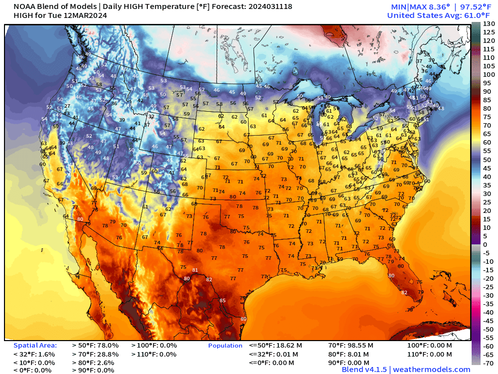
Heading into the weekend, a ridge builds across the Western U.S. finally to bring spring like temperatures into the Pacific NW with Seattle closing in on 70°F

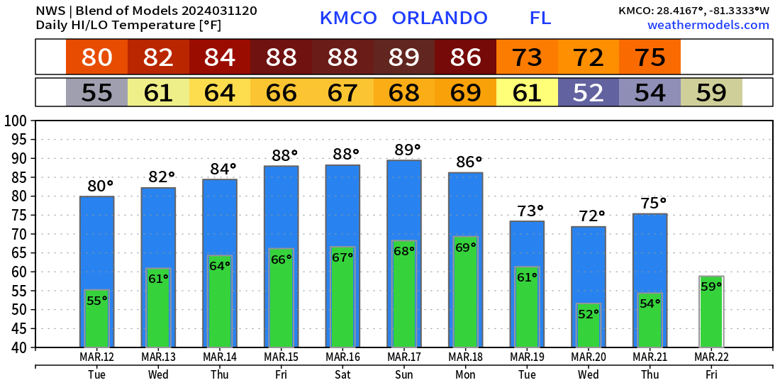
Orlando close to 90°F Friday-Sunday
Washington D.C. in the 70s for the rest of the week.

Even when the Arctic front blasts the Midwest by Sunday/Monday, temperatures only fall into the upper 20s in Chicago. Cold air pools are moderated very quickly and the chances of extreme cold almost vaporize for the Midwest and Great Lakes heading into the last 10-days of March according to climatology.

Short Term | Next 18-Hours
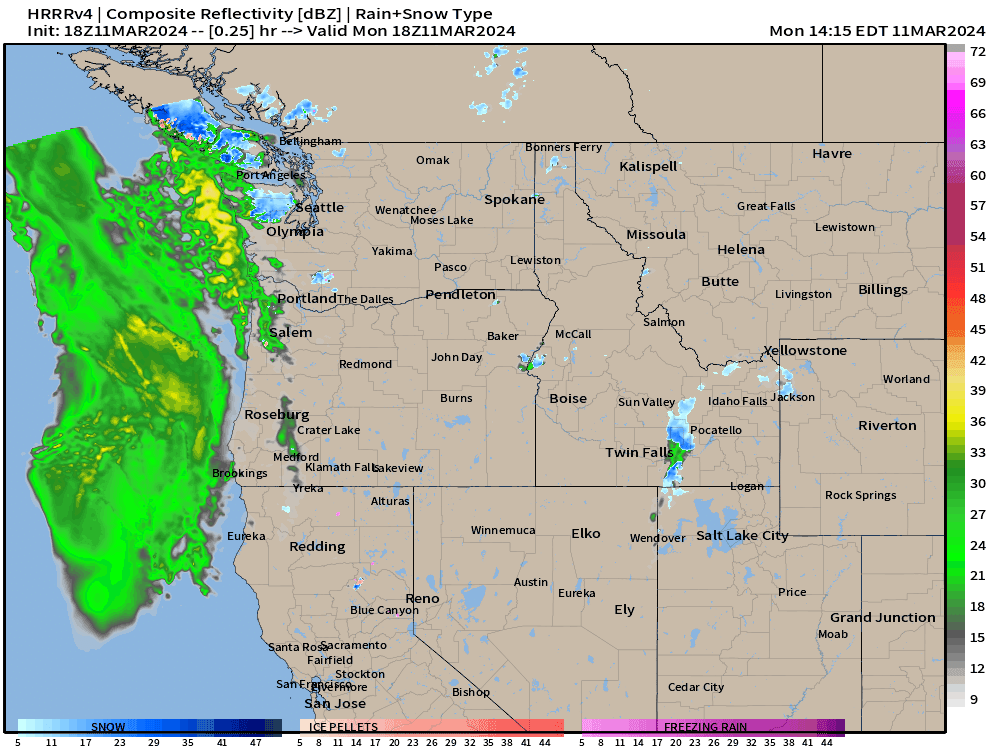
A storm system crashes into the Pacific Northwest with rain/snow but a warming trend is on the way finally for the Western U.S. as the trough in place for the better part of a month finally breaks down.

This moisture moves eastward into the Rockies and a storm system forms in the lee of the mountains. Denver, Colorado in the 10-12” range from models — and ensembles.
Weather Systems for next 10-days
Keep reading with a 7-day free trial
Subscribe to Weather Trader to keep reading this post and get 7 days of free access to the full post archives.