


March 10, 2025 Monday Weather Update
Quiet weather until major storm develops later in week

Good evening!
Quiet day across much of the Lower 48 except for clouds and rain in the Southeast. But that’s finally moved out of Atlanta and tomorrow will be beautiful. We’re in a more Spring like pattern east of the Rockies through the third week of March — and that gets us officially to Spring.
Dynamic Tropopause Next 8-days
Top story for the week will be a powerful storm system in the central U.S. with minimum pressure in the low-970s mb — exceptionally low over land. However, this system develops east of the Rockies (Lee low) with a strong cut-off low or cold mid-level trough. The overall upper-level pattern remains in-tact with the polar vortex (purple and white fuzzball over Hudson Bay) still providing the western Lower 48 with winter weather.
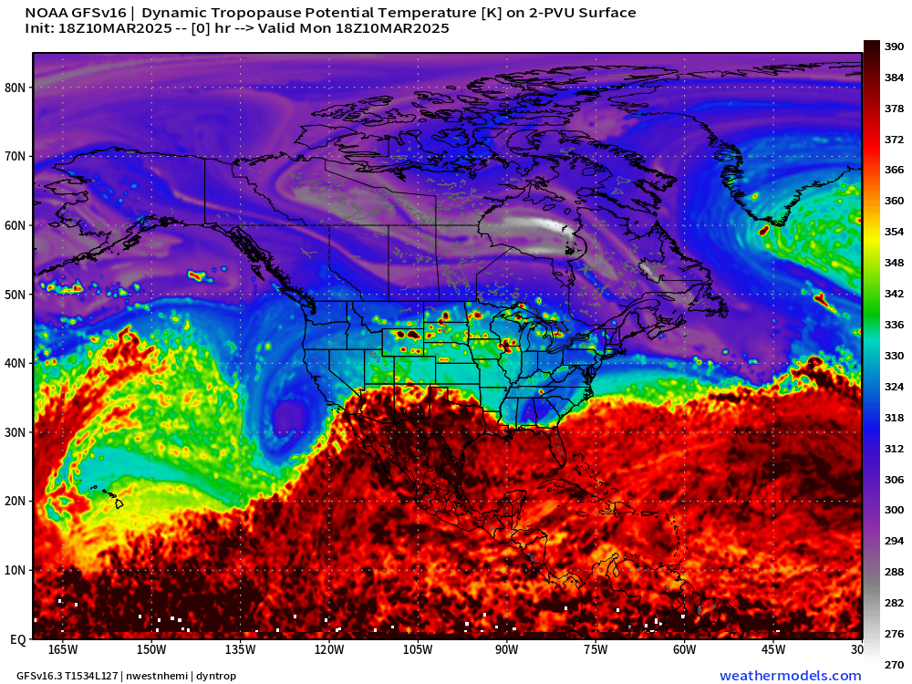
Good news seeing the polar vortex (white fuzzball) anchored over Hudson Bay finally dislodged. And the end of the loop, you can see a strong anti-cyclone or ridge rolling through the central U.S. = much warmer pattern ahead for the following week.
But, we need to deal with some heavy-duty, cut-off lows with very low pressure surface cyclones. This is typical of the transition season e.g. March across the middle-latitudes with Rossby wave breaking and trough thinning episodes.
This weekend, the storm system is mature and occluded over the Great Lakes, but it deepens into the 970s mb in the 48-hours prior. Early Sunday:

This Evening Satellite Imagery
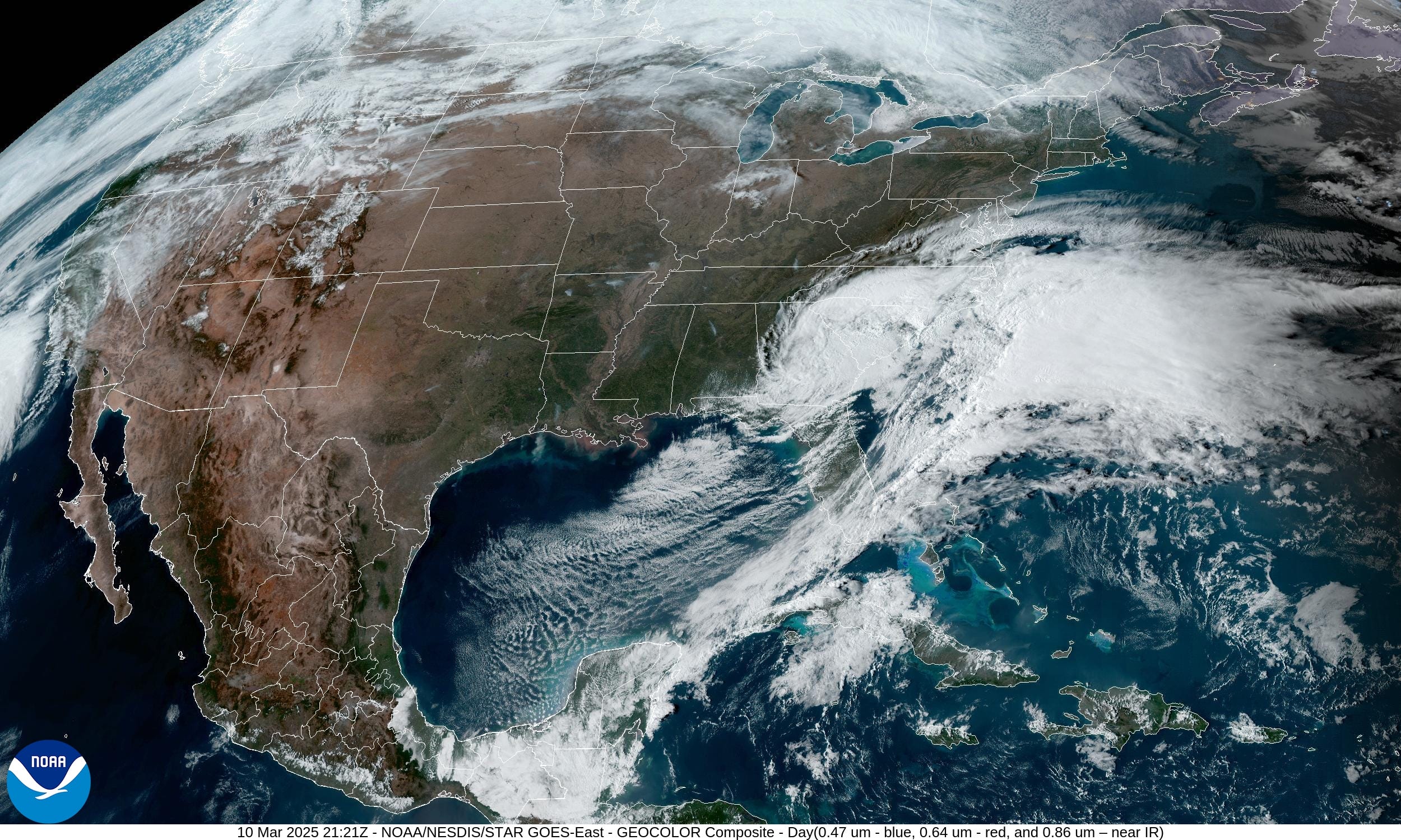
5:21 PM EDT imagery — shows the rain and clouds finally moving off the Southeast coast. Sunshine from Texas to Michigan and east to Pennsylvania with mild to warm temperatuers.
Significant Warmth | Highs Next 9-days
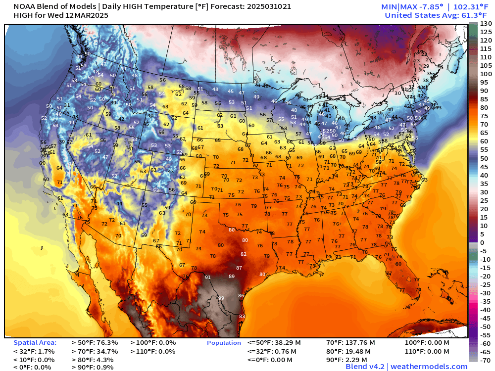
Nice burst of 70s across the Midwest and Great Lakes even for a day or two.
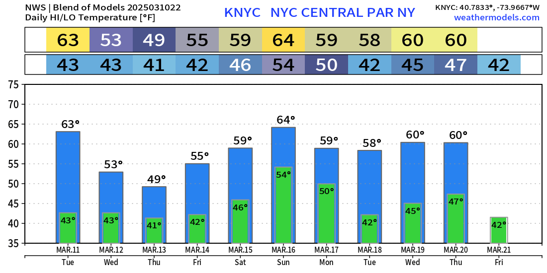
Blend of Models | Next 10-Days | Cities
Washington D.C. — spring like temperatures for the next 10-days

Chicago: 74°F for Friday!

Boston: next week into the 50s and 60s.

New York City: into the 50s and 60s.
Central U.S. Storm System
By 4-days, the central pressure drops in the low-970s across Nebraska with a very tightly wound mature cyclone. However, there isn’t much moisture available for the system at all. It’s more of a cold-core cut-off low that crosses the Rockies and drops pressure adiabatically (PV conservation). Really not expecting much to happen with the storm until the Gulf of Mexico moisture stream can be tapped, and the low tracks into the Great Lakes to capture Pacific origin moisture.
Friday GFS | 96-hours


Saturday GFS | 132-Hours


Keep reading with a 7-day free trial
Subscribe to Weather Trader to keep reading this post and get 7 days of free access to the full post archives.