


March 10, 2024 Warm Week Ahead
Turning much colder in extended range the following week

Warmth until early next week (March 18-19)
Extended period of “Arctic” air descends upon Lower 48 for following week
Another “boatload” of rainfall for Southeast / Gulf Coast states this weekend with 5-7” forecast from Jackson, MS to Montgomery, AL
A Nor’easter pops up in the models for Day 10 across Northeast, but very low likelihood at this juncture. Little ensemble or A.I. support.
Western Ridge builds finally after weeks to finally flip the script on cold air for last 10-days of March east of the Rockies
High Temperatures Next 8-Days

Each successive week, climatology increases by several degrees across the Lower 48 as we quickly leave winter behind. The warm mid-March sun easily warms much of the eastern U.S. into the 60s and 70s except for northern New England.
Fair weather and clear skies will help dry out the Southeast before another drenching this weekend.
Atlanta into the upper-70s by Thursday. I’ll be on the watch for 80°F

Orlando pushing 90°F by Friday and Saturday.

Chicago into the 60s for a few days with mild temperatures after a weak front.

Washington D.C. pushing 70°F on Tuesday and then warmer to 75°F by Friday.
Meteorologists love to deliver this wonderful weather to end winter!

Short Term | Next 2-days

Still need to get rid of the light snow showers across the Northeast after Monday morning. A storm system crashes into the Pacific Northwest with rain/snow but a warming trend is on the way finally for the Western U.S. as the trough in place for the better part of a month finally breaks down.
Precipitation for next 3-days
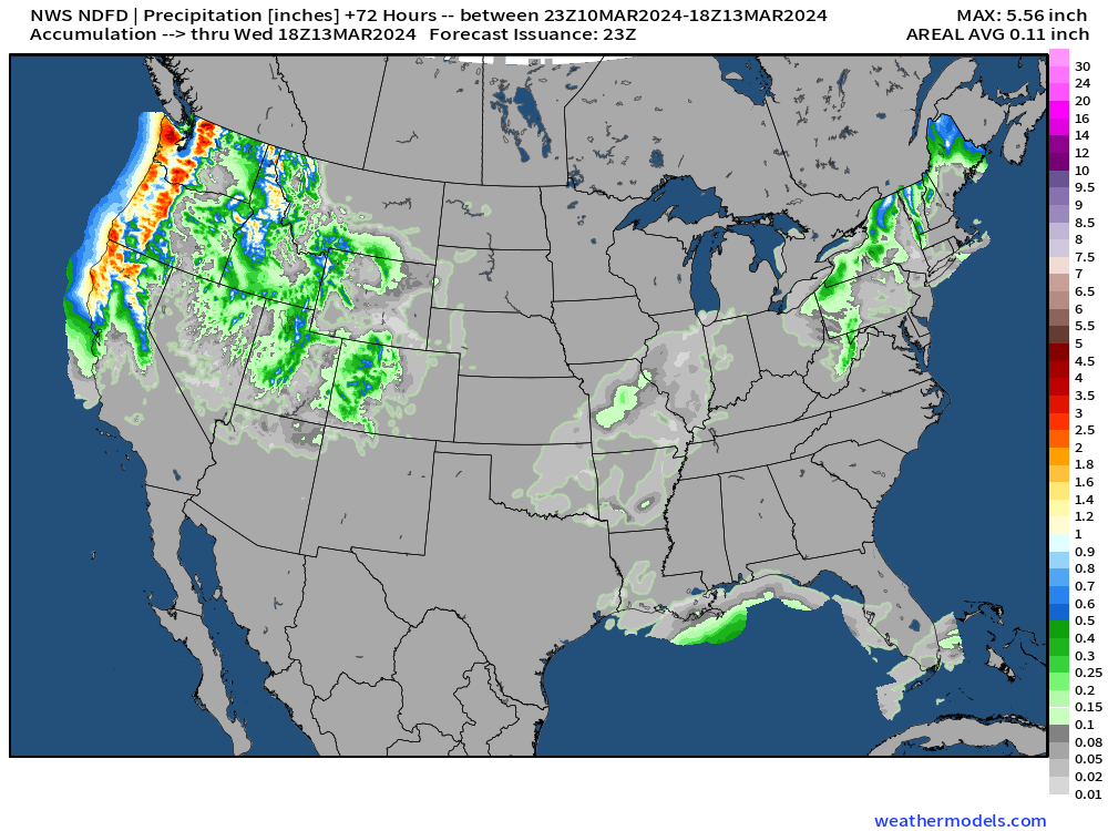
The rain/snow is significant for the Pacific NW coastal range with heavier snow at elevation. That moves east across the Great Basin by mid-week.
Finally a dry spell for the Southeast until the weekend.
Keep reading with a 7-day free trial
Subscribe to Weather Trader to keep reading this post and get 7 days of free access to the full post archives.