Laura to Become a Large Hurricane in Gulf of Mexico
Interests along the Texas and Louisiana Gulf Coast should prepare for potential major hurricane
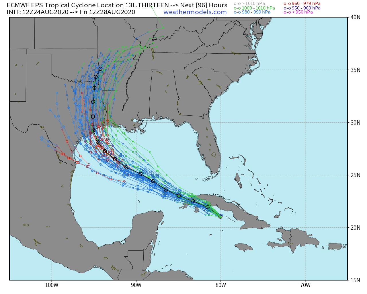
The National Hurricane Center 5 pm Update discussion did mention the ECMWF ensemble mean shifting westward over Houston but did not budge the cone or landfall location out of Louisiana. The ensemble solutions are closely clustered to a point at 25°N and 90°W and then curve to the Texas coastline with some spread. However, as this is only a 3-day forecast until landfall, the uncertainty is still large.

And here is the NHC 5 pm forecast cone with Hurricane Watches hoisted along the Gulf Coast including Houston.

Intensity to Major Hurricane?
The SST is very warm — near 90F in the central Gulf of Mexico with a deep reservoir of warm water. Laura may undergo a burst of Rapid Intensification in the next 2-days which could create a very intense storm of at least Major Hurricane strength (Category 3+). There is strong support with the global and mesoscale models for a major hurricane. The wind shear that destroyed former Hurricane Marco will NOT be a concern for Laura. What is the maximum intensity limit for Laura? Technically it’s Category 5 with the very warm water, but in reality, we will probably 130-mph or so — mid-range Category 4.

Western Atlantic to light up in 10-days
The same ensemble system is showing a powerful Hurricane Nana by the first week of September with potential U.S. impacts. Too soon to say much more other than the signal is very strong at this juncture for another 2020 Atlantic hurricane as we head to the peak of the season (September 10th).

Maps are all from WeatherModels.com and I encourage you to subscribe to my service if you would like to see the underlying models (ECMWF, GFS, ensembles) that go into the forecasts you see on TV.


