


June 8, 2020 Tropical Update: Cristobal heads up the Mississippi
Heavy rainfall and some gusty winds will accompany Depression into the Great Lakes
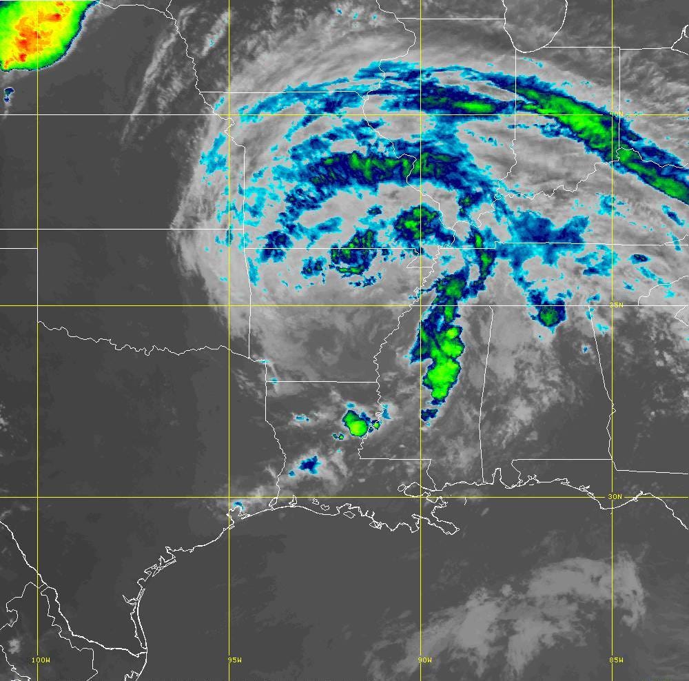
At 9 pm Monday evening, Cristobal was tracking through Arkansas with a large rain shield to the north of the center and bands of thunderstorms to the east — in the warm sector.

Winds are probably 25-mph sustained and well away from the center so it will technically be classified as a depression and fully tropical at least through tomorrow morning and maybe afternoon. So, the question is when does it become post-tropical or become frontal in nature. That’s probably somewhere around eastern Iowa or southern Wisconsin on Wednesday. The Weather Channel posted a Tweet about the potential for Cristobal’s track to be unprecedented — the most North and West (together) in the past 150-years+. Of course, this needs to be a tropical designated storm to really count but I’ll give the post-tropical track some credit because the winds will be howling across the Great Lakes by late Tuesday with gusts over 40-mph in Chicago.


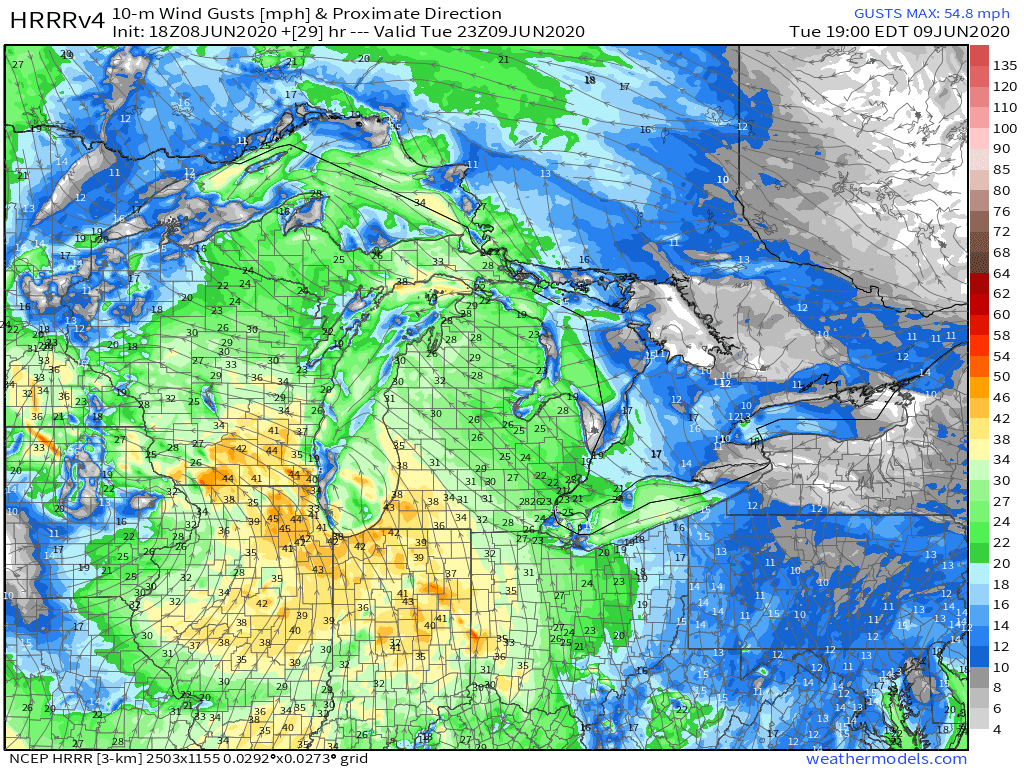
This are the remnants of Cristobal with very warm temperatures ahead of the storm with sultry dewpoints. It will definitely be a tropical storm like feeling across the region. But, a non-tropical or middle-latitude storm will be absolutely cranking across the Plains states. There is a lot of very cold air amid a deep trough (for June) coming out of Colorado. 50-70 mph gusts look likely across Kansas and Nebraska heading through Tuesday evening into Wednesday.

The barometers will get a workout too! Maybe 982 mb with the storm center — combination of Cristobal’s remnants and the developing midlatitude cyclone.

Rest of the tropics remain a ghost town — nothing brewing for the next 10-days. Sort of expect some action in the Eastern Pacific but nope.
All of my maps are from https://weathermodels.com (subscriptions are on sale 25% off for hurricane season or about $11/month).
