


June 7, 2025 Tropical Update Weekend
Eastern Pacific south of Mexico with 2 Invests with high chances

2025 Atlantic Hurricane Season [Day 7]. My expectation for this year is 14 named storms, 7 hurricanes, and 3 majors. So far, 0 named storms, 0 hurricane, and 0 majors.

Saturday’s Tropical Weather Headlines
Atlantic tropical update: No areas being watched through the next 7-days (June 14) by NHC and the ECMWF ensembles are blank for 15-days (June 21).
Eastern Pacific tropical update: We now have 2 areas being watched within the monsoon trough with high chance of development in the next 24-hours.
Saharan Dust / Air Layer continues to fill the eastern tropical Atlantic with one weak tropical wave crossing the basin.
Thank you to readers continuing into this Hurricane Season. My goal is to keep you informed about ongoing extreme weather events inside and outside of the tropics, but also a week (hopefully) heads up on what’s coming. I’ll be using a variety of weather modeling output, some of it may be unfamiliar, but it’s state-of-the-art and industry leading standard.
ECMWF 00Z | Integrated Vapor Transport | Next 10-days
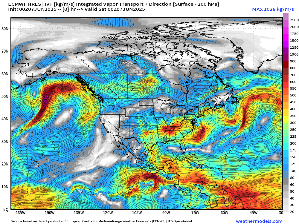
Two areas of cyclonic circulation developed out of the monsoon trough rather close together. Each could become a tropical depression or storm but not much more before reaching cooler water. By later next week, another system is likely to develop, perhaps getting an earlier / eastward start and becoming a hurricane. And, at Day 10, the process repeats a bit further east off Panama coast. See the trend? Maybe then at/after Day 15 or so, the Atlantic can see something develop?
No tropical cyclone formation likely in the Atlantic basin in the next 10-days+
Keep reading with a 7-day free trial
Subscribe to Weather Trader to keep reading this post and get 7 days of free access to the full post archives.