


June 7, 2024 Tropical Update: Watching Gulf of Mexico
AIFS model showing 2 Gulf of Mexico systems in next 2 weeks

Welcome to the 2024 Atlantic Hurricane Season | Please subscribe for $5/month for email inbox deliveries every morning — or more often as conditions warrant.
The investment in my research and development will pay off as A.I. enabled weather forecasts become a normal and indispensable part of our weather forecasting enterprise.
Gulf of Mexico area for potential tropical storm development next week and the following week
ECMWF AIFS modeling and EPS ensembles show significant support for 2 tropical systems
The systems would battle wind shear.
Atlantic Basin Tropical Weather Outlook
No areas of interest in the NHC Tropical Weather Outlook across the Atlantic tropics as we head through the first week of the 2024 Atlantic Hurricane Season.
Synoptic Analysis
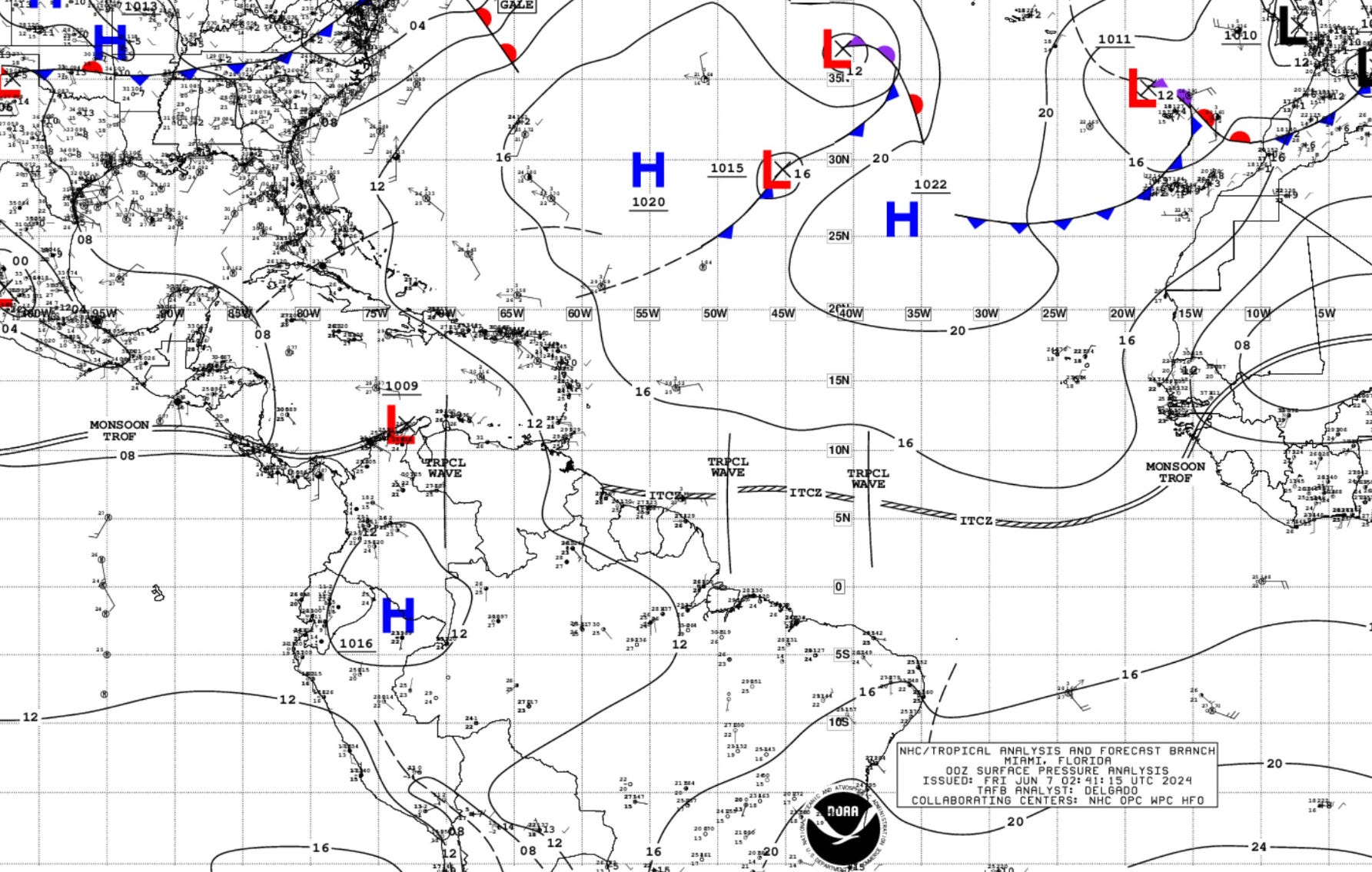
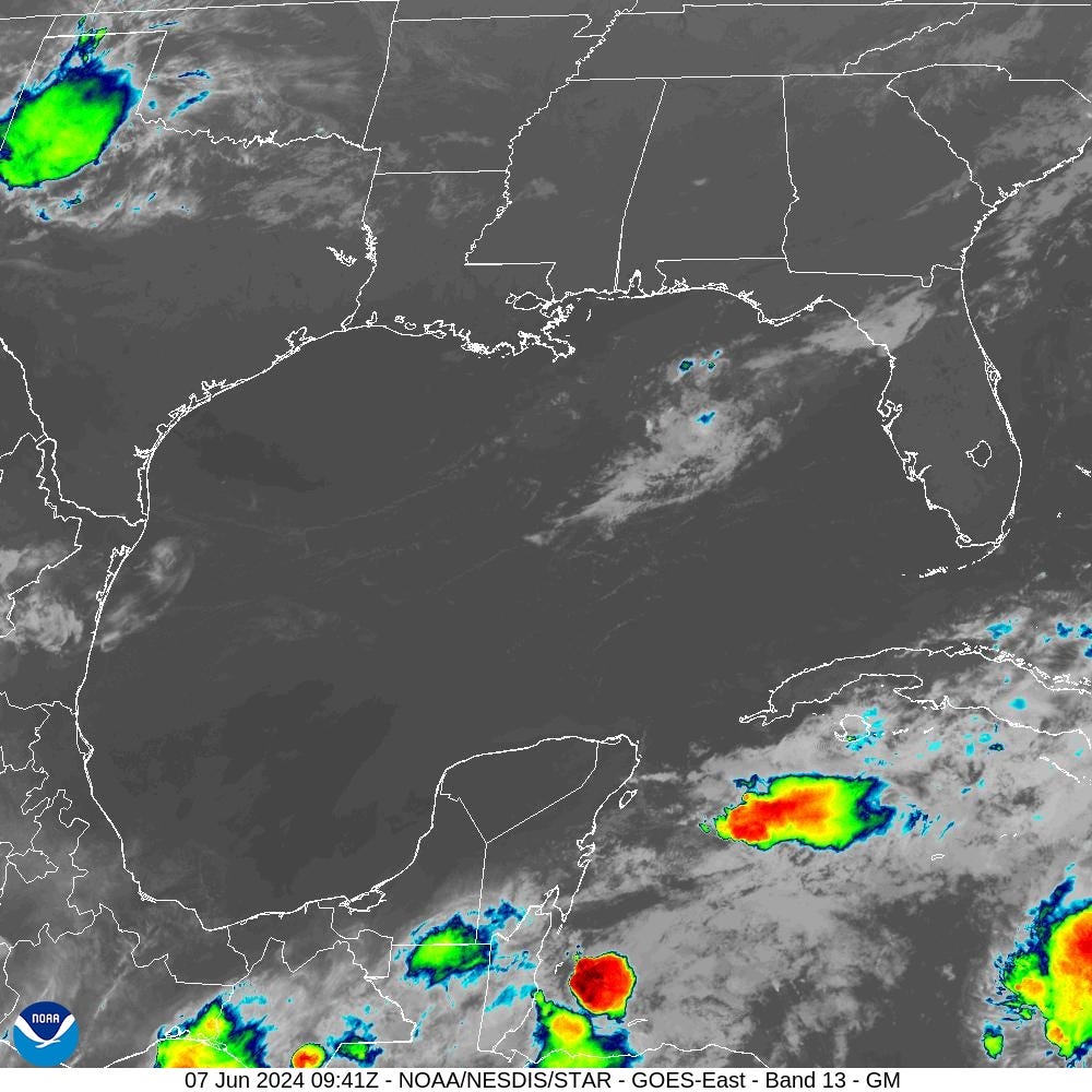
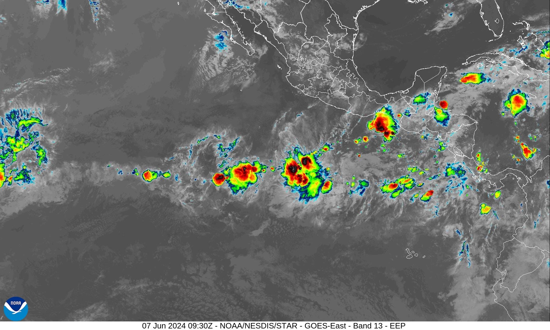
3 tropical waves in the deep tropical Atlantic along the ITCZ with the westernmost wave nearing Central America. The Gulf of Mexico is almost entirely clear of showers and clouds. An area of showers over Cuba and Jamaica is the only area of convection that is large enough to warrant some attention, but tropical development is unlikely.
High pressure dominates in the subtropics from Bermuda to the Azores but only at 1020 or 1022 mb.
...TROPICAL WAVES...

A central Atlantic tropical wave is along 39W, south of 11N, and
moving westward at about 10 kt. Scattered moderate to isolated
strong convection is observed from 05N to 10N and between 37W and
46W.

Another central Atlantic tropical wave is along 49W, south of 11N,
and moving westward at about 10 kt. Scattered moderate convection
is noted from 05N to 09N and between 47W and 51W.

A central Caribbean tropical wave is along 70W, south of 14N, and
moving westward at 10-15 kt. No significant deep convection is
occurring in the Caribbean Sea.
Basin Wide Infrared Satellite Imagery

Gulf of Mexico
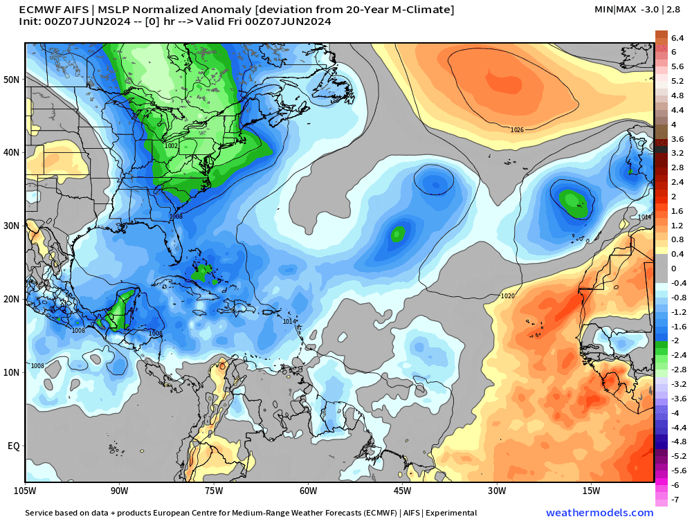
Precipitation Anomaly Next 10-days

Gulf of Mexico the focus of exceptional rainfall over the next 10-days associated with tropical systems.
[Convection or heavy rain and storms occur in paths or tracks with or w/o organized tropical cyclones. Where it rains is the obvious footprint or evidence of where ascent, instability, and potential for development could/might occur in a 10-day period from a weather model. This is an easy way to eyeball where/if TCs will occur.]
ECMWF IFS | 10-Day Precipitable Water Anomaly Forecast
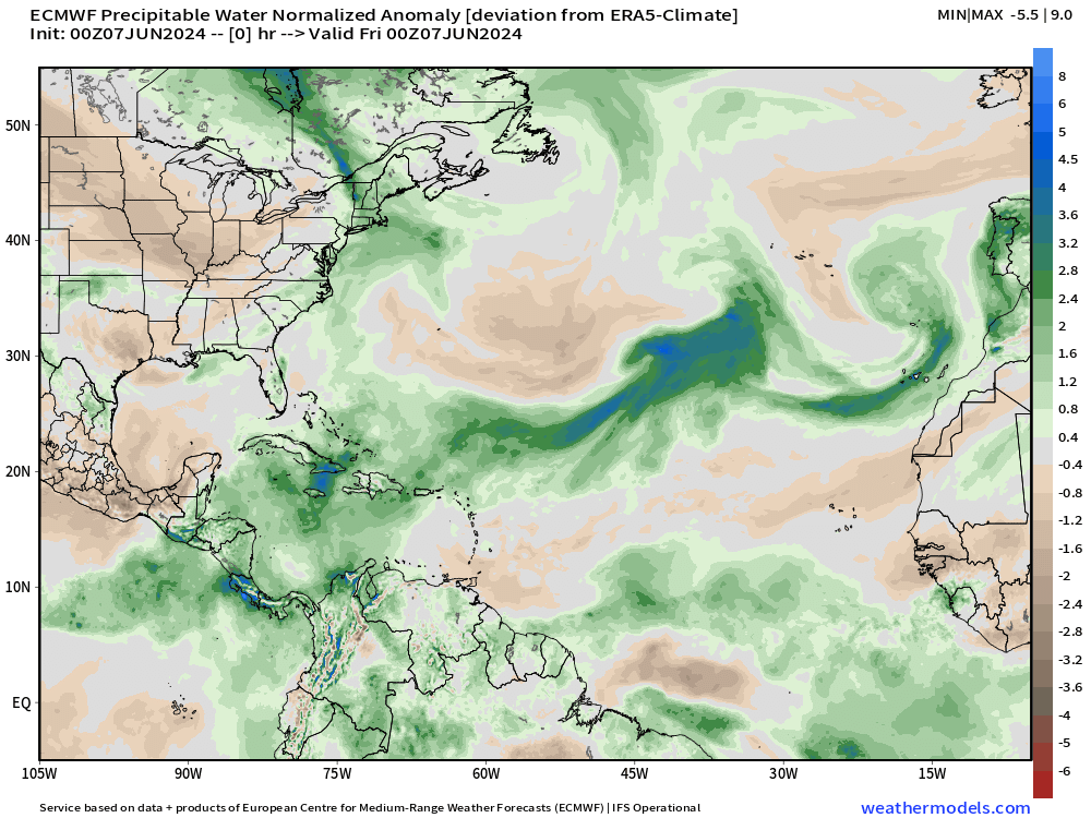
At the end of the 10-day loop, we can see a bit of a swirl in the southern Gulf of Mexico with moisture arriving from a tropical wave way back in the Main Development Region (MDR).
That’s our best chance of a tropical storm so far in 2024 — but plenty of waiting and watching.
[This is the “normalized anomaly” of precipitable water (my favorite variable) taking into account climatology (30-years) and calculating deviations from the historical mean. This allows easy tracking of extreme features like the tropical wave in the eastern Atlantic. The dry air with the late-season cold front is highlighted by this weekend.]
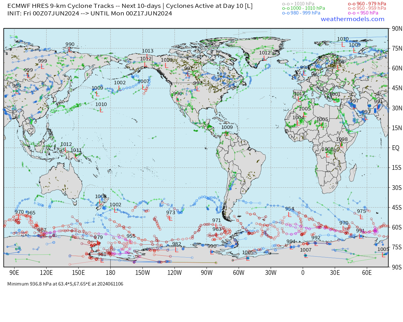
15-Day | Atlantic EPS Cyclone Tracks

Many more ensemble members [majority] now show the development of a tropical system in the Caribbean gyre in the 10-15 day time frame.
Active storm locations at Day 10:

Eastern Pacific Tropical Weather Outlook
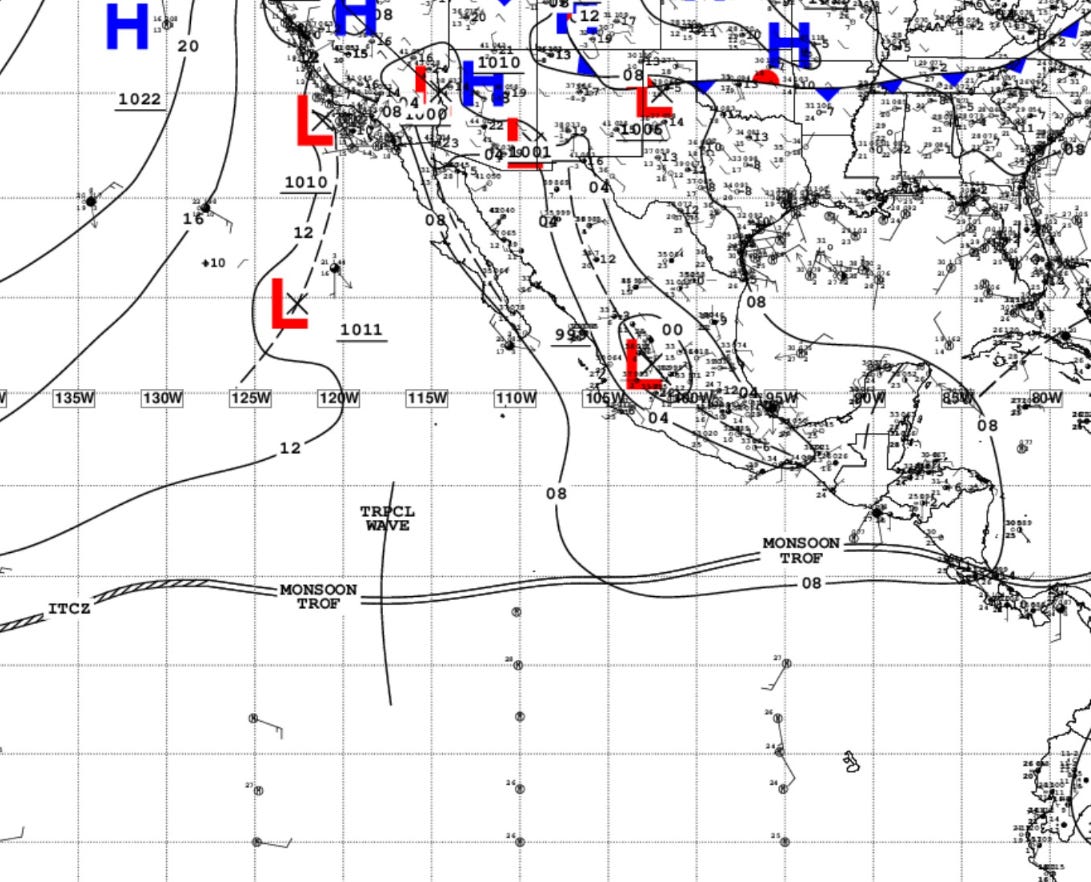
A tropical wave is analyzed along the monsoon trough but no development is expected. Convection flaring overnight for the diurnal maximum but unlikely to find favorable environment for further organization.
NHC does not have any areas of interest in the Tropical Weather Outlook through 48-hours and 7-days — June 14.
June can be quiet busy in the Eastern Pacific as the Caribbean gyre spawns vorticity + tropical waves reach the very warm waters west of Central America.
However, the convection associated with the waves has remained weak and unable to persist — so far evidence of a quiet season due to transition to La Nina.
ECMWF HRES 10-Day Storm Tracks
No areas of tropical cyclone development in the 10-day IFS HRES forecast through June 17, 2024 in the Pacific or Atlantic.
ECMWF AIFS 15-Day Storm Tracks
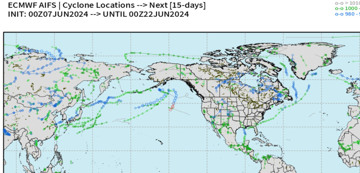
Using the MSLP normalized anomaly, we can see the surface pressure depressions associated with tropical waves and potential tropical storms.
While not intense — there is a bias in the surface pressure of tropical cyclones in the AIFS — there are 2 potential systems in the Gulf of Mexico:
Wednesday June 12: +5.5 days from 00z AIFS

Thursday June 20, 2024: +13 days from 00z AIFS

Structure of the large system with a < 998 mb surface pressure and heavy rainfall along the eastern flank of the storm = subtropical or hybrid development?

We really have no idea about the tropical cyclone genesis bias or hit-rate or skill — so all we can do is watch the model data on a day to day basis to learn.
Western Pacific Tropical Weather Outlook
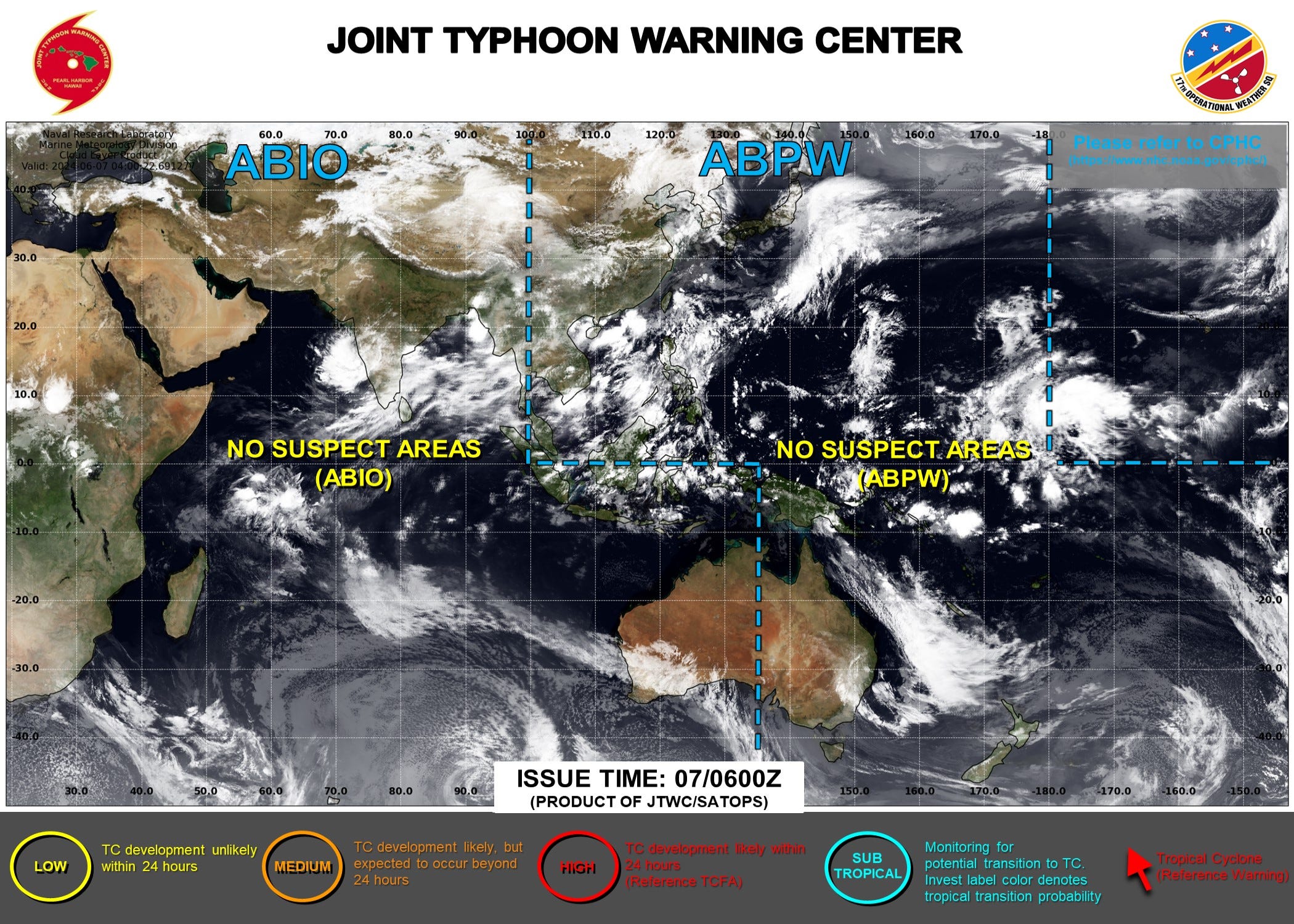
Ghost town — No areas of interest during the next 48-hours to 7-days.
Thank you to Subscribers and Supporters! Welcome to June 2024 and Atlantic Hurricane Season.
Maps sourced from weathermodels.com designed and innovated by yours truly! I actually create all of my content from scratch.