


June 6, 2025 Tropical Update Friday
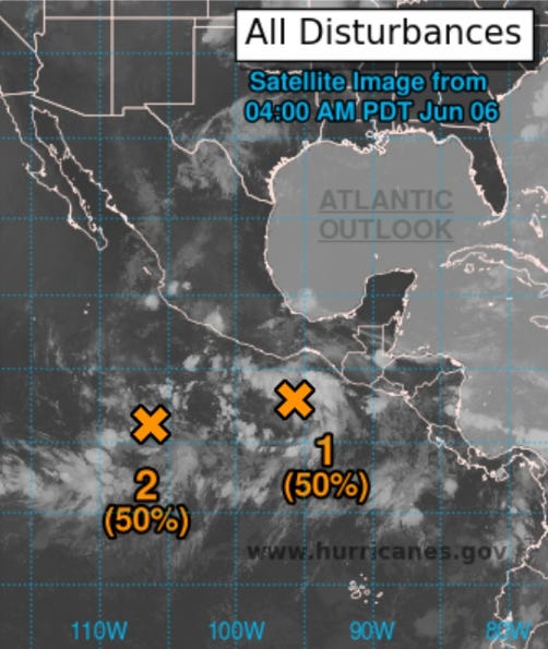
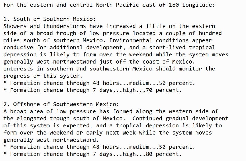
Eastern Pacific only show in town with 2 areas being watched

2025 Atlantic Hurricane Season [Day 6]. My expectation for this year is 14 named storms, 7 hurricanes, and 3 majors.
Also, thank you to [new] subscribers continuing into this Hurricane Season. My goal is to keep you informed about ongoing extreme weather events inside and outside of the tropics, but also a week (hopefully) heads up on what’s coming. I’ll be using a variety of weather modeling output, some of it may be unfamiliar, but it’s state-of-the-art and industry leading standard.
Friday’s Tropical Weather Headlines
Atlantic tropical update: No areas being watched through the next 7-days (June 13) by NHC and the ECMWF ensembles are blank for 15-days (June 20).
Eastern Pacific tropical update: We now have 2 areas being watched within the monsoon trough
Saharan Dust / Air Layer continues to fill the eastern tropical Atlantic.
ECMWF 00Z | Integrated Vapor Transport | Next 10-days
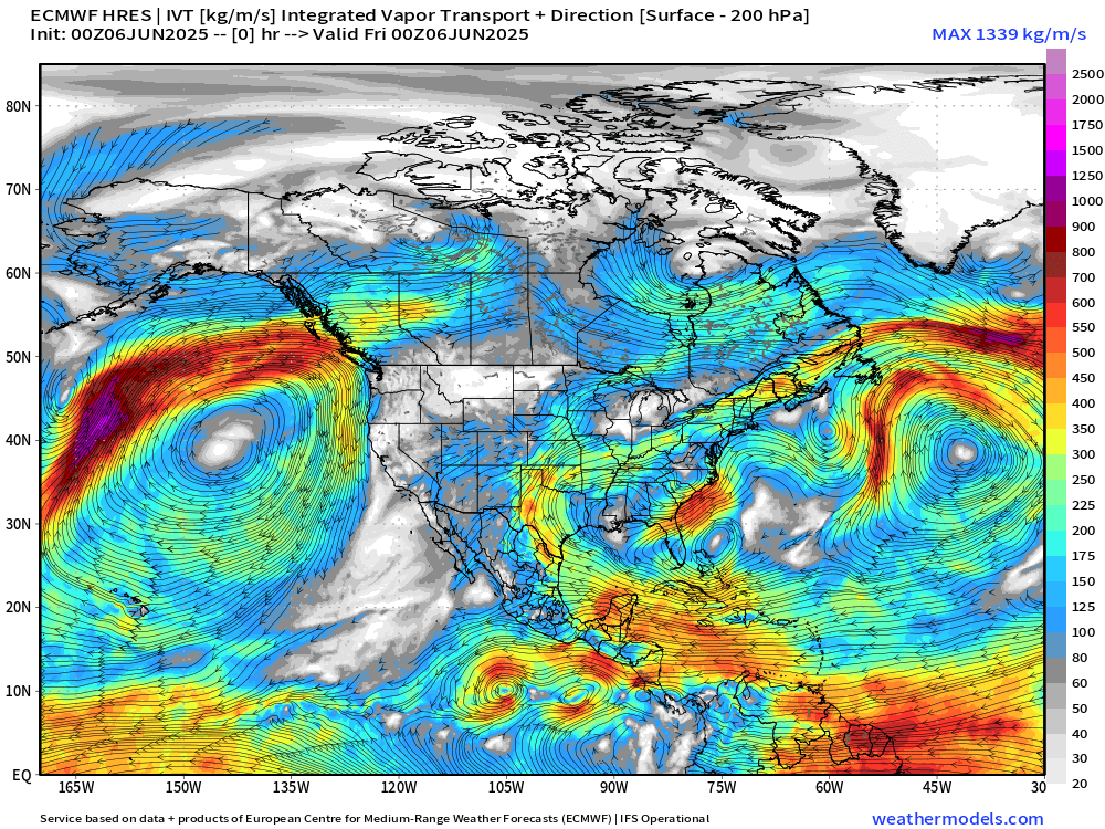
Off the southern coast of Mexico, two areas of weak circulation may each reach tropical depression or storm classification in the next 2-3 days. Then, by next weekend, the monsoon trough could combine with a passing tropical wave to spin up another system. However, with recent slow-going with development and global models (except for GFS) being less excited, I don’t think we’ll see a full-fledged hurricane.
The prevailing flow climatologically in the Atlantic is a strong Bermuda - Azores High pressure with moisture out of Caribbean wrapping around through the Gulf of Mexico and into the Plains and Southeast U.S.
However, persistent troughs out of Canada seem to be winning the battle against tropical air masses, preventing the formation of “heat domes” and keeping the entire Eastern U.S. unsettled and stormy.
No tropical cyclone formation likely in the Atlantic basin in the next 10-days+
Precipitable Water Next 5-days | Atlantic Ocean
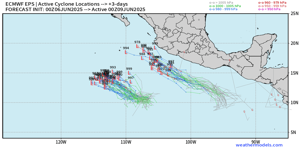
We need > 2” PWAT to fire up a tropical storm or a hurricane, and in the Eastern Pacific, we see Barbara spinning up by Sunday.

Tropical Atlantic | Precipitation and MSLP Next 10-days
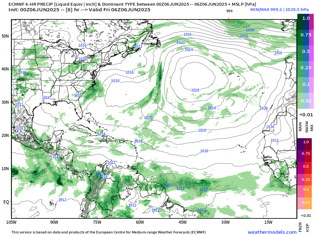
Strong 1028-1030 mb High Pressure across the Atlantic basin at 35°N (Azores High) eventually breaks down because of cold fronts / Canadian troughs. Until then, the strong Azores high will shove the ITCZ in the Atlantic slightly south of climatological position. You can see that in the precipitation anomaly vs. climatology.
Precipitation Anomaly Next 10-days [% of normal]

If you wondered, Australia and the top half of Africa do not get much rain during June. Also, precipitation occurs in weather systems that appears as “extreme events” because climatology/normal averages so many zero or null events. However, you could condition the events on “if it rains” then what’s the expected location and intensity. More on that down the road.

Atlantic Basin
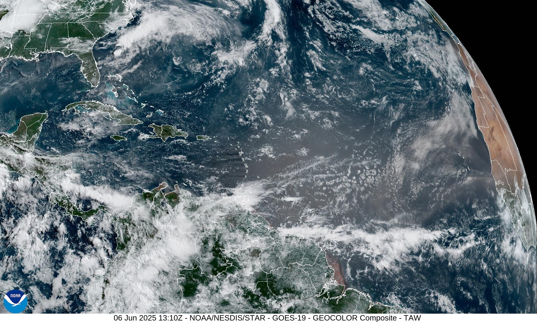
Eastern Atlantic Satellite Image
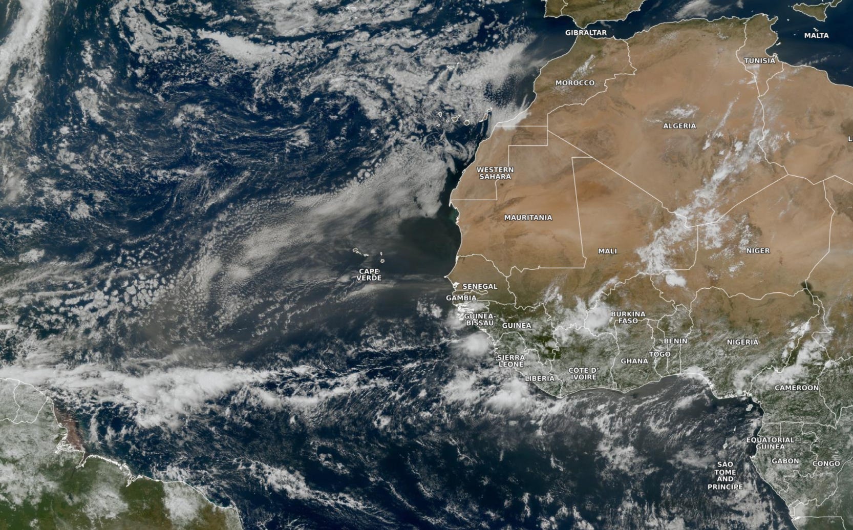
Central and Eastern Atlantic has glint of dust from the Sahara as typically seen in June — very little shower and storm activity outside of the ITCZ. Not seeing vigorous waves over equatorial Africa, either.
ECMWF CAMS 00z DUST Aerosol Optical Depth (AOD) | 5-days Forecast

Our SAL dust plume will rotate anti-cyclonically over Florida during the next 2-days, providing a light haze to the sky. The next plume elongates into the Caribbean in 4-days. Then, no surprise, more dust collects off the coast of Africa ready for crossing the ocean.
Atlantic Ocean Surface Temperatures (SST) Next 14-days
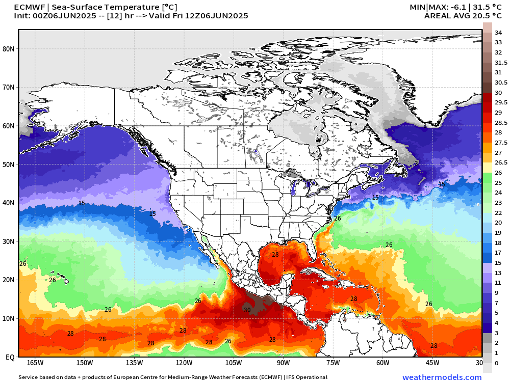
Day after day, the actual SST warms generally across the Northern Hemisphere until late summer. Storms, troughs, high pressure cells, etc. all contribute to unevenly warming the ocean through a variety of processes b/c it’s a coupled ocean-atmosphere system. We need 26°C for a minimal tropical storm and 28°C usually for a hurricane. Through June 20th, the 26°C isotherm slowly expands northward off the U.S. East Coast.

However, compared to normal (last 20-years) the intensity of the Gulf of Mexico —> Florida —> SW Atlantic warm pool has decreased its warm anomaly.

This depiction uses ECMWF SSTs with a recent 20-year model hindcast climatology.
Global SST and Anomaly


Patterns of SST across the globe respond to the previous days/weeks of atmospheric forcing (wind stress), rainfall/clouds, and radiative balance. On longer timescales than weekly/monthly, we have El Nino Southern Oscillation as an inter-annual feature, and then longer time scales — decadal (PDO/AMO) and centennial + solar/orbiting forcings. The ocean operates a lot slower than the atmosphere due to the 1000x heat capacity of water vs. air.
The tropics look generally quite cool — near or just below the previous 20-year mean, quite a downward change from 2023 and 2024.
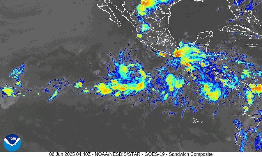
Tropical Atlantic Satellite Imagery
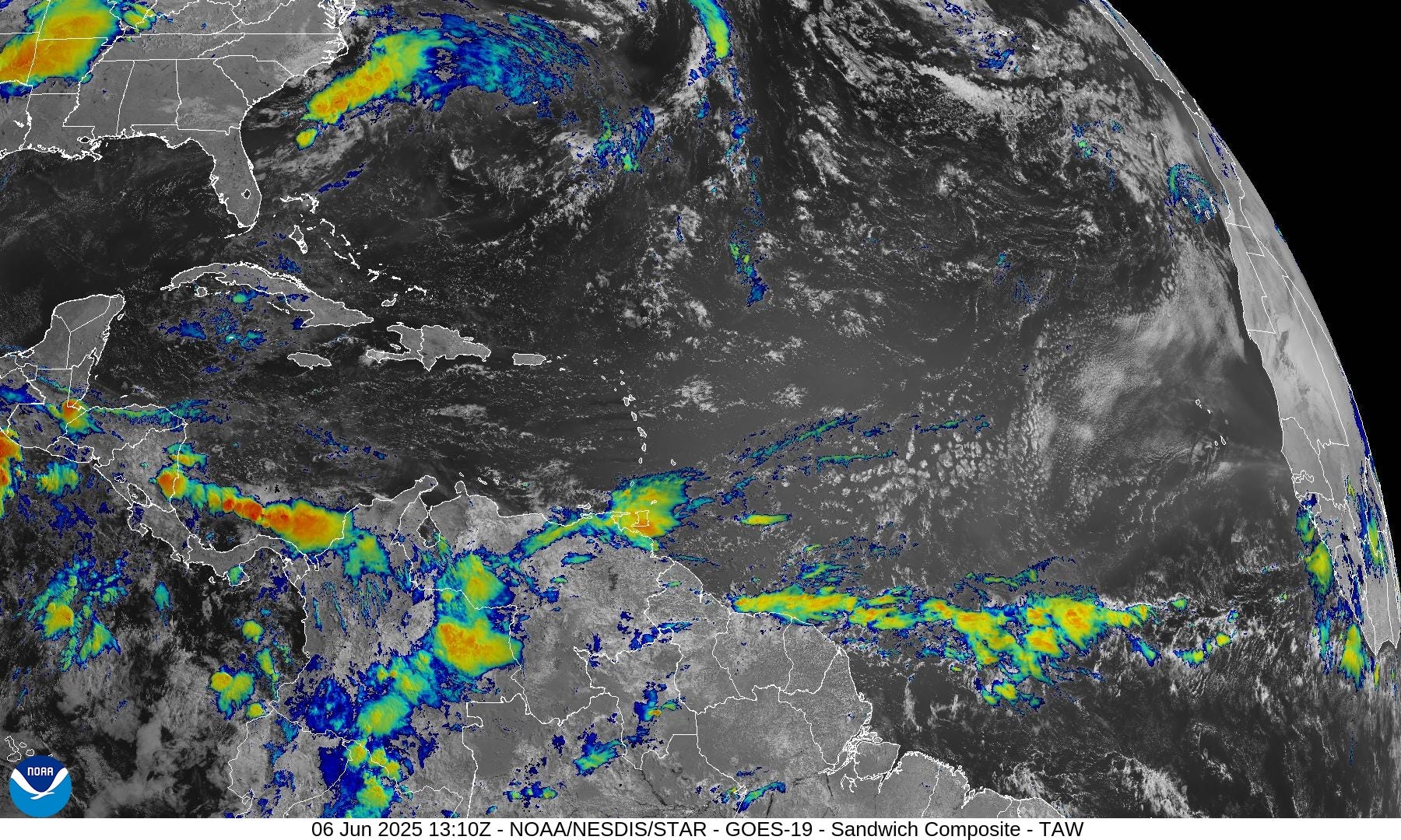
Only point of discussion is Saharan dust — lack of convection is noticeable as a result.
Tropical Surface Analysis 06Z
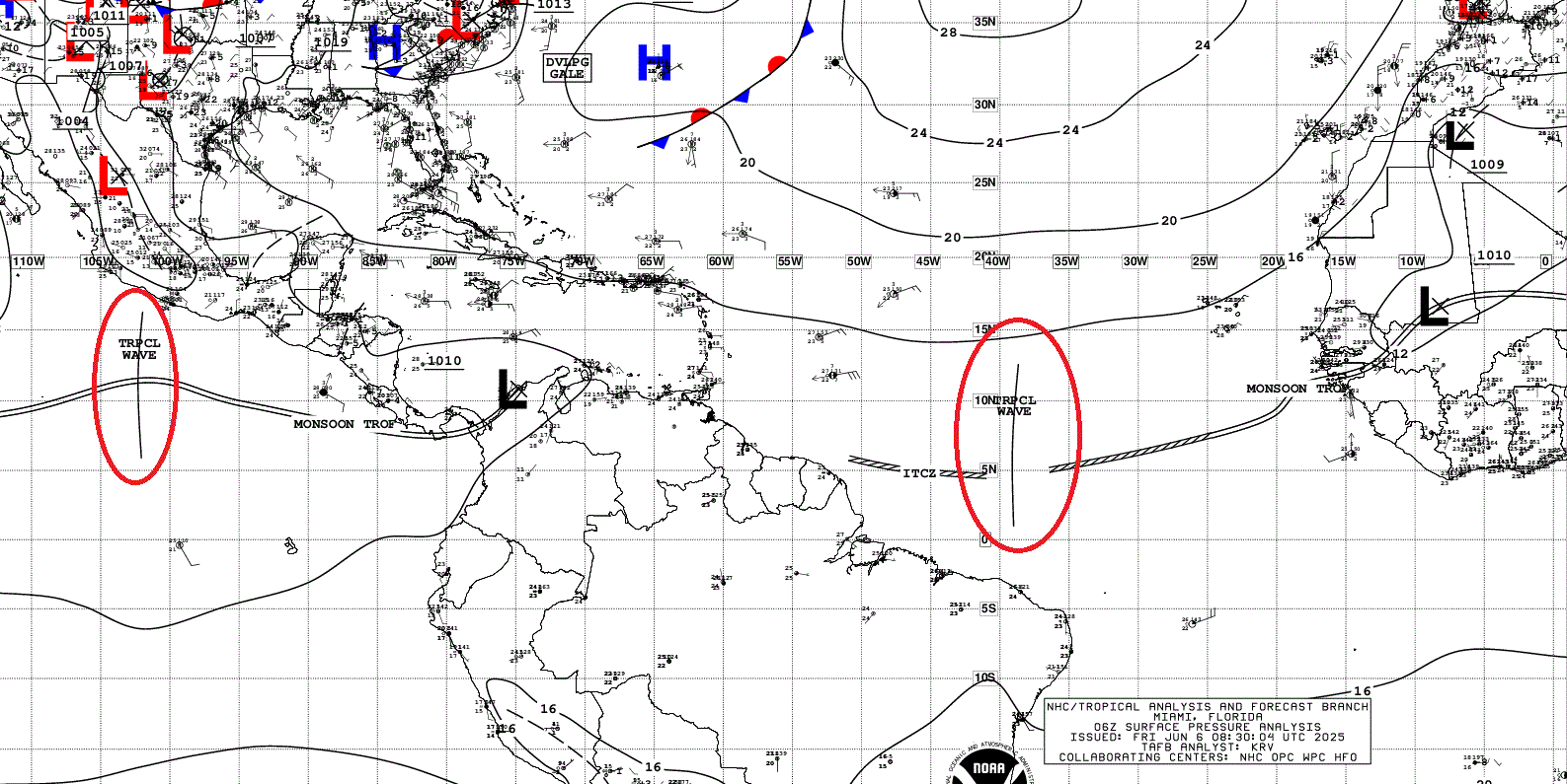
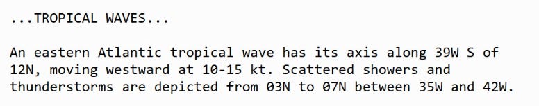
Atlantic Tropical Waves = 1 but no development expected [plausible or possible] in the central tropical Atlantic
GFS Model Spurious Cyclones Update | Cyclone Happy
Days 0 to 10 Relative Vorticity
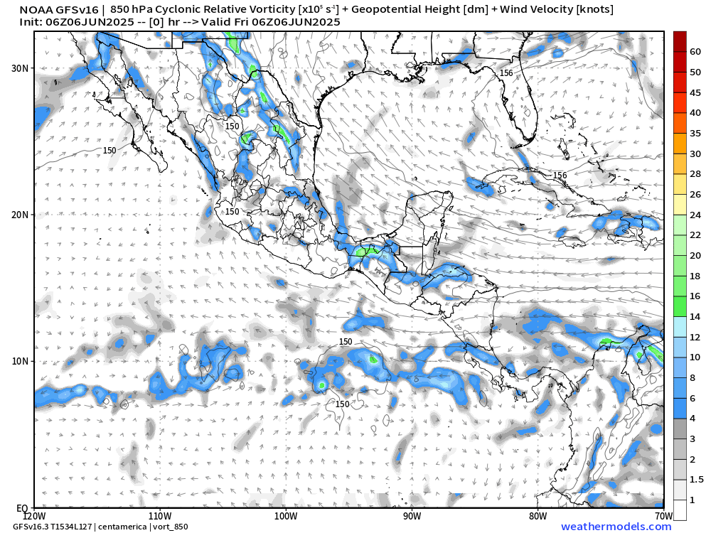
We can look at the GFS every day for weeks and see a modeled tropical storm or hurricane in the Caribbean or Gulf especially after Day 10. However, this is a known bias/false alarm problem with spurious convective — vorticity spin-ups due to the convective parameterization or estimation of vorticity generation due to intense diabatic heating.
Perhaps it’s worthwhile to show what will not happen.
Today’s next 10-days update shows a gyre remaining over Central America which would limit organization.
Medium range ensemble model outlook
These are 51-realizations of the same model with different initial conditions. Each ensemble gets equal ~2% weight in a mean calculation.
ECMWF Ensembles | 10-Days | All Storm Tracks

Blank slate through June 16 except for 2/51 (4%) tracks out of the Eastern Pacific.
Day 15 | All Storm Tracks

We do have a few ensembles coming out of the Eastern Pacific into the Western Gulf at Day 10-12, but that’s not a likely outcome (< 5%) … otherwise, blank slate through June 21st.
Eastern Pacific Tropical Update
Two areas of convection are developing an overall circulation envelop out of the monsoon trough. We’ll see which one or both develop!
ECMWF next 6-days
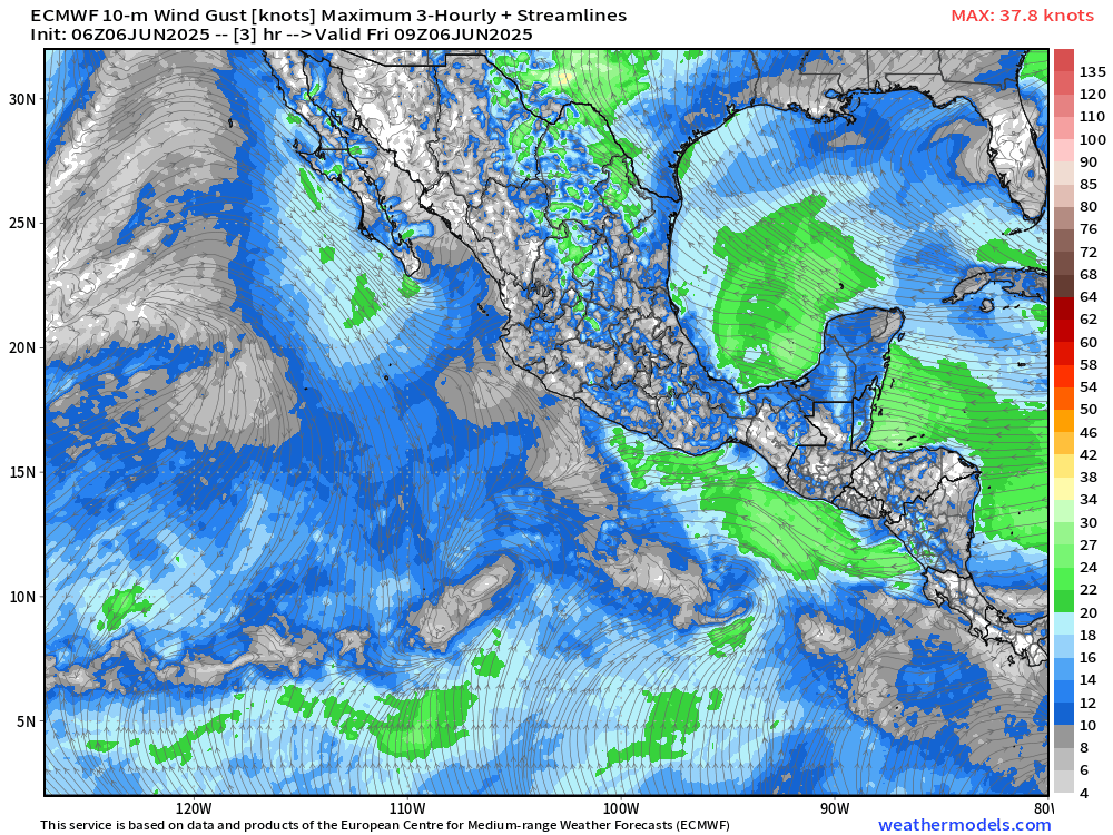
Whatever develops out of the Eastern Pacific seems to be rather weak — perhaps 2 named systems that reach tropical storm status.
ECMWF 00z Ensembles | Eastern Pacific
However, even at Day 3, there are several intense ensemble members with hurricanes as options.
72-Hours active storm tracks
Western Pacific Tropical Update
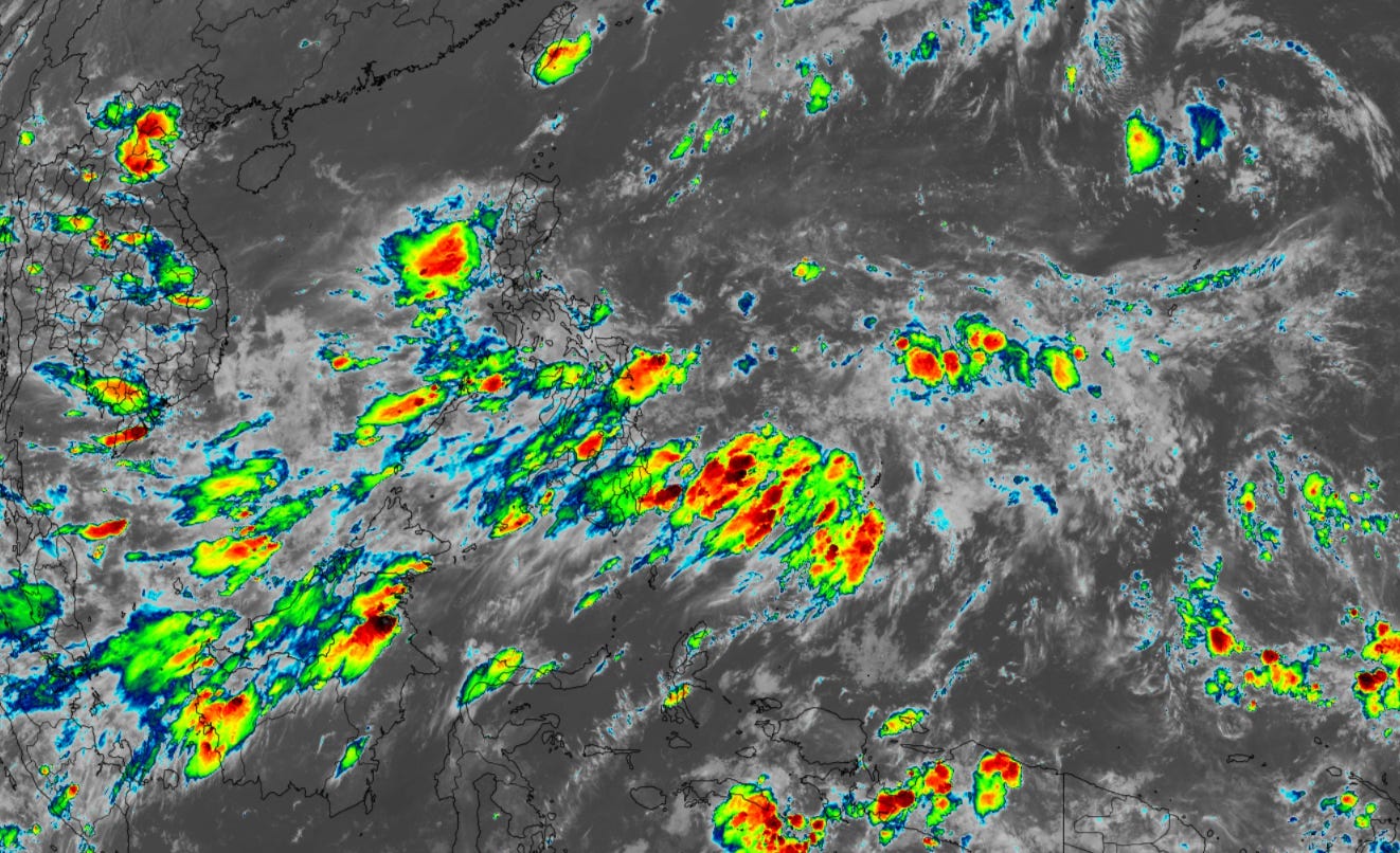
Mess of convection in the monsoon trough, but nothing imminent. However, ensembles suggest that large gyre near the Philippines could turn into a TS or Typhoon with sufficient time.

Day 10 ECMWF Outlook for Western Pacific
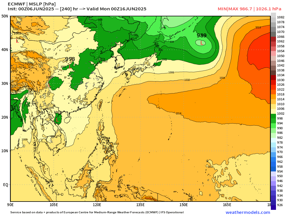
Blank slate …
Day 5 Active Cyclone Tracks

In the China Sea and Philippines, the ensembles at Day 5 show a strong signal for development of a typhoon. We’ll watch over the next few days.
Ryan’s Notes:
June 2025: We use the ECMWF for medium-range prediction because the GFS can’t be trusted due to false-alarm bias, and unrealistic intensification of tropical convection into spurious (ghost) storms. I don’t agree this is a good thing like CNN.
Maps sourced from weathermodels.com designed and innovated by yours truly! Please subscribe there for real-time access to the newest maps, charts from all of the weather models including ECMWF.
So, nothing in North Atlantic any time soon
What is the over/under on when the narrative will be shifted to AGW is preventing hurricanes and yes, it will kill us all?