


June 5, 2025 Tropical Update Thursday
Seasonal forecast updated from ECMWF for June

We are now in the 2025 Atlantic Hurricane Season [Day 5]. My expectation for this year is 14 named storms, 7 hurricanes, and 3 majors.
Also, thank you to [new] subscribers continuing into this Hurricane Season. My goal is to keep you informed about ongoing extreme weather events inside and outside of the tropics, but also a week (hopefully) heads up on what’s coming. I’ll be using a variety of weather modeling output, some of it may be unfamiliar, but it’s state-of-the-art and industry leading standard.
Wednesday’s Tropical Weather Headlines
Atlantic tropical update: No areas being watched through the next 7-days (June 12).
Eastern Pacific tropical update: NHC remains at 80% chance of next system in 7-days — Barbara.
Saharan Dust / Air Layer continues to fill the eastern tropical Atlantic.
ECMWF Seasonal Forecast Update for June 2025 now includes entire hurricane season.
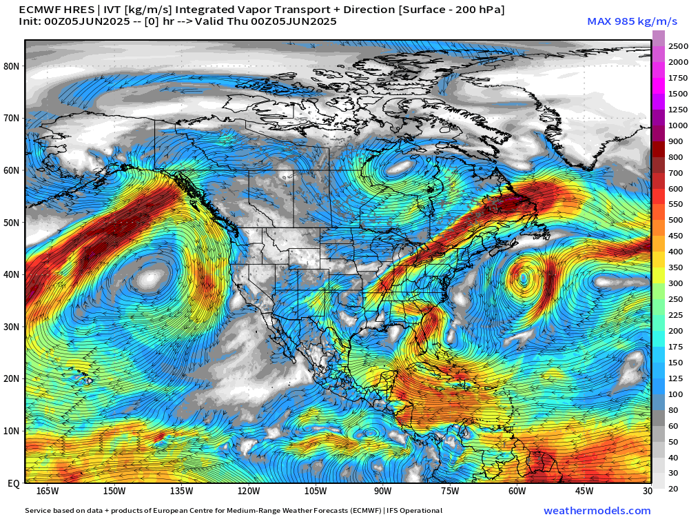
ECMWF 00Z | Integrated Vapor Transport | Next 10-days
We use the ECMWF for medium-range prediction because the GFS can’t be trusted due to false-alarm bias, and unrealistic intensification of tropical convection into spurious (ghost) storms. I don’t agree this is a good thing like CNN.
Easterly flow south of Southern Mexico will likely spin up at least 1 tropical cyclone — Barbara, and then another into late next week (Day 10). However, as we’ve seen over the past few days, genesis is slow. The inability to rapidly organize means the systems run out of real estate and warm water, and decay relatively quickly.
However, this time, it doesn’t look like there’s an upper-level low off the west side of Baja California to advect moisture into the U.S. Southwest.
A strong moisture feed out of the Caribbean bends into the western Gulf of Mexico keeping the Plains and Texas unsettled. This a continuing wet pattern for the Eastern U.S. that lacks sustained heat waves.
ECMWF Seasonal Forecast Update | June 2025
Keep reading with a 7-day free trial
Subscribe to Weather Trader to keep reading this post and get 7 days of free access to the full post archives.