


June 5, 2024 Tropical Update
ECMWF Seasonal Update shows highly active Atlantic

Welcome to the 2024 Atlantic Hurricane Season | Please subscribe for $5/month for email inbox deliveries every morning — or more often as conditions warrant.
The investment in my research and development will pay off as A.I. enabled weather forecasts become a normal and indispensable part of our weather forecasting enterprise.
ECMWF Seasonal Forecast | June 2024

The July-December 2024 ECMWF seasonal prognostication from the seasonal model released today shows 21.1 Named Storms vs. a model climatology of 13.5 — highly significant “active” season for the Atlantic.
During a growing La Nina, we expect average or below average activity across the Pacific including the typhoons and hurricanes from China to Mexico. The seasonal model does show such a solution, so there’s some credibility in the overall forecast for the seasonal ahead.

11.3 Hurricanes in the Atlantic vs. 7.2 model climatology = well above normal
10.8 Typhoons in the Western Pacific vs. 12.8 model climatology = below normal

And, where the storms develop — travel and then potentially make landfall — is a very difficult proposition to forecast in the next 3-6 months.
Red = enhanced expected values of tropical storm density —> the hurricane alley north of the Antilles into the SE United States is easy to discern.
Atlantic Basin Tropical Weather Outlook
No areas of interest in the NHC Tropical Weather Outlook across the Atlantic tropics as we head through the first week of the 2024 Atlantic Hurricane Season.
Synoptic Analysis
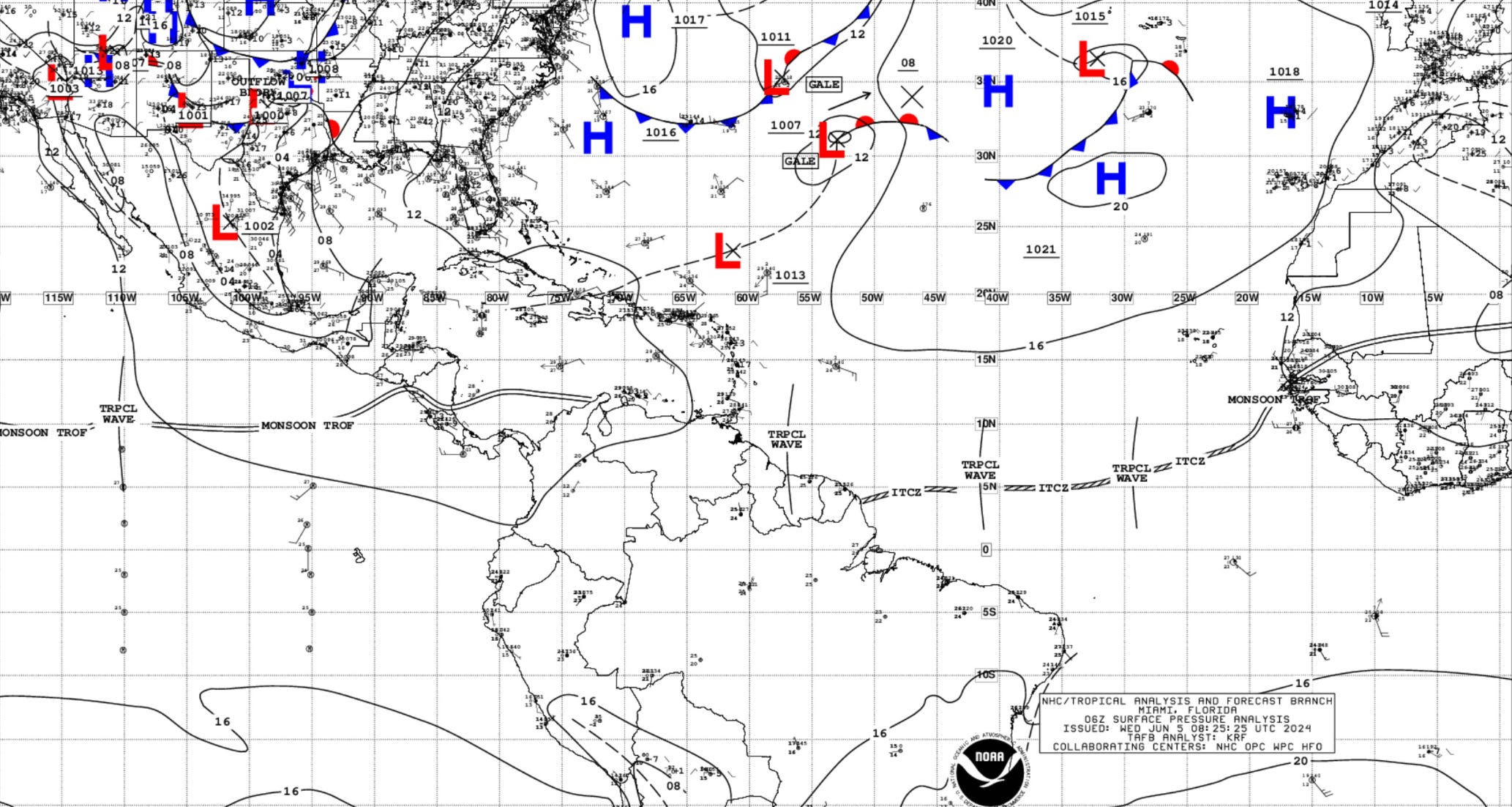
3 tropical waves in the deep tropical Atlantic along the ITCZ. High pressure dominates in the subtropics from Bermuda to the Azores. However, an upper-level trough is creating a weakness in the ridging streaming tropical moisture northward along 60°W longitude with a surface low generating gales.
...TROPICAL WAVES...

A far eastern Atlantic tropical wave is near 29°W from 11°N
southward, and moving west at around 10 kt. Scattered moderate
convection is from 2°N to 10°N between 24°W and 31°W.

A second tropical wave is near 41°W/42°W from 11°N southward, and
moving west at around 15 kt. Nearby convection is described below.

Another Atlantic tropical wave is near 57°W from 14°N southward to
Suriname, moving west near 10 kt. Nearby convection is described
below.
Basin Wide GeoColor and Infrared Satellite Imagery
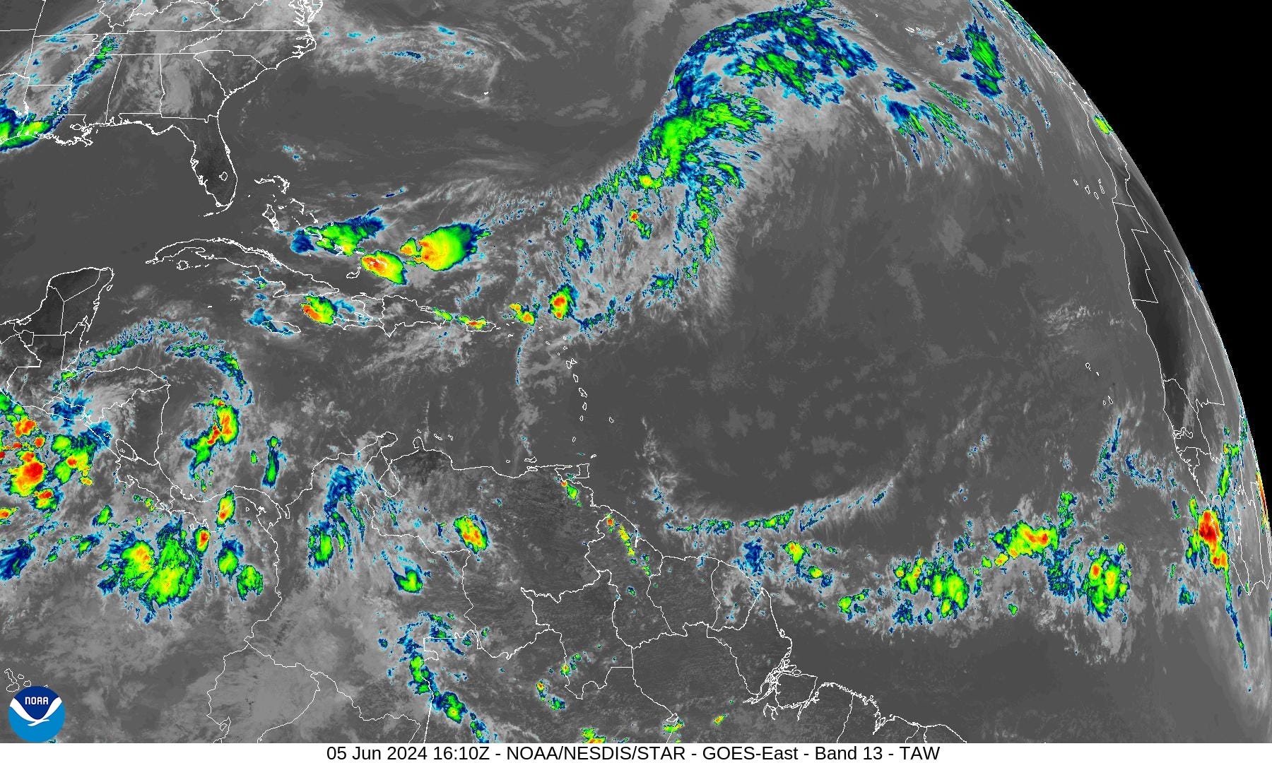
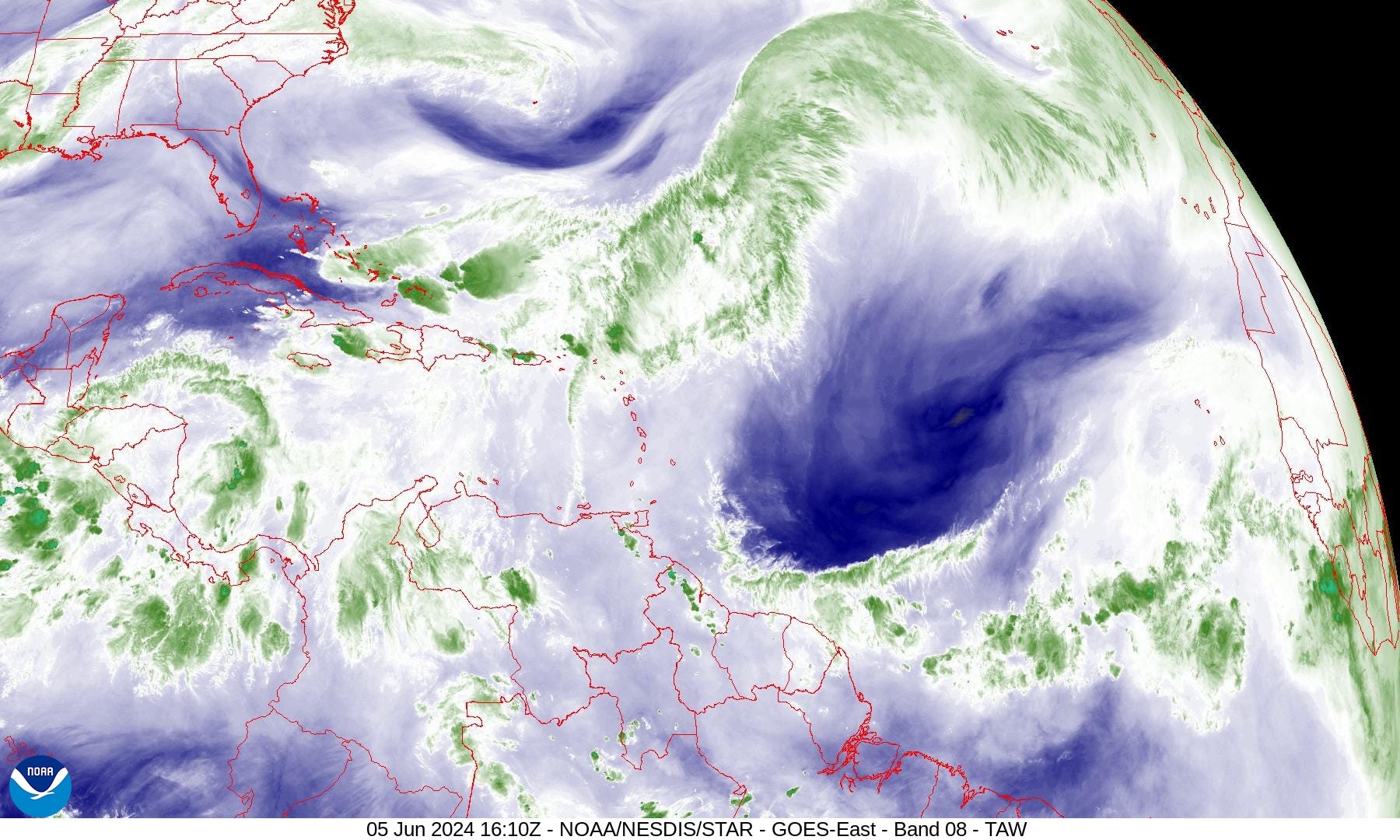
Significant dry air across much of the central Atlantic in the Main Development Region (MDR) that would disfavor any tropical development in any month let alone early June.
Gulf of Mexico
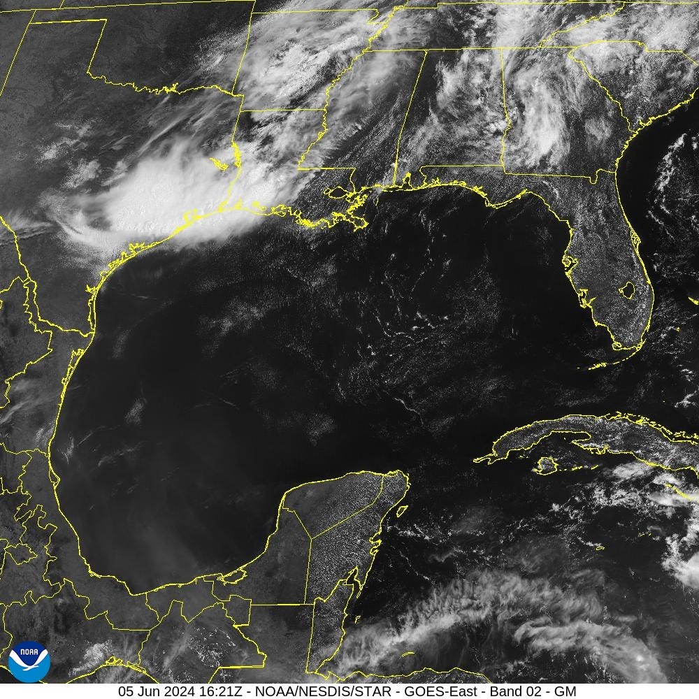
The Gulf of Mexico is entirely clear with some smoke/haze in the Bay of Campeche from forest fires burning in Mexico. An area of thunderstorms is sinking southward through Texas including Houston into the Gulf of Mexico.
The ITCZ is narrowly constrained to 5°N latitude with dry air in the MDR.

Precipitation Anomaly Next 10-days

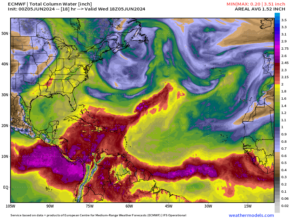
Convection or heavy rain and storms occur in paths or tracks with or w/o organized tropical cyclones. Where it rains is the obvious footprint or evidence of where ascent, instability, and potential for development could/might occur in a 10-day period from a weather model. This is an easy way to eyeball where/if TCs will occur.
ECMWF IFS | 10-Day Precipitable Water Anomaly Forecast
Keep reading with a 7-day free trial
Subscribe to Weather Trader to keep reading this post and get 7 days of free access to the full post archives.