


June 4, 2024 Tropical Update
Global tropics remain quiet for next week, at least

Welcome to the 2024 Atlantic Hurricane Season | Please subscribe for $5/month for email inbox deliveries every morning — or more often as conditions warrant.
The investment in my research and development will pay off as A.I. enabled weather forecasts become a normal and indispensable part of our weather forecasting enterprise.
An interesting new paper was published on African Easterly Wave (AEW) strength and behavior over the past 4-decades using a tracking algorithm on the ERA5 reanalysis data.

Key Points
Tropical cyclogenesis occurs farther west for weaker developing African easterly waves (AEWs) than for stronger developing AEWs
Tropical cyclones (TCs) from weaker developing AEWs are more likely to make landfall due to their genesis proximity to the Americas
Weaker developing AEWs tend to develop into TCs over warmer sea surface temperatures than stronger developing AEWs
Weaker tropical waves take longer to develop into tropical storms & Hurricanes so they undergo genesis over warmer water and closer to land —> more likely to make landfall + stronger.
Atlantic Basin Tropical Weather Outlook
No areas of interest in the NHC Tropical Weather Outlook across the Atlantic tropics as we officially start the first week of the 2024 Atlantic Hurricane Season.
Synoptic Analysis
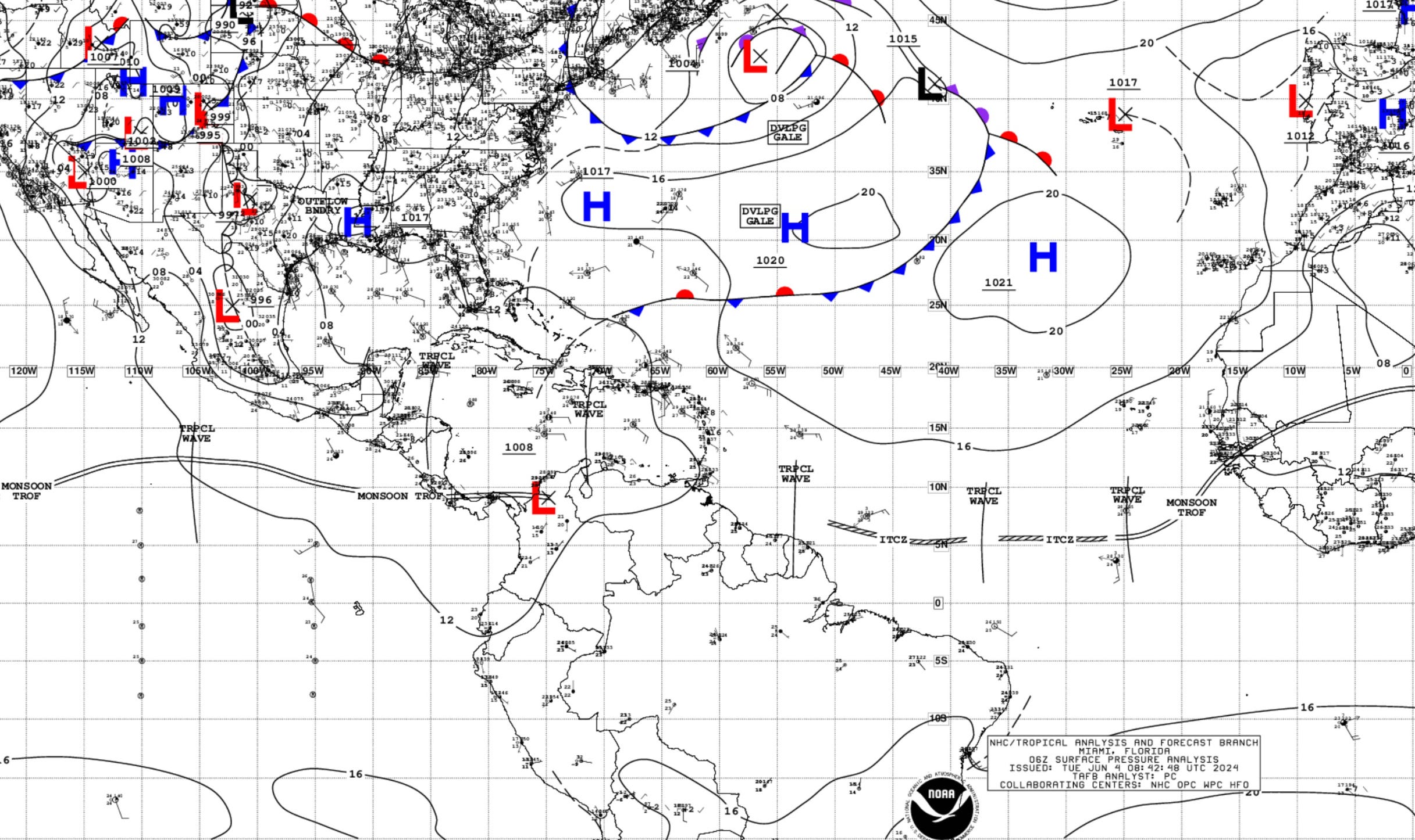
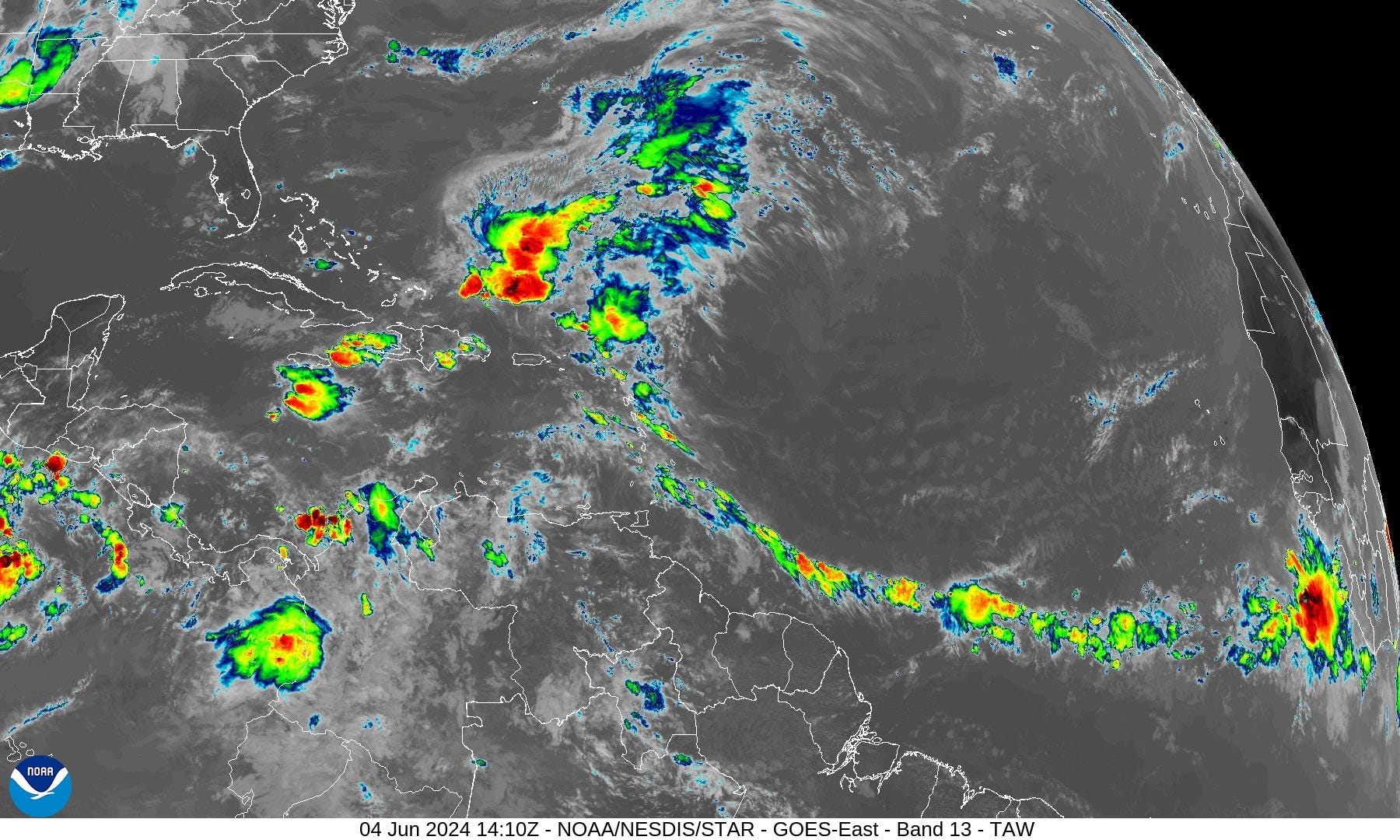
6 tropical waves area lined up from the Eastern Pacific to the eastern Tropical Atlantic along the ITCZ. High pressure dominates in the subtropics from Bermuda to the Azores. However, an upper-level trough is creating a weakness in the ridging streaming tropical moisture northward along 60°W longitude.
Heavy Rainfall in Hispaniola, Jamaica, and Eastern Cuba:

A persistent upper-level trough over the western Caribbean will
sustain a diffluent pattern aloft across the area through Friday.
This will support the generation of strong thunderstorms capable
of producing dangerous lightning, heavy rain, and gusty winds
through Friday.

Heavy rain can lead to flash flooding and
mudslides, especially in areas of Hispaniola where the ground
remains saturated from recent heavy rain events. According to the
most recent models, this afternoon and Thu afternoon will be the
days with the most significant precipitation over north-central
Dominican Republic and northeast Haiti.

There are also indications
that significant rainfall could occur over eastern Cuba and the
Cayman Islands where abundant moisture will remain in place.
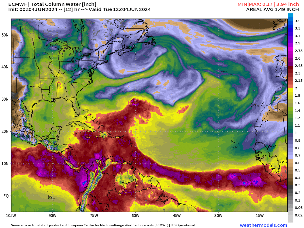
Precipitable water (inch) and the normalized anomaly (deviations) from climatology highlight the location of the ITCZ and large area of deep tropical moisture extending out of the Caribbean.

The deepest tropical moisture with PWAT > 2” extends along the ITCZ from the coast of Africa to the Greater Antilles. Nothing organized at this time.
Precipitable % of Normal | ECMWF HRES

The Gulf of Mexico remains bone dry for the next 5-days. The heaviest rainfall will be over eastern Cuba and in the ocean NE of the Greater Antilles.
Basin Wide GeoColor and Infrared Satellite Imagery
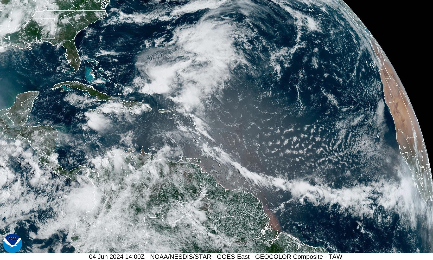
Gulf of Mexico
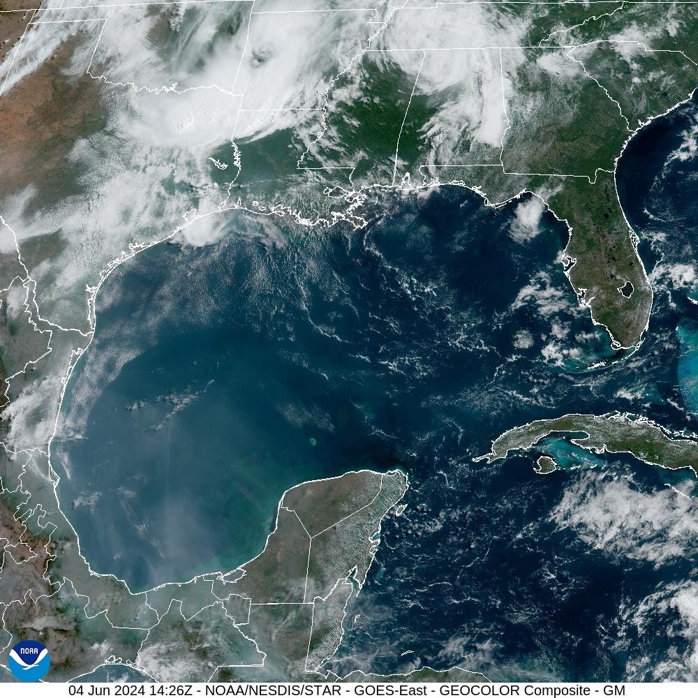
The Gulf of Mexico is entirely clear with some smoke/haze in the Bay of Campeche from forest fires burning in Mexico.
10-Day Precipitable Water Anomaly Forecast
Keep reading with a 7-day free trial
Subscribe to Weather Trader to keep reading this post and get 7 days of free access to the full post archives.