


June 30, 2025 Hurricane Season Monday
Frontal boundary across Florida could spur tropical development into weekend

2025 Atlantic Hurricane Season [Day 30]. My expectation for this year is 14 named storms, 7 hurricanes, and 3 majors. So far, 2 named storm, 0 hurricanes, and 0 majors.
Monday’s Tropical Update
Atlantic Basin: Tropical Storm Barry (02L) formed in the Bay of Campeche on Sunday and moved into Mexico. It was poorly organized. A stalled frontal boundary by this weekend could see something development on either side of Florida (20%).
Eastern Pacific Basin: Tropical Storm Flossie (06E) will become a hurricane in the next 24-48 hours on a track parallel to southern Mexico
Western Pacific Basin: Likely 2 tropical storms or typhoons to develop in next 5-days out of the monsoon trough
Monday High Temperatures

Extremely hot across the U.S. Southwest with temperatures around Phoenix pushing 117°F. However, the rest of the Lower 48 east of the Rockies is near-normal for the last day of June. Overall 123 million population will hit 90°F.
Arizona well into the 110s today

Upper-80s in London this afternoon
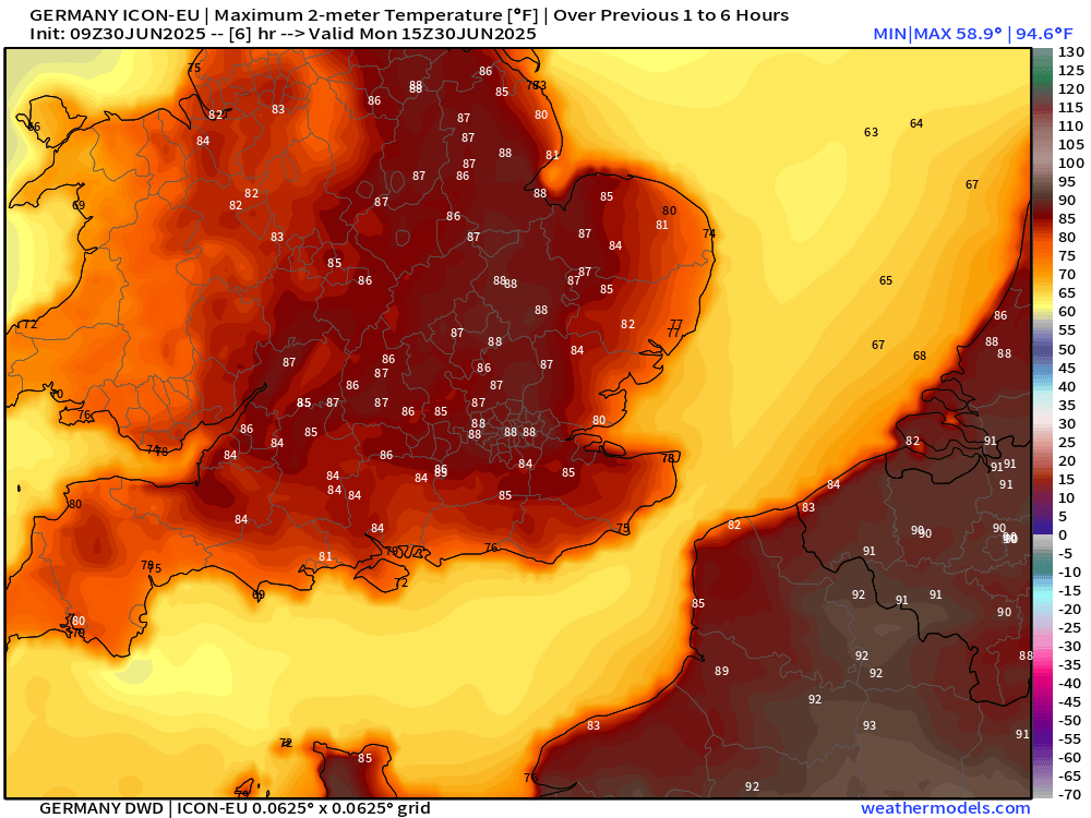
Upper-90s in Paris and over 100°F in France, Spain, and Portugal.


Lows for Tuesday Morning
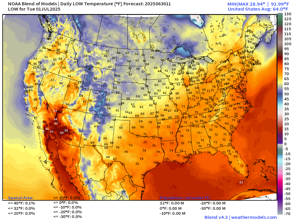
Might not dip below 90°F in Phoenix. Low-70s popular across Texas, Southeast, and into the Ohio River Valley and Mid-Atlantic. Typical for July 1st.
Weather on Monday

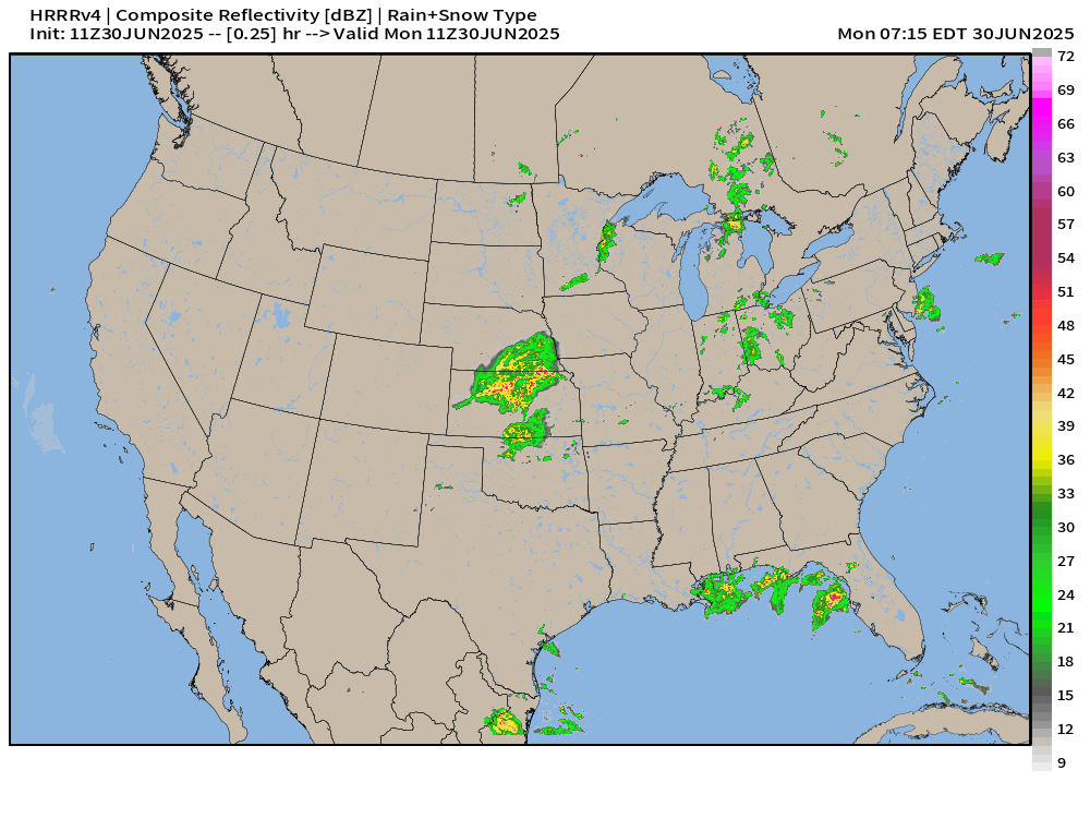
Pop-up thunderstorms a threat over much of the Lower 48 east of the Rockies. Maine looks to escape precipitation today.
A frontal boundary draped from Michigan back to north Texas will focus heavy rain in Albuquerque, Topeka, and perhaps around Indianapolis.
HRRR Radar Simulation Next 18-hours
NWS Precipitation Next 24-hours

Could be 1-2” in a thunderstorm that lingers over an area.
NWS WPC Precipitation Next 7-days
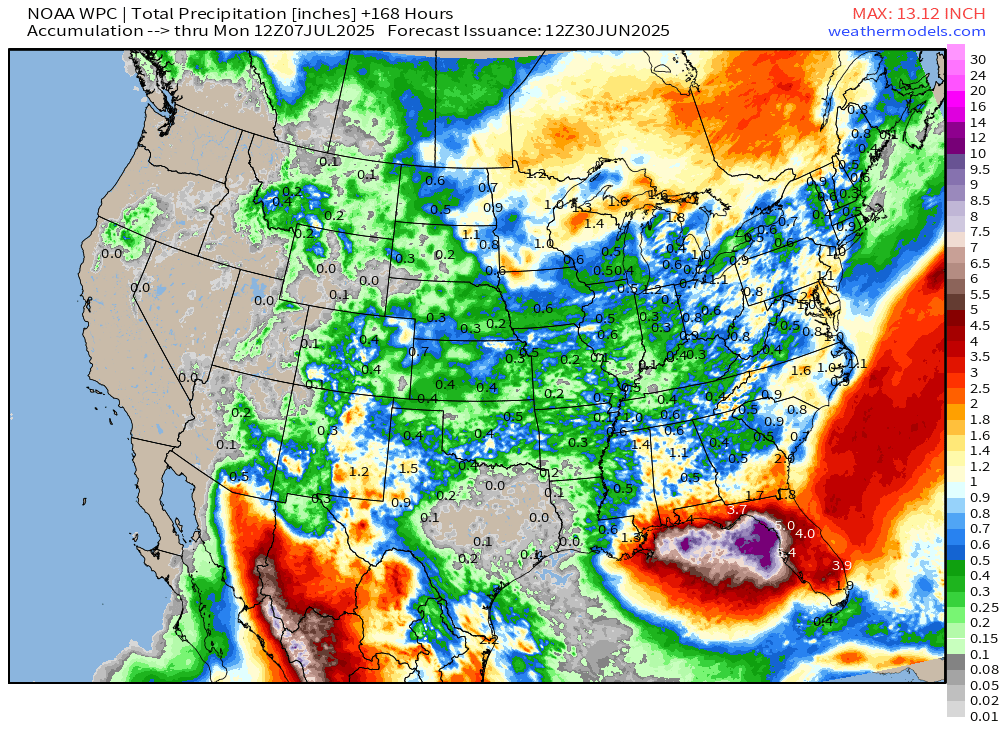
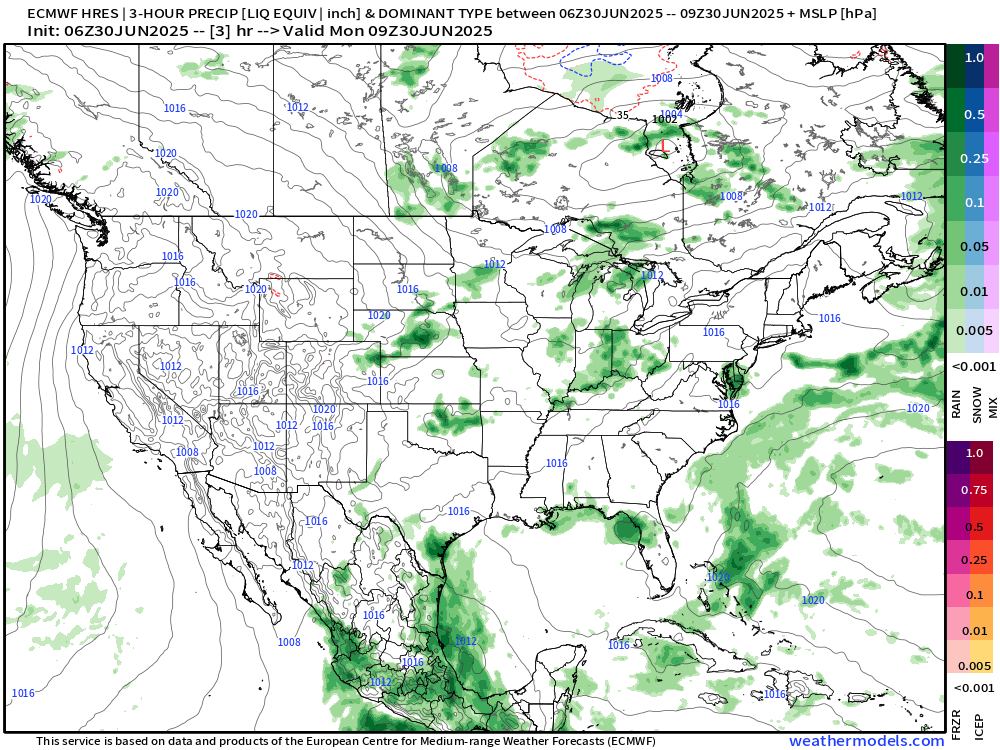
Tail end of a frontal boundary stalls out over the Gulf Coast focusing heavy rain for days. An area of low pressure could also develop leading to even more rain > 12” on the Gulf side of Florida.

Next 10-days

Huge rainfall hole in Texas — no precipitation expected.
The monsoon showers back up to Arizona and may include Phoenix.
ECMWF 00Z | Integrated Vapor Transport | Next 8-days

Flossie holds together if it hugs the Mexico coastline as the SST is quite warm, but fizzles quickly west of Baja California. Another weaker system might develop out of a trailing tropical wave.
Note the tail end of the frontal boundary in north Florida by Days 6-7. An area of low pressure could acquire tropical characteristics and meander off the coast. Regardless of development, heavy precipitation amounts will be fueled by the circulation and onshore flow + daytime thunderstorms.
Thank you to readers continuing into this Hurricane Season. My goal is to keep you informed about ongoing extreme weather events inside and outside of the tropics, but also a week (hopefully) heads up on what’s coming. I’ll be using a variety of weather modeling output, some of it may be unfamiliar, but it’s state-of-the-art and industry leading standard.
Next 6-days MSLP + Precipitation | ECMWF 06z
Flossie decays just west of the tip of Baja California over cool water in 5-days.
Atlantic Basin Outlook
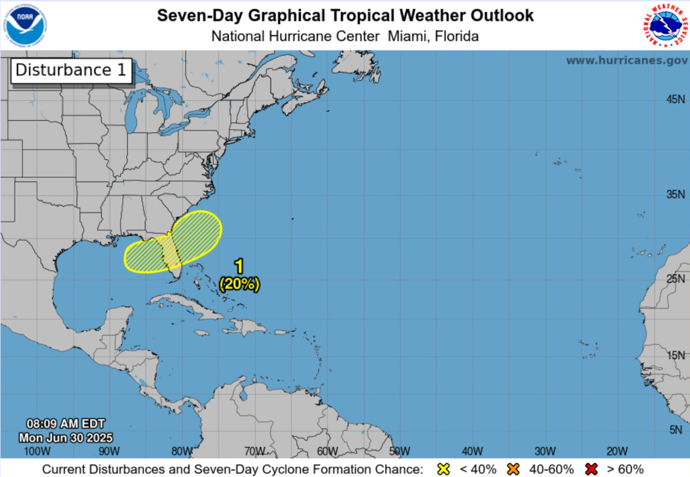
NHC has hatched a 20% (low chance) region on both sides of Florida in 7-days watching the tail end of a frontal boundary for tropical development. There is some model support — of course the GFS is most excited.
Keep reading with a 7-day free trial
Subscribe to Weather Trader to keep reading this post and get 7 days of free access to the full post archives.